Posted on 05/26/2018 8:59:39 AM PDT by NautiNurse
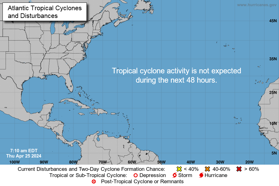
The 2018 Atlantic Tropical Storm season is off to an early start with Subtropical Storm Alberto. Gradual strengthening is forecast until the system reaches the northern Gulf Coast by Monday night.
Rainfall totals of 5 to 10 inches with maximum amounts of 15 inches are possible along the track of Alberto from eastern Louisiana, across much of Mississippi, Alabama, western Tennessee and the western Florida panhandle. Rainfall totals of 3 to 5 inches with maximum totals of 8 inches possible from the southern Appalachians into the coastal southeast.

Mash image to find lots of satellite imagery links
Public Advisories
NHC Discussions
FL Radar Map with Alberto Track Overlay
Bouy Activity Near Alberto
NHC Local Weather Statements/Radar Key West, FL
NHC Local Weather Statements/Radar New Orleans, LA
NHC Local Weather Statements/Radar Mobile, LA
Tropical, subtropical, extratropical?
It is often difficult to tell from looking at forecast model data whether a low that is expected to develop near the U.S. coast will be tropical, subtropical, or extratropical. The difference is important, since tropical systems have the potential to quickly grow into hurricanes, while extratropical or subtropical storms do not. So, here's a quick meteorology lesson on the normal progression one sees from extratropical cyclone, to subtropical cyclone, to tropical cyclone.
1. An extratropical cyclone forms. Extratropical cyclones have cold air at their core, and derive their energy from the release of potential energy when cold and warm air masses interact. These storms always have one or more fronts connected to them, and can occur over land or ocean. An extratropical cyclone can have winds as weak as a tropical depression, or as strong as a hurricane. Examples of extratropical cyclones include blizzards, Nor'easters, and the ordinary low pressure systems that give the continents at mid-latitudes much of their precipitation.
2. If the waters under the extratropical cyclone are at least 21C (70F), thunderstorm activity will gradually build inside the storm and moisten and warm the lower levels. Over time, the core of the storm may gradually go from cold to warm, and the storm will start getting some of its energy from "latent heat", which is the energy released when water vapor that has evaporated from warm ocean waters condenses into liquid water. Latent heat is what powers tropical cyclones. At this point, the storm is called subtropical. If the winds are already more than 39 mph (as happened in the case 2007's Subtropical Storm Andrea), it is called a subtropical storm. If the winds are less than 39 mph, then it is called a subtropical depression. So, you don't need to start with a subtropical depression in order to get a subtropical storm.
good stuff thanks.
You’re welcome, it is a pretty thorough article. It explained to me why we are seeing those heavier rain and wind bands all the way over on the East coast of the state this morning!
Good info. Thanks for the primer!
Summary of 1100 AM EDT...Information
-----------------------------------------------
130 MI...WSW Of Tampa FL
185 MI...SSE Of Apalachicola FL
Max sustained winds 50 MPH
Moving...N or 5 DEGREES AT 14 MPH...
994 MB...
11am here in the Sarasota area, S of Tampa. Mostly wind, not much rain.
Thanks for these threads!
Mild rain/t-storm bands brushing Tampa Bay. A few breezy gusts, otherwise calm. Pretty tame thus far.
Once again you had to go and make it official. I was hoping to ignore the thing, but the Mrs. got wind of it. At least with this one, I won’t have to pay for someone to put up the shutters. Thanks for the heads up.
7 miles from the Gulf where Pinellas, Pasco and Hillsborough meet.
Barring an errant tornado, you should be fine as Alberto pedals well offshore.

Here on the Space Coast we're getting a lot of rain and wind, somewhere between 5 and 6 on the Beaufort Scale. NWS at MLB says Wind SE 22 G 31. We're feeling it!
You are definitely getting effects worse than here on the FL Gulf coast.
Just came back from St. Pete Beach and traveling over the Howard Franklin was a bit unnerving. Vehicle got blown around and waves were crashing over the wall. But, made it home safely.
Thanks for your local report. I hope your vehicle wasn’t covered in salt spray.
Why are such storms even named? This is how we get our rain here in the Southeast.
Global warming! Global cooling! Climate change!
Because the gubermint hacks have to have the MAX number of named storms to support their globull warming scam.
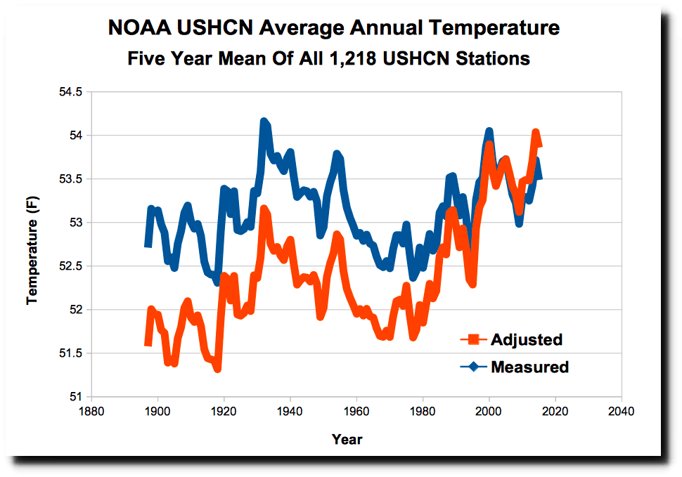
The number of named storms is even more important than years earlier because the average temperatures are DROPPING, not rising as their CO2 correlation is NOT working (i.e. average temperatures are NOT rising as CO2 rises which means all of their models are WRONG).
As many do NOT know, the wx scam is made possible by the scammers correcting temperatures such that in past decades, the temperatures were COOLER than the recorded data shows and NOW, the temperatures are WARMER than the recorded data shows.

Adjusted temperatures are cooler before 2000 and warmer after 2000 than what was actually read. The adjusted temperatures show warming but actual data simply shows variations. The 1930's were hotter than anytime more recently.
A week ago this ‘disturbance’ wasn’t going to amount to anything.
And yet these same idiots can tell us “global warming”/”climate change” will doom us all in 50 years.
Wow, what a pretentious storm, thinking he's "too cool" to hang out with the tropical kids.
Disclaimer: Opinions posted on Free Republic are those of the individual posters and do not necessarily represent the opinion of Free Republic or its management. All materials posted herein are protected by copyright law and the exemption for fair use of copyrighted works.