
Posted on 10/06/2009 10:19:44 AM PDT by sukhoi-30mki
F-15Ks Primed with 'Unpatriotic' Maps
The Air Force's F-15K fighter jets carried some digital map information that is at odds with their mission to defend the country, it has emerged. The jets carried digital maps that referred to Korea's Dokdo Islets either by their Japanese name "Takeshima" or as "Liancourt Rocks," the East Sea as "Sea of Japan," and Mt. Baekdu in Chinese as "Changbaishan" -- all names that are red rags to many patriotic Koreans.
This was revealed by Grand National Party lawmaker Kim Jang-soo, a former defense minister, in a questionnaire distributed Sunday prior to a parliamentary audit of the Defense Ministry.
According to data the Air Force submitted to Kim, the information was ironically found in digital maps carried by F-15Ks mobilized for an exercise to defend Dokdo between July 29 and Aug. 1, 2008. It said the commanding general of the Air Force Operations Command ordered the wrong information corrected and revised digital maps were distributed in February this year.
Korea bought 40 F-15Ks worth W4.5 trillion (US$1=W1,176), or W100 billion each, between 2005 and 2008.
The error occurred because Boeing, the manufacturer, used digital maps made by the U.S. National Geospatial-Intelligence Agency, and the Korean Air Force did not check this in the process of procurement.
The Army geospatial-intelligence corps, which is in charge of making maps for the Korean armed forces, has asked the U.S. on as many as nine occasions at bilateral geospatial-intelligence conferences since 2002 to correct the misnomers, "Takeshima" and "Sea of Japan," but to no avail.
"Considering that the country is expected to procure 20 more F-15Ks from next year, we should clarify our firm determination that such an incident cannot be repeated."
englishnews@chosun.com /
Ouch!
“Say, is that the sun up there?”
“I don’t know, I’m a stranger in town.”
Shouldn't that be "red frags"?
Note to Boeing: If you happen to win the IAF fighter competition, make sure to update the digital map names along the Indian-Pakistan and Indian-Chinese borders.
Boeing can’t do that. The database is from NGIC.
TC
Anything that doesn't kowtow to their nationalistic shtick is an insult...
(This line censored to preserve FR decorum...)
One man’s Eastern Sea is always another man’s Western Sea.
Yup. Repo the planes, return the money and let them order something from France. I'm sure Boeing can refit them for another customer.
Koreans payed hard cash for the fighters. Boeing better knowtow to their demands if they want future contracts.
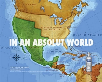
I don't know...they probably felt the way I did when I saw this ad...
~~~~~~~~~~~~
Modern "GIS" maps are composed of many complex datbase "layers": (Base map and/or photo, DEM, [Digital Elevation or "terrain" model] rivers, roads, buildings, labels, target coordinates, etc., etc....)
Creation of military-grade GIS maps and the databases that generate them is a huge job -- and the output is very valuable -- and, possibly, highly classified.
Digital maps and the GIS databases that create them must be maintained: they change periodically and must be updated -- especially if they contain overhead imagery base layers.
~~~~~~~~~~~~
There is NO WAY foreign nationals should be given (or even allowed) access to the base GIS datasets of our U.S. National Geospatial-Intelligence Agency -- just to satisfy the provincial vanity of purchasers of a few A/C.
~~~~~~~~~~~~
But, IF the A/C ship with limited subsets of the LABELS database layer, it might be possible to train Korean techs to edit only the LABELS data subset that is within their provincial control. OR,-- or IF the onboard maps are "flattened" into "bitmap" ("GeoTIFF, etc.) layers, the customer (Korea) might be authorized and trained to edit the LABELS info with an ordinary image processor ("Photoshop") to customize the base map to suit their own whims.
None of the above is necessarily cheap or easy. IF the Koreans are allowed to modify the mapsets, they should negotiate a separate "Training and Maintenance" contract for editable local map data file sections they can download, edit, and re-upload. And, they should pay $$$ for the training and software to do so.
Provincial, nationalist vanity and GIS are a costly and security-sensitive combination. Just "bitc#ing" after the fact is not justification for compromise of those datasets...
~~~~~~~~~~~~
It ain't like handing them a new paper map with some whiteouts and penciled-in names...
Sorry; intended to copy you on #13...
You, apparently, haven't lived in the Far East -- as I have -- and have no idea how wacked out orientals can get when they think they have "lost face" -- over a perceived or dreamed-up slight...
I posted how the Ks could be accommodated with training, software and a limited dataset -- on their $$$ -- if they want to exercise their vanity. The maps are not "part of" the aircraft; if the Ks object to an accepted "atlas" name, than they can make their own &^$^% maps.
sampleman said it very well:
"One man’s Eastern Sea is always another man’s Western Sea."
~~~~~~~~~~~~~
If you want a "vanity plate" on your car, pay for it -- or STFU!
the maps as shipped are correct.
They are not. Obviously you have never done business before. Its the customer who is always correct. Maps are the most vital part of the navigational unit on board an aircraft. Its not part of the aircraft itself but neither are the avionics, sensors, weapon systems. However international arms deals are negotiated as a complete package with delivery platform, weapon systems, and every other additional equippment all customised as part of a block configuration. Its no different for maps, gps, navigational systems. Every single piece is thoroughly inspected and customised.
And if you read the article, the error was corrected and revised maps are promptly delivered. No airforce would want to operate faulty maps. As for US geospatial-intelligence they can use whatever names they want for their own purpose and Koreans or anybody dont have a say in that.
Obviously, you are wrong. At the government/international level, Its [sic] the customer who contract which is always correct. If the contract included map customization, the supplier fouled up; otherwise, if the customer wants custom maps not in the contract, the customer pays for a contract add-on.
And it seems from the article. The foul up was on part of the supplier and also an oversite on part of the Koreans which was corrected by the supplier and that proves my original point. Case closed.
Indeed — as is your mind, newbie...
Disclaimer: Opinions posted on Free Republic are those of the individual posters and do not necessarily represent the opinion of Free Republic or its management. All materials posted herein are protected by copyright law and the exemption for fair use of copyrighted works.