Posted on 05/29/2008 9:49:18 AM PDT by MplsSteve
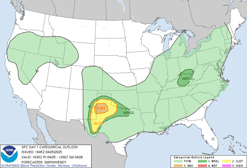
Keep an eye on the skies and listen to the radio. Could be a rough day today.
Stay safe everyone!
Public weather must be more important than private weather.
Prayers going up for all those in the affected areas!!! Be careful out there!!!
Got my weather radio on and my eye on the radar here in central Iowa!
Sounds like we’re gonna have fun tonight!!
This pattern is getting old fast . . . S.C.KS.
WELCOME TO FREE REPUBLIC’S MINNESOTA PING LIST!
95 MEMBERS AND GROWING...!
FREEPMAIL ME IF YOU WANT ON OR OFF THIS PING LIST!

We’re heading to Mt. Rushmore tomorrow!
Well I’ll certainly be paying attention. I read Soucheray’s column yesterday. He was discussing how little he knew about tornadoes and how they can just burst on the scene.
Funny how I’ve reached the same conclusion at the same time as he did. I always assumed we could see anything that was approaching.
P.S., Did you read about the man in Hugo who was outside when the hurricane approached? He couldn’t get back into his house or garage, and hung onto a small section of wall. It was about the only piece of his home not touched. Incredible.

Should be ok in that area tomorrow.... I think. I think most of it will be over on top of us or even further east by then.
Nebraska?
no-o-o- I’m just getting started on repairs from Memorial weekend storms - 4th hail damage repair in as many years - ugh. St. Michael is “Hail Alley”
I think the Twin Cities are gonna be OK. Any severe weather should be down near Albert Lea, Mankato and Worthington.
But then again, I’ll knock on wood (my skull) and hope the forecast holds up.
My fingers are crossed!
Watches have started going up. Eastern Colorado/Wyoming all the way into Eastern Nebraska.

Damn this is getting old, we’ve been in the weather box more this year than ever.
   SEL6

   URGENT - IMMEDIATE BROADCAST REQUESTED
   TORNADO WATCH NUMBER 386
   NWS STORM PREDICTION CENTER NORMAN OK
   230 PM CDT THU MAY 29 2008

   THE NWS STORM PREDICTION CENTER HAS ISSUED A
   TORNADO WATCH FOR PORTIONS OF

          PARTS OF NORTHERN KANSAS
          MUCH OF CENTRAL AND PARTS OF EASTERN NEBRASKA

   EFFECTIVE THIS THURSDAY AFTERNOON AND EVENING FROM 230 PM UNTIL
   1000 PM CDT.

   THIS IS A PARTICULARLY DANGEROUS SITUATION...

   DESTRUCTIVE TORNADOES...LARGE HAIL TO 4 INCHES IN DIAMETER...
   THUNDERSTORM WIND GUSTS TO 80 MPH...AND DANGEROUS LIGHTNING ARE
   POSSIBLE IN THESE AREAS.

   THE TORNADO WATCH AREA IS APPROXIMATELY ALONG AND 95 STATUTE
   MILES EAST AND WEST OF A LINE FROM 35 MILES NORTH NORTHEAST OF
   ONEILL NEBRASKA TO 45 MILES WEST SOUTHWEST OF RUSSELL KANSAS.
   FOR A COMPLETE DEPICTION OF THE WATCH SEE THE ASSOCIATED WATCH
   OUTLINE UPDATE (WOUS64 KWNS WOU6).

   REMEMBER...A TORNADO WATCH MEANS CONDITIONS ARE FAVORABLE FOR
   TORNADOES AND SEVERE THUNDERSTORMS IN AND CLOSE TO THE WATCH
   AREA. PERSONS IN THESE AREAS SHOULD BE ON THE LOOKOUT FOR
   THREATENING WEATHER CONDITIONS AND LISTEN FOR LATER STATEMENTS
   AND POSSIBLE WARNINGS.

   OTHER WATCH INFORMATION...CONTINUE...WW 384...WW 385...

   DISCUSSION...SUPERCELLS EXPECTED TO DEVELOP RAPIDLY ACROSS WATCH
   AREA REMAINDER OF AFTERNOON. STRONG SHEAR AND MLCAPES AOA 3000 J/KG
   SUPPORT TORNADOES AND VERY LARGE HAIL WITH ANY SUPERCELL.  POTENTIAL
   FOR LONG LIVED SUPERCELLS ACCOMPANIED BY STRONG TORNADOES.

   AVIATION...TORNADOES AND A FEW SEVERE THUNDERSTORMS WITH HAIL
   SURFACE AND ALOFT TO 4 INCHES. EXTREME TURBULENCE AND SURFACE
   WIND GUSTS TO 70 KNOTS. A FEW CUMULONIMBI WITH MAXIMUM TOPS TO
   550. MEAN STORM MOTION VECTOR 24035.


   ...HALES
Disclaimer: Opinions posted on Free Republic are those of the individual posters and do not necessarily represent the opinion of Free Republic or its management. All materials posted herein are protected by copyright law and the exemption for fair use of copyrighted works.