
Posted on 09/24/2005 9:58:36 AM PDT by Howlin
Hurricane Rita landfall is anticipated within the next few hours. Strong winds and heavy rains are battering southern Louisiana and southeastern Texas.
MSM news crews are shouting over the howling winds as they foolishly describe blowing rain, swaying trees, and crashing waves through rain splattered camera lenses. It's a hurricane. We know these things already.
An 18 wheeler rig reportedly overturned on an I-10 bridge. The fate of the truck driver is unknown at this time. Reports of widespread power outages in Lake Charles. KPLC-TV Lake Charles local news has remarkably improvised their reporting from a remote location. They are taking calls from residents, NWS, and public utility representatives, and alerting residents to local conditions.
On the flip side, CNN announced to the world that law enforcement officers had evacuated from Port Arthur TX with the rest of the population. Engraved looter invitations would have been more elegant.
Godspeed to all those in the path of this storm.
The following links are self-updating:
Public Advisory Currently published every 3 hours 5A, 8A, 11A, 2P, etc. ET
NHC Discussion Published every six hours 6A, 11A, 6P, 11P
Three Day Forecast Track
Five Day Forecast Track
Rita Forecast Track Archive
Forecast Models
Buoy Data Western Gulf of Mexico
Houston/Galveston/Beaumont/Lake Charles Wx Watches/Warnings
Jefferson Co TX NWS Weather
Current Weather Warnings and Watches for Texas
Current Weather Warnings and Watches for Louisiana
Hi Res Houston Flood Zone Map Slow load, great detail
Images:
Lake Charles Long Range Radar Still image, with loop link
Houston/Galveston Long Range Radar Still image, with loop link
Lake Charles Experimental Radar Outages and Delays May Occur
Storm Floater IR Loop
GOM WV Loop
GOM IR Still Image
Visible Storm Floater Still (only visible during daylight hours)
Color Enhanced Atlantic Loop
Streaming Video: (coverage may be intermittent)
KHOU-TV/DT Houston
KPRC-TV/DT Houston
KTRK-TV/DT Houston
KTRH-AM Houston
KPLC-TV/DT Lake Charles/Lafayette
KSLA-TV/DT Shreveport
Additional Resources:
Hurricane Rita Freeper CHECK IN THREAD
FReeper Sign In Thread (LOCKED) Check in to let us know whether you are staying, going, and when you get there
FReepers Offering Lodging To Rita Evacuees People and/or Pet Friendly FReepers Offering Shelter
KHOU Houston
KTRK ABC News Houston
KPLC Lake Charles Evac Routes, news
KFDM Beaumont/Port Arthur News, evac info
Hurricane City
Wxnation Houston
Galveston Webcams
Golden Triangle Weather Page Provides Galveston Weather, Warnings, Radar, etc.
| Category | Wind Speed | Barometric Pressure | Storm Surge | Damage Potential |
|---|---|---|---|---|
| Tropical Depression |
< 39 mph < 34 kts |
Minimal | ||
| Tropical Storm |
39 - 73 mph 34 - 63 kts |
Minimal | ||
| Hurricane 1 (Weak) |
74 - 95 mph 64 - 82 kts |
28.94" or more 980.02 mb or more |
4.0' - 5.0' 1.2 m - 1.5 m |
Minimal damage to vegetation |
| Hurricane 2 (Moderate) |
96 - 110 mph 83 - 95 kts |
28.50" - 28.93" 965.12 mb - 979.68 mb |
6.0' - 8.0' 1.8 m - 2.4 m |
Moderate damage to houses |
| Hurricane 3 (Strong) |
111 - 130 mph 96 - 112 kts |
27.91" - 28.49" 945.14 mb - 964.78 mb |
9.0' - 12.0' 2.7 m - 3.7 m |
Extensive damage to small buildings |
| Hurricane 4 (Very strong) |
131 - 155 mph 113 - 135 kts |
27.17" - 27.90" 920.08 mb - 944.80 mb |
13.0' - 18.0' 3.9 m - 5.5 m |
Extreme structural damage |
| Hurricane 5 (Devastating) |
Greater than 155 mph Greater than 135 kts |
Less than 27.17" Less than 920.08 mb |
Greater than 18.0' Greater than 5.5m |
Catastrophic building failures possible |
Previous Threads:
Hurricane Rita Live Thread, Part VII
Hurricane Rita Live Thread, Part VI
Hurricane Rita Live Thread, Part V
Hurricane Rita Live Thread, Part IV
Hurricane Rita Live Thread, Part III
Hurricane Rita Live Thread, Part II
Hurricane Rita Live Thread, Part I
Tropical Storm Rita
Tropical Depression 18
Stinking caps...
EMERGENCY RELEASES FROM THE DAM AT LAKE LIVINGSTON WILL CAUSE RAPID RISES ON THE TRINITY RIVER BELOW LAKE LIVINGSTON.
A MANDATORY EVACUATION HAS BEEN DECLARED FOR PORTIONS OF POLK...SAN JACINTO...AND LIBERTY COUNTIES BELOW LAKE LIVINGSTON. PERSONS ARE URGED TO STAY AWAY FROM THE RIVER
UNTIL WATER LEVELS RECEDE.
http://iwin.nws.noaa.gov/iwin/tx/flood.html
Fox reporter in St. Charles on now -- looks like the storm is still raging, river flooding downtown.
The RATS will figure a way out to get their votes in LA.
Lake Charles doesn't look good, still pouring rain and wind....BIG TIME! God please subside this storm!
St. Charles River has gone over it's banks...
Also, Housley is actually reporting, and has his hood up (rather than a baseball cap). No hysterics. Good job, Adam!
I knew it had to deal with the dam, but I didn't get to stay long enough (hubby was working on getting me upstairs to look at what he found at the green dump where he gets our firewood) to check.
Thursday afternoon on Hannity Joey predicted Galveston and right on up the I-45 corridor stalling short of Dallas and then going southwest down the I-35 corridor. He missed by 70 miles and a category. Exact same afternoon the NHC forecast put it as just west of Sabine Pass as a CAT 3 then to a slow crawl to the Texarkana area. They missed by 18 miles and hit right on the CAT.
Don'tKnowJackuweather can take another hike.
Darn, looks like LA is getting it from every side....Lifting prayers for the folk in LA...we are standing with you!
It was probably wise of them to go ahead and open the gates
with 10-12" of rain and counting upstream.
I wish there were a Livingston dam cam..its probably quite a site.
Have you seen this:
http://www.freerepublic.com/focus/f-news/1489838/posts
I wonder about Avery Island. Aren't the strategic pet reserves down there?
Thank you very much :))
Could you believe it? The hurricanae is still battering Louisiana!!!! Watching Lake Charles, still under violent siege, really makes Blanco's comments seem even more out of touch. Is she crazy?
YIKES!!! She dreams up some silly little job corps make-work project, (because Louisianians are too stupid to get their government hand-outs without help), while the hurricane still blows away the southwest corner of the state! This is beyond embarrassing!
That matches what the software says, right at 9 feet, at the edges...deeper at Port Arthur. Most likely.
Ditto on Houma, the report had the water's edge near there, not in town.
Here:
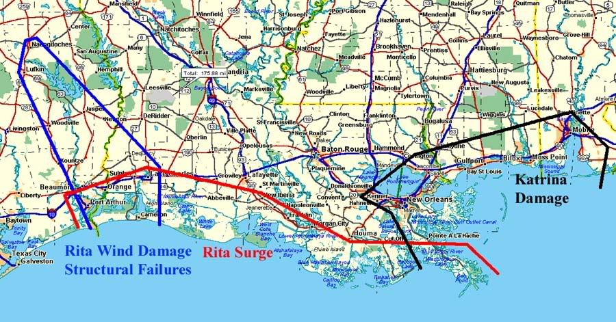
http://i4.photobucket.com/albums/y138/jeffers_mz/Rita/BigPicture.jpg
Big picture view, based on collected anecdotal reports to date.
Yes, and it is the media that drive this. When a reporter say something like - "Wolf, there are people stranded on the highway with no water." - I just want to scream who's fault is it they have no water! If the idiot is too dumb to fill up their car with gas, food & water (remember the evacuation order was give Tuesday) then it is their own fault.
My brother in law got a map, avoided I-45, left @4am Thursday and got to Dallas in 12 hours. Get a map, get supplies, and take responsibility.
Disclaimer: Opinions posted on Free Republic are those of the individual posters and do not necessarily represent the opinion of Free Republic or its management. All materials posted herein are protected by copyright law and the exemption for fair use of copyrighted works.