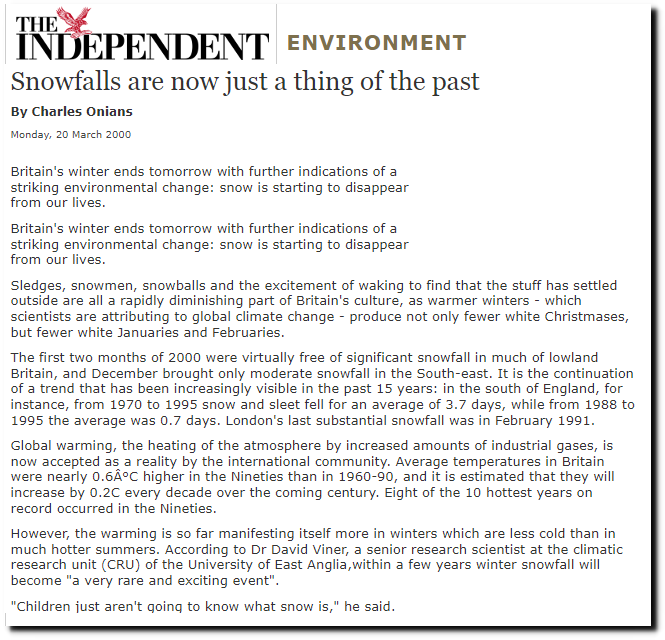
Posted on 11/12/2026 3:10:13 PM PST by george76
Heavy snow and strong winds could reduce visibility across the Sierra to near zero through Saturday morning. Conditions are expected to ease Saturday afternoon and Sunday before the next round arrives Sunday night.
...
The storm heading for the mountains this weekend is now strong enough for winter storm warnings. The National Weather Service has upgraded the winter storm watches to warnings, and they take effect Friday morning.
Exposed ridges could see gusts as strong as 90 mph, while the highest terrain could pick up 24 inches of heavy, wet snow. Down in the towns, the official forecast looks far tamer, as the NWS snowfall map below shows.
Where Will the Wind Be Strongest?
Around Lake Tahoe. The NWS Reno winter storm warnings put ridge gusts at 70 to 90 mph, with 35 to 45 mph expected in Truckee, South Lake Tahoe, Incline Village and the other lakeside towns.
Out on the water, waves could build to 2 to 4 feet. The office spells out what all that wind could do on land:
“Strong winds and Sierra cement snow could cause damage to trees and power lines.”
In Mono County, ridge gusts could reach 60 to 80 mph, with 45 to 55 mph along Highway 395 through Mammoth Lakes, Lee Vining and Bridgeport.
How Much Snow Is Coming?
The deepest totals are split between two areas. NWS Sacramento expects up to 12 inches across the Northern Sierra above 6,000 feet and up to 24 inches on the highest peaks, a zone that takes in Interstate 80, Highway 50 and Lassen Volcanic National Park. Mono County could pick up 12 to 24 inches above 7,000 feet.
Along the crest west of Lake Tahoe, totals could reach 20 inches, while lower-elevation communities around the lake are forecast to get much less. The Eastern Sierra Slopes near Aspendell and Whitney Portal could get 5 to 10 inches, according to NWS Las Vegas.
Farther south, the earlier winter storm watch for Yosemite, Kings Canyon and Sequoia is now a warning too. NWS Hanford expects up to 18 inches above 6,000 feet there, with gusts as high as 50 mph.
How Much Snow Will the Towns Actually Get?
Far less than the peaks.
....
The official snowfall map from NWS Reno shows how much elevation matters here. The heaviest band, 12 to 18 inches, runs along the crest between Lake Tahoe and Mammoth Lakes, while South Lake Tahoe is marked at just 1 inch and Mammoth Lakes at 2 inches through Saturday morning.
When Is the Worst of It?
Friday night into Saturday morning. The warnings start at 10 a.m. Friday PST around Tahoe and in the Northern Sierra and at 1 p.m. in Mono County and on the Eastern Sierra Slopes. Most end by 10 a.m. Saturday, but the warning for the southern Sierra parks holds until 4 a.m. Tuesday.
That timing lands squarely on the Friday evening drive, and NWS Sacramento adds near-whiteout conditions to the list of possible impacts.
It doesn’t end there, though. The Sacramento office lays out what comes next:
“Lull in activity Saturday afternoon through Sunday, followed by additional snow Sunday night through Monday.”
Dear FRiends,
We need your continuing support to keep FR funded. Your donations are our sole source of funding. No sugar daddies, no advertisers, no paid memberships, no commercial sales, no gimmicks, no tax subsidies. No spam, no pop-ups, no ad trackers.
If you enjoy using FR and agree it's a worthwhile endeavor, please consider making a contribution today:
Click here: to donate by Credit Card
Or here: to donate by PayPal
Or by mail to: Free Republic, LLC - PO Box 9771 - Fresno, CA 93794
Thank you very much and God bless you,
Jim
So, this storm is limited to Lake Tahoe?
No, Mammoth Lakes and south.. There is a map
Tahoe is to the Bay Area what the Hamptons are to New York. That’s where all the rich people go for holidays and/or long weekends. So the media is going to focus on what matters to rich people, not the general population.
24 inches of heavy, wet snow , Oh My Back
Lassen to the north and Mammoth to the south. That’s a big spread!
East Anglia, where all the lies originated.
Half inch possible at lake level. So guessing the bigger totals will a little higher. Mix forecast for “down here” in Reno of rain snow. 😴
Thanks for your response. (Thumbs up).
LOL! True.
Thanks (smiley Face) Hotmail down, LOL.
I see these reports.
Living in Colorado, I say to myself...
“I have a 1999 GMC Suburban. The thing is a tank.”
When the first snowstorm hits, I call it the, “Darwin Storm.”
The idiots who haven’t a clue as to how to adjust one’s driving practices and skills for the conditions presented...get taken out pretty quickly.
I have a feeling that the 2026-2027 winter might be as bad as 2006-2007’s.
My motorcycles will be saddened, though.
Stay safe and drive slow, FRiends.
Leave your house early.
Keep your gas tanks full at all times.
Buy rock salt NOW. Snow shovels and icebreaking axes, too.
My $0.02
Watch out for Donner Pass.
It’s the end of the world!
Disclaimer: Opinions posted on Free Republic are those of the individual posters and do not necessarily represent the opinion of Free Republic or its management. All materials posted herein are protected by copyright law and the exemption for fair use of copyrighted works.