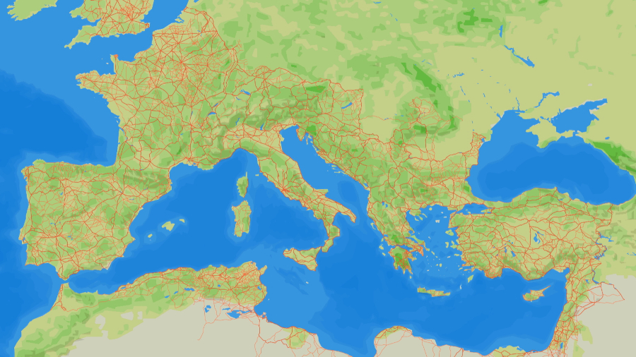
Map of Roman road network across Europe and North AfricaAutonomous University of Barcelona
Map of Roman road network across Europe and North AfricaAutonomous University of Barcelona
Hey!!
Look where all the roads lead to!!
Fascinating! More extensive than I ever imagined.
Where are the CCTVs located? 🤔😊👍. Pretty sure some of the cobblestones are still walked on today.
Built to the specs of the 2 horse cart. And the basis of all roads, and therefore all things we put on roads, to this day. Yup, the 2 horse cart is the most impactful invention in human history.
What surprises me is North Africa. Never knew they put that much work into that area.
Roman roads are such good evidence of what civilization lost when the empires of antiquity collapsed into the “Dark Ages”. Look at all the care and thought that went into making this road network. Then for probably 1300 years afterward, roads were simply made by horses and carts going over the same path and beating down the vegetation. From layers of stone with drainage back to mud paths.
Visiting the local courthouse and they had a map of the county showing items of interest when the county was organized. On the map was a military road from Sioux city military post to Sioux falls military post. Was within a mile of where I grew up.
so cool! thanks for sharing, i’ve explored many of these roads and sites throughout Switzerland and central Europe.
https://itiner-e.org/
Think of the potholes.