Free Republic
Browse · Search
General/Chat
Topics · Post Article

authors: Lorelei Curtin, William J. D’Andrea, Nicholas L. Balascio, Sabrina Shirazi, Beth Shapiro, Gregory A. de Wet, Raymond S. Bradley & Jostein Bakke

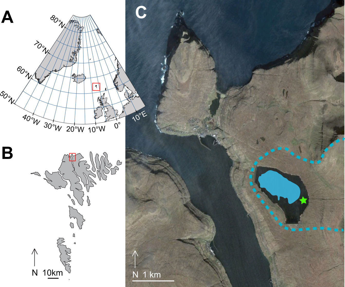
a Map of North Atlantic region, with the Faroe Islands in red box. b Map of the Faroe Islands, with the Eiði region in red box. c Eiðisvatn, with blue fill showing the approximate extent of the lake before the emplacement of the hydroelectric dam, green star showing the approximate location of Argisbrekka. Blue dashed line indicates Eiðisvatn watershed boundary. Satellite imagery from Google Earth, Image ©2021 Maxar Technologies, Landsat/Copernicus.
Fig. 1: Maps of the North Atlantic, Faroe Islands, and study location.

1 posted on 01/02/2022 11:16:44 AM PST by SunkenCiv
[ Post Reply | Private Reply | View Replies ]


To: SunkenCiv

“CE”

Oh stop.


5 posted on 01/02/2022 12:44:32 PM PST by Republican Wildcat
[ Post Reply | Private Reply | To 1 | View Replies ]

To: SunkenCiv

This is actually pretty significant.


7 posted on 01/02/2022 1:17:09 PM PST by Openurmind (The ultimate test of a moral society is the kind of world it leaves to its children. ~ D. Bonhoeffer)
[ Post Reply | Private Reply | To 1 | View Replies ]

To: SunkenCiv

Well, when there’s an Ice Sheet across the North Atlantic, people just walked across, looking for Polar Bears stuck on icebergs...............................


8 posted on 01/03/2022 6:05:34 AM PST by Red Badger (Homeless veterans camp in the streets while illegal aliens are put up in hotels.....................)
[ Post Reply | Private Reply | To 1 | View Replies ]

Free Republic
Browse · Search
General/Chat
Topics · Post Article


FreeRepublic, LLC, PO BOX 9771, FRESNO, CA 93794
FreeRepublic.com is powered by software copyright 2000-2008 John Robinson