To: ColdOne; GOP Poet; DoughtyOne; BenLurkin
Both towns (Palu and Dongala) are situated as vulnerable tsunami targets. Palu is at the end of a long, narrow river estuary, which funneled and focused the tsunami right into its center.
The "destroyed fishing village" of Dongala is on the beach, out on a point at the mouth of the estuary -- perfectly sited to catch the full force of a tsunami.
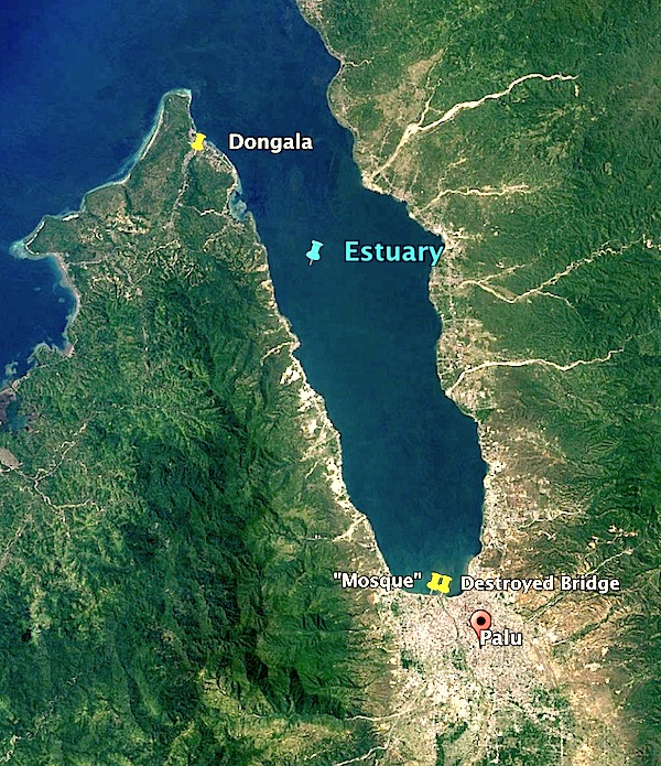
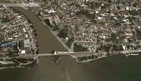
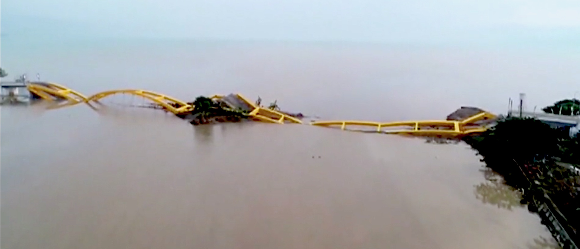
Palu is also a river valley, situated to force the wave to run the maximum distance inland -- with its most important bridge right on the beach -- at the very mouth of the river.
~~~~~~~~~~~
Look at that top photo. You'd think that folks living on the "Ring of Fire" -- on an island in the middle of an ocean prone to tsunamis -- would notice all that nice, undeveloped, elevated ground that surrounds their suicidal townsites...

SMH...
TXnMA

21 posted on
09/30/2018 5:43:32 PM PDT by
TXnMA
("Allah": Satan's current alias. "Islam": Satan's invading army. "Muslims": Satan's useful idiots.)
To: TXnMA
...would notice all that nice, undeveloped, elevated ground that surrounds their suicidal townsites... When the principal mode of transportation is walking or boating, low flat land close to the river is chosen first and has the most value.
Although one would expect them to be in better shape due to all that walking, maybe modern, Western values will impart themselves on these folks and they will grow up and not just out.
It really seems densely populated. Is their entire life centered on the river?
22 posted on
09/30/2018 5:53:51 PM PDT by
texas booster
(Join FreeRepublic's Folding@Home team (Team # 36120) Cure Alzheimer's!)
To: TXnMA
Thanks for the photos. The problem with those inlets, is that the water is landlocked, and it swells right up to the lowland focal point. Sad...
23 posted on
09/30/2018 5:55:00 PM PDT by
DoughtyOne
(01/26/18 DJIA 30 stocks $26,616.71 48.794% > open 11/07/16 $215.71 from 50% increase in 1.2183 yrs)
To: TXnMA
“...would notice all that nice, undeveloped, elevated ground that surrounds their suicidal townsites... “
Probably a dozing volcano...
29 posted on
09/30/2018 7:10:25 PM PDT by
PLMerite
("They say that we were Cold Warriors. Yes, and a bloody good show, too." - Robert Conquest)
FreeRepublic.com is powered by software copyright 2000-2008 John Robinson