** ping **
Why “on Earth” (pun intended) is this crappy image the “Geology Picture of the Week”?
![]()
To enlarge, click here
The geological history of the Australian continental mass is extremely prolonged and involved, continuing from the Archaean to the recent. Recent geological events are confined to intraplate earthquakes, as Australia sits far from the plate boundary and has done so since the formation of the Stirling Range during the Cretaceous.
Tectonic setting
The Australian landmass has been part of all major supercontinents, but its association with Gondwana is especially notable as important correlations have been made geologically with the African continental mass and Antarctica.
Australia separated from Antarctica over a prolonged period beginning in the Permian and continuing through to the Jurassic. This was started by rifting along the southern basin of Australia, and contributed to the rifting off of Tasmania.

Seismicity map of Australia, USGS.
Australia is currently involved with a collision with the Sunda Arc and New Guinea, which is believed to be an Arc-Arc collision zone. Stresses from the Papuan collision are currently building up, resulting in intraplate earthquakes and incipient thrusting as far south as the Flinders Ranges. It is expected that the oceanic crust north of Australia will eventually sunder, forming a small oceanic subduction zone before the Papuan Arc is accreted to the Australian continent.
Australia is currently moving toward Eurasia at the rate of 5 centimetres a year.
Archaean
There are three main cratonic shields of recognised Archaean age within the Australian landmass.
The Yilgarn Craton, the Pilbara Craton and the Gawler Craton. Several other Archaean-Proterozoic fold belts exist, usually sandwiched around the edges of these major cratonic shields.
The history of the Archaean cratons is extremely complex and protracted and the reader is referred to each craton respectively. The cratons, however, appear to have been assembled to form the greater Australian landmass in the late Archaean to mesoproterozoic, in the period of ~2400 Ma through to 1,600 Ma from a period of Proterozoic orogenies. Chiefly the Capricorn Orogeny is partly responsible for the assembly of the West Australian landmass by joining the Yilgarn and Pilbara cratons. The Capricorn Orogeny is exposed in the rocks of the Bangemall Basin, Gascoyne Complex granite-gneisses and the Glengarry, Yerrida and Padbury basins. Unknown Proterozoic orogenic belts, possibly similar to the Albany Complex in southern Western Australia and the Musgrave Block, represent the Proterozoic link between the Yilgarn and Gawler cratons, covered by the Proterozoic-Palaeozoic Officer and Amadeus basins.
Here's one that should be more permanent:

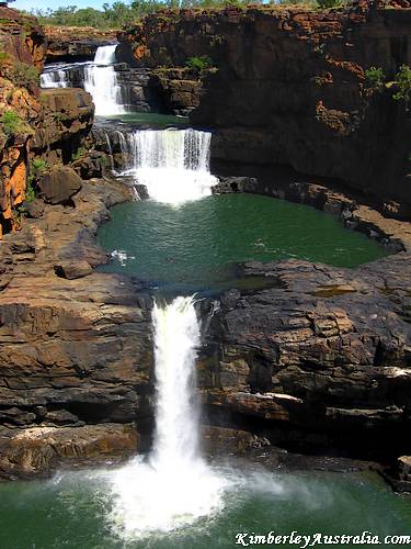
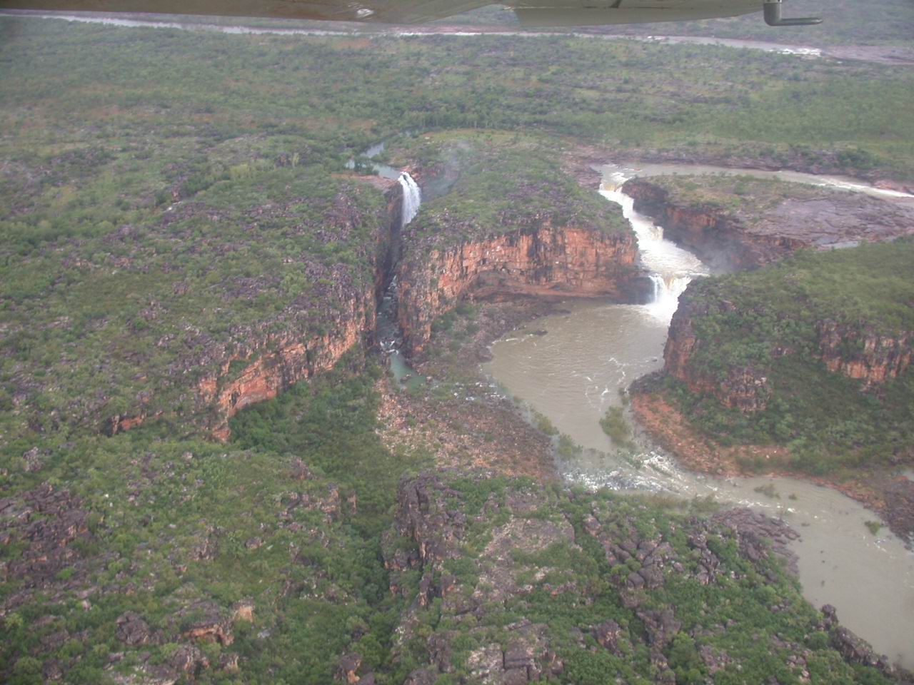
The picture below is Mitchell Falls from an airplane at high water flow. Click for full-size.
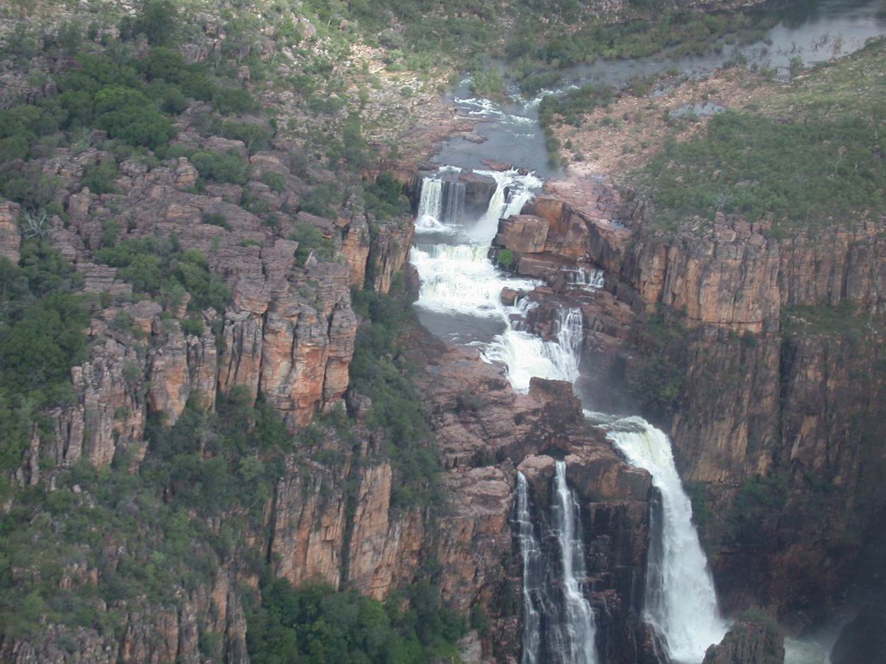
The picture below is from the Web site at the bottom; they don't have a name for this waterfall, but it's impressive. Anybody have an idea? (I don't have time to research it)