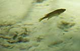
Will keep looking....
Great pict.
** ping **
There is a wonderful little spring with a sand boil under only 3 or 4 inches of water near Peterborough Ontario. Any Freepers in the area?

Will keep looking....
There is a small approximately 24" dia sand boil on the northern end of Cumberland islandNational Sea Shore.
It doesn't have a pond above it. If you put your hand in slowly it will penetrate but if you hit with your fist it will resist.
It is near Mount Cumberland Isalnd.... elevation 35 feet.
There are images of sand boils from the November 2002 mag 7.3 quake along the Denali Fault at the U. of Alaska Fairbanks Seismology website here:
www.aeic.alaska.edu/seis
Sand boils created in the January 6, 2001 Bhuj, India earthquake (moment magnitude 7.6).
Such features are caused by soil losing its internal cohesion (friction between soil particles) during the strong shaking of a large earthquake, a process called liquefaction. During liquefaction, the soil settles (consolidates), and extracted water may be forced to the surface. In sand boils, expelled water caries sand particles with it to the surface through volcano-like vents that may cover large areas with sand (sand boils are also called sand volcanoes). Liquefaction can also cause foundation failure during earthquakes as soil consolidates, and is a serious hazard in seismic regions with sandy or other porous soils. Ancient sand boil features, for example in exposed channel banks of the Pacific Northwest, are indicators of prehistoric strong shaking. Before sand boils were understood, some fossil examples were conjectured to be preserved animals burrows! The largest of the Bhuj boils shown is approximately 2 m in diameter.
[ Photo by C.P. Rajendran; reproduced from the cover of Seismological Research Letters, July/August, 2002.]
For more information: Soil Liquefaction Web Site at the University of Washington
Check out the pic in lower right side
tfn.net/springs/FernHammock.htm
This is the sand boil area at Juniper Springs