Transcript
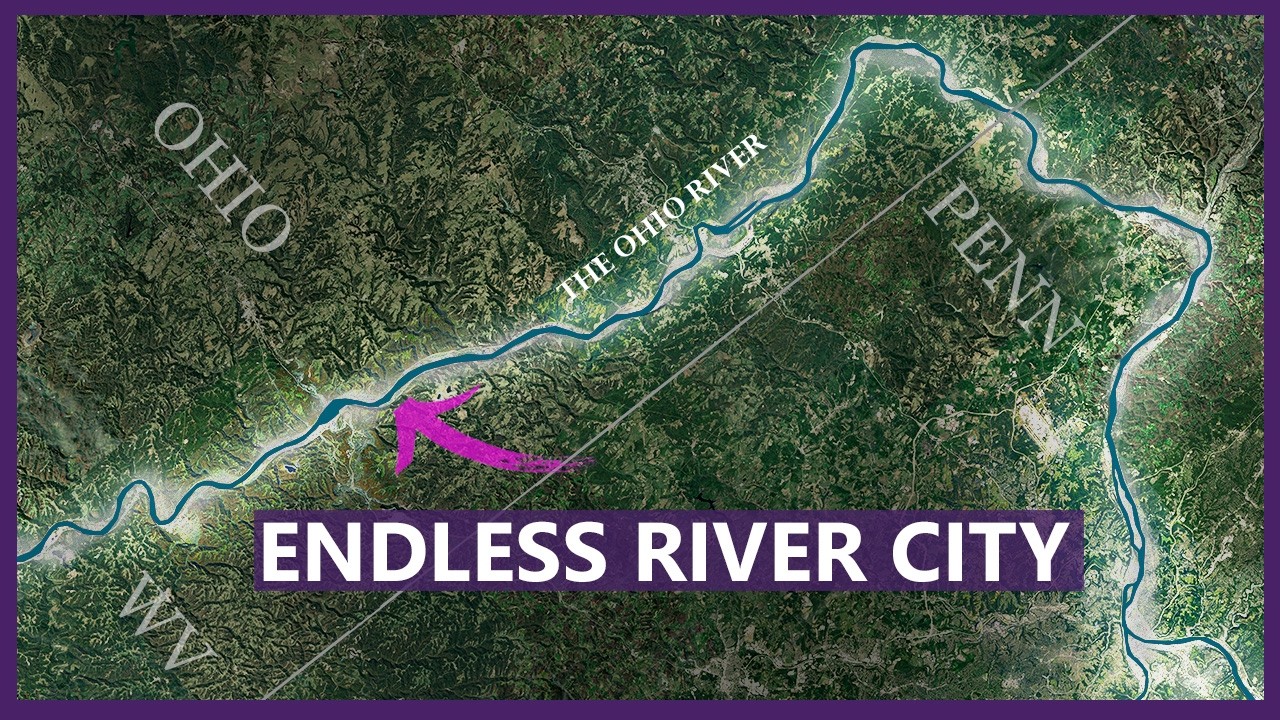
This is Pittsburgh. It’s your typical city with a normal urban footprint. This is just how cities are supposed to be shaped, right? So, here’s where things get weird. Starting outside of Pittsburgh is the most unique urban and industrial condition in the entire nation. And the craziest part, it’s 100 miles long. This continuous urban condition narrowly stretches along the Ohio River Valley. It has so many varieties of cities, communities, and industrial areas. The decaying towns of the Rust Belt are here, but there’s also a lot of surprises along the way that I don’t think anyone is expecting. Today, I’m going to go on a high-level journey through this area as there are so many unexpected and forgotten places that should be known on a national level. So, let’s lay out exactly where this 100-mile corridor begins and ends.
So, it might seem like I’m starting this linear city somewhat arbitrarily outside of Pittsburgh. I mean, after all, doesn’t the urban industrial corridor extend through Pittsburgh as well? Well, I think of Pittsburgh as a very distinct entity. It spreads three-dimensionally across a vast area and represents a different typology of urban existence. To show you what I mean, I want to highlight the unique character of this urban industrial corridor. This area I’m looking at is from Pittsburgh, Pennsylvania, all the way down to Mountainsville, West Virginia. Look at the roads that connect it, the multiple levels of infrastructure, the way the neighborhoods and even the municipalities are physically and visually separated from one another in this very unique urban typology. There is the river level and the plateau level. And it’s fascinating to see what types of development occupy each level.
Now, I couldn’t find a single name for this entire corridor. Is that because the people here don’t think of it as one continuous place? Instead, do they see the towns as their own unique entities? I want to propose a name for the strip for two reasons. First, to make it easier for me to talk about, and second, maybe to help it start gaining a sense of identity, and it deserves to be talked about more. I’m giving it the name the Ohio River Steel Ribbon. Let me know in the comments if I’m on to something here or I’m just completely off base.
Let’s take a high-level journey from the most upstream point at the edge of Pittsburgh to the appropriately named Mountainsville, West Virginia. So, I’m going to be starting the journey here at McKe’s Rocks. I think this is a perfect place to set the tone. Throughout this trip, we’re going to be seeing industry dominate the landscape and shape the towns around it. We’re also going to see the complicated relationship between these industries and the people who depend on them. The corporations do provide jobs, and they built some communities. But when the corporation really starts to struggle, the community declines with it. But here in McKe’s Rocks, the idea of Uklitian zoning has never been more visually obvious. The town is almost completely divided into separate zones: the industrial land to the north and the residential area to the south. The infrastructure is acting as hard boundaries between them. The railroad tracks combined with the dramatic change in topography create a clear western edge to the town, and development is forced into these narrow pockets of usable land.
The neighborhoods around the Pittsburgh and Alagany Railroad Company are especially interesting because they contrast so sharply with the industrial landscape surrounding them. Taking a quick vibe check from the ground, these appear to be classic company-built neighborhoods: modest two-bedroom, one-bath homes constructed for workers who power the industrial buildings we see here today. Many of these homes sell for under $70,000, which tells you a lot about the current economic situation of this little town.
So, we’re going to continue down the river. We’re going to sail past Belleview and Avalon, which are both very quaint and lovely little suburbs of Pittsburgh, and we’re going to get to Neville Island. So, Neville Township occupies nearly all of Neville Island. It’s developed primarily for heavy industry, petroleum storage, and manufacturing, and is connected to both shores by bridges, making it a strategic industrial location. And we can see those with these massive petroleum containers and this huge pile of aggregate for concrete. It really does feel like a post-apocalyptic wasteland on this island, at least until you reach the western end of the island. The houses in this township here are pretty unique because they aren’t company houses like we saw in the past town. These houses would easily go for a million dollars if they were in my home city of Charlotte, but they’re here and they’re valued around $200,000. Maybe it’s because they aren’t in the best shape. Or perhaps it’s because they are located on this pre-mentioned post-apocalyptic industrial island wasteland, but who can really say?
There’s a small little downtown area. I can’t really say they have a lot going on right now. That being said, it does look pretty reasonably well taken care of, which can’t be said for many of the cities we’re going to see today as we’re going down the corridor. What’s also interesting is there isn’t a single highway designation connecting this entire corridor. Instead, the routes constantly are changing names, which tells me policymakers don’t really recognize this urban condition as one continuous place. Annoyingly, Amtrak does not have service and stops throughout this area. And if there were anywhere in the country I’d want to sit on an Amtrak business class seat listening to Woody Guthrie with my forehead pressed against the window, it would be this area right here. But that’s just not the case.
Kilbuck Run, across the river from the island, there are actually some really lovely houses with piers over here. I appreciate how narrow the flat area is here, and we can see easily the highway infrastructure that’s necessary to support this corridor. We see a local road, we see train tracks, and we see a highway. They’re just trying to squeeze as much as they can together wherever they have land to do.
So, Coropolis was founded in 1886 as a railroad and manufacturing town, and it features one of the best-preserved traditional downtowns this side of Pittsburgh. And it is a really lovely little downtown. It looks to be no larger than a couple of blocks. It has some timeless architecture, some urban apartment buildings, it has restaurants, and it’s an interesting reminder that this area is not monolithic. There’s a lot of economic diversity along the river here.
So, Wickley has a population of just under 4,000 people, and it’s one of the wealthiest little towns outside of Pittsburgh. The median household income is $11,000 a year. And just to compare that to McKe’s Rocks that we saw earlier that had a median household income of $41,000 a year. So you can see the giant difference. An interesting thing to note about how this town relates to the river: other than this one little lookout, the riverfront is completely walled off by a rail line. I guess when you are wealthy enough, you no longer need a physical relationship to the river. The downtown does look really nice and very well taken care of. The lack of surface parking lots and shopping centers is noticeable, and it looks like they use the old historic buildings for their original mercantile purpose, which is pretty rare these days, at least in most of the country.
But now, let’s see how the wealthy on this corridor live. So, let’s dive into one of their neighborhoods. Yeah, these are definitely some expensive-looking houses. Across the river, it looks like a Sunbelt suburban development was dropped here. Going down the river, there are several cul-de-sac developments like this, and they are almost always on the hill instead of the lower plane as the cities and towns I am categorizing as part of the corridor. It’s a great visual analogy of how they are physically, stylistically, and culturally different than the historic way of building along the Ohio River.
We’re going to pass by Edgeworth, another little suburban town, Leitell, which has a massive industrial area, leaving barely any room for our neighborhood. Ambridge, a town of just under 7,000 people, was a planned company town built by the American Bridge Company in 1905. One thing I have loved in researching this video is all the little towns I would never have known about, even though I have traveled to this area a while back now. I mean, just look at this small town called Woodlon. It is crammed in a tiny little valley hidden from the river. Zooming in on it, sure it has seen some better days, but the buildings here are very highly crafted. And just look at the residential neighborhoods that are on the hill. I mean, these are some really nice houses. Woodlon, if you’re listening to me, it’s time to stop hiding, little guy. Let your star shine.
West Iliquipa, a town of about 9,000 residents. It’s interesting to see all these tiny little bedroom factory communities and how multifamily residential buildings are just placed in the middle of single-family residential neighborhoods. And I love to see this because it accommodates people of different economic backgrounds. It just gives people more options on places to live. But I’m really fascinated by Baker Street, which is this little neighborhood wedged in a valley between the hills. All the houses here look like they’re built exactly the same, but with different coats of paint. With the state that these houses are in, I would doubt that people are still living here in the next couple of decades.
As we go up north, we pass by narrow neighborhoods, strips of industrial areas, and we get to Conway. Here in Conway, we see the 20th-century style strip mall developments with a very new-looking Walmart. It’s funny. It’s on a street named Economy Way. And I guess the city saw itself transitioning from a place where people all work in a single factory and shopped at the factory store to now working at Walmart and buying everything from Walmart. How the times have really changed. I have to say the railroad that is bordering Conway from the river is just absolutely massive. After all, the railroad is just as important to the history and economy of this area as possibly even the Ohio River. Now, I’m going to look at what might be my favorite little conglomeration of towns that I’ve seen so far on this journey because there’s just so much going on in such a little stretch of the river.
[subscribe msg redacted]
So looking back at this group of cities, we have Manaka, we have Freedom, we have Rochester, we have Beaver, we have Vanport, we have a Texas roadhouse right here. I mean, what more could you possibly want? The town of Manaca has about 5,500 people and it’s near a massive Shell Pennsylvania prochemical complex, which honestly doesn’t sound like the best thing to live near, but this prochemicals plant is part of a massive $14 billion investment in Beaver County. This is a very positive thing to see, and it gives me hope that we might see a revitalization of this area at some point in our lifetimes.
Now over to the city of Rochester. It really looks like the Ohio River has a restraining order against the city. I mean, just look at it. There’s a highway. There’s railroad tracks, massive parking lots, and a downtown filled with pawn shops and gun stores. So, to answer your question, yes, the population here is declining.
Beaver is one of Pennsylvania’s oldest river communities. It was founded in 1792, right where the Beaver River meets the Ohio River. Beaver has a really nice series of parks in its downtown core that looks like the largest civic area I’ve seen so far on this journey. The downtown has wide streets and it really does look full of life. It’s classic Americana. Looking at the architectural styles going into the neighborhoods, the city looks very well taken care of. Before looking at all these places, my impression was that everywhere in the rust belt is decaying. But I think it’s safe to say that Beaver is doing pretty well for itself. It’s interesting to note that it actually has seen a population increase since the 2020 census.
And just something to note as a person from the city of Charlotte, North Carolina. Yes, uh Charlotte, I am blown away by all the historic buildings and districts that everyone has here. If you live here, you are so lucky in so many ways to be near architecture and cities that are walkable like this.
If you’re searching for a functional passenger train station in Beaver, you should know that the rail service to Beaver ended decades ago. The historic Beaver train station still stands luckily. Originally an 1897 passenger terminal, it has been beautifully restored and it’s an event center now, which I find incredibly sad. Beaver Valley Mall is not doing very well itself. When your mall is anchored by a U-Haul, a Roll King Guns, and a church, it’s no wonder this mall has a 3.5-star rating.
Past here, the urban and industrial areas start to get a little more sparse. But the Ohio River, Steel Ribbon, as I have stated earlier, is continuous. Please don’t trash the concept of this video in the comments, please. I may start to cry. The town of Shipping Port is where Beaver Valley Nuclear Power Station is, and it’s a massive complex. To briefly stop at Midland, a town of 2,500 people, is crazy to look at the former industrial plant and just see it slowly degrading back to nature. It’s sad to think that this will be the fate of a lot of the places that we’ve seen on this journey.
And just like that, we leave Pennsylvania and we enter the area of the tri-state point with Ohio generally being on the northwest side of the river and West Virginia being towards the southeast side. Looking at the first little town in Ohio called East End. I’m guessing they haven’t yet mastered the art of sidewalk building because it just kind of stops and starts, but other than that, it doesn’t look stylistically much different than the Pennsylvania towns we’ve been looking at so far.
Chester, West Virginia is our first stop in West Virginia. The downtown was absolutely gutted for fast food drive-throughs. There doesn’t seem to be a large industrial presence here. I’m starting to notice a lot of above-ground pools, and I didn’t think it would be a great climate for that, but to each their own. East Liverpool has just under 10,000 residents, and it’s known as the pottery capital of the world. Yes, it did produce a lot of pottery, but I feel like calling it the pottery capital of the world is kind of an overstatement, but we’ll let it slide. I just love the architecture here. As we zoom in on the downtown, it really is beautiful. But I do feel a bit sad when I think about when these quaint towns were built. The people here, they must have always thought that the grandness that they envisioned for this area would just continue to grow, but instead is now today a stagnating place.
In 1970, East Liverpool, Ohio had 26,000 residents, which is crazy because today it only has 10,000. I mean that is a dying city. But let’s keep getting down the river. Newell, West Virginia, which is home to the famous Laughlin China Company, which is the maker of the Fiesta Dinnerware. And knowing that they make Fiesta wear, I had high hopes that this would be a cheerful fiesta-like atmosphere. So, let’s see. It’s more akin to that party you show up to that you thought would be wild, but it’s just a couple of people sipping out of a bunch of solo cups. Tweaking, crafting is here, which might be a bad omen for the town. I have to say though, the lighting for this Google Street View on Harrison Street is really nice. Just fascinating to see the built environment as it is and just soak in the atmosphere. There’s a little kitty over here. This Pink Floyd Hall is such a fun little surprise. As a big Pink Floyd fan myself, whenever I get a chance to make it to New, West Virginia, I have to come see it. But that’s when my YouTube videos have a larger budget than the $20 that I allocate for them right now, which I spent at Bojangles for breakfast this morning. If you’ve been to this place, let me know in the comments. I’m dying to know what its story is, but we got to keep moving down the river.
We’re just going to keep going past Wellsville, Ohio. And this is where the Mountaineer Resort and Casino is. I know many people in this area are employed at this resort, but I just don’t love the idea of a casino as an economic driver in an area. Gambling just isn’t a good financial decision for most people. Most people who come here just end up making a sizable donation to a corporation. But I’ll leave it there for now. This cluster island is really keeping the corridor continuous. There are no gaps in my 100m corridor here, people. I don’t want to hear in the comments that this 100m corridor is a farce. It is not. Moscow, then Stratton. They’re really holding down the concept of this video.
We get to Toronto, Ohio. It has a little bit less than 5,000 residents, and it’s known as the gym city and a once thriving steel town. It is a little less thriving today, I would have to say. But I love how narrow Fourth Street is through the downtown area. It’s a great human scale and it looks like a very walkable area. And it looks like there are still many businesses open here as well. Looking at the neighborhoods, someone just built a McMansion. I’m seeing some more above-ground pools. And I’m fascinated by the historic dense housing development on Madison in town. And at the edge of town are of course giant industrial buildings. The time factory that is a steel producer is still in business and it looks like it’s still going strong. It is a giant employer for this town. Brown’s Island is the site of a former coke producing plant. Given the looks of it, I doubt any legal coke is being produced on this island.
Now, this next city may be one of the most interesting we’ve seen so far. We get to Weirton, West Virginia, and it has a little bit less than 20,000 residents. This city is in this crescent-shaped valley that intersects at the Ohio River in two places. One half is a dense gritted urban fabric. The other half is a massive steel producing factory. The scale of this industrial area is just staggering. So, the Weirton Steel Corporation was once one of the largest integrated steel mills in the entire country, employing over 12,000 workers at its peak. It was both West Virginia’s largest private employer and its largest taxpayer. Unfortunately, following bankruptcy, multiple corporate acquisitions, and the idling of remaining operations, the property is now being redeveloped for other uses. Notice how the golf course and the country club are elevated above the town, so you can look down on the town below as you’re at the 18th hole. Somewhat of a metaphor, I think, but for me, this is really the most interesting little sliver of the city. Looking at how the city grid just starts to vanish back into nature in the far north of the city makes me wonder how much of these cities we’ve seen so far will end up just like this.
Now on to Steubenville, Ohio. The downtown here feels like it’s on a much greater scale than anything we’ve seen so far on this journey. With a population of 18,000, it is a real city. It peaked in the 1940s at 37,000 people and it’s been deflating ever since. The churches are stunning and the office buildings are actually really tall with the First National Bank in Trust building stretching up to 12 stories tall. I always wonder what these places were like back in their heyday when things were growing and the money was coming in. What’s that phrase about wishing you knew you were in the good old times when they were happening? Well, I wish I could walk these streets in that moment. Instead, I am virtually loitering in the year 2026. I haven’t talked a lot about bridges on this journey, but the Market Street Bridge is so narrow and old, it’s really just a relic of the past. It’s amazing that it still exists. In Finsby, West Virginia, the ground is just stained with coal at the Port of West Virginia.
I really like the houses here. They’re so quaint, and it’s just a shame that so much beauty seems to be rusting away in this corridor. Wellsburg, West Virginia, is one of the oldest chartered cities in West Virginia. Okay, so some of my favorite cities that I really want to show you are further down the river. So, we’re just going to skip a couple of towns here. Now, if you love history, this next city is for you. Martins Ferry, Ohio, is the oldest settlement in Ohio, and it’s founded in 1779. And it really does feel very historic, not just the downtown area, but in the neighborhoods as well. It’s a very compact city with a slightly more irregular grid than other cities we’ve looked at today.
One thing I want to mention is that I’m giving a very big picture view of these cities, and I am glossing over a lot of little details, and all these places really deserve a full-length video. So, any interesting thing I leave out in these places is not meant to disrespect anyone or any place. It’s just that I don’t think anyone’s capable of listening to me drone on for hours on end. So, this video has to be a little bit shorter than that.
Bridgeport, Ohio. It’s connected to Wheeling, West Virginia, by the historic Wheeling Suspension Bridge. Wheeling, West Virginia, has a population of about 26,000 people. It’s the first capital of West Virginia. It has the most populated island on the entire Ohio River, and it’s just a lovely city that is overdue for rebirth. I’m actually fascinated by Wheeling. My first ever long-form YouTube video was done on Wheeling, West Virginia. So, if you’re interested in knowing a little bit more about this special city, I will link this video at the end of this video, the little town of Bair, Ohio.
I am in love with the historic B&O railroad viaduct. A very Romanesque, aqueduct-esque structure. Definitely from a time when infrastructure had a bit more of a high-level craft to it, but of course, manual labor was a lot cheaper back in the day. This idea of craft, it’s a running theme for all the buildings and the infrastructure along this corridor. Things are just so finely crafted here, but a sense that the best days are long in the past. And the hope for the future isn’t really growth. It’s just preservation at this point. I mean, in this little town, when I look at a vacant lot, I don’t think, “Wow, I can’t wait to see how they use this space in the middle of the city.” Instead, I look at the buildings and I think, “Man, I bet they’re going to level this building any day now. What a shame.”
We pass by Big Mansion. It’s a small industrial city that expanded during the steel boom, and it’s completely cut in half by a highway. And I’m starting to notice a trend with streets paved with brick in this area.
And finally, we get to the last stop on this journey at the end of the 100-mile corridor: Moundsville, West Virginia. A town of about 8,000 people. The cities, the industrial areas, and here. And I hate to say it, but this place looks incredibly bleak right now. Old historic storefronts have been covered up. Vacant lots are everywhere in this core. A couple of blocks from the downtown is the Grave Creek Mound. It’s one of the most important prehistoric sites in the entire country. It’s a solemn reminder that this area has been home to humans for over 2,000 years, showing that sometimes with death, there is a rebirth, and this place will always be a place for humans to thrive. As long as we all appreciate this steel ribbon on the Ohio River, I think this area could come back and see a rebirth like we’ve never seen before.
If you have any stories to share on these cities, please leave them in the comments. I would love to hear them. And by the way, check out this video I made on Wheeling, West Virginia, almost a year ago now. It was my first ever long-form video. Probably not my best work, but Wheeling is a fascinating little city that I think you’ll appreciate getting to know a little bit more. Thank you all for watching.