Posted on 10/09/2026 11:05:00 AM PDT by E. Pluribus Unum
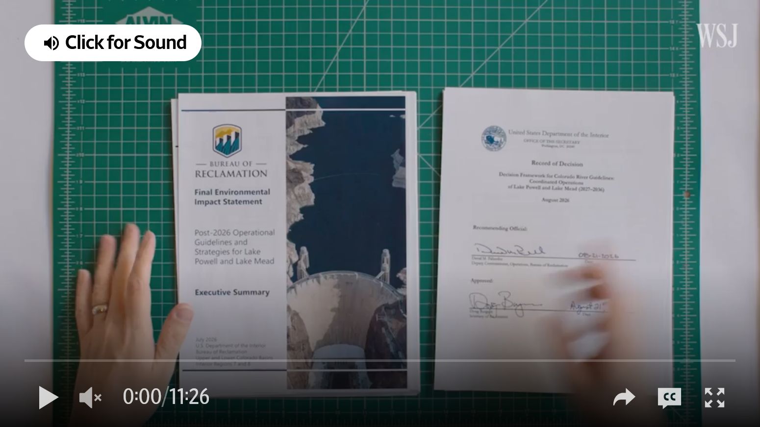
About 40 million people rely on the Colorado River. But an extended drought and a century-old legal framework have pushed the system to a breaking point. Now, a federal plan threatening deep cuts has ignited a political and legal war across the Southwest.
Watch Arizona State University water law professor Rhett Larson break down where the government’s framework falls short, why easy fixes won’t solve the issue, and what structural overhauls are needed to protect a crucial regional economy.
(Excerpt) Read more at wsj.com ...
The last 100 million people attributed to immigration are most of the problem.




The Austrian model would work, the cities will out bid the agricultural every time as retail water rates are 10x or more vs agricultural the units are not even comparable. Agri acre feet 325850 gallons, residential and commercial is by the 1000 gallons unit. $10 per 1000 retail in places vs $100 for an acre foot goes which one gets the water in a bid system.
Thanks those should have already been sized to a 6.5” mobile screen they show up on mine in line with the text above them.
“Desalination: Can turn seawater into usable water, but remains expensive”
Expensive? How expensive is no or limited water? Not the best argument to make. California has an ocean of water waiting to be desalinated and should be the leader in the technology.
Yes, it is true. Sale of the water rights should more than compensate farmers for the value of the crops. Otherwise they could bid more for the water.
There would be considerable relocation of resources as the system adjusts. Watch for “rent seekers” especially governments, to try to cash in, demanding a “share”.
Expensive? How expensive is no or limited water? Not the best argument to make. California has an ocean of water waiting to be desalinated and should be the leader in the technology.
The constraints on desalination building is primarily regulatory, and, to a certain extent, power costs.
Ask the Israelis they do it for 54 Cents per cubic meter wholesale. That’s cheaper than north Texas bulk water rates and far under retail water rates.
One four pad nuke plant ask the Koreans to build a monster like they did for the UAE. Build it right at the mouth of the Colorado River in the Sea of Cortez it’s only 480 feet up hill to Lake Havasu where both CA and AZ pull their River water out of. A 4 acre pad dedicated to RO desal and pumping can make 10 million acre feet per year more if you use the 15,000MWth of 40C condenser heat to drive MSF desal too upwards of 4 million acre feet more. That single 4 pad would double the volume of water in the whole basin. We gave Ukraine 200 billion a project of this scale would have been less. It’s only 220 miles up the river valley and across the flat lands and couple of small ranges of hills.
We have the tech we lack the will.
Who in 1920 would have thought the country would be stupid enough to build cities with millions of people out in the desert?
IIRC, in Arizona much of that alfalfa is grown by foreign farm owners
I haven’t even read the article yet but I’m sure it is Trump’s fault.
Oooooooo that’s a bingo!
Saudi is the major player in AZ.
I am.just gonna leave this here discuss.
To move 8.02 million acre-feet (MAF) per year north from Mexico to Lake Havasu, you have to build an engineering marvel that handles a massive flow rate of 11,100 cubic feet per second (cfs).
To put that volume into perspective, the [California Aqueduct](https://www.google.com/search?kgmid=/g/11b6__0bl5) maxes out at about 13,100 cfs, and the [Central Arizona Project (CAP)](https://www.gcairoinc.com/central_arizona_project.php) handles roughly 3,000 cfs. Your proposed open-top, concrete-lined aqueduct would essentially be a man-made river nearly four times larger than the CAP canal, engineered to carve through the desert and step up in elevation. [1, 2, 3]
## 1. Blueprint & Dimensions of the Megachannel
Because water creates friction against the walls of a canal, civil engineers use a trapezoidal cross-section to maximize flow efficiency and prevent the banks from collapsing. [4]
To move 11,100 cfs smoothly via gravity, the channel requires massive structural dimensions:
*
* Top Width: ~110 feet (the width of an 8-lane highway).
* Bottom Width: ~40 feet.
* Water Depth: ~30 feet deep, surging with fast-moving, crystal-clear desalinated water.
* Lining: 3.5 to 5 inches of steel-reinforced concrete to prevent water from seeping out into the porous desert floor. [2, 5, 6]
*
[ Sea Level ] ──► (Pump Lift #1: +150ft) ──► [ Gravity Canal Section A (Drops 5” per mile) ]
│
┌────────────────────────────────────────────────────────────────┘
▼
(Pump Lift #2: +150ft) ──► [ Gravity Canal Section B (Drops 5” per mile) ]
│
┌────────────────────────────────────────────────────────────────┘
▼
(Pump Lift #3: +200ft) ──► [ Gravity Canal Section C ] ──► 🌊 [ Enters Lake Havasu at 450ft ]
1. The Segments (Flat Runs): The channel is built in long, gently sloping concrete segments. The water moves along these stretches under pure gravity at roughly 3 to 4 miles per hour.
2. The Steps (Pumping Plants): When the canal floor gets too close to the local ground level, it hits a massive pumping plant. A series of industrial vertical-turbine pumps—powered directly by the dedicated 500 MW line from the nuclear plant—lifts the literal river up a massive concrete wall or through a ridge. [7, 8, 9]
3. The Reset: Once the water is lifted 150 to 200 feet at the “step,” it empties into the next elevated canal segment to start its slow, gravity-driven downhill slide toward the next step. [7]
*
* Siphons for Crossings: The aqueduct will inevitably cross local dry washes, highways, or existing canals. To cross these without interrupting flow, engineers build inverted siphons—massive underground concrete pipes that drop the water under the obstacle and use hydraulic pressure to push it back up into the open canal on the other side. [3, 10]
* The Chocolate Mountains Ridge: Just north of the border, the terrain gets rugged. Instead of trying to build a canal over every ridge, engineers use tunnel-boring machines to drill a massive horseshoe-shaped tunnel (roughly 25 feet in diameter) straight through the mountain rock, letting the river flow uninterrupted right through the mountain. [7, 8]
*
## 4. Mitigating Desert Evaporation
Running an open-top river through the blistering Sonoran desert means facing extreme evaporation rates. To protect the 8 MAF annual yield, the canal can be fitted with floating solar arrays. Covering the 110-foot-wide channel with solar panels accomplishes two major goals: [11, 12]
1. It shades the water, cutting evaporation losses down to nearly zero.
2. It generates gigawatts of supplementary clean energy along the 230-mile corridor to help offset the massive power required by the pumping stations.
## 1. Capital Expenditure (CapEx) Estimate for the Project
Building a world-altering binational infrastructure asset of this scale requires pricing three independent mega-systems: the nuclear powerhouse, the desalination footprint, and the man-made river.
*
* 4-Reactor Nuclear Facility (APR-1400): Based on South Korea’s historical construction costs for the 4-reactor Barakah plant in the UAE, a 5,600 MW nuclear station sits at roughly $25 billion to $30 billion.
* 12 MAF/Year Hybrid Desal Facility: Scaling up a hybrid Seawater Reverse Osmosis (SWRO) and Adsorption system to produce 11.9 billion gallons a day (12.02 MAF/yr) requires an unprecedented buildout, roughly priced at $45 billion to $55 billion.
* The 230-Mile Trapezoidal Aqueduct: Incorporating a 110-foot-wide steel-reinforced concrete channel, massive stair-step pumping stations, inverted siphons, and 3,490 acres of canal-spanning floating solar panels requires roughly $25 billion to $35 billion.
*
Total Estimated CapEx: $95 Billion to $120 Billion
| Spending Category / Megaproject | Total Cost (USD) | What It Buys / Achieves |
|-—|-—|-—|
| U.S. Appropriations for Ukraine Response (Feb 2022–Present) | $196.4 Billion | • $130+ billion in direct military/security assistance • Governance, humanitarian, and economic operational support • Replenishing U.S. domestic defense stockpiles |
| Binational Nuclear-Desal Megaproject (Estimated Maximum CapEx) | $120.0 Billion | • 4 South Korean APR-1400 nuclear reactors • The largest hybrid desalination facility on Earth • A 230-mile solar-canopied, man-made river |
*
* The Current Spend ($196.4B): The funding dedicated to the Ukraine war represents an ongoing, reactive geopolitical expense aimed at containing foreign conflict, subsidizing international budgets, and cycling capital through domestic defense manufacturing industries. Once munitions are spent, that specific capital does not return a physical, long-term resource dividend. [4, 5]
* The Project Spend ($120.0B): For roughly 60% of what has been spent on the Ukraine response, the United States could fully fund this entire nuclear-desal project from scratch. It is a one-time capital investment in a permanent, physical asset that completely solves the Southwest water crisis for the next 80 to 100 years.
*
By building a new, climate-resilient river from the Sea of Cortez to Lake Havasu, the project transforms the geopolitical dynamic of the American West and northern Mexico—turning a multi-state scarcity conflict into a multi-generational economic and agricultural boom.
Check out my last post we can build for less than we have the ukes a second Colorado River flowing inland today, no new tech needed nothing but good old will to do great things were were a country that could pull off such a project. Now we would absolutely need the Koreans and Israelis but so be it.
12 million acre feet per year the largest desal on the planet and not that hard to build. In less than a decade we could solve the water issue for the next 100 years the life of the reactors themselves.
Nukes yes now what was the question.
I have a great idea...
a. Boot all the illegals using up water.
b. Stop subsidizing the growing of corn for ethanol in Colorado River system and outlaw irrigation for the purpose of growing corn in the Colorado River system desert.
c. Tell California and Mexico they can both pound sand - they’ll get water when implementing a, b, and c refill the Colorado River aquifer. Half the problem wouldn’t exist without Mexican illegals and most ofnthe rest of the problem wouldn’t exist without California’s crooked deal.
Make it a mile-wide lake with counter-invasion elements.
Then Texas sells the water through a pipe going back to Tucson and on to Phx.
The AZ 'relief' remainder then gets piped instead to Kalifornia.
Profit: TEXAS.
Corn is not the main crop it’s almonds and alfalfa hay for cows.
Alfalfa is 4-5 million AF a year in California alone not just from the Colorado basin the North Sac basin sends lots of water to the central valley too.
Get over the illegals even in California all of not agricultural us is only 10% of the state total that 10% is residential and commercial and industrial too.
Residential is half that 10% so 5% even if half the population was illegals it’s not than only 2.5% would be saved again you are flat out tilting at windmills.
Agriculture is the water hog always has been using FIVE FEET of water per square-foot of land area per year to grow grass in the desert is stupid.
At least get your facts right. Or let the actual hydro geologists do what is needed.
https://www.ppic.org/publication/water-use-in-california/
Banning almonds and alfalfa would fix the imbalance over night. The cities use so little compared to big agri it’s laughable to worry about 5% when you are dumping millions of AF on cows grass.
The Rio you smoking something?
There are already 2 empty massive reservoirs in the Rio in New Mexico they sit empty because every drop of that river is used up it’s lack of rainfall vs consumption no amount of storage space can fix a structural deficit like this.
Elephant Butte Lake: 4.5% full as of 2026-10-09
https://www.waterdatafortexas.org/reservoirs/statewide
The only choice is to taken more water from the NM part of the snow pack and rain across the continental divide in the Colorado basin side and they push it via tunnels under the divide into the upper Rio basin so even NM is mining Colorado River water.
Look up you see that 100W line where is all that red? Yeah the Rio basin. Colorado and WY and parts of NM in the Colorado basin side are green that’s it and it’s almost all snow pack and monsoon season rain. The whole western part of the country does multiple decade long droughts it’s long cycles again and again over 1000+ year times spans. We have decades of dry left of this cycle holds like the tree rings show it should. El Nino might help some it did dump a tropical storm remnants across Texas and parts of NM recently but that didn’t end out droughts in Texas the ground is so dry after 60+ days no rain it all ran off as flash floods little for.down to the vados zones
Disclaimer: Opinions posted on Free Republic are those of the individual posters and do not necessarily represent the opinion of Free Republic or its management. All materials posted herein are protected by copyright law and the exemption for fair use of copyrighted works.