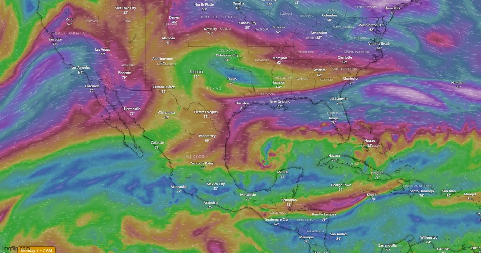
The current upper-level winds; 35K feet aloft.
These are the winds that will direct large storms. They will drag the top of the storm and the bottom will follow.
The upper winds currently run right through the Florida peninsula.
Milton is predicted to move north and get grabbed by the upper-level winds and get pulled through the middle.
The last 3 disturbances to the west of Mexico haven't been strong enough, nor north enough, to ride that big line of winds through Southern California.
Water temperature and wind direction north of these areas has not been conducive to creating disturbances.
The best they can HAARP are these around Acapulco.
Suffice it to say that I believe this is evidence for weather creation/manipulation.
The GOM/Caribbean storms are [being generated] developing in the same general location.
They [appear] ‘timed’ for this time of year that has upper-level winds blowing clearly W->E.
Although not an anomaly that so many GOM storms are forming at this time of year, it does point to water and wind variables that can be taken advantage of.
That, and the “natural formation” storms off the West Coast of Africa have tended to be pushed north as they touch the Gulf Stream.
Jamaica been havin a bad coupla months, mon.