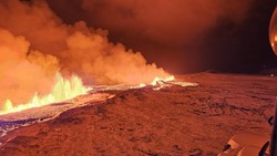
Grindavik sits in a penninsula at about 10-20 meters above sea level. This eruption is happening on a plateau about 90-95m above sea level ~5km to the north.
There are no intervening ridges, only a stepped valley that would carry any large lava flow pretty much straight through Grindavik to the sea.
https://www.google.com/maps/@63.8613701,-22.3718264,13.04z/data=!5m1!1e4?entry=ttu
Cue “The End” by The Doors:
Coast Guard Helicopter Flyby Along Eruption
https://www.youtube.com/watch?v=nhPyeDropFs
