Free Republic
Browse · Search
General/Chat
Topics · Post Article

To: SunkenCiv
Maybe what the author is attempting to do is liken what he sees on Google Earth to the raised field agriculture seen throughout various regions of Peru and Bolivia:

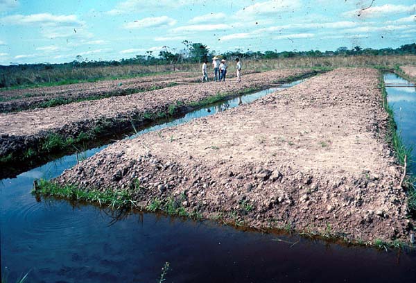
However, it seems most unlikely, the distance between the 'channels' is far too wide at almost a mile, to practise any form of agriculture we can image. Furthermore, the raised fields of which I have various images collected, all have cross-channels, without which there would be no entry or exit possible, to the watercraft presumed to have been used used for transportation.

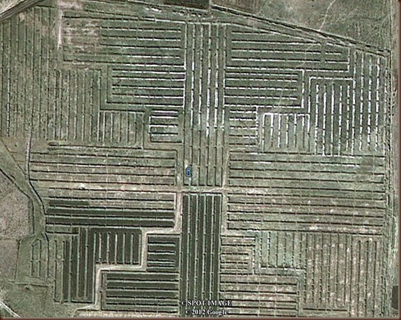
Fossilized Tiwanaku Farmland from the Above (Suka kollas)

159 posted on 01/04/2015 4:38:13 PM PST by Fred Nerks (Fair Dinkum!)
[ Post Reply | Private Reply | To 157 | View Replies ]


To: Fred Nerks; SunkenCiv; All

Since nearly all the lines are oriented to the Okavango, then they would not need cross channels. I would be interested to know to what extent all this is flooded in the rainy season. Anyone have a Google Earth or similar site that would cover that season?


164 posted on 01/05/2015 1:03:42 AM PST by gleeaikin
[ Post Reply | Private Reply | To 159 | View Replies ]

Free Republic
Browse · Search
General/Chat
Topics · Post Article


FreeRepublic, LLC, PO BOX 9771, FRESNO, CA 93794
FreeRepublic.com is powered by software copyright 2000-2008 John Robinson