To: Fred Nerks; SunkenCiv; All
Since nearly all the lines are oriented to the Okavango, then they would not need cross channels. I would be interested to know to what extent all this is flooded in the rainy season. Anyone have a Google Earth or similar site that would cover that season?
To: gleeaikin
Since nearly all the lines are oriented to the Okavango, then they would not need cross channels... 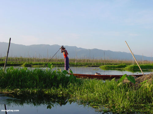
I'm thinking like I am the gardener, producing potatoes and or maize/corn on fields that are almost one mile in width and which go on forever...with channels in between that are some 6 foot wide that carry the water from the delta.
The above image is an example from Myanmar (Burma) and one needs to ask; how would all that produce be transported? By boat? For how many miles? How are the workers delivered? How many miles would they need to walk or row to work?
I would be interested to know to what extent all this is flooded in the rainy season. Anyone have a Google Earth or similar site that would cover that season?
I can't offer any further information, I'm tempted now to write to the author and ask him that very question.
166 posted on
01/05/2015 3:48:17 AM PST by
Fred Nerks
(Fair Dinkum!)
To: gleeaikin
http://vimeo.com/64351951
this is the vimeo video that started it.
Ancient Irrigation of South Africa
from Gary Schoenung 1 year ago
The Okavango delta in South Africa is surrounded by evidence of hundreds of miles of artificial irrigation. The parallel channels that you see are a mile or so apart. This suggests that there was once an extremely large population there utilizing advanced agricultural techniques. (VIDEO UPDATED September 8 2013)
It’s one of a series of 10:
http://vimeo.com/user12206452/videos
167 posted on
01/05/2015 5:00:56 PM PST by
Fred Nerks
(Fair Dinkum!)
FreeRepublic.com is powered by software copyright 2000-2008 John Robinson