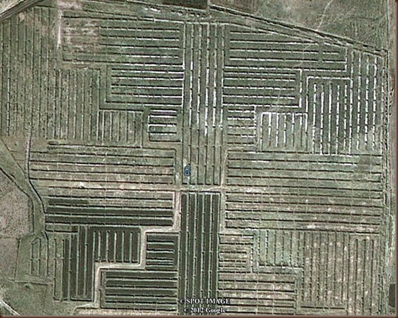
Thanks glee’. The whole formation is fairly uniform, and spread out over such a large area, that it is bound to be natural, because it would otherwise be tremendously extravagant of labor, not to mention that it would have been done to address a lack of water, and that characteristic doesn’t correlate with a large population capable of constructing it over such a large area. One of the papers someone up there linked had the steps needed to produce what is seen, and it seemed plausible. The nearby delta used to drain into a now-vanished lake, and these straight-line formations are seen on both sides. This isn’t to say that it could not be artificial, just that one would expect different areas of it to be more eroded because it is older, with a smallish population gradually moving to find fertile soil and abandoning former areas.
Maybe what the author is attempting to do is liken what he sees on Google Earth to the raised field agriculture seen throughout various regions of Peru and Bolivia:

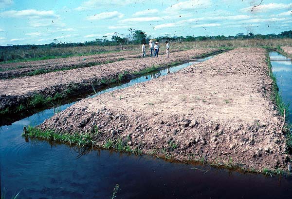
However, it seems most unlikely, the distance between the 'channels' is far too wide at almost a mile, to practise any form of agriculture we can image. Furthermore, the raised fields of which I have various images collected, all have cross-channels, without which there would be no entry or exit possible, to the watercraft presumed to have been used used for transportation.
Fossilized Tiwanaku Farmland from the Above (Suka kollas)