Skip to comments.
The "Mother" of all IRAQ Map Links! (Must See!)
UT Library Online ^
| 3-23-2003
| Editorial Staff - Compiled by VANNROX
Posted on 03/23/2003 6:40:46 PM PST by vannrox
Perry-Castañeda Library
Map Collection
Iraq Maps
The following maps were produced by the U.S. Central Intelligence Agency, unless otherwise indicated.
Country Maps
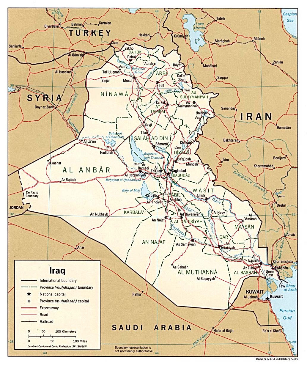
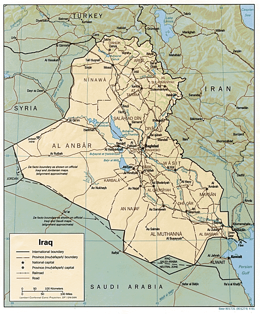
- Iraq (Political) 1999 (323K) and pdf format (199K)
- Iraq (Political) 1996 (295K)
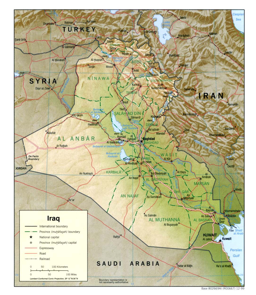
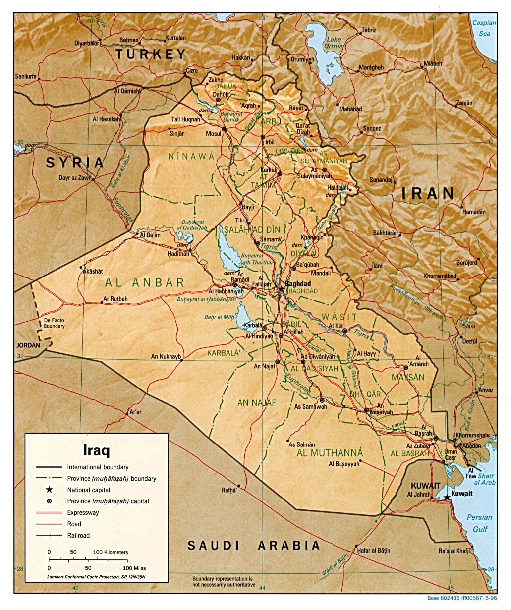
- Iraq (Shaded Relief) 1999 (323K) and pdf format (221K)
- Iraq (Shaded Relief) 1996 (307K)
- Iraq (Shaded Relief) From the CIA Atlas of the Middle East, 1993 (580k)
- Iraq (Shaded Relief) 1991 (377K)
- Iraq (Small Map) 2002 (14K)
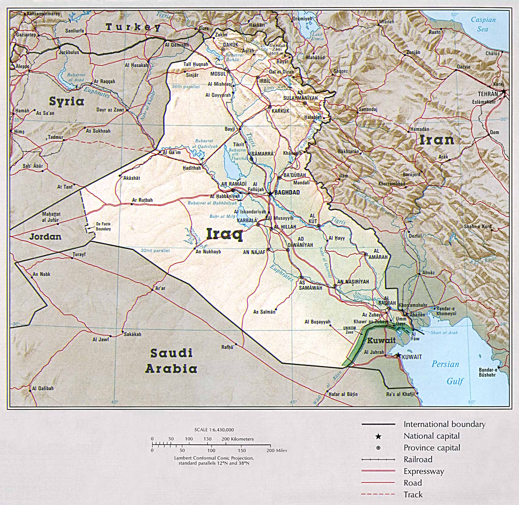
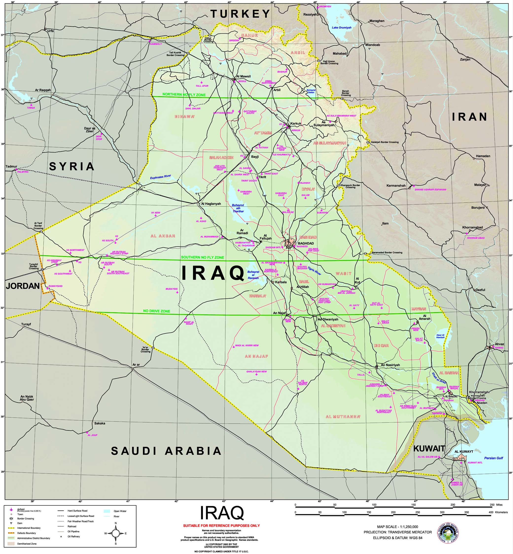
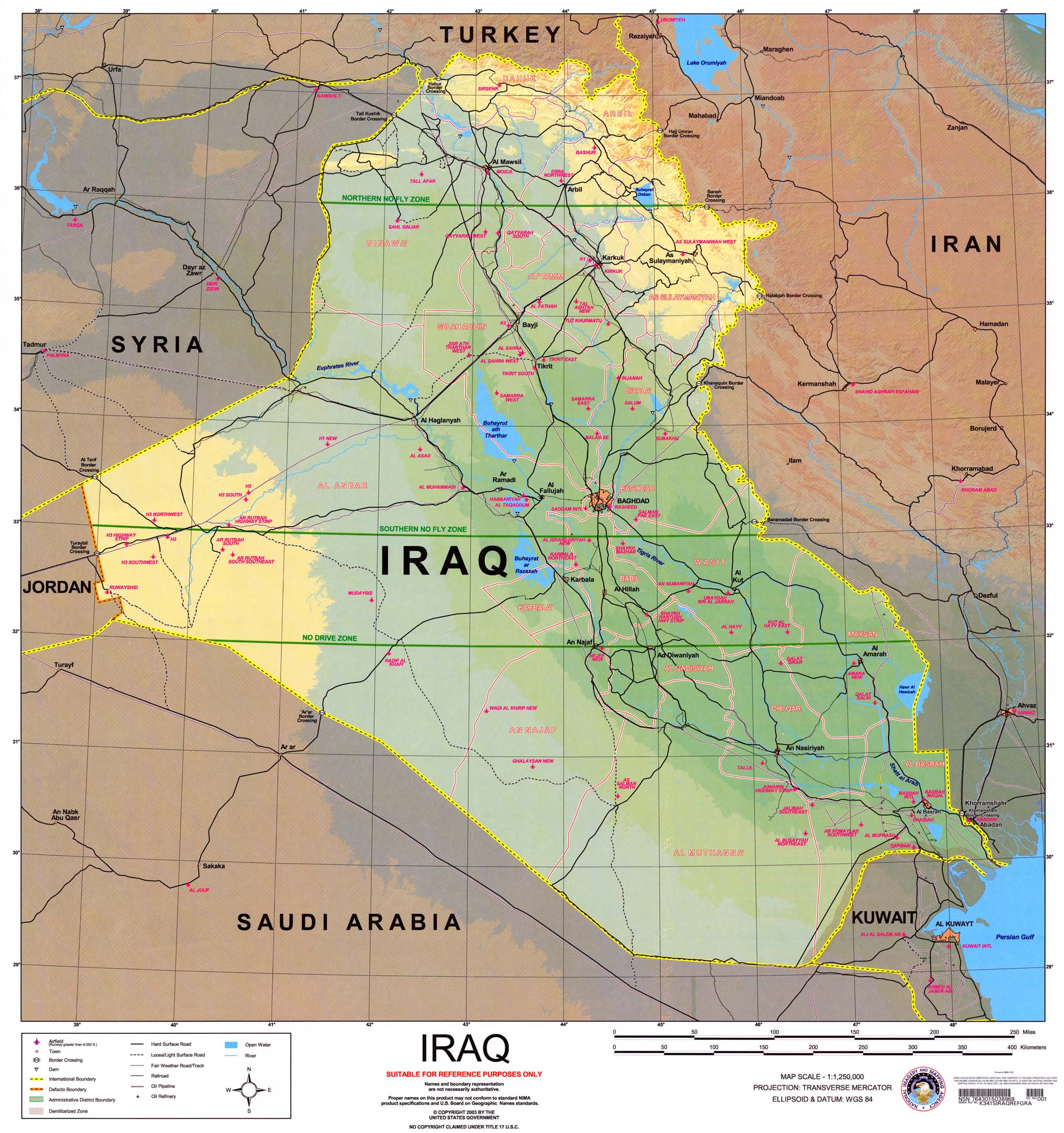
- Iraq (Special Reference Graphic) NIMA 2003 (608K)
- Iraq (Special Reference Graphic) NIMA 2003 (608K) with gradient tints
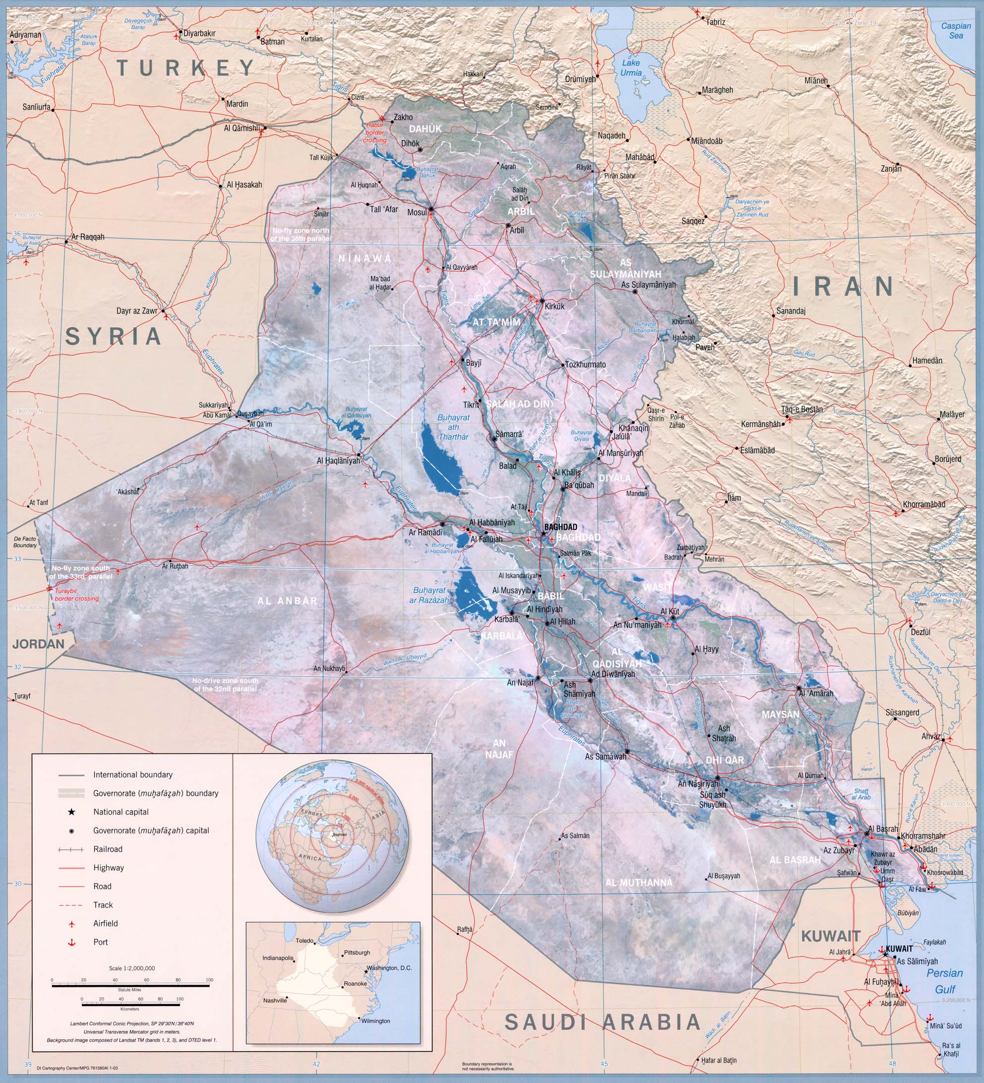
- Iraq (Wall Map) (632K) From Iraq: Country Profile, 2003 and Entire Map with insets (1.2MB)
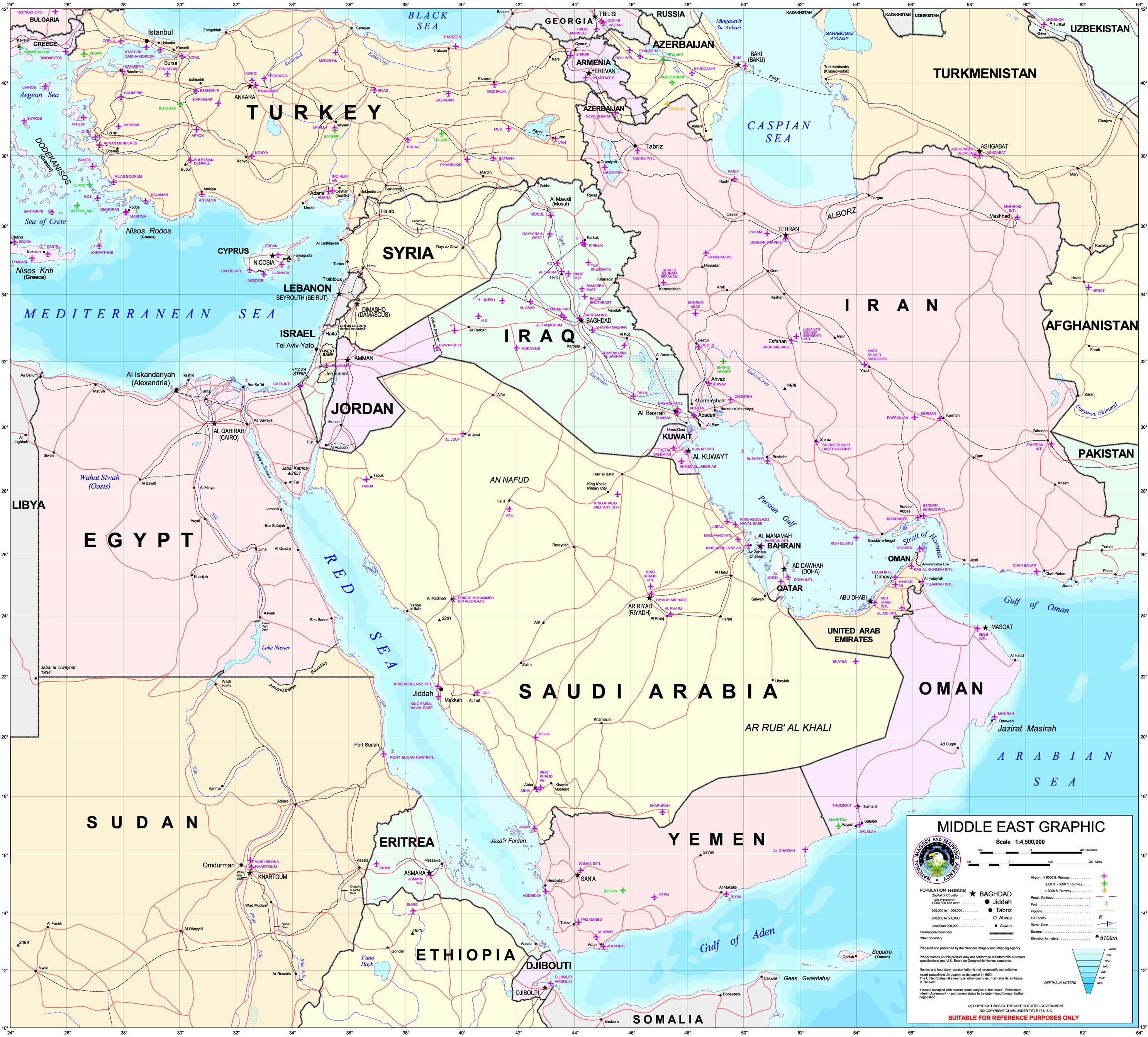
- Middle East Graphic (Special Reference Graphic) NIMA 2003 (1MB)
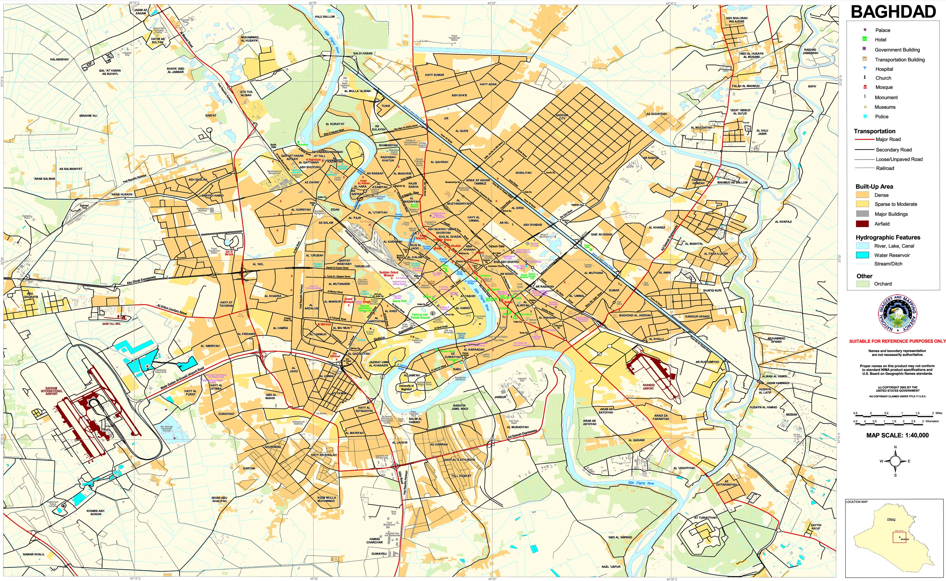
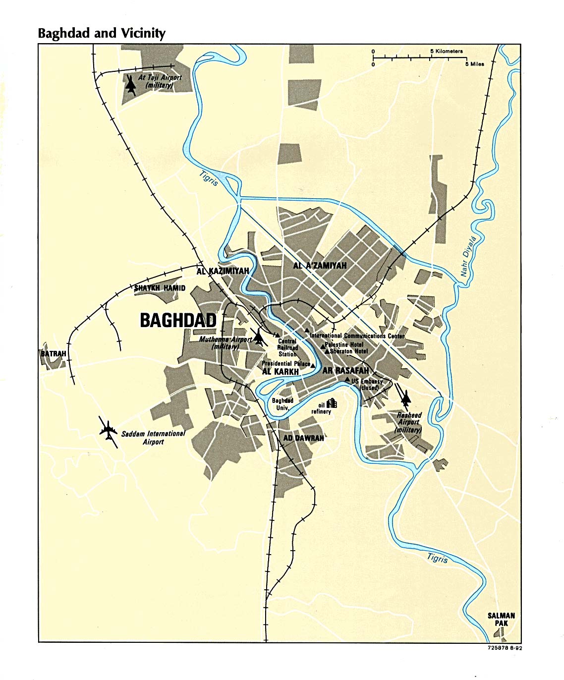
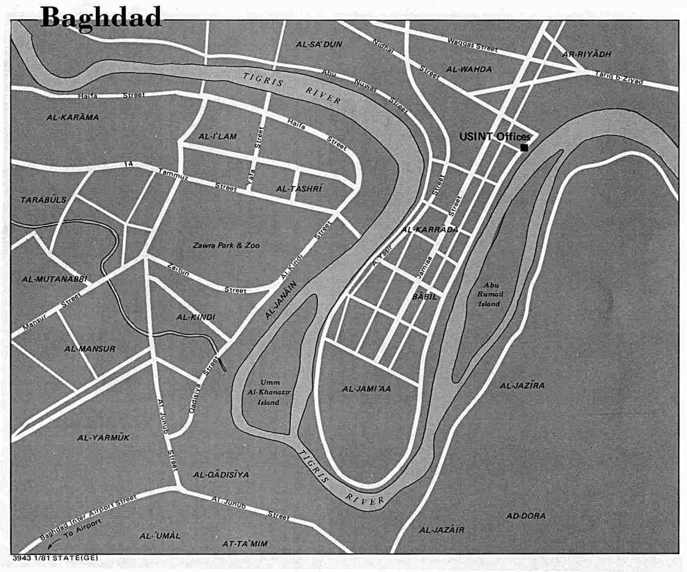
City Maps
Detailed Maps
- Al Basrah Region (tactical pilotage chart) original scale 1:500,000 Portion of Defense Mapping Agency TPC H-6B 1991 (833K) Not for navigational use
- Al Basrah Region - Oil and Gas Fields original scale 1:670,000 From Iraq-Iran: Central and Southern Border Areas CIA 1980 (400K)
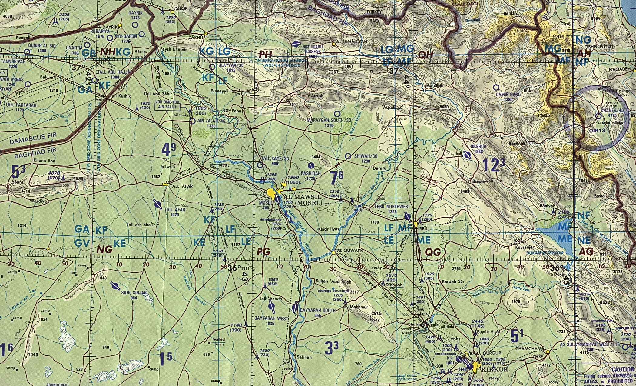
- Al Mawsil [Mosul]-Arbil Region, Northern Iraq (tactical pilotage chart) original scale 1:500,000 Portion of Defense Mapping Agency TPC G-4B 1989 (927K) Not for navigational use
- Baghdad Region original scale 1:670,000 From Iraq-Iran: Central and Southern Border Areas CIA 1980 (1136K)
- Baghdad Region (tactical pilotage chart) original scale 1:500,000 Portion of Defense Mapping Agency TPC G-4C 1991 (657K) Not for navigational use
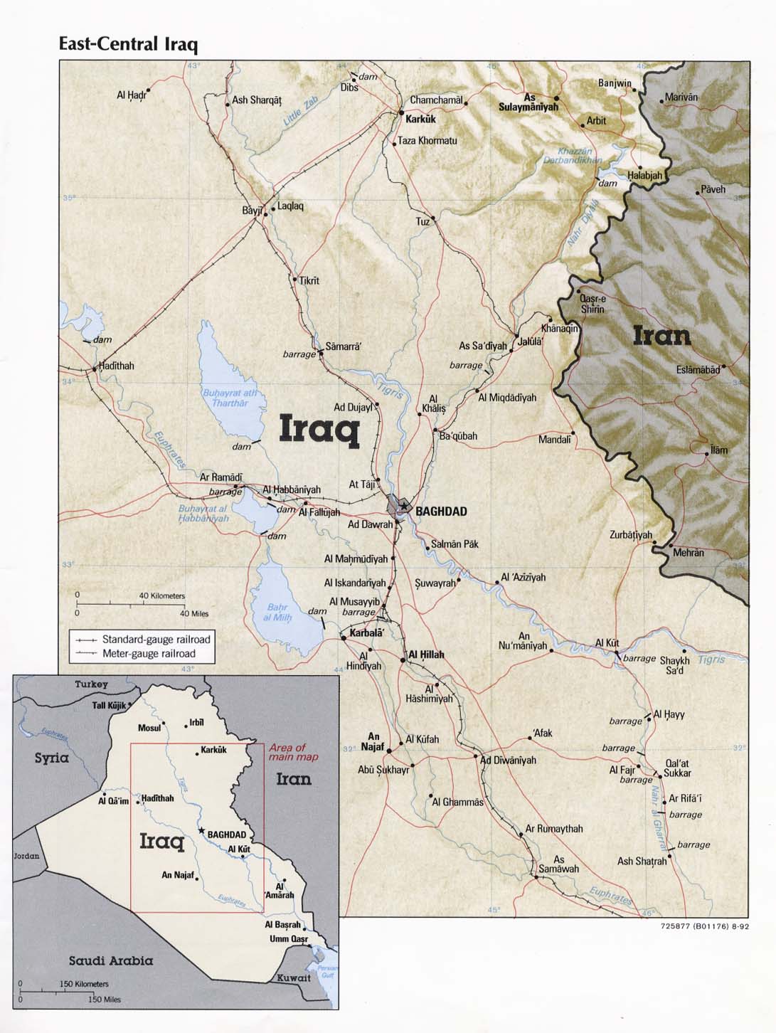
- East-Central Iraq From Iraq a Map Folio CIA 1992 (181K)
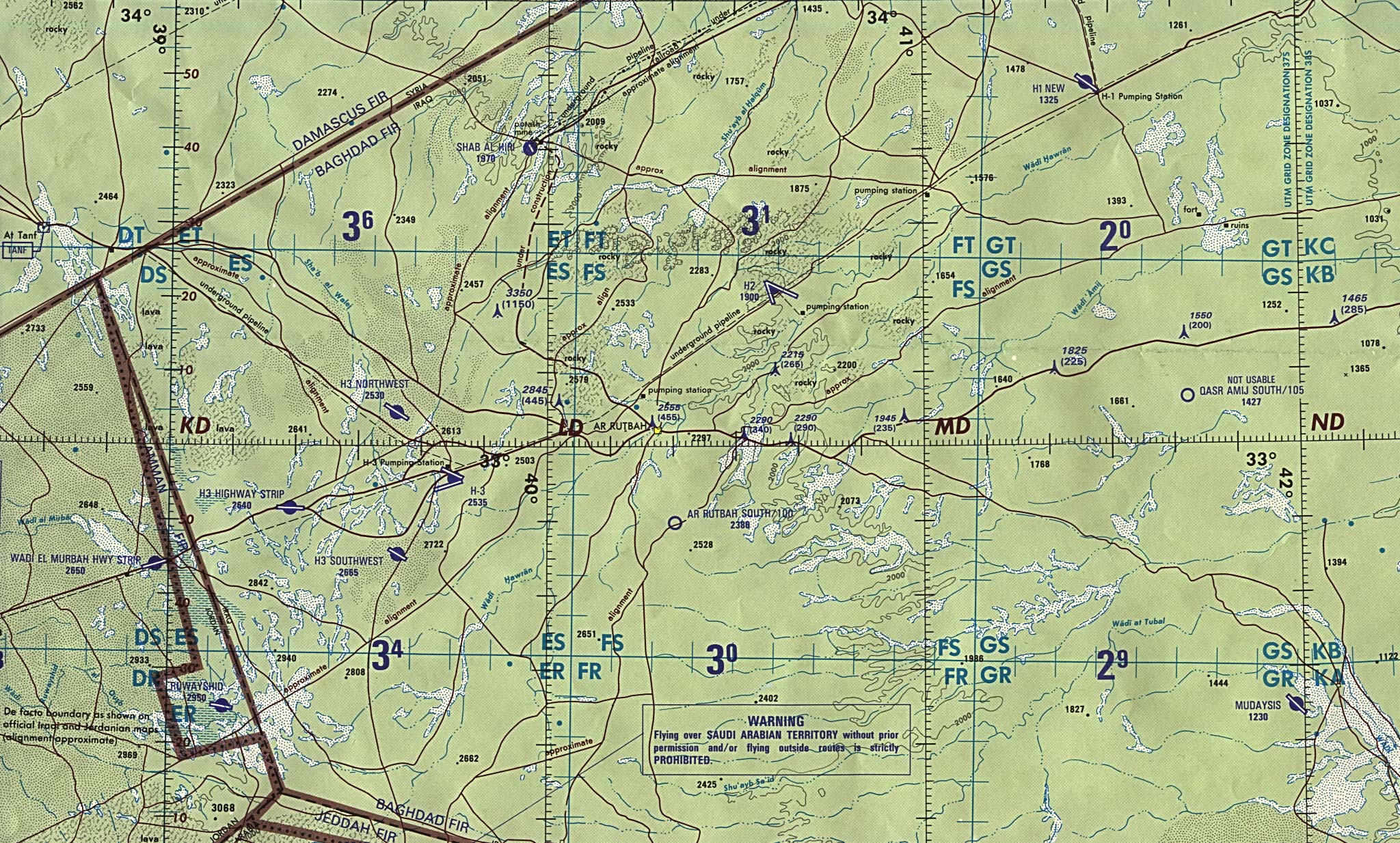
- Husaybah [Qusaybah] and Iraq/Syria Border (tactical pilotage chart) original scale 1:500,000 Portion of Defense Mapping Agency TPC G-4C 1991 (638K) Not for navigational use
- Iraq/Jordan Border (operational navigation chart) original scale 1:1,000,000 Portion of Defense Mapping Agency ONC G-4 1990 (833K) Not for navigational use
- Kirkuk-Arbil Region (tactical pilotage chart) original scale 1:500,000 Portion of Defense Mapping Agency TPC G-4C 1991 (676K) Not for navigational use
- Northern Iraq (operational navigation chart) original scale 1:1,000,000 Portion of Defense Mapping Agency ONC G-4 1990 (1MB) Not for navigational use
- Sulaymaniyah Region (tactical pilotage chart) original scale 1:500,000 Portion of Defense Mapping Agency TPC G-4C 1991 (721K) Not for navigational use
- Turkey (wall map) 2002 Includes Northern and Central Iraq, Shows Air Bases. Inset map of Tigris and Euphrates Drainage Basin
- Western Kuwait and Neighboring Iraq (tactical pilotage chart) original scale 1:500,000 Portion of Defense Mapping Agency TPC H-6A 1991 (638K) Not for navigational use
Thematic Maps
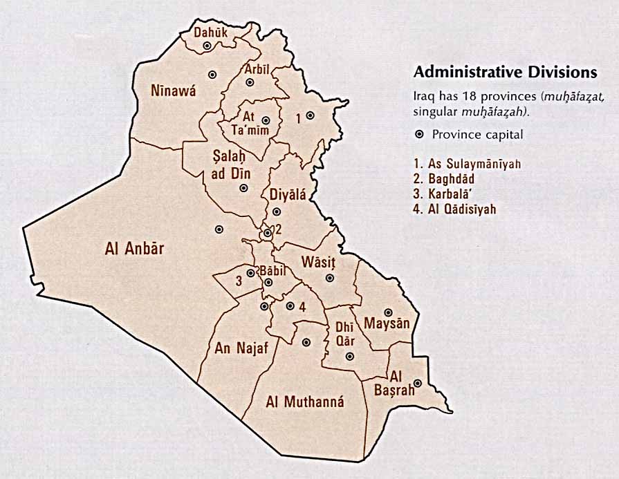
- Iraq: Administrative Divisions From Atlas of the Middle East, CIA, 1993 (69K)
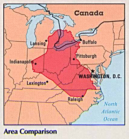
- Iraq: Area Comparison From Atlas of the Middle East, CIA, 1993 (38K)
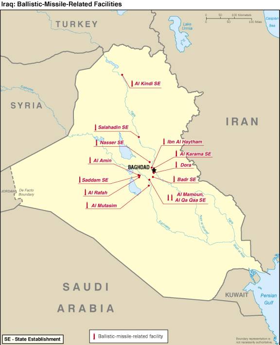
- Iraq: Ballistic-Missile-Related Facilities From Iraq's Weapons of Mass Destruction Programs, U.S. Director of Central Intelligence, October 2002 (37K)
- Iraq: Country Information From Atlas of the Middle East, CIA, 1993 (128K) Flag and statistics, not a map
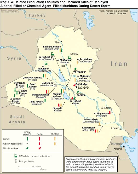
- Iraq: CW-Related Production and Declared Sites of Deployed Alcohol-Filled or Chemical Agent-Filled Munitions During Desert Storm From Iraq's Weapons of Mass Destruction Programs, U.S. Director of Central Intelligence, October 2002 (62K)
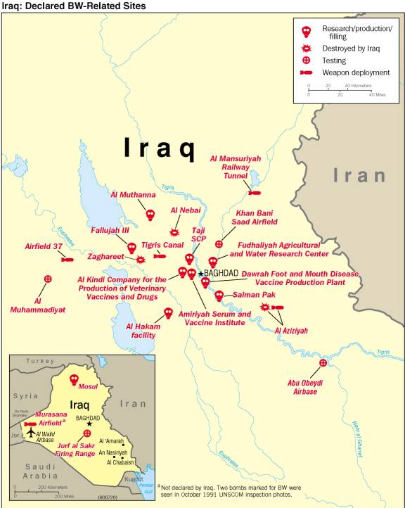
- Iraq: Declared BW-Related Sites From Iraq's Weapons of Mass Destruction Programs, U.S. Director of Central Intelligence, October 2002 (52K)
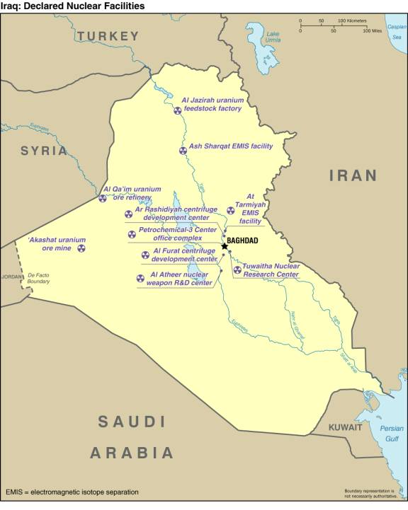
- Iraq: Declared Nuclear Facilities From Iraq's Weapons of Mass Destruction Programs, U.S. Director of Central Intelligence, October 2002 (39K)
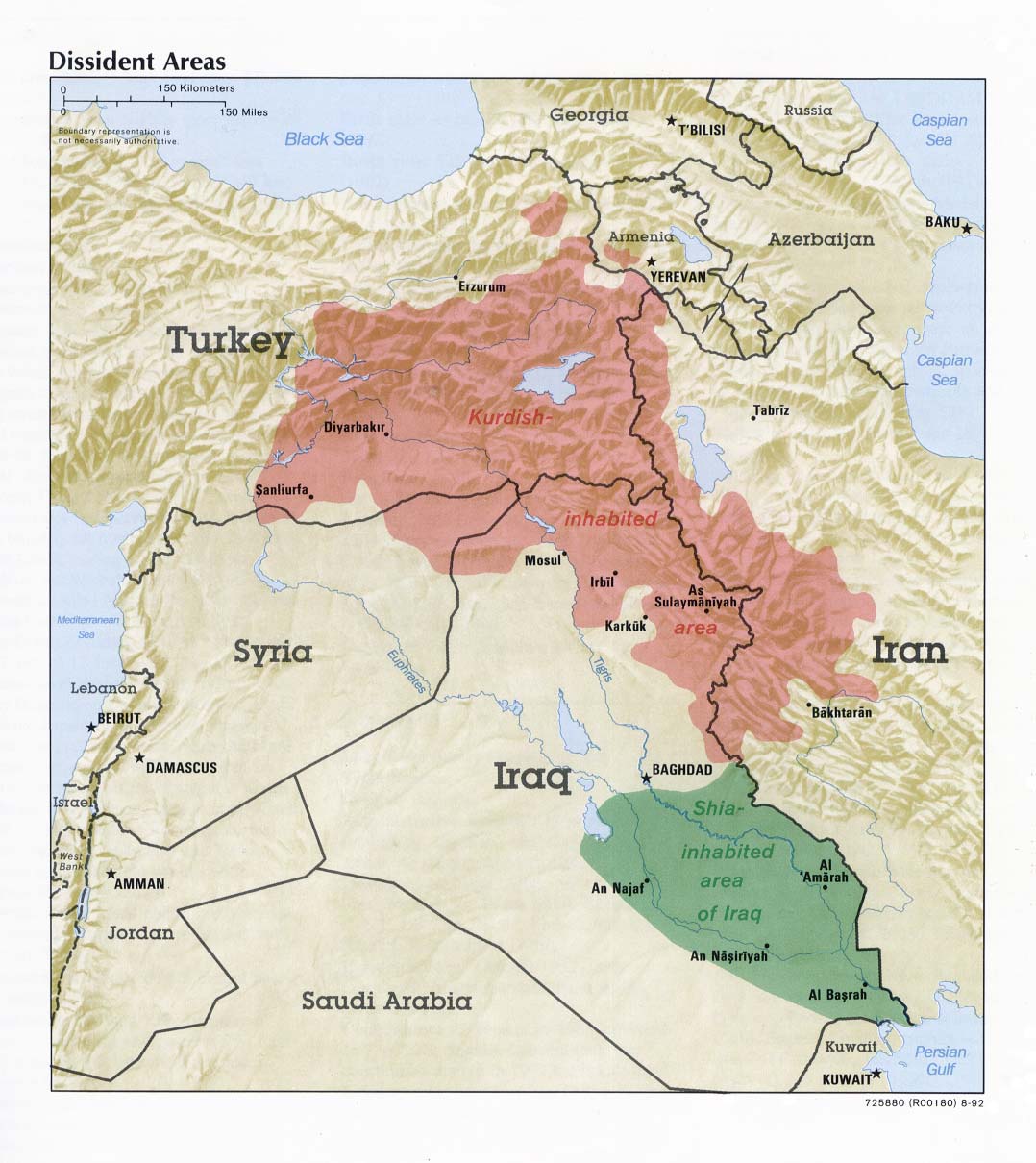
- Iraq: Dissident Areas From Iraq a Map Folio, CIA, 1992 (170K)
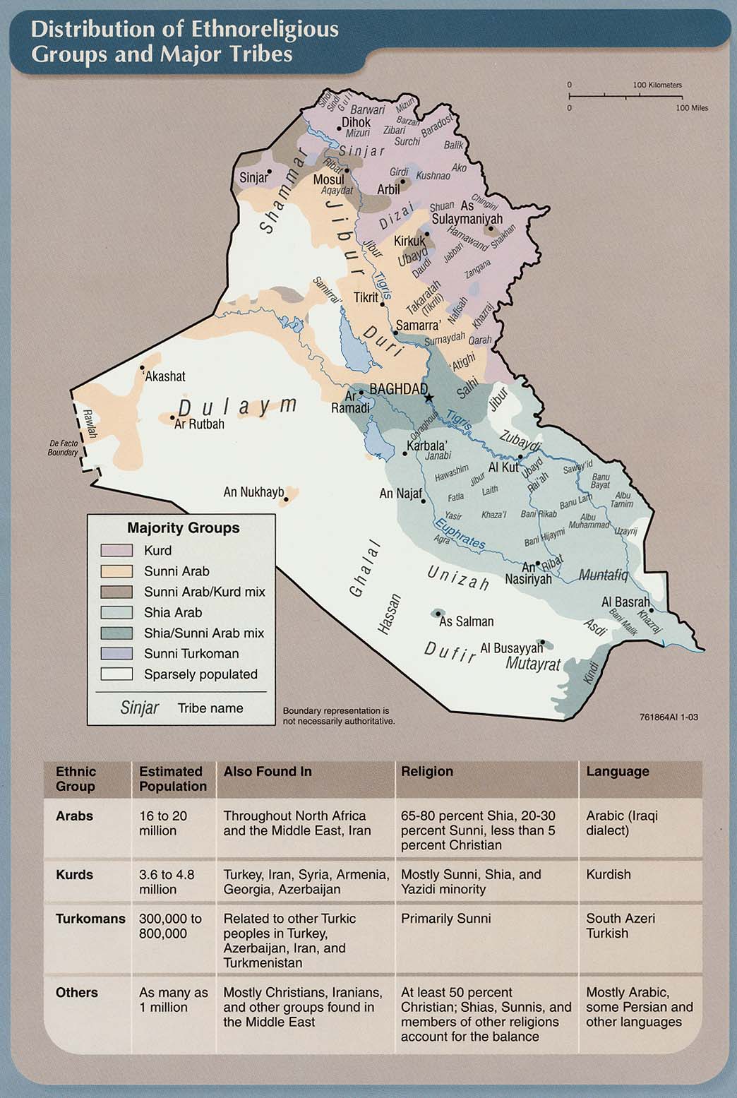
- Iraq: Distribution of Ethnoreligious Groups and Major Tribes From Iraq: Country Profile [map], CIA, January 2003 (215K) and pdf format (216K)
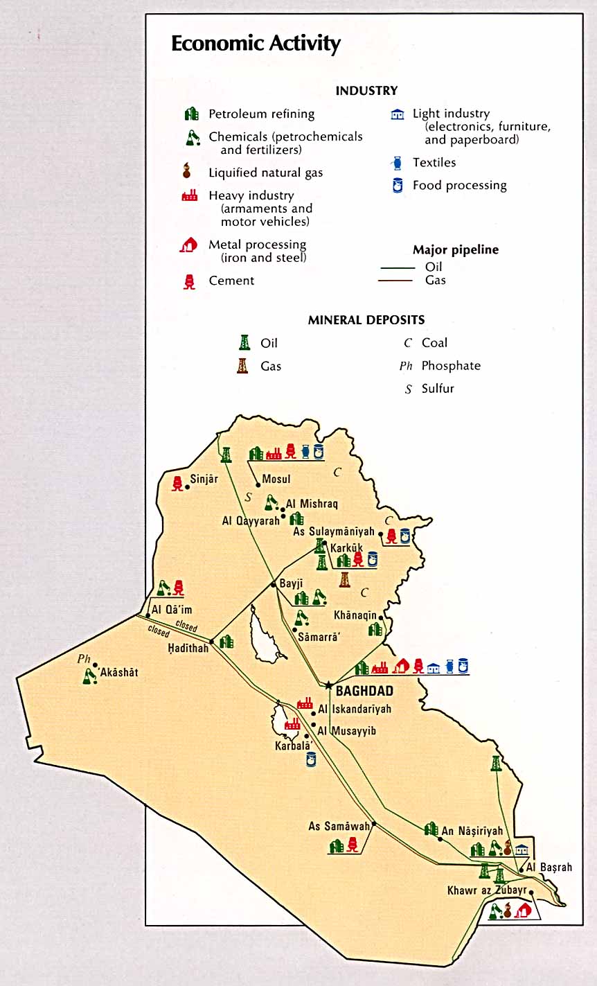
- Iraq: Economic Activity From Atlas of the Middle East, CIA, 1993 (115K)
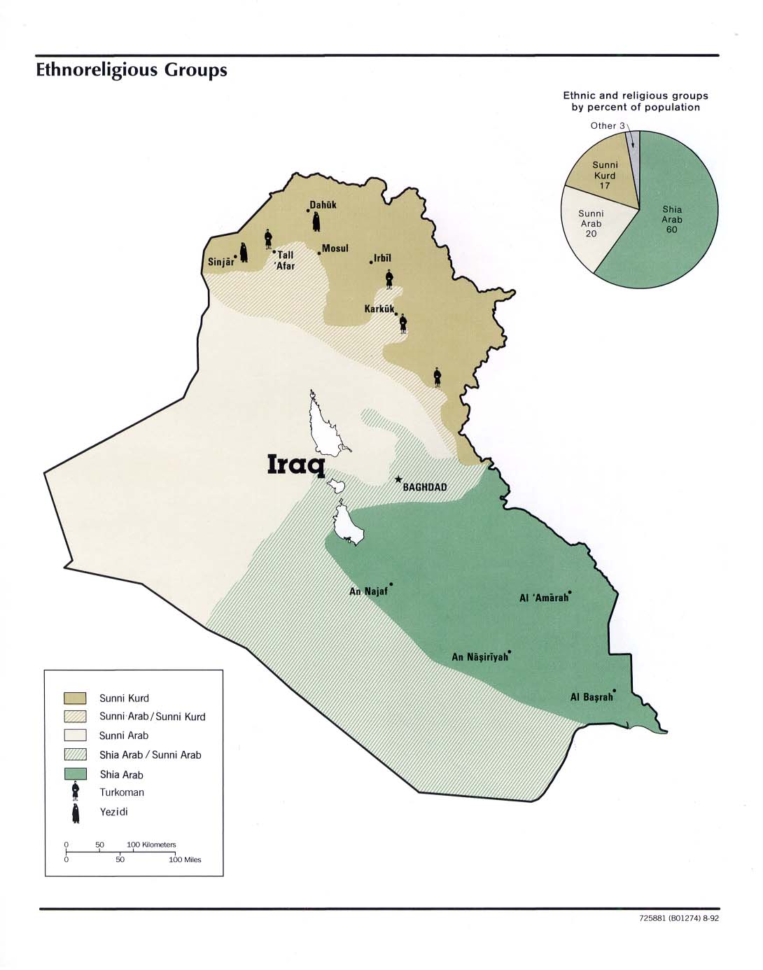
- Iraq: Ethnoreligious Groups From Iraq a Map Folio, CIA, 1992 (112K)
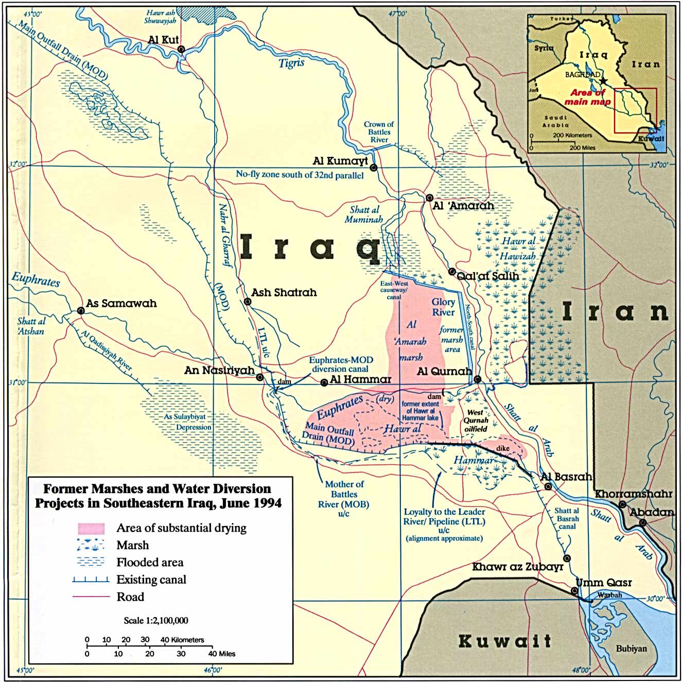
- Iraq: Former Marshes and Water Diversion Projects in Southeastern Iraq From The Destruction of Iraq's Southern Marshes, CIA Publication IA 94-10020, 1994 (243K)
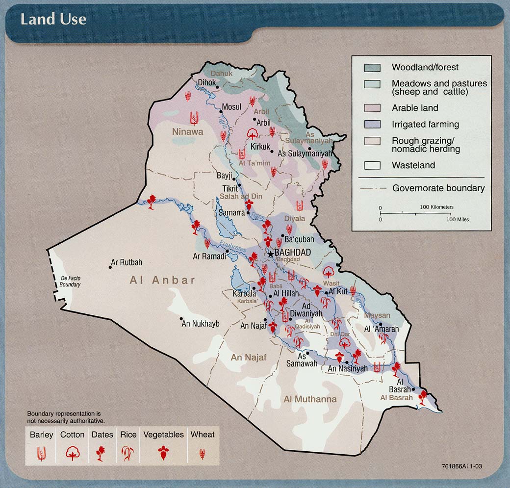
- Iraq: Land Use From Iraq: Country Profile [map], CIA, January 2003 (213K) and pdf format (211K)
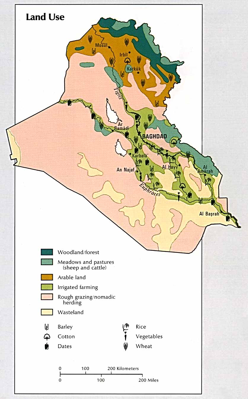
- Iraq: Land Use From Atlas of the Middle East, CIA, 1993 (111K)
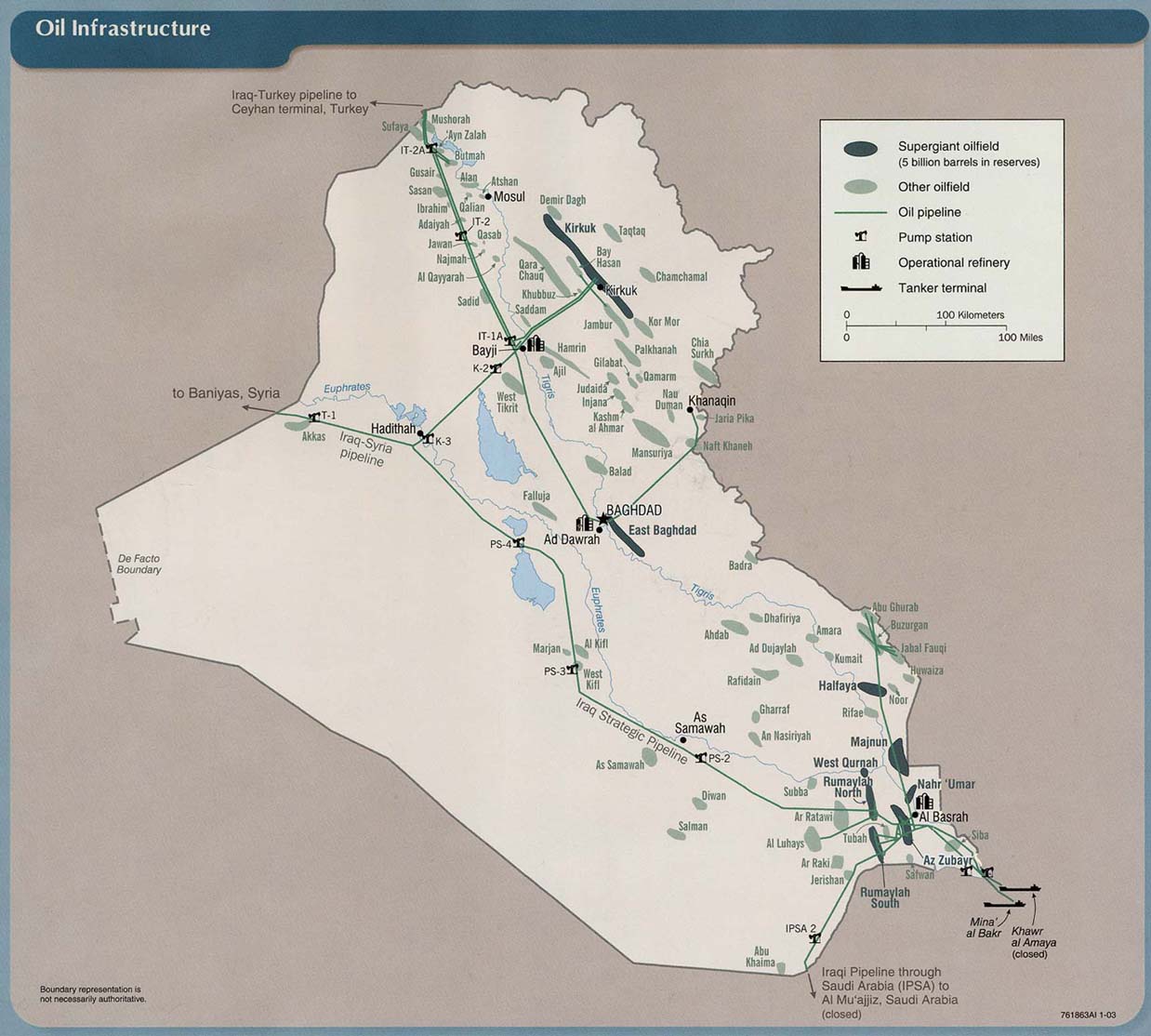
- Iraq: Oil Infrastructure From Iraq: Country Profile [map], CIA, January 2003 (157K) and pdf format (160K)
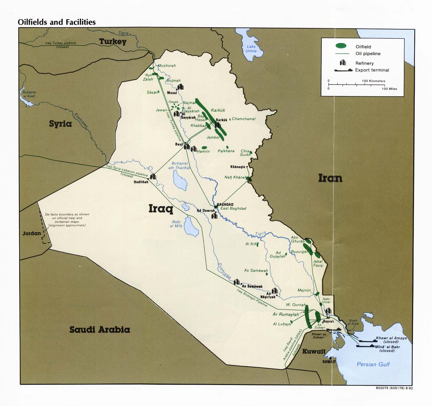
- Iraq: Oilfields and Facilities From Iraq a Map Folio, CIA, 1992 (182K)
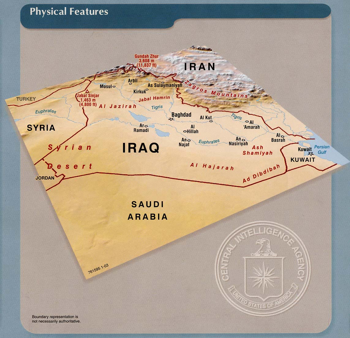
- Iraq: Physical Features From Iraq: Country Profile [map], CIA, January 2003 (226K) and pdf format (221K)
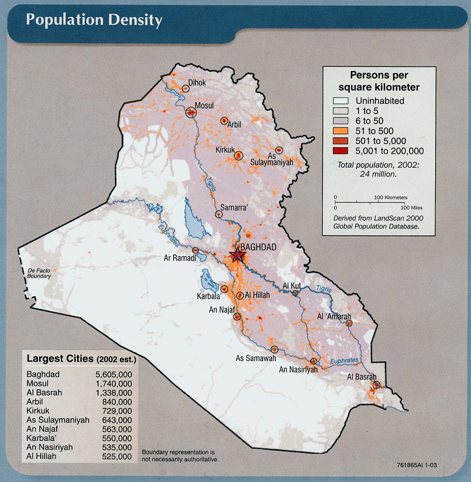
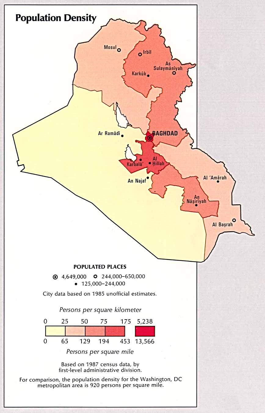
- Iraq: Population Density From Iraq: Country Profile [map], CIA, January 2003 (213K) and pdf format (183K)
- Iraq: Population Density From Atlas of the Middle East, CIA, 1993 (185K)
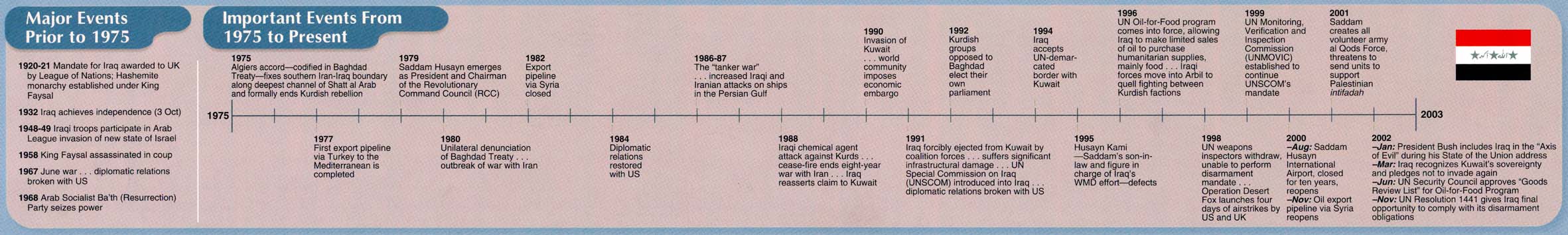
- Iraq: Time Line "Major Events Prior to 1975, Important Events from 1975 to Present" From Iraq: Country Profile [map], CIA, January 2003 (151K) Chart
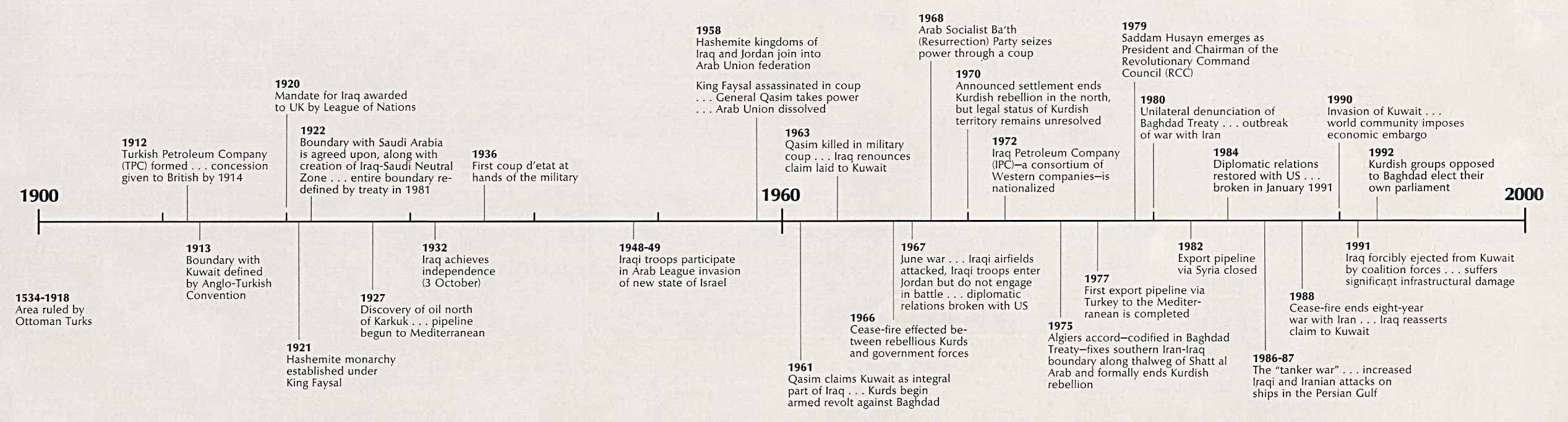
- Iraq: Time Line From Atlas of the Middle East, CIA, 1993 (210K) Chart
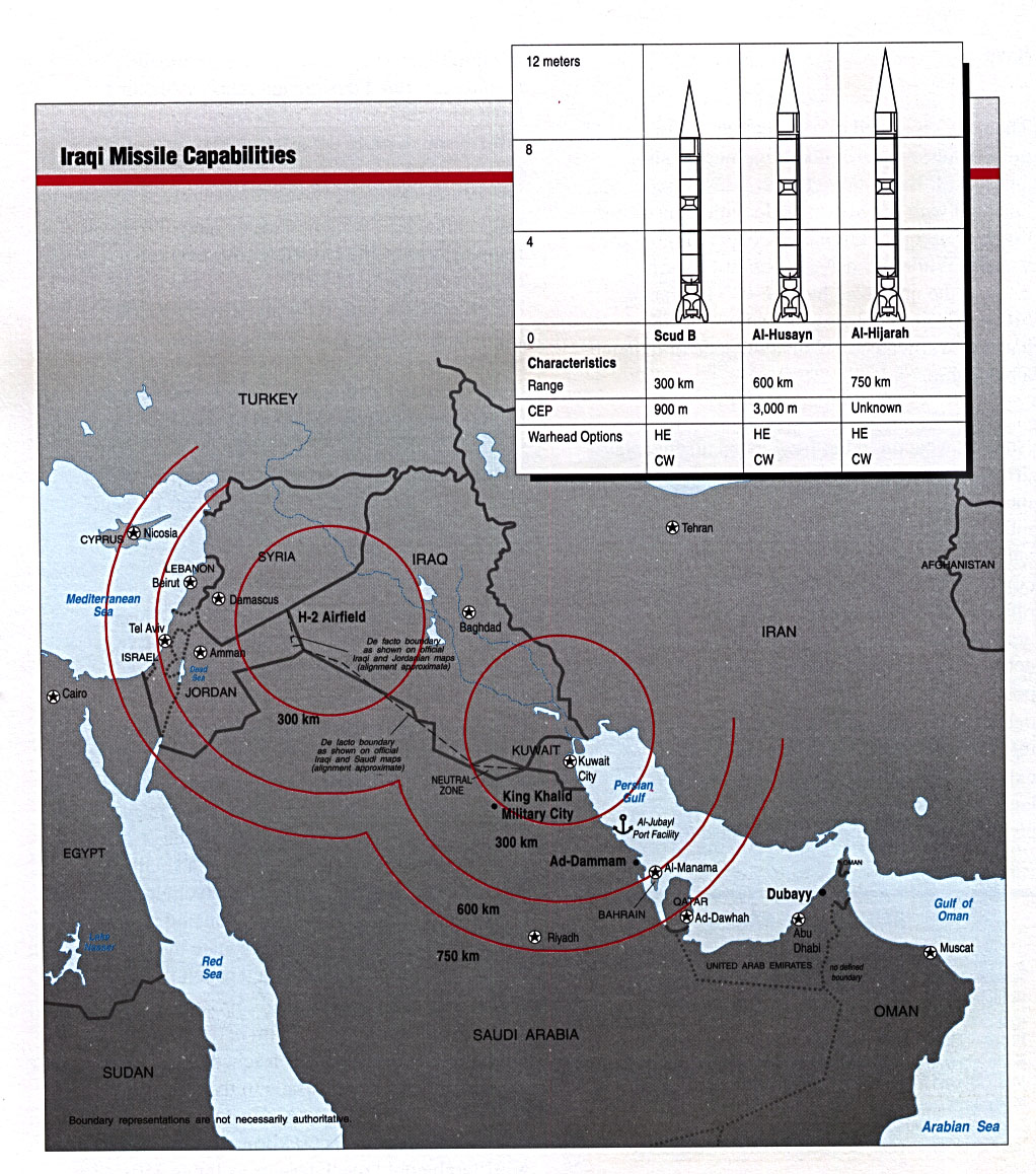
- Iraqi Missile Capabilities From Conduct of the Persian Gulf War: Final Report to Congress, U.S. Dept. of Defense, April 1992 (338K)
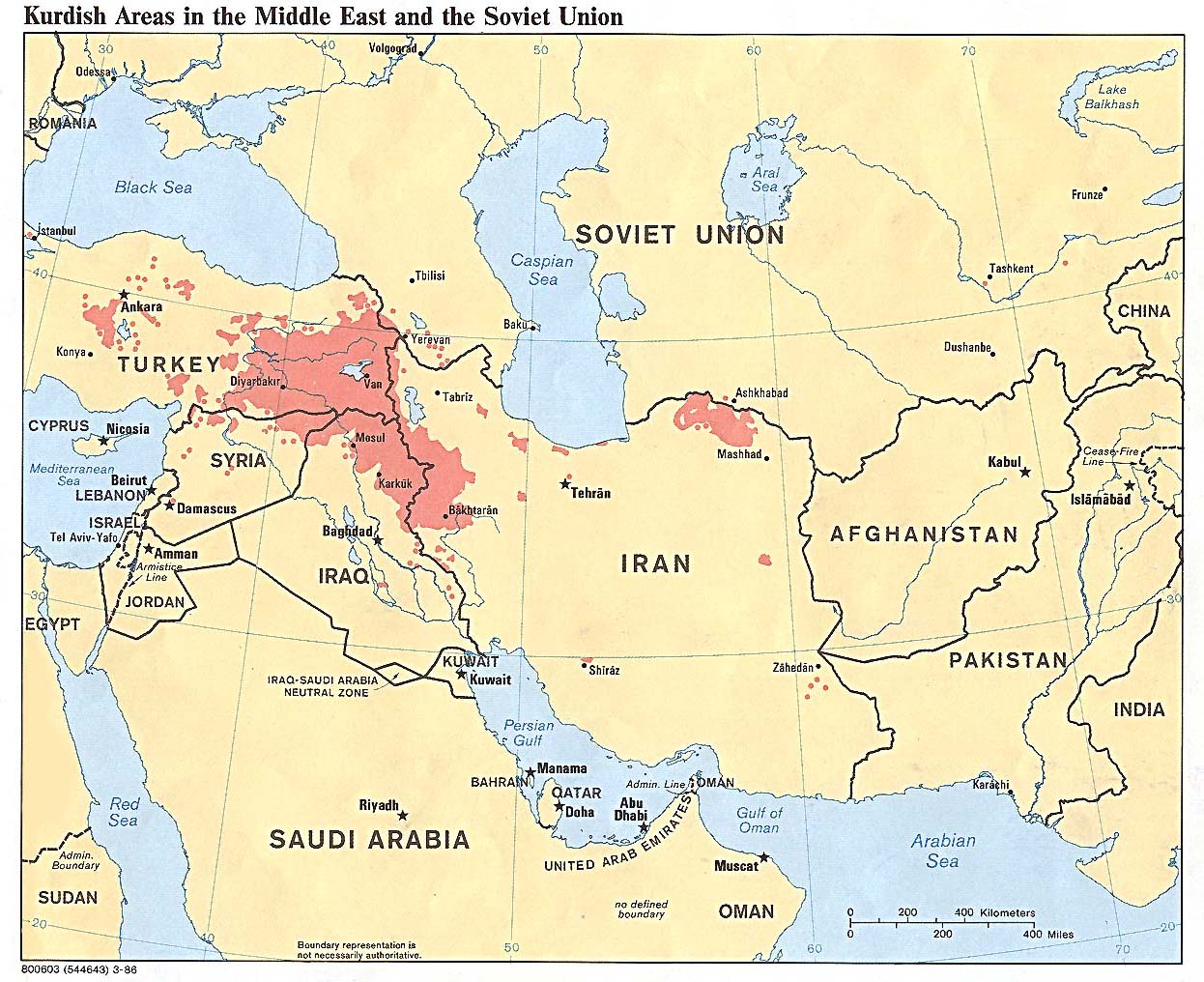
- Kurdish Areas in the Middle East and the Soviet Union 1986 (254K)
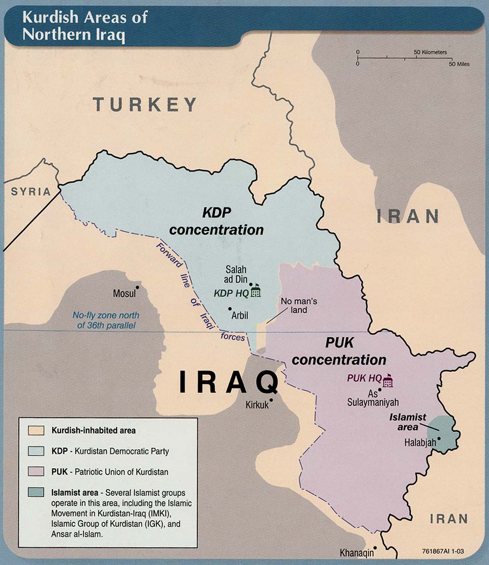
- Kurdish Areas of Northern Iraq From Iraq: Country Profile [map], CIA, January 2003 (165K) and pdf format (164K)
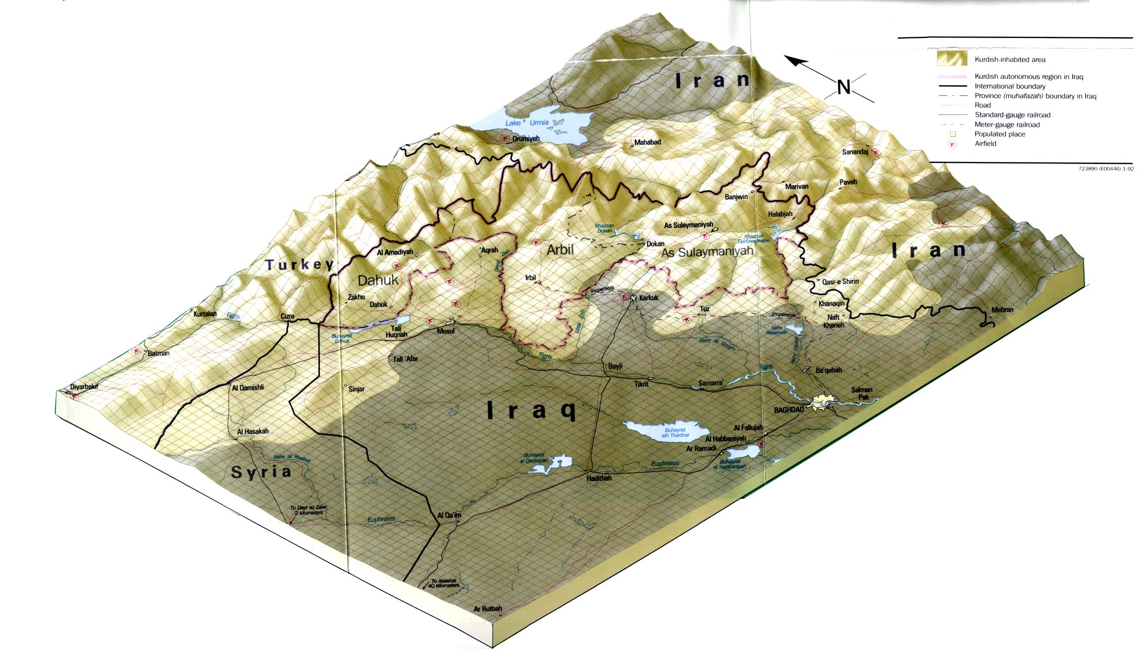
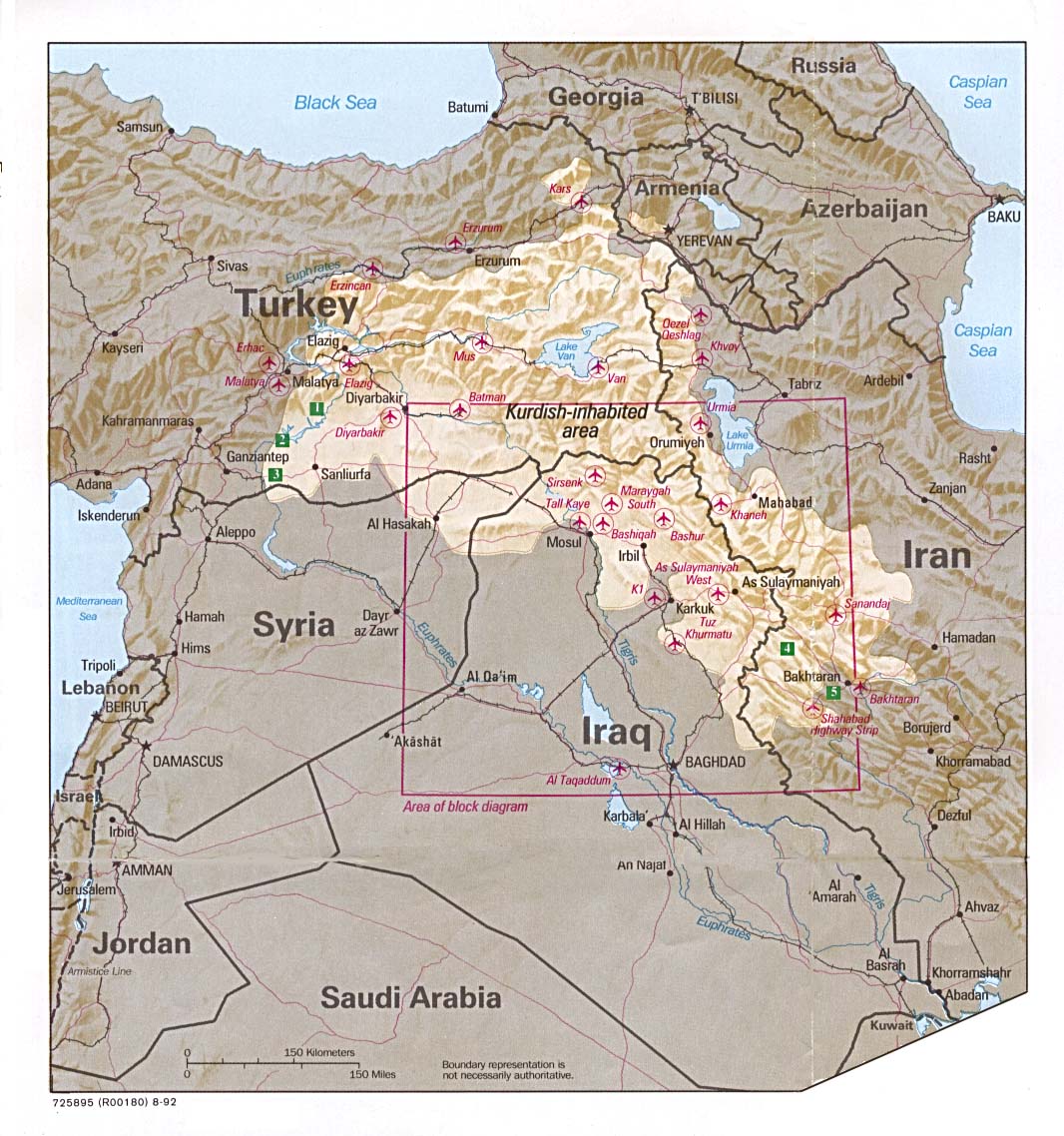
- Kurdish Lands From Iraq: A Map Folio, CIA, 1992 (319K)
- Kurdish Lands (location map) From Iraq: A Map Folio, CIA, 1992 (235K)
Historical Maps
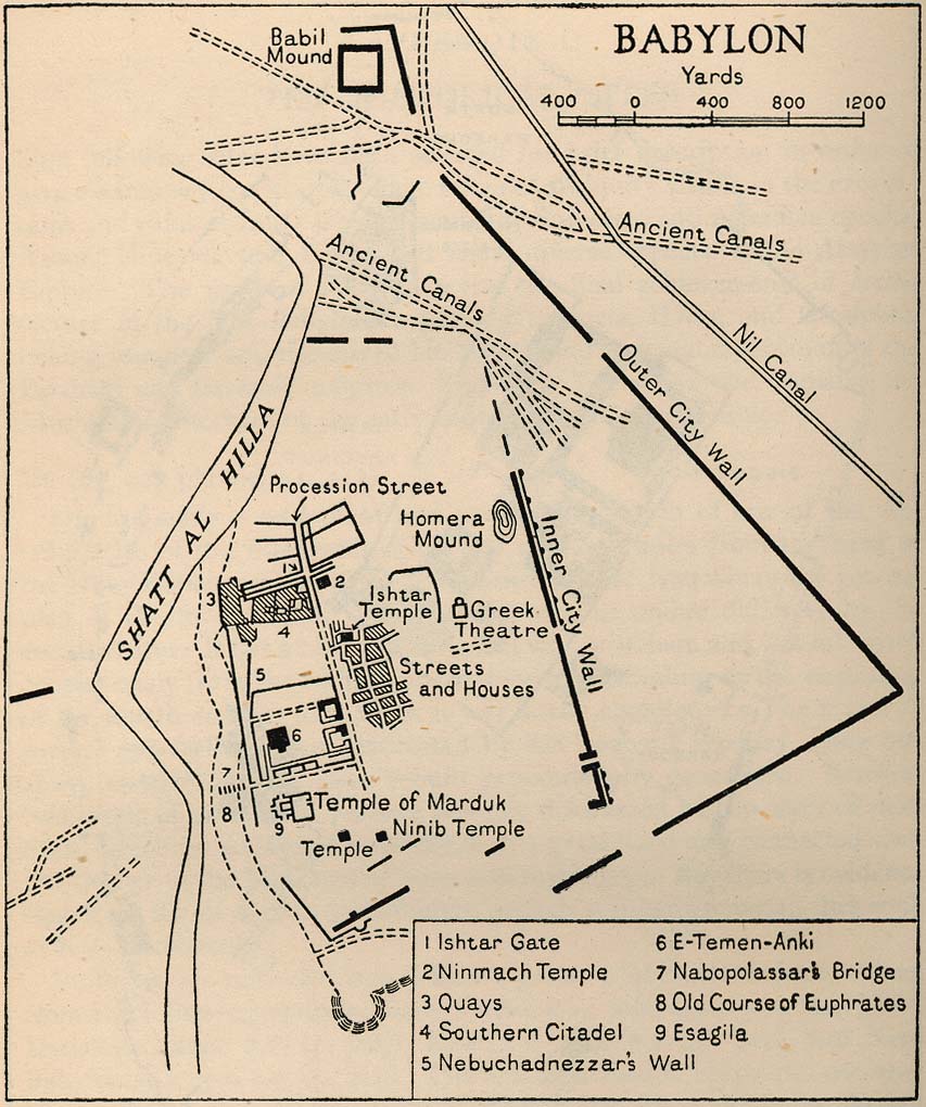
- Babylon From Iraq and the Persian Gulf, Great Britain. Naval Intelligence Division, 1944 (173K)
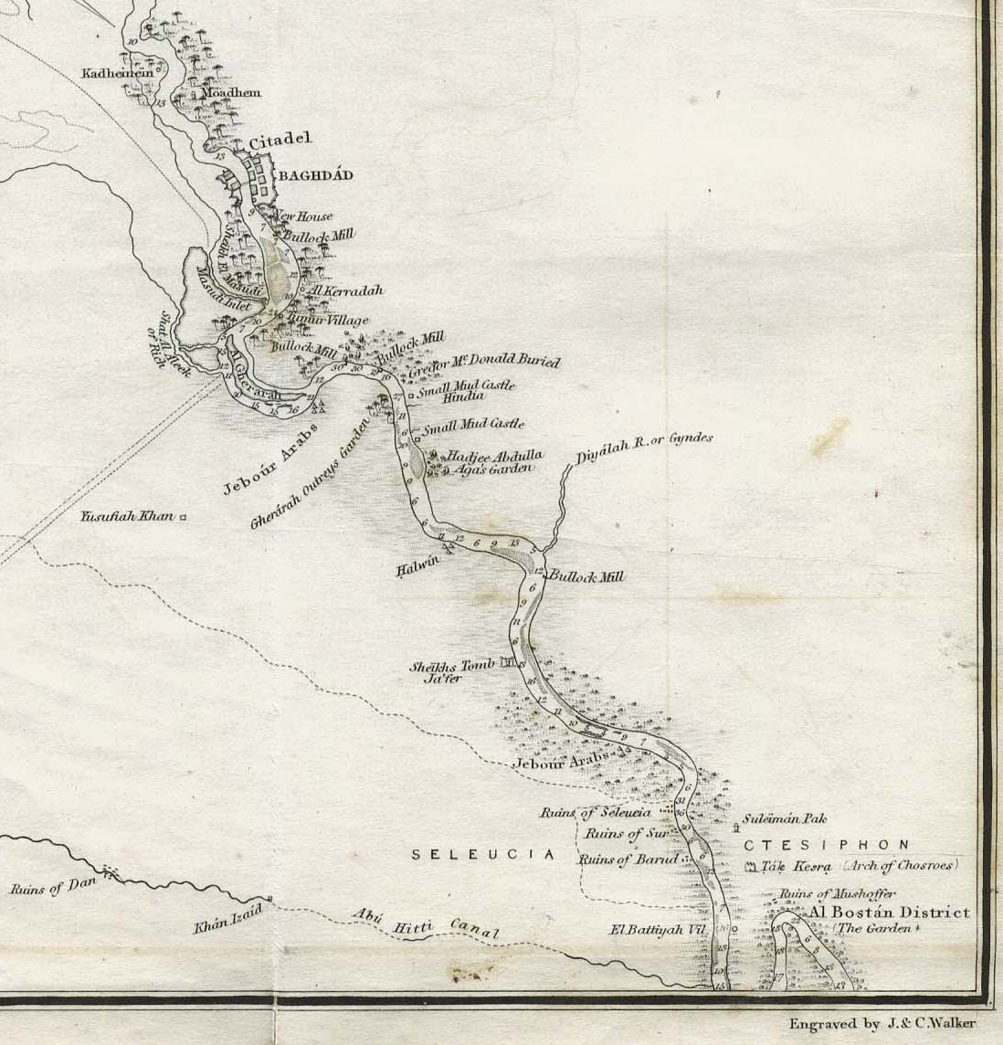
- Baghdad 1849 (176K) Part of "The River Euphrates From Hit to the Kuthah River and The River Tigris from Sammara to the Abu Hitti Canal..." from Maps volume, sheet VII of The Expedition for the Survey of the Rivers Euphrates and Tigris, Carried on by Order of the British Government in the years 1835, 1836, and 1837... by Francis Rawdon Chesney. London, Longman, Brown, Green, and Longmans, 1850.
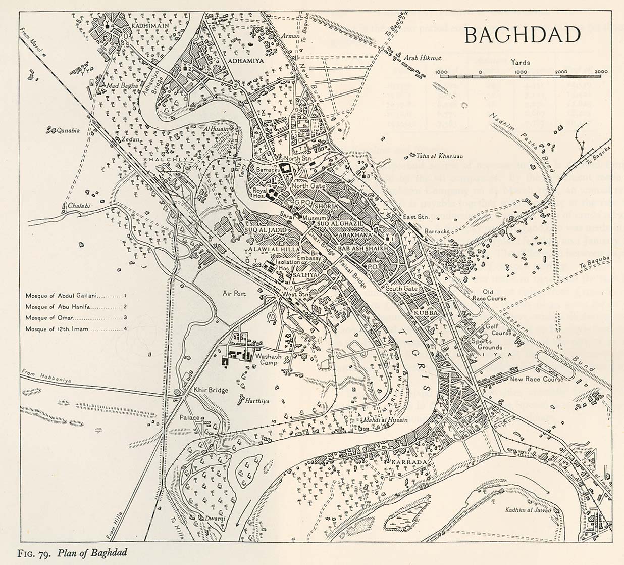
- Baghdad 1944 From Iraq and the Persian Gulf, Great Britain. Naval Intelligence Division, 1944 (346K)
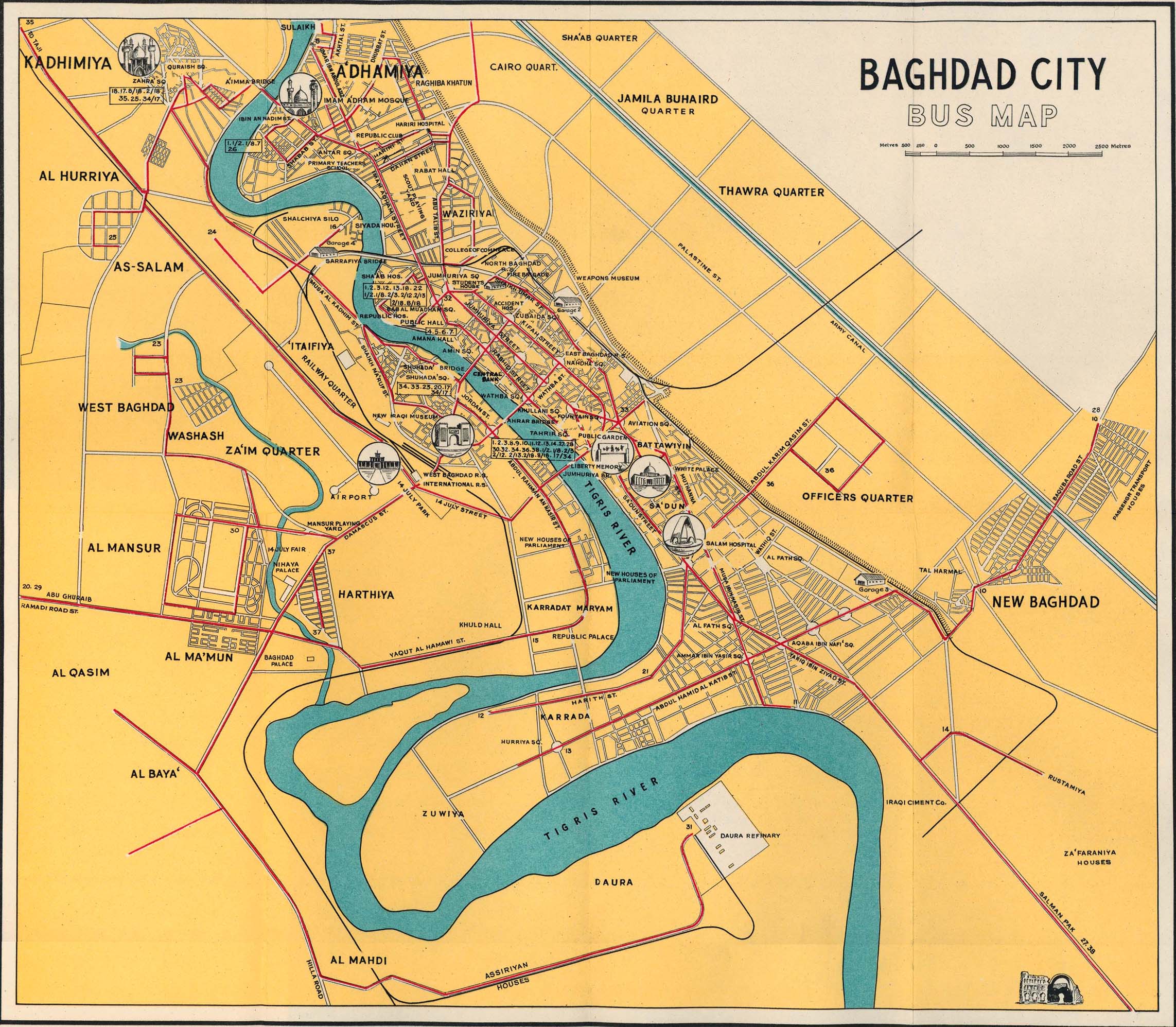
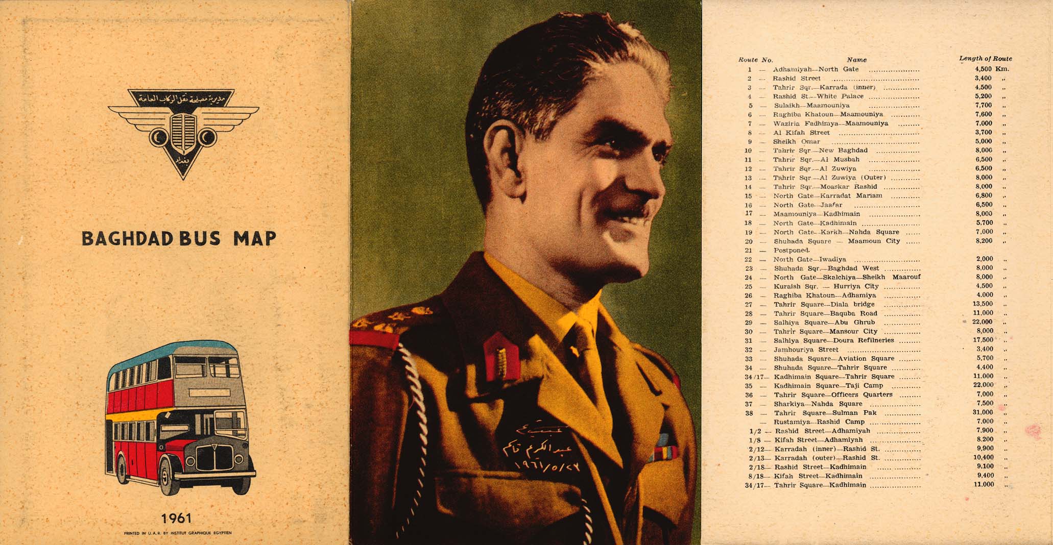
- Baghdad 1961 Baghdad Bus Map (708K) and map cover and route information (291K)
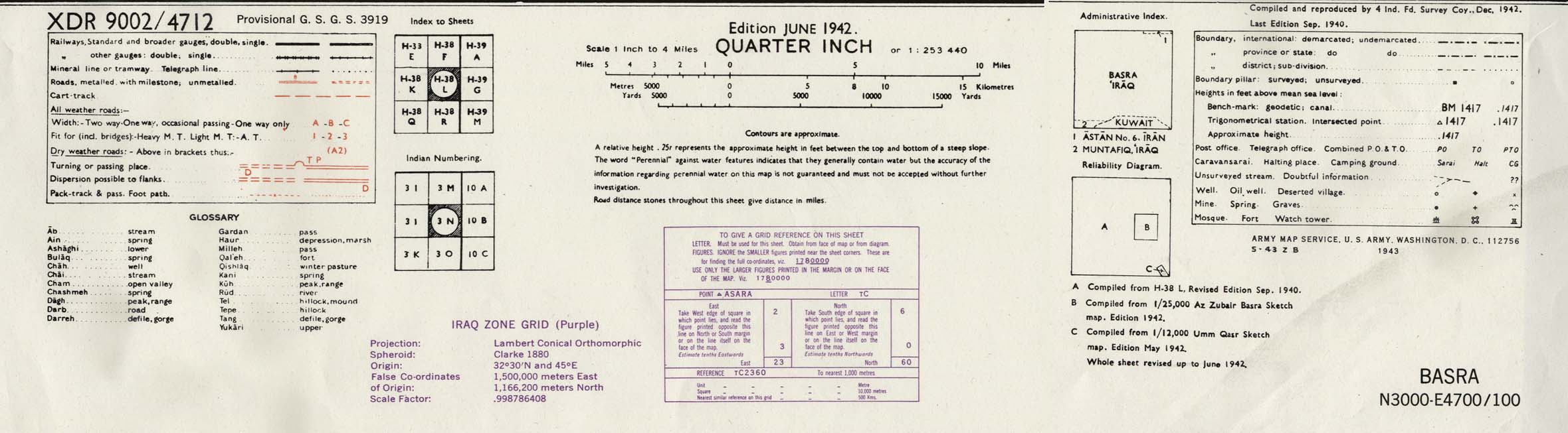
- Basra Area 1942 (423K) map key and scale (185K) Part of sheet H-38 L Basra. Edition June 1942. Original scale 1:253,440 Compiled and Reproduced by India Field Survey Company, December 1942. Published by the U.S. Army Map Service, May 1943.
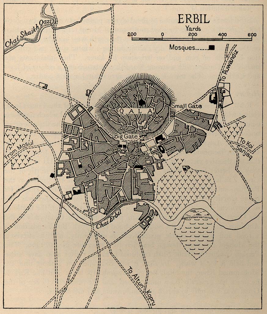
- Erbil 1944 From Iraq and the Persian Gulf, Great Britain. Naval Intelligence Division, 1944 (238K)
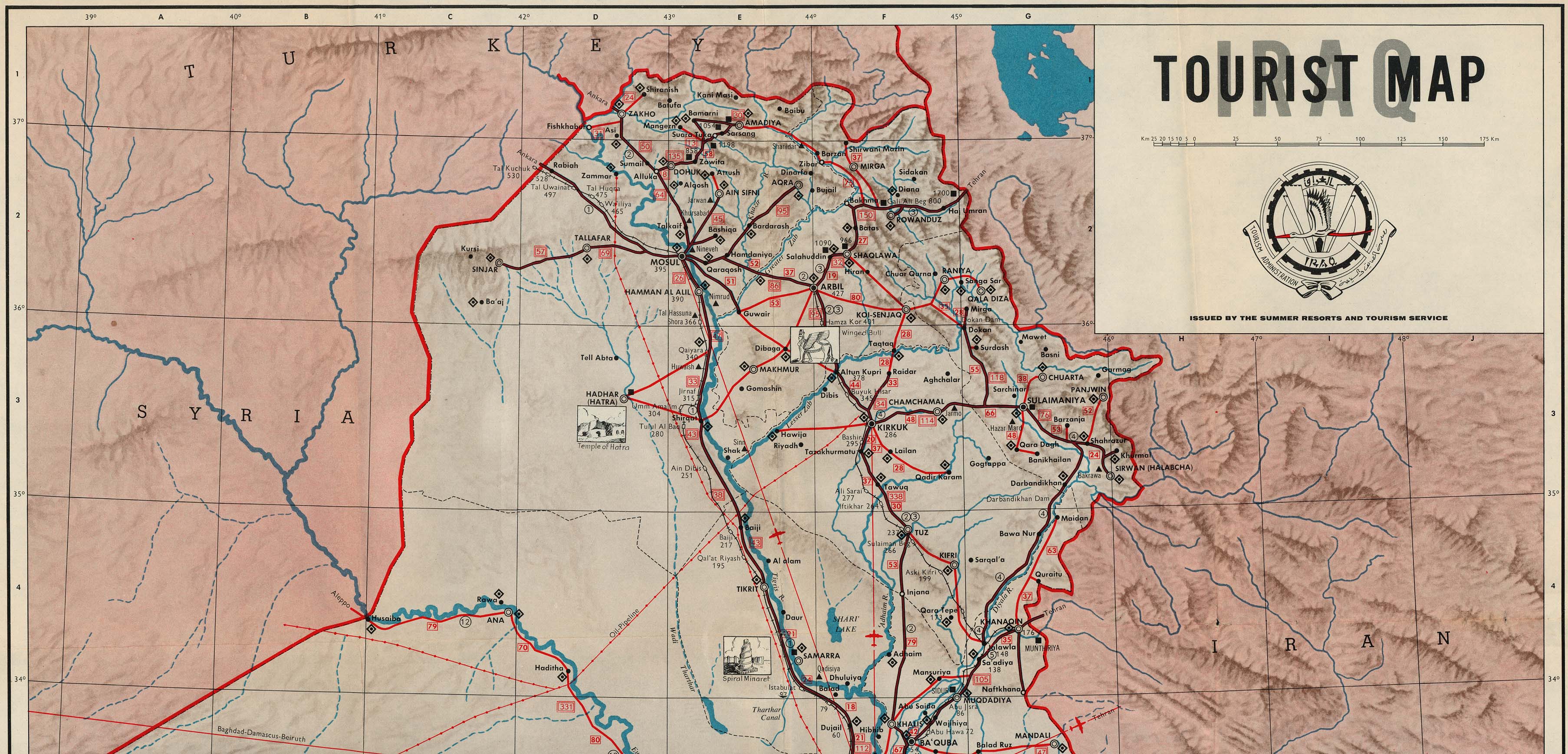
- Iraq - Northern and map legend from Iraq Tourist Map, Iraq Tourism Administration, ca. 1970 (935K)
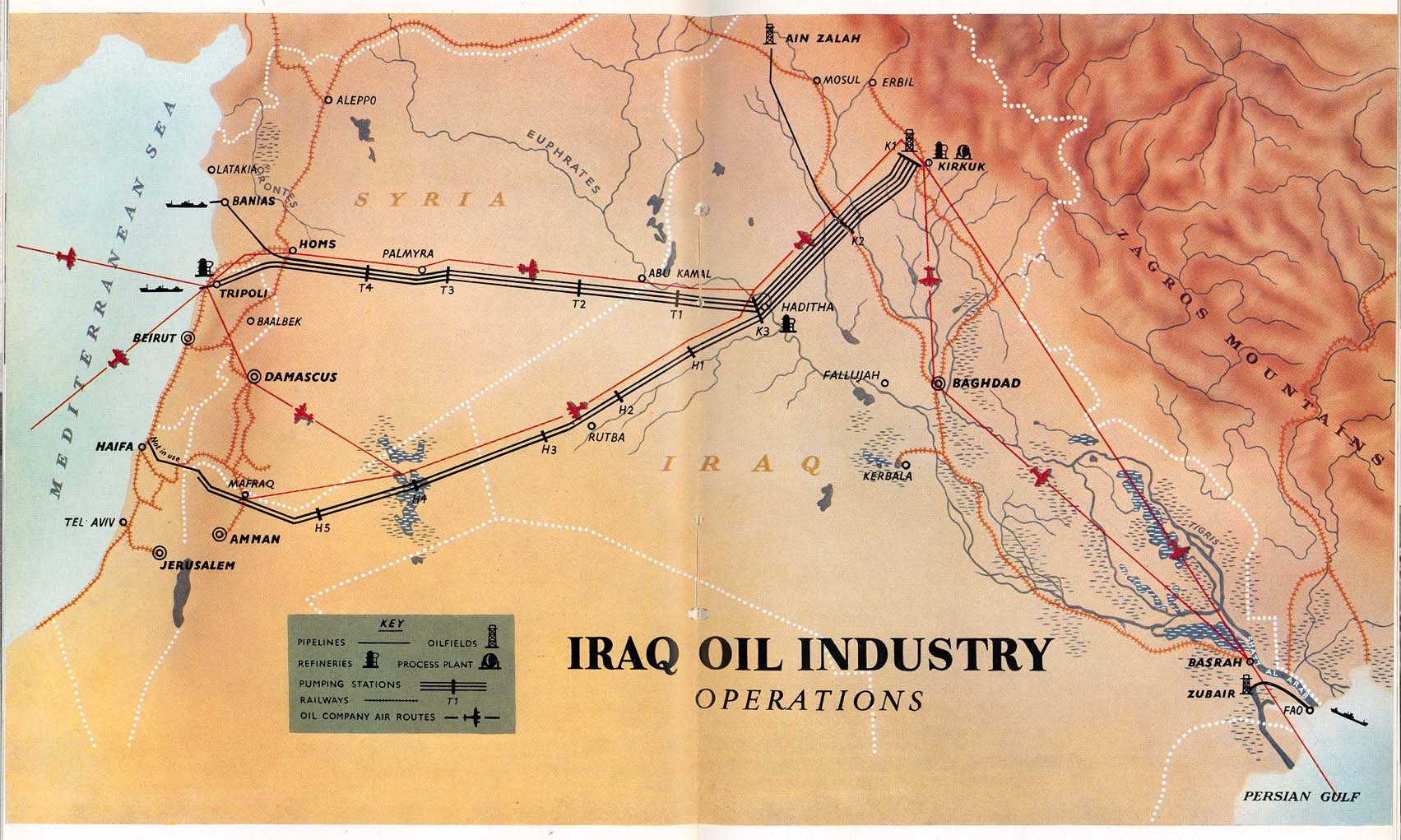
- Iraq Oil Industry Operations 1953 From Iraq Today, Directorate-General of Propaganda, Baghdad, 1953
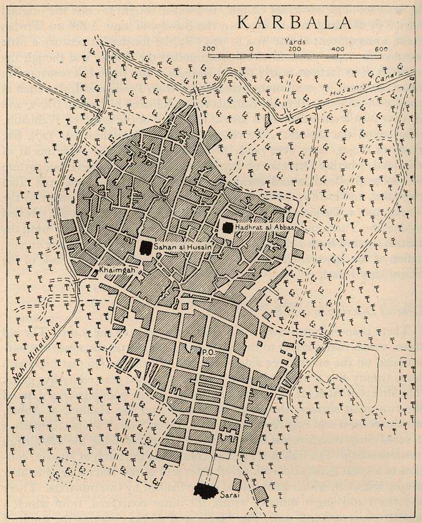
- Karbala 1944 From Iraq and the Persian Gulf, Great Britain. Naval Intelligence Division, 1944 (243K)
- Kuwait Historical Maps 1987-1991
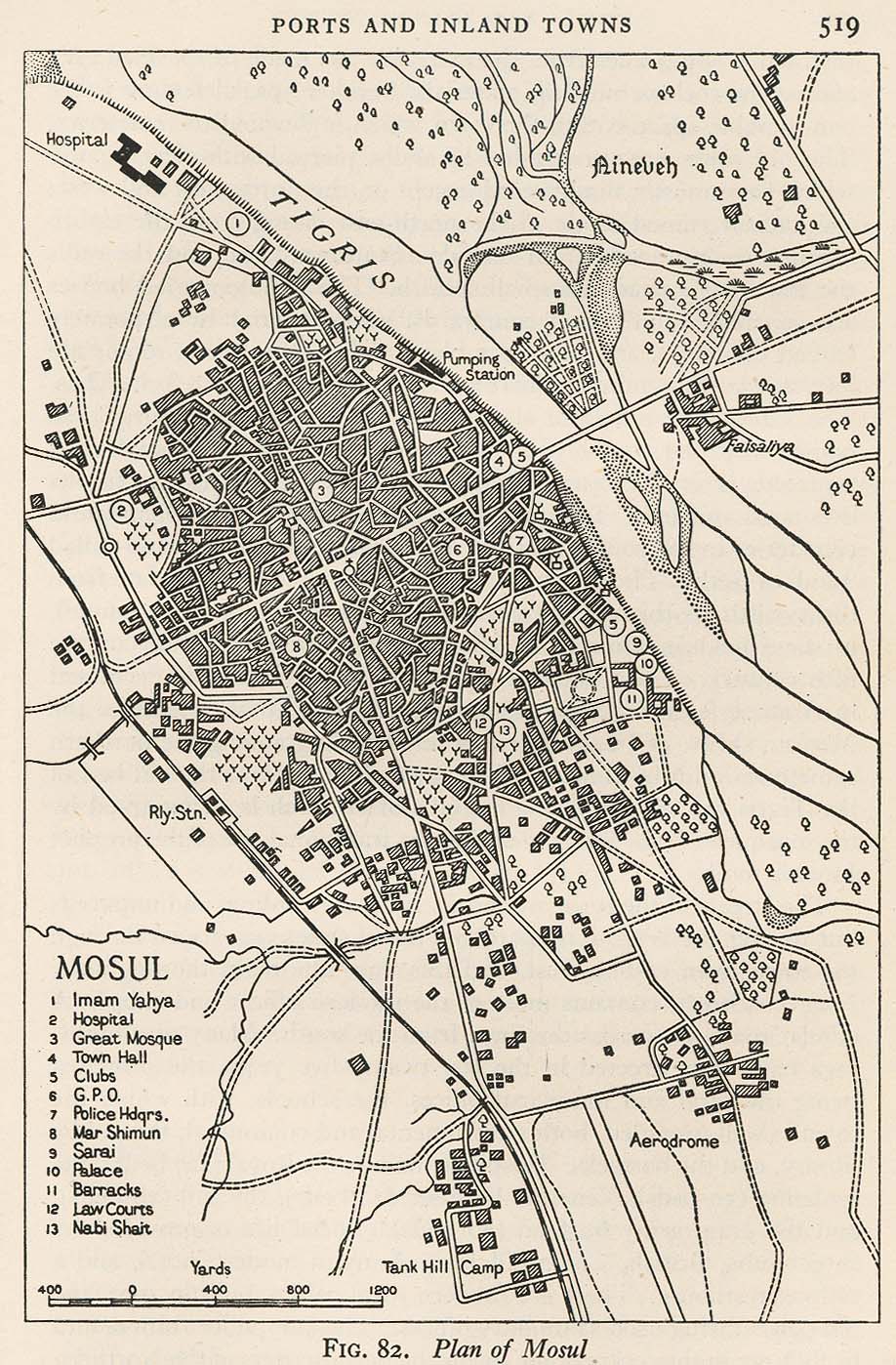
- Mosul 1944 From Iraq and the Persian Gulf, Great Britain. Naval Intelligence Division, 1944 (317K)
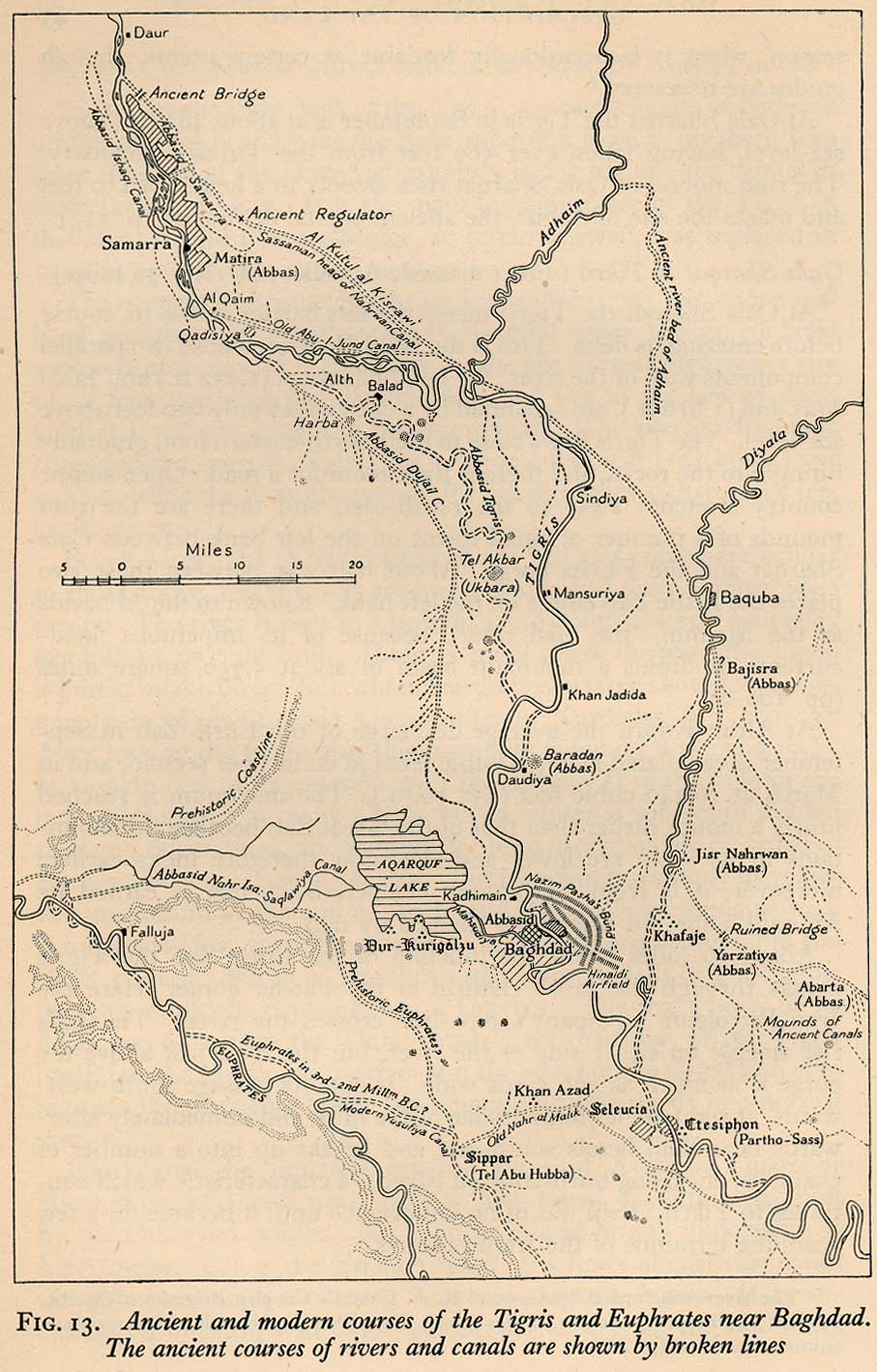
- Tigris and Euphrates Near Baghdad, Ancient and Modern Courses From Iraq and the Persian Gulf, Great Britain. Naval Intelligence Division, 1944 (209K)
- Other Middle East Historical Maps
Iraq Maps on Other Web Sites
Maps on Other Web Sites [1990-1991]:
Gulf War Maps on Other Web Sites [1998]:
TOPICS: Constitution/Conservatism; Crime/Corruption; Culture/Society; Extended News; Foreign Affairs; Government; News/Current Events; United Kingdom
KEYWORDS: 911; chart; chemical; data; iraq; map; maps; nuclear; saddam; terror; war; warlist; wtc
Navigation: use the links below to view more comments.
first previous 1-20, 21-40, 41-60, 61 next last
To: vannrox
This is golden great!
And, just in time. In the last couple of days, I've needed to look at some maps. I was going to do a map search, & then just saw the link! Thanks!
To: vannrox
Bump and thanks.
42
posted on
03/23/2003 9:31:20 PM PST
by
Kay Soze
(France - "The country where the worms live above ground")
To: vannrox
This is awesome!!! Thanks for your hard work!!!!
43
posted on
03/23/2003 9:42:11 PM PST
by
BossLady
(This just in.....Iraqi Information Minister receives Oscar for Best Actor in Comedy)
To: vannrox
BIG thanks!!!
To: vannrox
UT has THE best map collection I've ever found on the net. Thanks for posting this; I had forgotten about it.
To: vannrox
Bump
To: dighton
The whole Perry-Casteneda map collection is outstanding. Wish I'd thought to post links to it :o)
47
posted on
03/24/2003 5:15:30 AM PST
by
Poohbah
(Crush your enemies, see them driven before you, and hear the lamentations of their women!)
To: vannrox
Morning, Vannrox. Pinging your maps again - sitting on a T-1; they're even better than last night on a dial up :)
48
posted on
03/24/2003 6:09:00 AM PST
by
bwteim
To: vannrox
bttt
49
posted on
03/24/2003 6:19:23 AM PST
by
Truth29
To: vannrox
I discovered the P-CL Map collection when my son was in Bosnia BFR (Before Free Republic). Thanks for posting this thread so I can bookmark.
50
posted on
03/24/2003 6:29:11 AM PST
by
leadpenny
(OPERATION IRAQI FREEDOM)
To: vannrox
Some of these maps are amazing! You ain't seen nothin' yet....

51
posted on
03/24/2003 8:48:49 AM PST
by
archy
(Keep in mind that the milk of human kindness comes from a beast that is both cannibal and a vampire.)
To: vannrox; a_Turk
Iraqi Airfields Interesting. Bamerni Airfield, north of Mosul and now said to be occupied by 5000 Turkish troops and a detatchment of Turkish tank forces, doesn't seem to be on that list of Iraqi airfield facilities.
-archy-/-
52
posted on
03/24/2003 8:56:25 AM PST
by
archy
(Keep in mind that the milk of human kindness comes from a beast that is both cannibal and a vampire.)
To: vannrox
They forgot the one with all the holes in the ground and missing buildings. Also, I didn't see the one where the US currently is in control of 75%of their country.
53
posted on
03/24/2003 8:56:51 AM PST
by
BSunday
(GO SADDAM!!!!!....to HELL, that is)
To: HAL9000
ol' van is giving you a run for your money
54
posted on
03/24/2003 9:14:56 AM PST
by
KC Burke
To: vannrox
Map bump
55
posted on
03/24/2003 9:27:17 AM PST
by
Mat_Helm
To: vannrox
Wow! Bookmarking and bumping ...
To: vannrox
To: vannrox
Later Perusal BUMP!
58
posted on
03/24/2003 11:01:14 AM PST
by
Pagey
(Hillary Rotten is a Smug , Holier-Than-Thou Socialist)
This is an "I want to be able to find this later" bump.
59
posted on
03/24/2003 6:24:27 PM PST
by
error99
("I believe stupidity should hurt."...used by permission from null and void all copyrights apply...)
To: archy
Just had a wonderful time looking at your map of the future Iraq.
I am ROTFLMAO wondering.....
WAS THAT A MOAB II? III?
60
posted on
03/24/2003 6:36:48 PM PST
by
3D-JOY
Navigation: use the links below to view more comments.
first previous 1-20, 21-40, 41-60, 61 next last
Disclaimer:
Opinions posted on Free Republic are those of the individual
posters and do not necessarily represent the opinion of Free Republic or its
management. All materials posted herein are protected by copyright law and the
exemption for fair use of copyrighted works.
FreeRepublic.com is powered by software copyright 2000-2008 John Robinson
![Al Mawsil [Mosul]-Arbil Region, Northern Iraq (tactical pilotage chart)](http://www.lib.utexas.edu/maps/middle_east_and_asia/iraq_north_g4b_89.jpg)
![Husaybah [Qusaybah] and Iraq/Syria Border (tactical pilotage chart)](http://www.lib.utexas.edu/maps/middle_east_and_asia/iraq_g4c_91.jpg)
![Iraq - Barley Production [1991] (USDA)](http://www.fas.usda.gov/pecad/remote/mideast_pecad/iraq/regions/barley_iraq.jpg)
![Iraq - Wheat Production [1991] (USDA)](http://www.fas.usda.gov/pecad/remote/mideast_pecad/iraq/regions/wheat_iraq.jpg)
![Operation Desert Storm: Ground Campaign [1991] (Rice University)](http://es.rice.edu/projects/Poli378/Gulf/CPGW_Images/cpgw_294.gif)