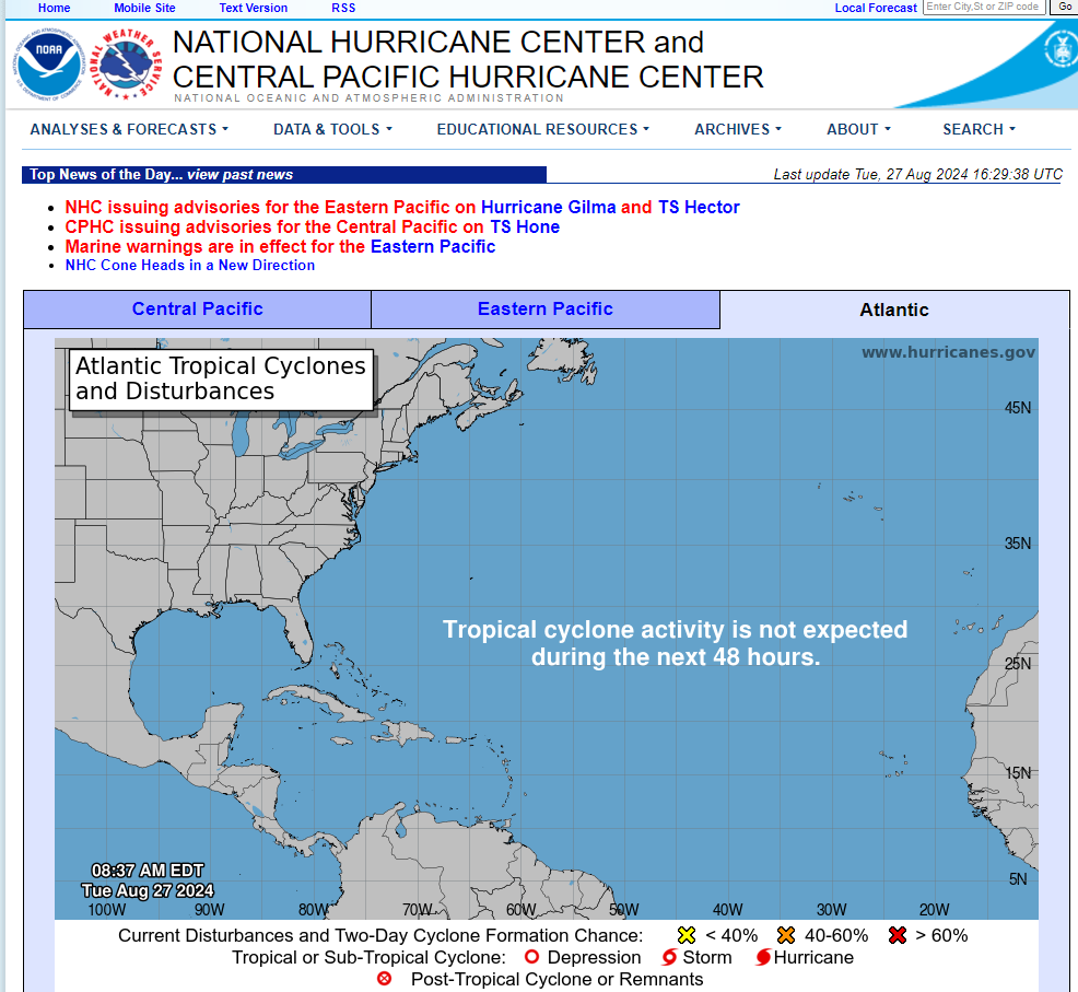
Ask, and ye shall receive...

Posted on 08/26/2024 4:40:09 PM PDT by Alas Babylon!
For over a year, surface temperatures in the Atlantic Ocean hit new highs, but that trend has reversed at record speed over the past few months, and nobody knows why.
{skip obligatory global warming bs next few paragraphs...}
NOAA data shows Atlantic sea surface temperatures have cooled at a surprising rate since May. Since June began, temperatures have been a degree or two Fahrenheit colder than normal for this time of year. That means El Niño will likely be replaced by its counterpart, La Niña, a weather system that allows cold water to rise to the surface of the Atlantic, some time between September and November. Both El Niño and La Niña are complex systems driven by trade winds, solar heating, and rainfall in the tropic regions, and can be difficult to predict. Still, the sudden shift in Atlantic temperatures has been puzzling, and nobody seems to know why it’s happened so quickly.
“We’ve gone through the list of possible mechanisms, and nothing checks the box so far,” Frans Philip Tuchen, a postdoctoral student at the University of Miami, told New Scientist.
I’m suddenly hungry.
“Sure you can pet them - they’re vegetarians.”
Doesn’t everything?
its warmer up there.
its warmer up there.
well, down on the ground.
thats where the water gets evaporated and the warmer ground air lifts up where it is cooler and the vapor cools off, clumps together, and spoils my picnic.
Brilliance and humor to boot!
More like 3 days out. The only long range semi accurate forecast is Ponder on Weather (Roy).
Bastardi mentioned the cooling happening in the Atlantic over this past weekend. As far as the dust argument, he said it is non a factor.
I posted a comment about the declining sea temps in Atlantic yesterday ironically. The temps are still much above what would be considered “average”. Why and when hurricanes form is a complicated matter. Obviously given the number of predictions of a massive season this year could be over blown, pun, but it only takes one where you are to make your life miserable for a while.
Lastly, the core of the hurricane season is still 75% ahead of us. Peaks around Sept 12th or so. If things are still quiet around that time, I would suggest the fanfare of a hype season was wrong. But note, Hurricane Andrew landed in So Florida as a category 5 storm on August 24th! in 92. It was the first named storm of that year. We are at number 5 already.
Because they are unburdened by what was burdensome, but is no longer a burden. And if you think about it, burdens can be burdensome unless they are unburdened.
Lol. Nice salad.
And as to what has gone before? Pffffft!
Ask, and ye shall receive...


One accurate forecast I can make—climate “experts” will be useless fools for the next century.
Lol.
Mash the link for the 7-Day graphical tropical weather outlook, below Marine Forecasts. Viola!

Disclaimer: Opinions posted on Free Republic are those of the individual posters and do not necessarily represent the opinion of Free Republic or its management. All materials posted herein are protected by copyright law and the exemption for fair use of copyrighted works.