Posted on 08/05/2024 8:36:22 AM PDT by NautiNurse
Hurricane Debby made landfall near Steinhatchee, Florida in the Florida Big Bend. While moving inland, Debby was downgraded to a Tropical Storm. The storm is expected to bring major flooding to the Southeastern U.S. over the next several days as the storm slows to a crawl.
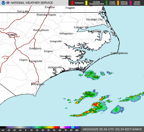
Mash the graphics below to enlarge. All links and images are self-updating.


Tropical Tidbits by Levi Cowan Local News: |

Click here: to donate by Credit Card
Or here: to donate by PayPal
Or by mail to: Free Republic, LLC - PO Box 9771 - Fresno, CA 93794
Thank you very much and God bless you.
WWSB reporting 4 Florida deaths from Debby. 13yo boy hit by tree in his mobile home shortly after Debby made landfall. 18 wheeler went over guardrail into Tampa Bypass canal off I-75 last night. Driver dead.
There are areas underwater in the highly planned community of Lakewood Ranch. Oh well...
One more thing...Charlotte County reporting large balls of floating fire ants. Egads!
Not unusual.
Until they land on you.
5.56mm
Yes. I filled up a box of fallen avocados after a tropical storm. Picked up the box and learned quickly that I had set it down on a nest of fire ants. Ran very quickly and dove into the pool. Ouch. Ouch.
Any predictions on forward speed or track?
BULLETIN
Tropical Storm Debby Intermediate Advisory Number 14A
NWS National Hurricane Center Miami FL AL042024
800 PM EDT Mon Aug 05 2024
...SLOW-MOVING DEBBY BRINGING TORRENTIAL RAINS TO PORTIONS OF
THE SOUTHEASTERN UNITED STATES...
...MAJOR FLOOD THREAT FOR THE SOUTHEASTERN UNITED STATES TO
CONTINUE FOR THE NEXT SEVERAL DAYS...
SUMMARY OF 800 PM EDT...0000 UTC...INFORMATION
From a historical perspective, I remember reading about what a flooding disaster Floyd was back in 1999 - especially in North Carolina.
Looks like it is about over the submarine base, and that Fort Stewart (or whatever woke name it might have now) is getting lots of rain.
1100 PM EDT Update
-------------------------------
About 60 MI NNW of Jacksonville FL
About 35 MI W of Brunswick GA
Max Sustained Winds...45 MPH
Movement...NE at 7 MPH
Minimum Pressure...997 MB
Tropical-storm-force winds extend outward up to 115 miles from the center.

On/Off Hurricane List Mash Here--> 
The lagoon in our backyard has been rising, but so far so good. Local news (WSAV - Savannah) says our area got 7.2" of rain *so far* as of 11 pm. Much more to come tomorrow, etc.
Watching the rain at night in the lights - coming down sideways and going in all directions - reminds me of the nor'easter snowstorms we always got up in Connecticut. The raindrops are moving the same way the snow would move during a nor'easter... if that makes any sense. ;-)
Gray Reef off Savannah shows 40 knot gusts with 83 degree water,barometer is 29.58 slowly falling. But, I don't know enough about the steering, forward speed and direction to figure out what it will do.
Rain amounts have to be crazy high.
Heres the 5:00 am discussion from NHC:
383
WTNT44 KNHC 060851
TCDAT4
Tropical Storm Debby Discussion Number 16
NWS National Hurricane Center Miami FL AL042024
500 AM EDT Tue Aug 06 2024
Debby’s center is just inland of the Georgia coast while most of
the deep convection is oriented in a couple of bands over the
Atlantic waters feeding northwestward into South Carolina.
Scatterometer data from late last evening indicated that the
tropical-storm-force wind field had expanded eastward over the
Atlantic waters, and that the maximum sustained winds were near 40
kt. This was confirmed by a few observations of 35-40 kt sustained
winds along the coasts of Georgia and South Carolina. The initial
intensity is therefore held at 40 kt.
Debby continues to move northeastward, or 050/6 kt, but the storm
will be trapped in a weak steering regime for the next couple of
days. The center is likely to move offshore the Georgia coast
later today, but then meander off the coast of South Carolina
through early Thursday. After that time, a strengthening ridge
over the western Atlantic and an approaching mid-latitude trough
over the upper Midwest should cause Debby to move faster toward the
north across the Carolinas and then into the Mid-Atlantic region
late this week. The updated NHC track forecast is a bit west of
the previous forecast starting at about 48 hours, trending in the
direction of the HCCA and TVCA consensus aids.
Little change in Debby’s intensity is expected today and tonight as
the center moves offshore. However, some strengthening is forecast
beginning on Wednesday due to the storm being in a low-shear
environment and over very warm waters of about 29 degrees Celsius.
The NHC intensity forecast continues to show a peak intensity of 50
kt in 48 hours, just before the center reaches the coast again,
which is near the top end of the guidance. Weakening is expected
to begin in 60 hours once the center moves inland. The cyclone is
likely to merge with a front over the eastern United States in 4 to
5 days.
Key Messages:
1. Potentially historic heavy rainfall across southeast Georgia and
eastern South Carolina through Friday will likely result in areas of
catastrophic flooding. Heavy rainfall will likely result in flooding
impacts from northern North Carolina through portions of
Mid-Atlantic States and southern New England through Sunday
morning.
2. Dangerous storm surge and tropical storm conditions will spread
northward along the southeast U.S. coast from northeastern Florida
to North Carolina through the middle of the week. Storm surge and
tropical storm watches and warnings have been issued for portions of
these areas. Residents in the storm surge watch and warning area
should follow any advice given by local officials.
3. In portions of Florida where Debby has passed, deadly hazards
remain, including downed power lines and flooded areas. Ensure
generators are properly ventilated to avoid carbon monoxide
poisoning. Exercise caution when using chainsaws and power tools,
and drink plenty of water to avoid heat exhaustion.
FORECAST POSITIONS AND MAX WINDS
INIT 06/0900Z 31.6N 81.6W 40 KT 45 MPH...INLAND
12H 06/1800Z 31.6N 81.0W 40 KT 45 MPH...OVER WATER
24H 07/0600Z 31.7N 79.9W 40 KT 45 MPH
36H 07/1800Z 31.9N 79.4W 45 KT 50 MPH
48H 08/0600Z 32.3N 79.5W 50 KT 60 MPH
60H 08/1800Z 33.1N 79.9W 45 KT 50 MPH...INLAND
72H 09/0600Z 34.1N 80.1W 35 KT 40 MPH...INLAND
96H 10/0600Z 38.5N 77.4W 30 KT 35 MPH...INLAND
120H 11/0600Z 43.4N 67.7W 35 KT 40 MPH...POST-TROP/EXTRATROP
$$
Forecaster Berg
........................
Looks like major flooding may happen.
500 AM EDT Update
-------------------------------
About 50 MI SW of Savannah GA
About 130 MI SW of Charleston SC
Max Sustained Winds...45 MPH
Movement...NE at 7 MPH
Minimum Pressure...999 MB
Tropical-storm-force winds extend outward up to 205 miles from the center.
On/Off Hurricane List Mash Here-->
If you haven't already, sign up for emergency phone alerts with your county. Don't forget to add tornado, flash flood, and storm surge to the alert list.
Agree, nighttime storms are the worst. I keep a thermos of hot coffee at the ready throughout the ugly weather.
Check in when you can with local updates. We've got your back! Remember, you are on high ground in a new home built to code.
The steering currents are collapsing. Debby will be meandering through Thursday.
A submarine is a good vessel to be in during heavy rains and hurricanes.
I’m afraid I’ve forgotten your (general) location to connect with my deep SW location.
(County would be OK).
A good friend lives in Pasco County, which seems to get ignored by hurricanes (not so much rain squalls).
Disclaimer: Opinions posted on Free Republic are those of the individual posters and do not necessarily represent the opinion of Free Republic or its management. All materials posted herein are protected by copyright law and the exemption for fair use of copyrighted works.