
Posted on 08/02/2024 2:11:33 PM PDT by NautiNurse
Tropical Storm watches and warnings have been issued from the Florida Keys up the Florida Gulf Coast to Suwanee. The system is crossing Central Cuba, moving at 16mph. The disturbance is expected to develop into a tropical depression on Saturday as it moves across the Straits of Florida, followed by intensification into a tropical storm by Saturday night. Governor DeSantis declared a state of emergency for 54 counties, most along the Gulf Coast and in northern Florida, to move assets in preparation for the storm.
August 13 marks 20 years since Hurricane Charley made landfall near Punta Gorda FL.
The rapid strengthening of Charley in the eastern Gulf of Mexico caught many by surprise. Around five hours before its Florida landfall, Charley was a strong Category 2 hurricane predicted to strengthen its strongest winds to 115 mph upon its landfall in the Tampa–Saint Petersburg area. About two hours before landfall, the National Hurricane Center issued a special advisory, notifying the public that Charley had become a 145 mph Category 4 hurricane, with a predicted landfall location in the Port Charlotte area. As a result of this change in forecast, numerous people in the Charlotte County area were unprepared for the hurricane, although the new track prediction was well within the previous forecast's margin of error. National Hurricane Center forecasting intern Robbie Berg publicly blamed the media for misleading residents into believing that a Tampa landfall was inevitable.
Mash the graphics below to enlarge. All links and images are self-updating.


Tropical Tidbits by Levi Cowan
Local News:
FOX4 News Southwest Florida
WWSB Sarasota/Bradenton
WFLA Tampa Bay
WESH2 Orlando
Don’t forget the Spam!
Upon reading that, one word came to mind.
“Katrina”
Hurricane Charley was all hyped for the big, bad, overdue Tampa Bay landfall. Massive evacuations (remarkably smooth process) occurred for St. Pete, Tampa, and the surrounding coastal areas. With the blip of the radar, we watched Charley veer eastward well south of Tampa Bay. Folks who had evacuated inland to Arcadia, Orlando, etc., received a bigger hit from Charley than their coastal homesteads.
Sandbags are limited to 10 per address. ;o)
I would imagine you can buy them if you want....
When I was a boy living in GITMO we had 3-4 hurricanes a year, usually around September. There was nowhere to go. You had to hunker down in your house and use a pushbroom to sweep water out of the house.
One year we got hit by the same hurricane 3 times.
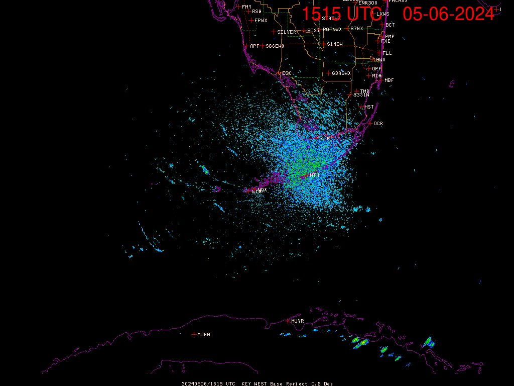
Heres Sand Key near Key West at 10:40 a
air temp.(no water aval.)
83.5 degrees
wind-=-30 knots gust to 34
baro.29.84 dropping
1100 AM EDT Update
-------------------------------
About 40 MI SE of Havana Cuba
About 125 MI S of Key West FL
Max Sustained Winds...35 MPH
Movement...WNW at 15 MPH
Minimum Pressure...1009 MB

On/Off Hurricane List Mash Here--> 
Wind in Islamorada is 25-30 knots gusting higher,rain on and of on and on off sometimes heavy.
Guesstimate you are ~155 miles from the storm center.
All indicators suggesting it won’t have time to get really ‘organized’, but that’s gonna mean a VERY large rainbag with potential for quick spin-up tornados over a wide area.
My own rule of thumb with tropical systems is that they aren’t very interesting until the pressure dips below ~995-1000 mb, and this blob is now at 1009... if they even have the ‘center’ correct.
I suppose the good news is that a bunch of areas on the peninsula currently marked as ‘abnormally dry’ will have that problem resolved this coming week (mostly the Big Bend region and a couple of counties East of Tampa/S. of Lakeland).
Exactamundo. It’s gonna be interesting to see how quickly this thing grows. Looks like it spans a pretty good area as well. Could be a huge tropical storm or even a #1.
thanks,this thing is getting more impressive all the time!
What are the steering current like?Is this storm likely to stall or keep a pretty good forward speed all the way to land?
Squall line passing through Tampa Bay area.
Consistent speed until it slows a bit approaching the Florida coast... at least that’s the forecast, but as big as this is, it could be an 18-24 hr event for some.
Thanks very much 18-24 would not be good.
Our gusts are getting stronger here,hard to say what the number is.
Unusual interim update for watches and warnings…
BULLETIN
Tropical Depression Four Intermediate Advisory Number 5A
NWS National Hurricane Center Miami FL AL042024
200 PM EDT Sat Aug 03 2024
...DEPRESSION STARTING TO MOVE INTO THE SOUTHEASTERN GULF OF
MEXICO...
...TROPICAL STORM WARNING ISSUED FOR PORTIONS OF THE FLORIDA KEYS...
SUMMARY OF 200 PM EDT...1800 UTC...INFORMATION
WATCHES AND WARNINGS
A Tropical Storm Warning is now in effect for the Florida Keys from
the Seven Mile Bridge westward.
Disclaimer: Opinions posted on Free Republic are those of the individual posters and do not necessarily represent the opinion of Free Republic or its management. All materials posted herein are protected by copyright law and the exemption for fair use of copyrighted works.