When the lane chart is georeferenced to the shoreline of the Izu Peninsula and Mikomoto Shima (Island), here's what I get:
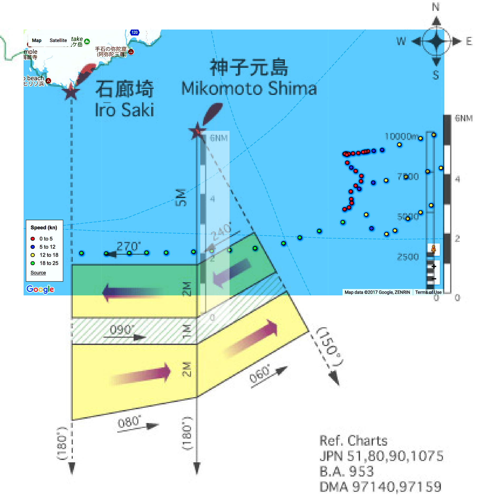
Obviously, the shipping lanes correspond neither to the AIS data nor to the shipping lanes (in darker blue) on the AIS plot.
For one thing, the shipping lane chart is not internally, dimensionally consistent: I've "ghosted in" a copy of the nautical miles scale from the chart -- against the dimension line south of Mikomoto Shima. The chart's own six (6) NM scale spans seven (7) NM on the chart!
Something ain't right !!
Just looked at the clock, and it's 5AM! I spent yesterday doing archaeology on a WWII iron ore mining and processing site -- dragging this 79-year-old carcass up & down hills and swinging a pickaxe.
I'm "tard" of futzing with this thing -- so, WYSIWYG!! Play with it as you like... I'm hitting the sack! '-)
TXnMA