To: SamAdams76
It really is.
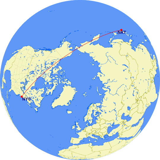
We loose perspective when we look at a flat map. That big curved line we see on standard map is just too difficult for our minds to process. Often we tend to think east-west when the shortest route on a sphere just may be over the top, which is not well represented on a standard map.
And since you brought it up:
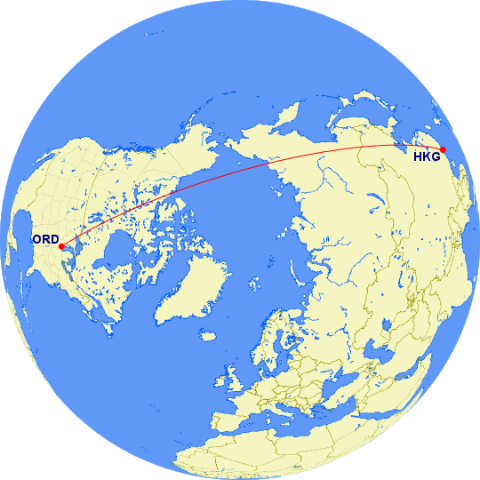
Last year I flew HKG-ORD:
29 posted on
11/15/2015 6:47:11 PM PST by
Gamecock
(Preach the gospel daily, use words if necessary is like saying Feed the hungry use food if necessary)
To: Gamecock
Pretty amazing perspective. Consider that thousands of people fly that route without even realizing that part of their trip is over the Arctic Circle, which just a century ago was mostly unexplored.
30 posted on
11/15/2015 7:23:47 PM PST by
SamAdams76
(It's time we sent a junkyard dog to Washington to run the low life out)
To: Gamecock
Is there a website where you can plot points like you did?
31 posted on
11/15/2015 7:32:39 PM PST by
Tea Party Terrorist
(Why work for a living when you can vote for a living?)
FreeRepublic.com is powered by software copyright 2000-2008 John Robinson