ping
Look on the coast of California it says,
“Here there be Liberals!”.
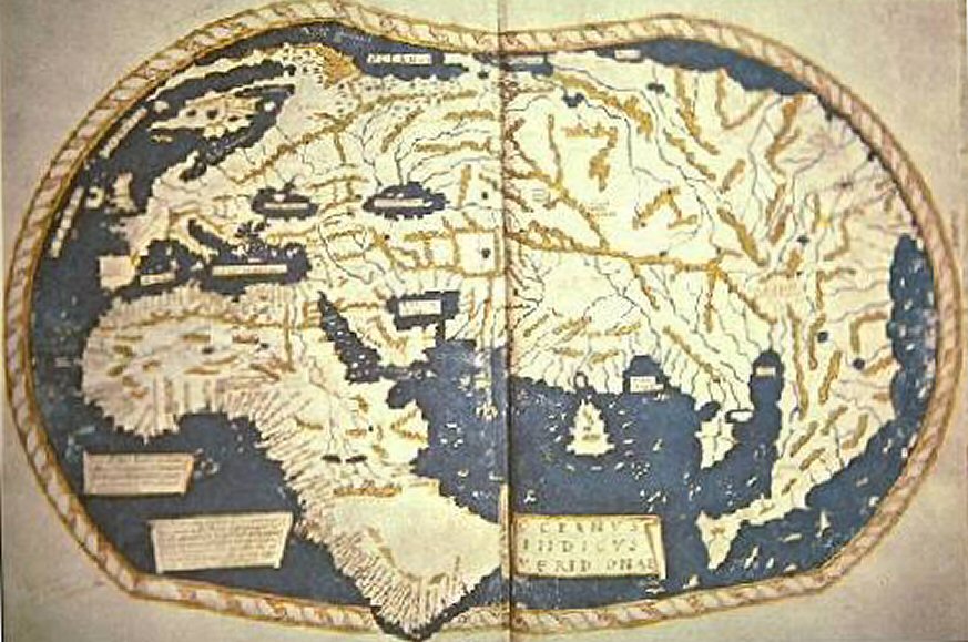
The Martellus Map: http://upload.wikimedia.org/wikipedia/commons/7/78/Henricus_Martellus_Germanus_%28Wirkungsjahre_1480-1496%29.jpg
No wonder he thought it would be a short trip.
Drink Ovaltine.
I believe the idea that Columbus thought there was a westward route to India is an urban legend. The idea that the world was round and approximately how large it was, predates Columbus. He just thought there was going to be unknown land out there (and there was). And he had a mix of gospel and pecuniary motives.
Wasn’t a really good map as Columbus missed North America and South America!
More detail:
Uncovering Hidden Text on a 500-Year-Old Map That Guided Columbus--Wired
I wonder how they went about making maps of entire countries/continents back then. They had no satellites, aircraft, or anything of the sort. Yet, they were fairly accurate for their time.
I’m sure the folks on ‘H2’ every Friday night would tell us it was done with help from the ETs!!! (lol)
I hope everyone understands that “the map holds secrets about what Europeans in the 15th Century knew about geography. But unfortunately much of its historic text has faded.”
Technology ping regarding studying the map
Unfortunately for us, the real map data was a state secret in 15th century Portugal, and Martellus only had access to what the Portuguese felt comfortable releasing. All that the Portuguese map makers knew was kept in the Lisbon Library which was destroyed in the 1755 Lisbon earthquake.
“I think I see Ohio, Columbus!”
“That’s Columbus, Ohio.”
Thanx for the post.
I just ordered the book 1491 and looking forward. The western hemisphere just before columbus.
Anyone ordering, I recommend you make sure it’s the second edition.