Free Republic
Browse · Search
News/Activism
Topics · Post Article

To: All
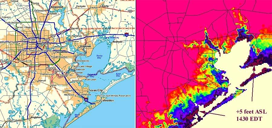
Here's what's flooded right now, 230 pm EDT, per NOAA: at plus five feet ASL:

Photobucket

At plus 13 feet ASL, about 80 percent of Galveston goes underwater:

http://i4.photobucket.com/albums/y138/jeffers_mz/Ikeplus13ASL.jpg

At plus 30 feet ASL, almost of all of Galveston and sigificant parts of the coastal metroplex are submerged:

http://i4.photobucket.com/albums/y138/jeffers_mz/Ikeplus30ASL.jpg

Here's a topographic map with five foot elevation increments:

http://i4.photobucket.com/albums/y138/jeffers_mz/Ike1.jpg

Wave height plus tide over mean sea level will add to the surge levels displayed.
754 posted on 09/12/2008 12:00:38 PM PDT by jeffers
[ Post Reply | Private Reply | To 700 | View Replies ]


To: jeffers

Thanks for posting that data and the graphics. It makes everything very clear.


967 posted on 09/12/2008 1:31:35 PM PDT by M. Espinola (Freedom is not 'free'.)
[ Post Reply | Private Reply | To 754 | View Replies ]

Free Republic
Browse · Search
News/Activism
Topics · Post Article


FreeRepublic, LLC, PO BOX 9771, FRESNO, CA 93794
FreeRepublic.com is powered by software copyright 2000-2008 John Robinson