
| This thread has been locked, it will not receive new replies. |
| Locked on 08/20/2007 8:22:08 AM PDT by Admin Moderator, reason: |
Posted on 08/19/2007 3:52:51 AM PDT by NautiNurse
Extremely dangerous Hurricane Dean is moving west-northwest through the Caribbean Sea. The current NHC forecast track indicates Dean's powerful center core will pass just south of the southwestern peninsula of Haiti, and should skirt Jamaica's southern shoreline. The storm maintained strong Category 4 wind status through the night during an eyewall replacement cycle. However, the minimum pressure supports Category 5, and additional strengthening of winds is likely.
Tourists in Jamaica crowded airports Saturday to leave the island nation. Jamaican Prime Minister Portia Simpson Miller addressed the Jamaican people, asking that everyone put aside their political differences and work together in advance of the imminent storm preceding Jamaica's general election scheduled for August 27. PM Miller announced that the Jamaican power grid and water would likely be shut down early Sunday morning in advance of the storm, and strongly urged citizens to seek shelter.
The United States and Barbados have pledged hurricane relief supplies and support to Jamaica as needed. No word yet from the United Nations...
Public Advisories Updated every three hours.
Tropical Storm Discussion Updated every six hours
Storm Track Archive Nice animated progression of 5 day forecast tracks
Buoy Data East Caribbean
Buoy Data West Caribbean
Storm Surge graphic
Satellite Images/Radar
Additional Resources:
StormCarib Island locals post their observations
Central Florida Hurricane Center
Hurricane City
Pilon Radar (link in msg 183) has a good picture of the eye right now just S/E of Jamaica.
I’m concerned about when it loops up to the NE that it could dump a lot of rain here in San Antonio.
Still going due west.
Yeah, San Antonio seems to be a hub for storms lately.
Very interesting. The continued lack of a fix makes plotting a bit of a waste, but the fact that there’s another (likely) ERC going on now is a bit of a relief. It’s also good that the pressure is going up.
Wow, winds up to 166 mph..
Conversion table for
knots to miles per hour KTS to MPH
5 Knots = 5.8 MPH
10 Knots = 11.5 MPH
15 Knots = 17.3 MPH
20 Knots = 23.0 MPH
25 Knots = 28.8 MPH
30 Knots = 34.6 MPH
35 Knots = 40.3 MPH
40 Knots = 46.1 MPH
45 Knots = 51.8 MPH
50 Knots = 57.6 MPH
55 Knots = 63.4 MPH
60 Knots = 69.1 MPH
65 Knots = 74.9 MPH
70 Knots = 80.6 MPH
75 Knots = 86.4 MPH
80 Knots = 92.2 MPH
85 Knots = 97.9 MPH
90 Knots = 103.7 MPH
95 Knots = 109.4 MPH
100 Knots = 115.2 MPH
105 Knots = 121.0 MPH
110 Knots = 126.7 MPH
115 Knots = 132.5 MPH
120 Knots = 138.2 MPH
125 Knots = 144.0 MPH
130 Knots = 149.8 MPH
135 Knots = 155.5 MPH
140 Knots = 161.3 MPH
145 Knots = 167.0 MPH
150 Knots = 172.8 MPH
Statement as of 2:00 PM EDT on August 19, 2007
...Core of extremely dangerous Hurricane Dean nearing Jamaica...

A Hurricane Warning remains in effect for Jamaica and the Cayman
Islands. Preparations to protect life and property in Jamaica
should have already been completed.  Preparations in the Cayman
Islands should be rushed to completion.
A Hurricane Warning remains in effect for the southwestern peninsula
of Haiti from west of the Haiti-dominican border to Port-au-Prince.
This will likely be downgraded to a Tropical Storm Warning later
today.
A Hurricane Watch remains in effect from Chetumal to San Felipe on
the Yucatan Peninsula of Mexico.

A Tropical Storm Warning is in effect for the coast of Haiti north
of Port-au-Prince to the northern Haiti-Dominican Republic border.
A Tropical Storm Warning is also in effect for portions of eastern
Cuba...from the province of Camaguey eastward to the province of
Guantanamo.
A tropical storm watch remains in effect for the following provinces
of Cuba...Pinar del Rio...la Habana... Ciego de Avila...Sancti
Spiritus... Cienfuegos... Matanzas...and Isla de la Juventud.

Interests elsewhere in the western Caribbean...including
Belize...and in the southern Gulf of Mexico should closely monitor
the progress of Dean.

For storm information specific to your area...please monitor
products issued by your local weather office.

At 200 PM EDT...1800z...the center of Hurricane Dean was located
near latitude 17.1 north...longitude 76.0 west or about 80 miles...
125 km...southeast of Kingston Jamaica.

Dean is moving west-northwest near 18 mph...30 km/hr. A motion
between west and west-northwest is expected over the next 24 hours.
On the forecast track...the center of Dean will be passing very
near the South Coast of Jamaica over the next six to twelve hours.

Maximum sustained winds are near 145 mph...230 km/hr...with higher
gusts.  Dean is a category four hurricane on the Saffir-Simpson
scale.  Fluctuations in intensity are common in major hurricanes and
are possible during the next 24 hours.

Hurricane force winds extend outward up to 60 miles...95 km...from
the center...and tropical storm force winds extend outward up to 205
miles...335 km.

The latest minimum central pressure reported by an Air Force Reserve
unit reconnaissance aircraft was 930 mb...27.46 inches.

Coastal storm surge flooding of 7 to 9 feet above normal tide
levels...along with large and dangerous battering waves...is
possible near the center of Dean within the Hurricane Warning area.

Storm total rainfall amounts of 5 to 10 inches can be expected over
Jamaica...with maximum amounts of up to 20 inches. Amounts of 4 to
8 inches with maximum amounts of 12 inches are expected over the
Cayman Islands. Additional amounts of 2 to 4 inches are possible
over southern Hispaniola with maximum storm totals of 10 inches.
Eastern Cuba could receive 2 to 4 inches of rain...with maximum
amounts up to 7 inches. These rains could cause life-threatening
flash floods and mudslides.

Repeating the 200 PM EDT position...17.1 N...76.0 W.  Movement
toward...west-northwest near 18 mph.  Maximum sustained winds...145
mph.  Minimum central pressure...930 mb.

The next advisory will be issued by the National
Hurricane Center at 500 PM EDT.

$$
Forecaster Franklin/Rhome
Don’t forget to drop that down by 10% to convert that flight-level winds to surface winds (or is it 15%; I can’t remember whether it’s 90% or 85% at 700 mb).
Looks like southern Jamaica will be getting the outer eyewall. Ouch.
at 700 mb, 0.9
Thanks.
Wife just came home from church and said the guy across the street from the church just finished boarding up.
And the northeast lead quadrant — not good...
Does anyone know if there are any FReepers in Jamaica or the Caymans? Please excuse me if this has already been discussed.
Thanks. I didnt know that.
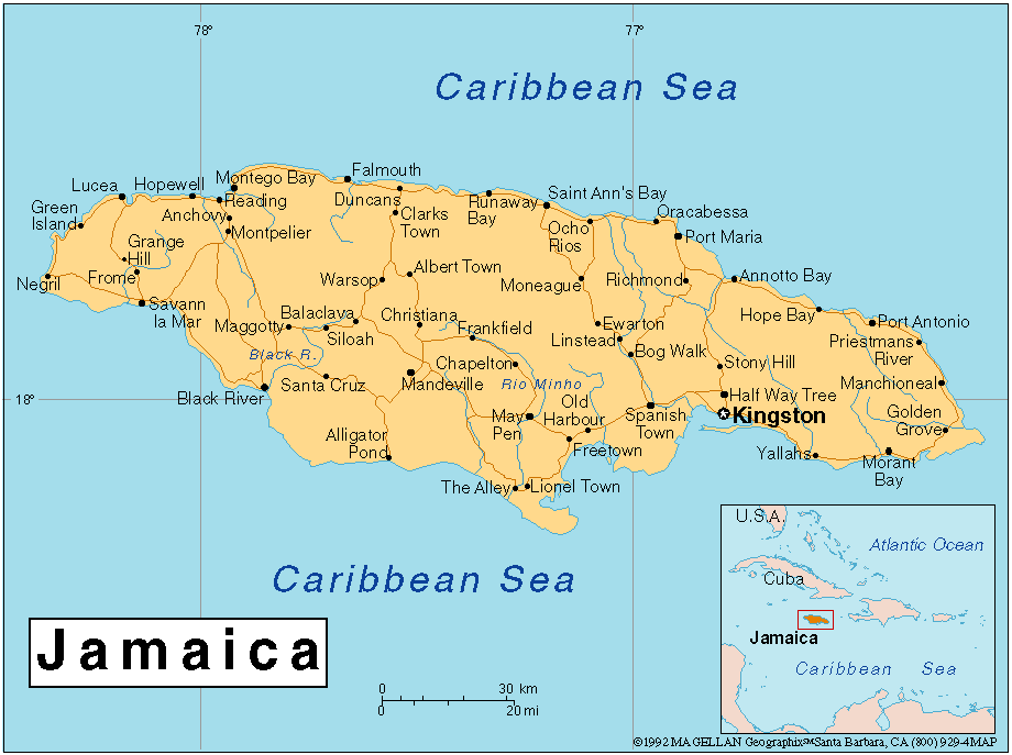
Dean should remain roughly 50 miles from Kingston.
Thank you for that conversion list. Much appreciated.
We boarded up the back yesterday. I see probably 1 0r 2 on a block doing so today.
Disclaimer: Opinions posted on Free Republic are those of the individual posters and do not necessarily represent the opinion of Free Republic or its management. All materials posted herein are protected by copyright law and the exemption for fair use of copyrighted works.