Skip to comments.
Hurricane Dean Live Thread [Now Cat 4]
NOAA/NWS ^
| August 16 2007
| NOAA/NWS
Posted on 08/16/2007 4:43:17 AM PDT by NautiNurse
Hurricane warnings have been issued for Dominica and St. Lucia as Hurricane Dean races westward into the Caribbean Sea at 24mph. This motion should bring the center of Dean near the Lesser Antilles on Friday. The increased forward speed of the storm has lessened preparation time for Caribbean Islands in its path. Hurricane Dean has favorable conditions to develop into a major hurricane over the next several days.
Public Advisories Updated every three hours.
Tropical Storm Discussion Updated every six hours
Three Day Tracking Map
Storm Track Archive Nice animated progression of 5 day forecast tracks
Buoy Data East Caribbean
Buoy Data West Caribbean
Storm Model Tracks
Storm Surge graphic
Satellite Images
Visible Satellite Still Image
IR Image
WV Image
Additional Resources:
Central Florida Hurricane Center
Hurricane City
| Category |
Wind Speed |
Barometric Pressure |
Storm Surge |
Damage Potential |
Tropical
Depression |
< 39 mph
< 34 kts |
|
|
Minimal |
Tropical
Storm |
39 - 73 mph
34 - 63 kts |
|
|
Minimal |
Hurricane 1
(Weak) |
74 - 95 mph
64 - 82 kts |
28.94" or more
980.02 mb or more |
4.0' - 5.0'
1.2 m - 1.5 m |
Minimal damage to vegetation |
Hurricane 2
(Moderate) |
96 - 110 mph
83 - 95 kts |
28.50" - 28.93"
965.12 mb - 979.68 mb |
6.0' - 8.0'
1.8 m - 2.4 m |
Moderate damage to houses |
Hurricane 3
(Strong) |
111 - 130 mph
96 - 112 kts |
27.91" - 28.49"
945.14 mb - 964.78 mb |
9.0' - 12.0'
2.7 m - 3.7 m |
Extensive damage to small buildings |
Hurricane 4
(Very strong) |
131 - 155 mph
113 - 135 kts |
27.17" - 27.90"
920.08 mb - 944.80 mb |
13.0' - 18.0'
3.9 m - 5.5 m |
Extreme structural damage |
Hurricane 5
(Devastating) |
Greater than 155 mph
Greater than 135 kts |
Less than 27.17"
Less than 920.08 mb |
Greater than 18.0'
Greater than 5.5m |
Catastrophic building failures possible |
TOPICS: Front Page News; News/Current Events
KEYWORDS: dean; hurricane; hurricanedean; tropical; tsdean
Navigation: use the links below to view more comments.
first previous 1-20 ... 521-540, 541-560, 561-580 ... 1,101-1,102 next last
To: yorkie
Thanks. I never cared much for them before. Someone mentioned them last year on a hurricane thread. They do go good with storms:’)
To: nwctwx
Yeah but the darn thing is that since we don’t know we all have to take precautions that it’s coming our way. We can’t wait.
To: SouthTexas
Flight data says Dean is borderline Cat 5 now. 927mb with 154 knot wind.
543
posted on
08/17/2007 10:23:26 PM PDT
by
nwctwx
To: nwctwx
reminder: 154 knots does not translate to surface wind.. there is a reduction factor that puts it in the 155-160pmh range.
544
posted on
08/17/2007 10:27:34 PM PDT
by
nwctwx
To: nwctwx
To: Ernest_at_the_Beach
Winds up to 150 now..
==
Statement as of 2:00 am AST on August 18, 2007
...Extremely dangerous category four Dean continues to intensify
while passing south of Puerto Rico...
a Hurricane Warning is in effect for the South Coast of the
Dominican Republic from Barahona westward to the Haiti-Dominican
Republic border. A Hurricane Warning means that hurricane
conditions are expected within the warning area within the next 24
hours. Preparations to protect life and property should be rushed
to completion.
A Hurricane Watch is in effect for Jamaica. A Hurricane Watch means
that hurricane conditions are possible within the watch area...
generally within 36 hours.
A Tropical Storm Warning remains in effect for the British Virgin
Islands....U.S. Virgin Islands and Puerto Rico. These warnings
will likely be discontinued later this morning. A Tropical Storm
Warning is in effect along the South Coast of the Dominican
Republic from Cabo engano westward to Barahona. A Tropical Storm
Warning means that tropical storm conditions are expected within
the warning area within the next 24 hours.
A tropical storm watch is in effect for portions of Cuba...from the
province of Camaguey eastward to the province of Guantanamo. A
tropical storm watch means that tropical storm conditions are
possible within the watch area...generally within 36 hours.
Interests elsewhere in the central and western Caribbean...including
western Cuba...the Cayman Islands...and the Yucatan Peninsula of
Mexico...should closely monitor the progress of Dean.
For storm information specific to your area...including possible
inland watches and warnings...please monitor products issued
by your local weather office.
At 200 am AST...0600z...the center of Hurricane Dean was located
near latitude 15.0 north...longitude 66.7 west or about 700 miles...
1125 km...east-southeast of Kingston Jamaica and about 240 miles...
390 km...south of San Juan Puerto Rico.
Dean is moving toward the west near 18 mph...30 km/hr...and this
general motion is expected to continue during the next 24 hours.
On this track...the core of the hurricane will be moving well south
of Puerto Rico tonight and south of the Dominican Republic later
today.
Reports from an Air Force hurricane hunter aircraft indicate that
maximum sustained winds have increased to near 150 mph...
240 km/hr...with higher gusts. Dean is a category four hurricane on
the Saffir-Simpson hurricane scale. Some additional strengthening
is forecast during the next 24 hours.
Hurricane force winds extend outward up to 60 miles...95 km...from
the center...and tropical storm force winds extend outward up to 205
miles...335 km.
The minimum central pressure just reported by the aircraft was 930
mb...27.46 inches.
Storm total rainfall amounts of 1 to 2 inches can be expected from
Dean over Puerto Rico...the Dominican Republic and Haiti with
maximum amounts up to 5 inches possible. These rains could cause
life-threatening flash floods and mudslides
repeating the 200 am AST position...15.0 N...66.7 W. Movement
toward...west near 18 mph. Maximum sustained winds...150 mph.
Minimum central pressure...930 mb.
The next advisory will be issued by the National
Hurricane Center at 500 am AST.
$$
Forecaster Beven
546
posted on
08/17/2007 10:51:03 PM PDT
by
nwctwx
To: nwctwx
Thanks for the update! Prayers for all those in the path of this powerful storm.
547
posted on
08/17/2007 11:12:56 PM PDT
by
sheikdetailfeather
(DEMOCRATS-POLITICIZING THE SAFETY OF AMERICA 24/7)
To: nwctwx
The minimum central pressure just reported by the aircraft was 930 mb...27.46 inches.
That's bad. Real bad. This storm is only going to intensify over the next 2 days.
Wednesday would really suck somewhere from Texas to Alabama.
548
posted on
08/17/2007 11:26:25 PM PDT
by
rmlew
(Build a wall, attrit the illegals, end the anchor babies, Americanize Immigrants)
To: Letitring
” I am so glad I am leaving for upstate New York soon. :) “
Now, there’s a sentence I never thought I’d see..... ;~)
549
posted on
08/18/2007 1:37:46 AM PDT
by
Uncle Ike
(We has met the enemy, and he is us........)
To: Rte66
Thanks for the info. Hope Onyx chimes in if she’s lurking. We lived on Grand Cayman for a few years, and always enjoyed Onyx’s updates on the hurricane situations from her daughter, who was living on the island.
550
posted on
08/18/2007 1:53:26 AM PDT
by
dawn53
To: All
http://www.wunderground.com/tropical/at200704.public.html#a_topad
Statement as of 5:00 am AST on August 18, 2007
...Extremely dangerous category four Dean continues westward through
the eastern and central Caribbean Sea...
a Hurricane Warning is in effect for the South Coast of the
Dominican Republic from Barahona westward to the Haiti-Dominican
Republic border. A Hurricane Warning means that hurricane
conditions are expected within the warning area within the next 24
hours. Preparations to protect life and property should be rushed
to completion.
A Hurricane Watch remains in effect for Jamaica. A Hurricane Watch
means that hurricane conditions are possible within the watch
area...generally within 36 hours. A Hurricane Warning will likely
be required for Jamaica later this morning.
A Tropical Storm Warning remains in effect for the British Virgin
Islands....U.S. Virgin Islands and Puerto Rico. These warnings
will likely be discontinued later today. A Tropical Storm
Warning is also in effect along the South Coast of the Dominican
Republic from Cabo engano westward to Barahona. A Tropical Storm
Warning means that tropical storm conditions are expected within
the warning area within the next 24 hours.
A tropical storm watch is in effect for portions of Cuba...from the
province of Camaguey eastward to the province of Guantanamo. A
tropical storm watch means that tropical storm conditions are
possible within the watch area...generally within 36 hours.
Interests elsewhere in the central and western Caribbean...including
western Cuba...the Cayman Islands...and the Yucatan Peninsula of
Mexico...should closely monitor the progress of Dean.
For storm information specific to your area...including possible
inland watches and warnings...please monitor products issued
by your local weather office.
At 500 am AST...0900z...the center of Hurricane Dean was located
near latitude 15.1 north...longitude 67.3 west or about 660 miles...
1065 km...east-southeast of Kingston Jamaica and about 240 miles...
390 km...south-southwest of San Juan Puerto Rico.
Dean is moving toward the west near 17 mph...28 km/hr. A general
westward to west-northwestward motion is expected during the next
24 hours. On this track...the core of the hurricane will be moving
south of the Dominican Republic later today and south of Haiti
tonight.
Maximum sustained winds are near 150 mph...240 km/hr...with higher
gusts. Dean is a category four hurricane on the Saffir-Simpson
scale. Some strengthening is possible during the next 24 hours. An
Air Force Reserve hurricane hunter aircraft is scheduled to reach
Dean in a few hours.
Hurricane force winds extend outward up to 60 miles...95 km...from
the center...and tropical storm force winds extend outward up to 205
miles...335 km. NOAA buoy 42059 recently reported a 1-minute
average wind of 59 mph.
The estimated minimum central pressure is 930 mb...27.46 inches.
Storm total rainfall amounts of 1 to 2 inches can be expected from
Dean over Puerto Rico...the Dominican Republic and Haiti with
maximum amounts up to 5 inches possible. These rains could cause
life-threatening flash floods and mudslides.
Repeating the 500 am AST position...15.1 N...67.3 W. Movement
toward...west near 17 mph. Maximum sustained winds...150 mph.
Minimum central pressure...930 mb.
An intermediate advisory will be issued by the National Hurricane
Center at 800 am AST followed by the next complete advisory at 1100
am AST.
$$
Forecaster Beven
551
posted on
08/18/2007 2:03:23 AM PDT
by
abb
(The Dinosaur Media: A One-Way Medium in a Two-Way World)
To: burzum
We used to live in the Caymans in the mid 1990’s and everyone still wore t-shirts that said “I survived Gilbert.” Then Ivan came through (we weren’t there then thank goodness), and the t-shirts said “I survived Ivan.” Looks like Dean at a Cat 5 is headed straight for the Caymans...guess they’ll have to print new t-shirts.
552
posted on
08/18/2007 2:03:48 AM PDT
by
dawn53
To: abb
http://www.wunderground.com/tropical/at200704.disc.html#a_topad
Hurricane Dean Discussion Number 21
Statement as of 5:00 am EDT on August 18, 2007
near 0500 UTC...an Air Force Reserve hurricane hunter aircraft
reported 154 kt flight-level winds in the northern eyewall of
Dean...and also reported that the central pressure fell to 930 mb.
The flight-level winds could have justified calling Dean a category
five hurricane. However...data from dropsondes...the stepped-
frequency microwave radiometer...and satellite intensity estimates
did not support that status. The intensity was thus set to a
slightly more conservative 130 kt. There has been little change in
the satellite appearance of Dean since the aircraft left...so 130
kt is the initial intensity for this advisory.
The initial motion is 275/15...again slightly slower than before.
Dean continues to be steered by a ridge over the western Atlantic
which should build westward during the next 72-96 hr as an
upper-level low over South Florida moves westward. In the short
term...the guidance is in good agreement on a west-northwestward
track toward Jamaica. The official forecast will follow
this...with the track down the left side of the guidance envelope
due to the initial motion. After that...UKMET...GFS...and
consensus models call for a motion toward the northern Yucatan
Peninsula and northeastern Mexico. The GFDL calls for a motion
through the Yucatan Channel to the Texas coast...while the ECMWF
and NOGAPS call for a more westerly motion through the central
Yucatan and the Bay of Campeche into Mainland Mexico. The track
forecast is nudged a little south of the previous forecast in best
agreement with the consensus models.
Since upper-level winds are forecast to remain favorable...the
intensity forecast calls for a gradual increase in strength through
72 hr due to increasing sea surface temperatures and maximum
potential intensity. However...there are likely to be significant
fluctuations on top of this due to difficult to time eyewall
replacement cycles. Passage over the Yucatan Peninsula should
cause some weakening...followed by re-intensification over the Gulf
of Mexico.
Forecast positions and Max winds
initial 18/0900z 15.1n 67.3w 130 kt
12hr VT 18/1800z 15.6n 69.6w 130 kt
24hr VT 19/0600z 16.5n 72.8w 135 kt
36hr VT 19/1800z 17.6n 76.4w 135 kt
48hr VT 20/0600z 18.5n 80.0w 135 kt
72hr VT 21/0600z 20.5n 86.5w 140 kt
96hr VT 22/0600z 22.5n 92.5w 110 kt
120hr VT 23/0600z 24.5n 98.0w 115 kt...inland
$$
forecaster Beven
553
posted on
08/18/2007 2:04:16 AM PDT
by
abb
(The Dinosaur Media: A One-Way Medium in a Two-Way World)
To: abb
554
posted on
08/18/2007 2:06:00 AM PDT
by
abb
(The Dinosaur Media: A One-Way Medium in a Two-Way World)
To: abb
555
posted on
08/18/2007 2:06:46 AM PDT
by
abb
(The Dinosaur Media: A One-Way Medium in a Two-Way World)
To: steveegg; alancarp
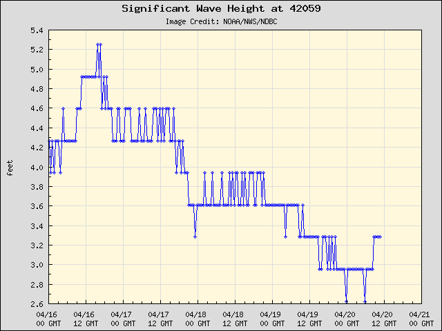
Bouy 42059 (still tickin'):
To: dawn53; onyx
I remember them well! I lurked for a number of years before joining FR and always lurked on the hurricane threads, until it was a hurricane (Rita) that actually drove me to join up.
I told JimRob that if I couldn’t get onto FR to post my location that Dubya and Rove wouldn’t know where to pick me up on the bus. In like Flinn, lol.
I’ll see what else I can find out about onyx’s whereabouts, but I can’t guarantee I’ll have any luck.
558
posted on
08/18/2007 3:09:47 AM PDT
by
Rte66
To: CindyDawg
To: dawn53
560
posted on
08/18/2007 3:28:24 AM PDT
by
Rte66
Navigation: use the links below to view more comments.
first previous 1-20 ... 521-540, 541-560, 561-580 ... 1,101-1,102 next last
Disclaimer:
Opinions posted on Free Republic are those of the individual
posters and do not necessarily represent the opinion of Free Republic or its
management. All materials posted herein are protected by copyright law and the
exemption for fair use of copyrighted works.
FreeRepublic.com is powered by software copyright 2000-2008 John Robinson
