Skip to comments.
West Coast Weather Alert (WCWA) .. Wet stormy weather on the way
Yahoo! Weather ^
| 12/12/02
| NWS
Posted on 12/12/2002 12:35:58 PM PST by NormsRevenge
Special weather statement
National Weather Service San Francisco ca
530 AM PST Thu Dec 12 2002
...Wet stormy weather on the way...
A Major rain event is expected to hit the district over the next several days. There will be a series of Pacific storms rolling into the California coast...With the first rains expected to Reach mainly the North Bay region this evening. Rains will continue in the North on Friday...And will be spreading South over the entire san Francisco and Monterey bay region.
The strongest in the storm series is likely to occur Saturday and Saturday night...With very heavy rains...Strong gusty winds...High Surf conditions...Possible flooding and coastal flooding...And even a few thunderstorms. Copious amounts of rainfall are possible... especially in the North Bay where rainfall totals through Sunday May exceed a Foot in some areas. Urban and small stream flooding will be a definite threat. In addition...Strong winds of 40-50 mph are expected across the region...Especially on Saturday.
Rain will decrease Sunday but there will not be much of a break... as the next Strong storm in the series is forecast to arrive Sunday night and Monday. This will Increase the potential for additional flooding. Rains should taper off into Tuesday...With a possible break in the weather centered around Wednesday. One more storm is on the horizon to move into the Central coast from late Thursday into Saturday of next week.
Watches...Warnings and advisories for Strong winds...Gales...High Surf...Flooding and coastal flooding will likely be needed over the next few days...With the first of these issuances probably coming later today.
Persons planning travel or outdoor activities should Monitor weather conditions and forecasts...And plan for wet blustery weather in the San Francisco and Monterey bay areas this weekend and on into next week. Please stay tuned to noaa weather radio and other local Media for further details or updates.
TOPICS: Extended News; Miscellaneous; US: California; US: Oregon; US: Washington
KEYWORDS: alert; elnino; guam; nws; stormy; supertyphoon; weather; wet
Navigation: use the links below to view more comments.
first previous 1-20 ... 41-60, 61-80, 81-100 ... 121 next last
To: Grampa Dave
To: Doomonyou
For some reason I am not able to post any of the radar maps on FR.
Go to your favorite weather site and look at this mother of a storm that we are in the middle of.
To: Grampa Dave
The mother of all storms, and the Smith right in the middle of it!
To: Doomonyou
We have at least a record re high flows today. One is the Russian at Cloverdale. The black spots on the map indicate flows that are higher than normal.

To: Doomonyou
Thanks for the post.
This is part of a report on the Smith. Read the amounts of rain projected just this weekend!
River Overview: All North Coast rivers, under low flow restrictions remained closed. with the exception of the Smith and main stem Eel. That will change by the weekend but don't get too excited. We expect all rivers to be high and muddy the following week as a major storm (s) is expected to hit Northern California this weekend with more to follow next week. Rainfall amounts could top 20 inches (just this weekend) according to some of the weather models and river fishing will be out of the question.
20 Inches in one weekend just might break the back of the drought Nazis of the enviral Watermelon Jihadists.
One of my son's got a report that before tonight is over 7 to 8 states could be under heavy rain or snow depending on the elevations. Also, this might be the minor storm.
To: Grampa Dave
Rainfall amounts could top 20 inches (just this weekend) according to some of the weather models and river fishing will be out of the question. Brown water rafting!
To: Doomonyou
Yeah, the annual Darwin Brown Water Rafting and steelheading competition for macho nuts.
The winners are no longer in the human genome pool!
To: Grampa Dave
Dr. Fine Bridge (Smith River)
Last measurment: 02:00PM PST Friday, December 13, 2002
Location: 41.8830N 124.133W (map) Near Crescent City, Del Norte County
Elevation: 63'
Operator: USGS and DWR
Values for the past 24 hours
RIV STG RAINTIP
FEET INCHES
Fri 1400 PST 0.00 11.24
1300 PST 17.53 11.16
1200 PST 17.71 11.12
1100 PST 17.84 11.12
1000 PST 18.04 11.12
0900 PST 18.20 11.12
0800 PST 18.39 0.00
0700 PST 18.39 11.12
0600 PST 18.26 11.12
0500 PST 17.83 11.00
0400 PST 17.11 11.08
0300 PST 16.18 11.08
0200 PST 15.50 11.08
0100 PST 15.13 11.08
0000 PST 14.98 0.00
Thu 2300 PST 14.86 10.96
2200 PST 1.00 10.76
2100 PST 14.74 10.44
2000 PST 14.75 9.88
1900 PST 14.72 9.36
1800 PST 1.00 9.16
1700 PST 14.72 9.00
1600 PST 14.73 8.80
1500 PST 14.75 8.64
To: Doomonyou
Can you find out what it was this past weekend or on Monday?
To: Doomonyou
I have a feeling that the Smith River would look like the Illinois River in the chart below.
The Chetco, Illinois and Smith have to be wall to wall mud, burnt trees and bushes rushing down stream after the 500,000 acre fire in the Kalmiopsis Wilderness this past summer. I just hope that there is not a massive fish kill in these streams with all the ashes turning into lye and other fire artifacts coming down stream.

To: Grampa Dave
I gotta run. We have a client in Kenwood (we are drawing plans for her new roof) and she has a ROOF LEAK! Temp fix, hopefully, it will last untill next week!
To: Doomonyou
Stay safe and drive carefully!
To: tubebender
Here is the latest alert for your area:
BULLETIN - IMMEDIATE BROADCAST REQUESTED
FLOOD WATCH NATIONAL WEATHER SERVICE EUREKA CA
300 PM PST FRI DEC 13 2002
...FLOOD WATCH TONIGHT THROUGH SUNDAY FOR HUMBOLDT...MENDOCINO AND DEL NORTE COUNTIES...
...FLOOD ADVISORY FOR THE RUSSIAN RIVER AT HOPLAND THROUGH SATURDAY...
THE NATIONAL WEATHER SERVICE HAS ISSUED A FLOOD WATCH FOR SMALL STREAM AND STREET FLOODING STARTING FRIDAY NIGHT...AND FOR RIVER FLOODING BEGINNING SATURDAY. FLOODING IS EXPECTED TO CONTINUE THROUGH SUNDAY.
MANY COASTAL CREEKS COULD FILL TO BANK FULL. THE STREAMS THAT COULD FLOOD FRIDAY NIGHT INCLUDE JACOBY AND FRESHWATER CREEKS NEAR HUMBOLDT BAY...THE TALMAGE AREA NEAR UKIAH...AND FELIZ CREEK NEAR HOPLAND. THE
GARCIA RIVER AT HIGHWAY 1 IS ALSO A CONCERN.
HYDROLOGIC FORECAST MODELS CONTINUE TO INDICATE THAT THE EEL...VAN DUZEN...AND THE NAVARRO RIVERS WILL RISE AND POSSIBLY CAUSE FLOODING. AREAS OF CONCERN ARE LOWER PORTIONS OF THE EEL RIVER DELTA...ALONG THE LOWER PORTIONS OF HIGHWAY 36...AND ALONG HIGHWAY 128 NEAR NAVARRO. ALL
OTHER AREA RIVERS AND SMALL STREAMS WILL ALSO RISE AND POSSIBLY EXPERIENCE FLOODING.
To: tubebender
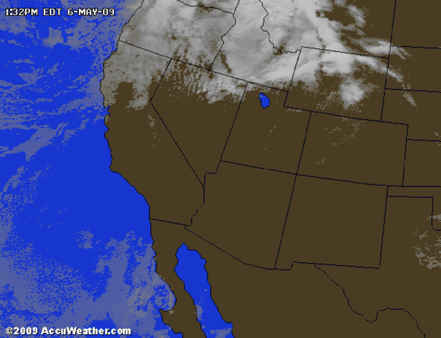
Eureka is not the only area in the eye of the beast. Look at our radar picture below:

To: Grampa Dave
Eureka is not the only area in the eye of the beast. Look at our radar picture below: I think you are getting the worst of it...we have had only .3 inch of rain since 8 AM. We went to Ferndale today to shop and send chocolate candy from Sweetness and Lite to family.and the Eel River is up nicely from just yesterday. Sadly it's a month late for fish and fishermen.
To: tubebender
We are getting drenched. As you can see from the radar shot since 2pm something, the storm seems to be stuck on us.
To: Grampa Dave
We are getting drenched. As you can see from the radar shot since 2pm something, the storm seems to be stuck on us.The grape gods are angry at Francis Coppola for that ridiculous price he paid over in the Rutherford District.
The barometer is rising and doppler radar is showing the rain has moved inland and is stalled over Napa. Hehehe...
To: tubebender
Just saw the KTVU 2news on cable. I hope you were able to move that wine you have set aside for your fellow FReepers to higher ground. I'll be gone tomorrow unless mother nature says other wise. It is raining buckets now but we have not had a lot of rain here in Eureka but the area around here.
To: Grampa Dave
10:30 PM. So far, just under six inches.
I'm drying my boots for the morrow. I'll oil 'em before I go out chainsaw and shovel in hand, making finer adjustments to the drainage (yup, I use a fair amount of wood to slow the water down).
To: Carry_Okie; tubebender
I think that we are over 6 inches. It has rained continually since mid morning.
Downtown Napa is on a flood watch at this moment inspite massive amounts of money spent to prevent this.
The good news is the lack of high tides now. They will happen tomorrow morning about 10 am.
We are up on the east hills. If we get flooded by the Napa River, you guys are in trouble too. We have the age old problem of being about mid hill. So a lot of water comes rushing down the hill. If your French Drains and special creek lanes don't work, you can be in real trouble. So far all have worked.
Stay safe Carry and Tubebender stay dry!
Navigation: use the links below to view more comments.
first previous 1-20 ... 41-60, 61-80, 81-100 ... 121 next last
Disclaimer:
Opinions posted on Free Republic are those of the individual
posters and do not necessarily represent the opinion of Free Republic or its
management. All materials posted herein are protected by copyright law and the
exemption for fair use of copyrighted works.
FreeRepublic.com is powered by software copyright 2000-2008 John Robinson
