To: MeanWestTexan
How about the reality of the map before Khrushchev transferred Crimea to Ukraine in 1956 after 300 hundred years of Russian rule? Like the 1945 map of Palestine? There are plenty of maps that reflect the rightful owners of these lands. There is only one reality and your reasoning is certainly not based on that reality.
19 posted on
07/01/2024 7:48:11 AM PDT by
hardspunned
(Former DC GOP globalist stooge)
To: hardspunned
Khrushchev transferred Crimea to Ukraine in 1956 after 300 hundred years of Russian ruleHave you read any history?"

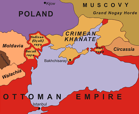
300 years before 1956 - in 1656 -- Crimea was part of the Tatar khanate, in fact it was part of the Tatar Khanate until 1783 so your "300 years" statement is flatly WRONG
It was Tatar ruled from the 13th century until 1783 - nearly 500 years which trumps the 170 years of rule from the Kremlin
And then you get the situation after the Tsar lost

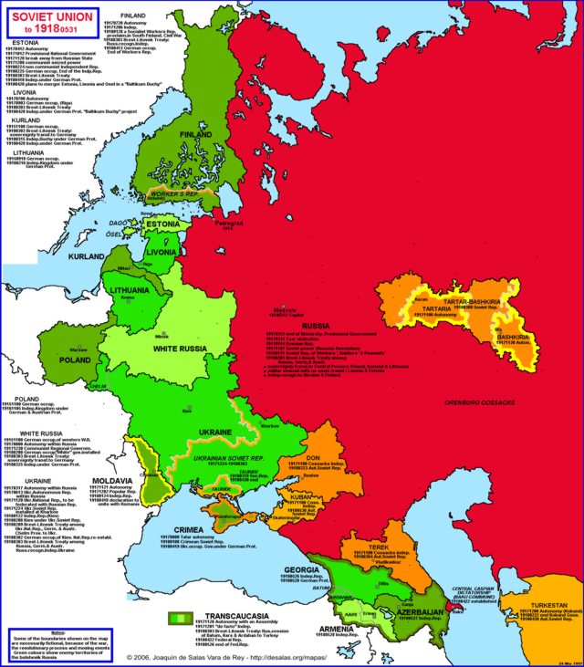
It was part of the Ukrainian state from May to June 1918 and was an independent SSR from May 1921 to 30 June 1945. The autonomous republic without its titled nationality was downgraded to an oblast (province) within the Russian SFSR on 30 June 1945
So Crimea was "Russian" only from 1783 to 1918, then from 1945 to 1954 = 144 years
The longest lived population in that area are the Crimean Tatars
27 posted on
07/01/2024 8:12:39 AM PDT by
Cronos
(I identify as an ambulance, my pronounces are wee/woo)
To: hardspunned
Belgerod is in Russia, comrade patriot.
It’s not occupied by Ukrainians, claimed by Ukraine, or anything else.
It’s just relatively close to the action and getting hit by the Russians by accident. To use your Israel analogy, this would be like the Israelis bombing Tel Aviv.
Not a pleasant place to be. The Ukrainians attack it due to troops and a fuel depo. And, on 20 April 2023, a Russian Su-34 fighter jet accidentally dropped a bomb on the city, leaving a crater 20 metres (66 ft) across and then had to be partially evacuated two days later due to another bomb probably from the same aircraft in a populated area.
28 posted on
07/01/2024 8:16:21 AM PDT by
MeanWestTexan
(Sometimes There Is No Lesser Of Two Evils)
FreeRepublic.com is powered by software copyright 2000-2008 John Robinson

