Immokoli is in Southwestern Florida, and not shown as a cotton growing region on DiogenesLamp's map.
Now our FRiend, DiogenesLamp just loves to make ridiculous claims (i.e., "no cotton=no slaves") and then post irrelevant maps to "prove it".
So here's a map (below) which could help disabuse rational minds of DiogenesLamp's nonsense.
1860 Slaveholder families per County

Notice (above) large numbers of slaveholder families throughout the South, including such Union states as Missouri, Kentucky & Maryland.
What were slaves in such states producing?
These maps (below) show that cotton was not the only product associated with slavery, and crops like wheat & tobacco were not restricted to Southern states.

Further, notice here (below): in 1860 cotton was grown in northern Kentucky and northern Missouri, meaning there was nothing about those latitudes which prevented cotton production.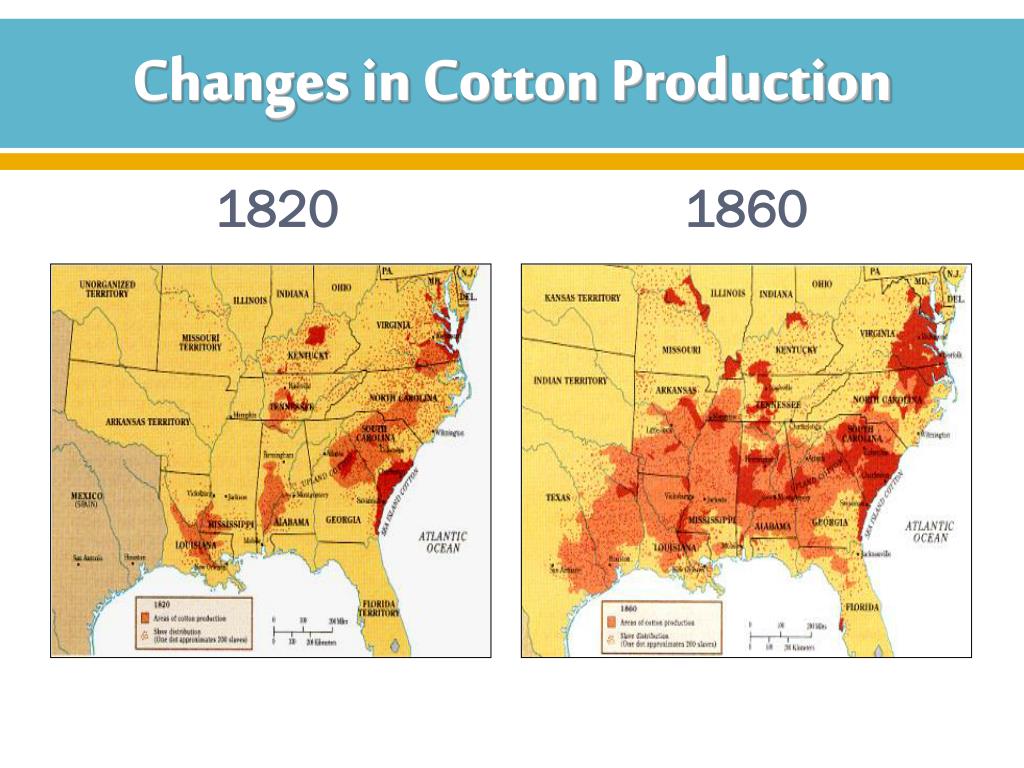
Also notice: "Bleeding Kansas" in the 1850s was contested by pro-slavery versus anti-slavery settlers.
Anti-slavery settlers eventually won, and cotton today is grown in both Kansas and Oklahoma.
Finally, by 1860 many thousands of slaves worked on railroads & manufacturing throughout the South, further demonstrating that DiogenesLamp's "no cotton = no slaves" equation is pure nonsense.