Posted on 09/12/2018 1:53:29 PM PDT by NautiNurse
The National Hurricane Center has been issuing advisories for Hurricane Florence since August 30. The five day "Cone of Uncertainty" archive progression since Aug. 30 may be found here. As the super-size storm named Florence approached the U.S. Atlantic Coast, stories abound of people who are refusing to evacuate barrier islands.
The 82nd Airborne has relocated all of its assets, while FEMA is using Fort Bragg as a major staging area for post-storm supplies, including meals, water and cots. Fort Jackson (Columbia SC) has cancelled events including basic training graduation to prepare for military and civilian evacuees from coastal locations.
While hurricane preparations are rushed to completion, some stores are closing for lack of hurricane supplies inventory. Smart phone app Gas Buddy provides updates for gasoline availability along evacuation routes.
Wave heights to 83 ft. were recorded while Hurricane Florence churned 435 miles from Wilmington, NC. Storm surge is predicted to reach 6-13 ft along the coastline to the N of landfall. Steering currents are forecast to collapse at or near landfall, resulting in Florence meandering for days. This is expected to result in up to 40 inches of rainfall in isolated areas in the Carolinas, and up to a foot of rain in the Appalachian Mountains.
Tropical Storm Isaac: The government of France has issued Tropical Storm Warnings and Watches for the Lesser Antilles.
Invest 95L: The National Hurricane Center predicts 70% chance of development in the Gulf of Mexico. Limited forecast models, satellite graphics and GOM buoy info are available for Invest 95L below.
Mash the graphics below to enlarge. All links and images are self-updating.
Local Weather: |
New Bern is getting hit right now. Hope the videos help give a visual of what’s happening.
Yikes.
Gotta be careful with that. Wind is known to crush the entire building inside the tie-down straps.
Sound and Fury in dead of night..Hurricane Florence now Hits Surf City, NC - 9/13/2018.
Storm Chaser video.
https://www.youtube.com/watch?v=17JdCNXN7bc
9-13-2018 Tonight Holly Ridge, NC - Wind Damage and Strong Winds
Shake Rattle and Roll!
https://www.youtube.com/watch?v=hrQ3ATUyJts&feature=youtu.be
Transformer Explosion, High Winds as Florence Hits Wilmington NC 9/13/2018..all goes dark
https://www.youtube.com/watch?v=t0nqO5iQNZA
Going to be a real messy there by morning....already a lot of damage. Videos show a lot..thanks.
Thanks for posting those!

New Bern is in a state of emergency..Get out.
Thanks.
I don’t know how to post pics. But, the image here shows a map of where the storm surges are.
https://www.nhc.noaa.gov/refresh/graphics_at1+shtml/152311.shtml?inundation
Can’t lift that...Berns having a heck of a hit. Saw cry for help from people stuck in their attic.
Omgosh!! Was that in a video or tv?
Thanks, I am not there, just observing.
Also, thank you for your videos posted as well.

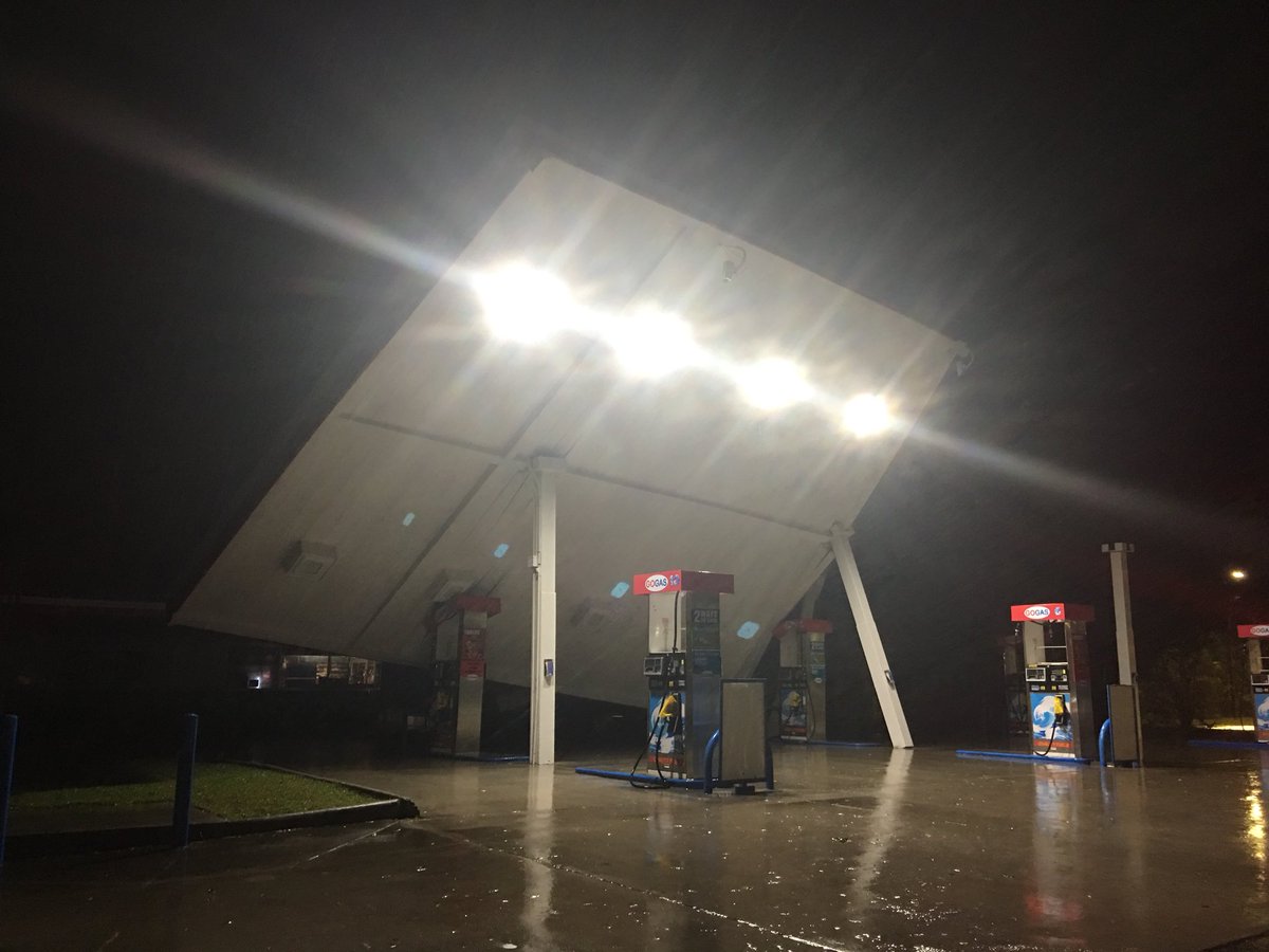
Hoping that doesn’t break loose and go flying...
Report:
Conditions continue to deteriorate, nearly 200000 without power....As of 2 a.m. EDT, Florence’s calm eye was located about 35 miles east of Wilmington, North Carolina, crawling west-northwestward at just 6 mph.
Extreme rainfall is already occurring in eastern North Carolina.
At least one site, located in Atlantic Beach, North Carolina and owned by the USGS, has received more than 20 inches of rainfall. A second observation station, located on Emerald Isle is not far behind.
I watched that thing rock and roll before it tilted over....have also seen roofs now gone off businesses. It’ll just get worse before this thing is over.
Disclaimer: Opinions posted on Free Republic are those of the individual posters and do not necessarily represent the opinion of Free Republic or its management. All materials posted herein are protected by copyright law and the exemption for fair use of copyrighted works.