

Posted on 07/27/2018 12:59:49 AM PDT by abigkahuna
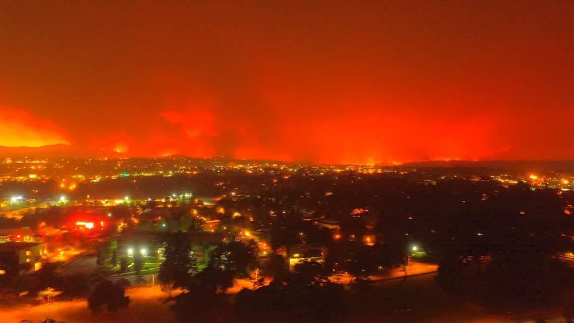
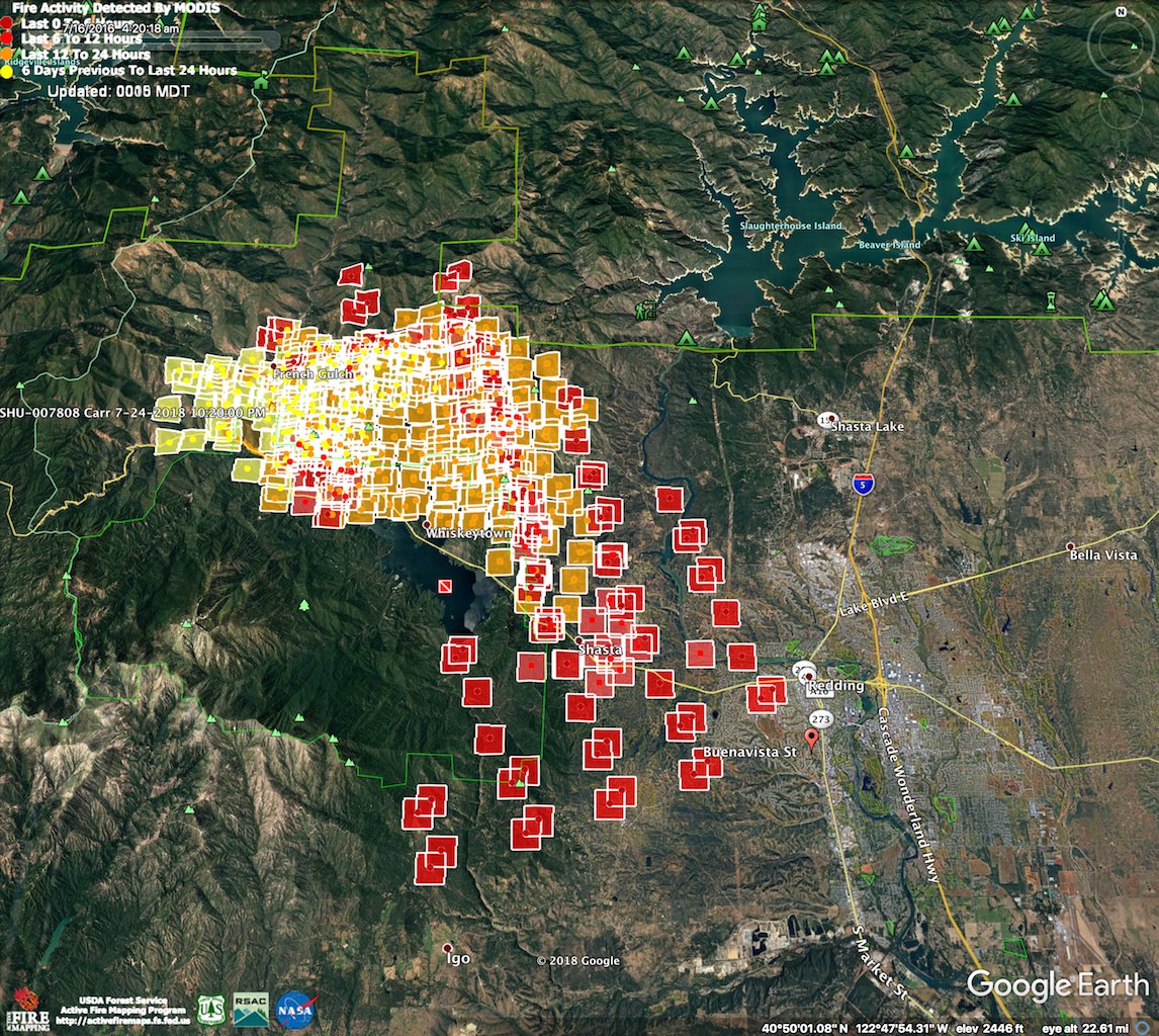
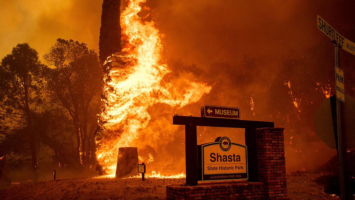
The Whiskeytown fire has gotten out of control. Huge walls of fire have now rolled through the western portions of the city of Redding, CA that has a population of around 90,000. There are reports of Fire Tornados ripping through neighborhoods. The Sacramento River was breached. Evacuations on going. Mass confusion. Firefighters have stopped working to fire and have go to a life saving mode to rescue those that they can. Entire neighborhoods are gone. No estimate on the number of homes lost right now. Redding Police and Shasta County Sheriff's Department can not pinpoint road closures as the fire is moving too fast. Redding Electric Untily has cut power to ensure line viabilty.
Fire is around 29,000 acres and six percent contained down from ten percent earlier.
So far the fire has not breeched Highway 5 but is approaching it from the west. #CARRFire
Prayers for all concerned!
Who made this call?
Someone who thought life saving was a priority?
The fire is creating winds of 60mph overturning vehicles. Was around 6700 acres yesterday and grew to its current size of 29000+. Local news stations and newspaper have gone dark or evacuated. Support coming in from the North and South, (Mt Shasta City and Chico/Butte County). Flames 100 ft high. Mercy Hospital being evacuated of patients. They are taking in only burn victims. The local Jail was evacuated.
Prayers up.
Cal Fire made the call. The fire is too erratic to fight this evening using personnel to save as many people as they can in the neighborhoods.
He said the fire behavior was so erratic, there were tornadoes within the fire "tossing around equipment, blowing windows out of Cal Fire pickup trucks."\


The problem is they can’t use their air resources because it is nighttime. One Redding TV Station evacuated to Eureka a station there and using and beaming the signals back.
The town of Burney has opened their arms saying they have hotels, campgrounds and land for animals. An hour east along hwy 299 E.
Indeed, terrible. I was just looking around using Google Street View and comparing to pics of what is burning on the news feed.
You can see the before and the sad after.
We are south of Redding, but had our WALL Fire last year as well as the fire in October down the road from us. Keeping figers crossed as everything is tinder dry. Temps have been 100+ all week. Luckily no winds for us...yet.

http://www.fire.ca.gov/current_incidents/incidentdetails/Index/2164
https://www.broadcastify.com/listen/feed/27691
Link?
That is stupid. inform people they can leave on their own. Elderly could be moved by other organizations.
Suit yourself.

Some amazing pictures

Disclaimer: Opinions posted on Free Republic are those of the individual posters and do not necessarily represent the opinion of Free Republic or its management. All materials posted herein are protected by copyright law and the exemption for fair use of copyrighted works.