Posted on 09/03/2017 11:14:08 AM PDT by goodnesswins
http://www.apnewsarchive.com/2017/Wildfires-are-threatening-thousands-of-homes-and-hindering-travel-in-the-Pacific-Northwest/id-0325ce4125ed474c82cd12e045308e20
http://www.arcgis.com/home/webmap/viewer.html?webmap=ed0a7dad32fe4848b20c6f91c74c79ea#!
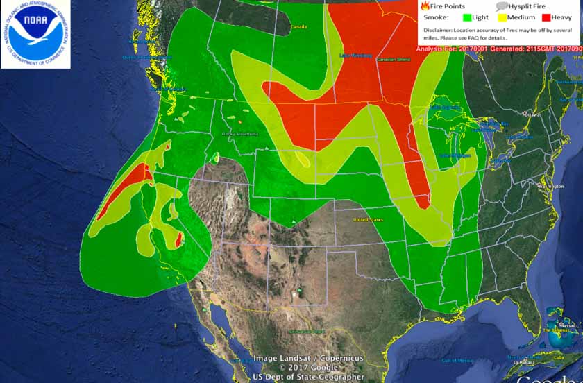
http://wildfiretoday.com/2017/08/28/wildfire-smoke-map-august-28-2017/ http://www.foxnews.com/us/2017/09/02/irritating-smoke-from-wildfires-choking-us-west-turning-lives-upside-down.html
MONTANA http://www.kare11.com/news/lightning-sparks-40-more-montana-wildfires/470081743
100s of Thousands of acres are or have burned. Thanks to idiot environmentalists policies, mostly.
Please REMOVE this thread....I posted wrong title. Thanks.


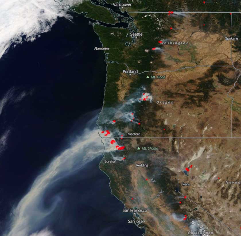
Satellite photo from September 1, 2017 showing smoke from wildfires. The red dots represent heat detected by the satellite.
Fixed instead of closing

If you would like more information about what's happening in Oregon, please FReepmail me.
Please send me your name by FReepmail if you want to be on this list.
I live east of Lebanon, OR, in the Cascade foot hills. Smoke was very heavy today, air nearly thick enough to cut with a knife.
Visibility was below two miles at times.
Disclaimer: Opinions posted on Free Republic are those of the individual posters and do not necessarily represent the opinion of Free Republic or its management. All materials posted herein are protected by copyright law and the exemption for fair use of copyrighted works.