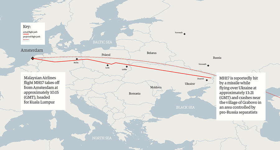
This image is sourced from Flight Radar 24. It has the actual and proposed flight plan.
Malaysia Airlines MH17 flight path map
http://www.theguardian.com/world/graphic/2014/jul/18/malaysia-mh17-flight-path-map-ukraine#
The article below said the flight plan deviated from the flight paths earlier in the week. I’ve read it was weather related, but the article doesn’t mention it. The Ukrainians need to allow the air traffic communication to be heard.
AVIATION EXPERT: Malaysia Flight Took A Significantly Different Route Than The Usual Course
Read more: http://www.businessinsider.com/malaysia-flight-17-took-different-route-2014-7#ixzz38EPl1Yjd
Now I'm not so sure the shooters didn't even consider whether or not this was a civilian flight and had reason to rule that out based on their experience. The path planned didnt look at all like it was heading to the encircled Mech unit, the actual path does.
Worth everyone seing, IMHO.
Thanks for the links.
It's pretty good photographic and other info showing the area and more than one SAM which surprised the Hell out of me. The only photographic evdence I've seen yet and does it come from US, NATO, OSCE, Ukraine, etc. ?