Skip to comments.
Earthquake swarm near the Salton Sea
USGS ^
| 08/26/2012
Posted on 08/26/2012 12:47:06 PM PDT by BenLurkin
Keep getting bigger.
Unusual.
TOPICS: Front Page News; News/Current Events; US: California
KEYWORDS: earthquake; saltonsea; saltonseaearthquakes
Navigation: use the links below to view more comments.
first previous 1-20 ... 221-240, 241-260, 261-280 ... 361-368 next last
To: Ingtar; BenLurkin
Ingtar wrote: " Ping so I can find this in the morning."
Good idea, Ingtar. As more information is given or if anything
else comes in, updates will no doubt be added.
241
posted on
08/26/2012 11:25:41 PM PDT
by
bd476
To: Lowell1775; All
Millions of freakin’ people won’t die in a big earthquake in CA. I’d be astounded if more than a few hundred did.
Now, in the mayhem and chaos created by supply disruption afterwards, amongst the home state of the “Free S*** Army”, that’s another issue...
242
posted on
08/26/2012 11:26:04 PM PDT
by
Axenolith
(Government blows, and that which governs least, blows least...)
To: BenLurkin
243
posted on
08/26/2012 11:30:44 PM PDT
by
bd476
To: bd476
Ping list sounds good. Count me in please. I live in the I.E. Pass area...Banning/Beaumont. Haven’t felt a thing all day. However did feel the Easter quake/s. Have read most of the posts on this thread, but still not clear what the suggestions mean as to what is causing the swarm.
244
posted on
08/26/2012 11:30:53 PM PDT
by
Conservative4Ever
(The Obamas = rude, crude and socially unacceptable)
To: penelopesire; Errant; machogirl
penelopesire wrote: "I just counted them up....84 shakes in the last 5 hours. Is that normal? Seems unbelievable."
Dr. Lucy Jones, USGS Seismologist said that there had not been a swarm like this since the 70s and before that the 30s. It will take them a day or two to get a better read on this unusual swarm because the earth is a different soil, different mix which makes it difficult to get an accurate reading.
. . . "What we're seeing is a classic Brawley seismic swarm,'' USGS seismologist Lucy Jones told City News Service. "We haven't seen one of these since the 1970s, and there was another one back in the 1930s.''
< Snip >
Jones said USGS seismographs and analysis computers were overwhelmed by the rash of rattling that began at sunrise, and reached a crescendo with a magnitude 5.3 quake just after 12:30 p.m. It was followed by a 4.9 shaker within two minutes.
"Our system is choking on so many earthquakes,'' Jones said. "This area of California is deep soils, and we do not get as precise data as we do over the rest of the state, and that makes our data a little less precise.''
Moderate Earthquakes Rock San Diego County Sunday, August 26, 2012 By KPBS and City News Service
245
posted on
08/26/2012 11:36:49 PM PDT
by
bd476
To: BenLurkin
3.4 10km ENE of Brawley, California 2012-08-27 06:31:27 33.023°N 115.433°W 7.4
2.9 7km W of Volcano, Hawaii 2012-08-27 05:47:33 19.426°N 155.312°W 5.9
3.0 6km N of Brawley, California 2012-08-27 05:47:24 33.040°N 115.532°W 12.3
2.9 7km S of Brawley, California 2012-08-27 05:39:43 32.913°N 115.532°W 14.5
5.4 105km S of Puerto El Triunfo, El Salvador 2012-08-27 05:38:07 12.333°N 88.591°W 57.8
5.2 72km SSW of Puerto Penasco, Mexico 2012-08-27 05:23:22 30.732°N 113.875°W 10.1
2.9 4km ENE of Westmorland, California 2012-08-27 05:20:51 33.054°N 115.582°W 0.3
2.9 9km ENE of Brawley, California 2012-08-27 05:11:55 33.021°N 115.447°W 3.0
2.7 17km ESE of Calipatria, California 2012-08-27 05:11:34 33.061°N 115.345°W 5.3
3.7 7km SSW of Calipatria, California 2012-08-27 05:09:05 33.057°N 115.536°W 7.7
4.6 128km S of Puerto El Triunfo, El Salvador 2012-08-27 05:01:30 12.124°N 88.645°W 19.9
2.9 7km N of Brawley, California 2012-08-27 05:01:21 33.050°N 115.530°W 12.6
2.8 3km NNW of Brawley, California 2012-08-27 04:59:36 33.008°N 115.548°W 10.6
2.8 27km SSE of Waimea, Hawaii 2012-08-27 04:59:24 19.791°N 155.570°W 16.2
4.8 79km SSW of Puerto El Triunfo, El Salvador 2012-08-27 04:53:52 12.593°N 88.753°W 20.3
2.6 7km ENE of Brawley, California 2012-08-27 04:53:17 33.011°N 115.458°W 9.6
3.4 6km ENE of Brawley, California 2012-08-27 04:46:13 32.991°N 115.463°W 5.0
4.9 5km N of Brawley, California 2012-08-27 04:41:36 33.030°N 115.531°W 9.0
7.3 111km S of Puerto El Triunfo, El Salvador 2012-08-27 04:37:20 12.278°N 88.528°W 20.3
2.7 5km SSE of Westmorland, California 2012-08-27 04:20:13 32.988°N 115.595°W 12.7
5.0 141km WNW of Tobelo, Indonesia 2012-08-27 03:47:18 2.234°N 126.844°E 82.3
2.5 4km NNW of Brawley, California 2012-08-27 03:41:40 33.014°N 115.547°W 13.6
2.7 7km E of Brawley, California 2012-08-27 03:29:40 32.986°N 115.455°W 4.5
3.8 152km NNE of Road Town, British Virgin Islands 2012-08-27 03:21:30 19.730°N 64.180°W 35.0
2.5 4km NNW of Brawley, California 2012-08-27 03:18:47 33.021°N 115.546°W 14.5
3.1 5km WNW of Brawley, California 2012-08-27 03:03:33 32.993°N 115.588°W 13.6
3.2 6km S of Westmorland, California 2012-08-27 02:53:15 32.977°N 115.609°W 13.2
2.5 4km NNW of Brawley, California 2012-08-27 02:47:23 33.009°N 115.554°W 12.6
2.5 5km N of Brawley, California 2012-08-27 02:28:10 33.023°N 115.540°W 14.0
3.4 4km WNW of Brawley, California 2012-08-27 00:58:45 32.998°N 115.579°W 13.0
3.4 4km N of Brawley, California 2012-08-27 00:58:34 33.018°N 115.539°W 0.1
5.1 131km E of Antofagasta, Chile 2012-08-27 00:39:53 23.805°S 69.120°W 57.1
2.9 4km SSE of Westmorland, California 2012-08-27 00:13:45 33.005°N 115.596°W 18.0
2.9 6km NNW of Brawley, California 2012-08-27 00:12:26 33.037°N 115.549°W 8.9
4.4 114km SSW of San Pedro de Atacama, Chile 2012-08-27 00:12:11 23.850°S 68.707°W 76.6
3.2 6km N of Brawley, California 2012-08-26 23:53:14 33.033°N 115.535°W 13.5
2.6 24km S of San Luis Rio Colorado, Mexico 2012-08-26 23:46:33 32.246°N 114.746°W 9.1
3.8 8km N of Brawley, California 2012-08-26 23:36:58 33.052°N 115.533°W 7.7
3.4 2km NNW of Brawley, California 2012-08-26 23:34:50 33.001°N 115.547°W 5.2
4.8 6km N of Brawley, California 2012-08-26 23:33:25 33.039°N 115.523°W 12.2
2.5 69km SW of Redoubt Volcano, Alaska 2012-08-26 23:21:07 59.992°N 153.523°W 100.0
2.7 4km NNW of Brawley, California 2012-08-26 23:21:05 33.021°N 115.541°W 13.3
4.3 93km SW of Jiquilillo, Nicaragua 2012-08-26 23:17:16 12.167°N 88.074°W 65.5
2.6 4km NW of Brawley, California 2012-08-26 23:16:22 33.007°N 115.564°W 13.0
2.6 5km N of Brawley, California 2012-08-26 23:13:45 33.032°N 115.536°W 12.9
5.0 141km NE of Tobelo, Indonesia 2012-08-26 23:06:13 2.684°N 128.858°E 44.6
4.3 4km SE of Westmorland, California 2012-08-26 22:58:41 33.002°N 115.591°W 12.9
3.4 5km NNW of Brawley, California 2012-08-26 22:53:35 33.023°N 115.553°W 12.5
3.4 5km WNW of Brawley, California 2012-08-26 22:52:09 32.998°N 115.589°W 12.4
2.5 33km SSW of Ferndale, California 2012-08-26 22:51:34 40.304°N 124.429°W 11.0
2.5 4km WNW of Brawley, California 2012-08-26 22:51:22 32.997°N 115.570°W 0.1
3.4 135km NNE of Road Town, British Virgin Islands 2012-08-26 22:38:56 19.618°N 64.347°W 26.0
4.2 15km SSE of Nueva Concepcion, Guatemala 2012-08-26 22:34:56 14.065°N 91.259°W 90.9
3.5 4km SE of Westmorland, California 2012-08-26 22:34:45 33.007°N 115.589°W
246
posted on
08/26/2012 11:48:52 PM PDT
by
waus
(FUBO UFCMF, Just in case I stuttered, FUBO)
To: waus
The battle under Brawley is not tectonic in nature.
247
posted on
08/26/2012 11:51:01 PM PDT
by
waus
(FUBO UFCMF, Just in case I stuttered, FUBO)
To: Lowell1775
Hate to say it CA Freepers, but I am praying for the big one. Hey no problem..People in CA are used to individuals like you wishing for death and destruction of other Americans. Happens all the time here. Of course, being in Ohio, it's understandable why you're so pissed off.
BTW, when you go to church, pray harder, think thoughts of harm and massive death! Maybe God will answer your prayers, and provide you with video of a few thousand dead and injured.
Oh yeah!
248
posted on
08/26/2012 11:58:10 PM PDT
by
dragnet2
(Diversion and evasion are tools of deceit)
To: Conservative4Ever
Conservative4Ever wrote: "Ping list sounds good. Count me in please. I live in the I.E. Pass area...Banning/Beaumont. Haven’t felt a thing all day. However did feel the Easter quake/s. Have read most of the posts on this thread, but still not clear what the suggestions mean as to what is causing the swarm."
While earthquakes are normal they are unsettling, especially when they're happening in swarms. That Beaumont quake was unnerving because I felt it over 100 miles from the epicenter. The fault lines, especially the San Andreas and the new one they discovered in the 1994 quake in the heart of the San Fernando Valley are all potentially affected by tremors.
There is no special cause for alarm over the swarm, it is just an odd occurrence according to Dr. Lucy Jones. Another seismologist on local news was downplaying the swarm saying it was not uncommon, then said that there had been another similar swarm as recently as the 1970s, and before that the 1930s, lol. That is a forty year spread between swarms, and in the 70s there was also the big L.A. quake.
Not to worry but it really is important to prepare and stay prepared for earthquakes. I learned the hard way during and after the Northridge quake how critical it is to tie things down and stock up on drinking water before it happens. I was very grateful for the drinking water which a local brewery gave out but found out later that the bad taste was due to them giving out filtered water which had been used somehow in the brewing process then filtered again causing bad taste and unusual effects, as it were.
I have been meaning to buy a nice tent in the event that building damage would require camping in the local parks as many people were forced to after the Northridge quake. Yet I still haven't gotten around to buying one yet. Our local parks are populated with coyotes, bobcats, snakes and black widows so I really hope I won't have to pitch a tent in the park.
249
posted on
08/27/2012 12:00:51 AM PDT
by
bd476
To: waus
Amazingly, 36 of the 54 quakes listed, are in either Brawley, Westmorland or Calipatria, CA, which are all right next to each other.
The battle is really heating up in preparation.
250
posted on
08/27/2012 12:03:28 AM PDT
by
waus
(FUBO UFCMF, Just in case I stuttered, FUBO)
To: BenLurkin
WOW MAP 1.7 2012/08/27 06:53:46 33.125 -115.631 8.9 5 km ( 3 mi) S of Obsidian Butte, CA MAP 1.8 2012/08/27 06:53:38 33.026 -115.523 10.5 6 km ( 3 mi) NNE of Brawley, CA MAP 1.9 2012/08/27 06:51:22 33.030 -115.538 10.0 6 km ( 4 mi) N of Brawley, CA MAP 2.3 2012/08/27 06:47:53 33.024 -115.529 19.7 5 km ( 3 mi) N of Brawley, CA MAP 1.7 2012/08/27 06:44:32 32.638 -115.494 13.8 3 km ( 2 mi) SW of Mexicali, Mexico MAP 1.0 2012/08/27 06:42:33 38.852 -122.826 0.0 6 km ( 4 mi) NNW of The Geysers, CA MAP 1.5 2012/08/27 06:38:28 32.928 -115.611 2.7 9 km ( 5 mi) SW of Brawley, CA MAP 3.4 2012/08/27 06:31:27 33.023 -115.433 7.4 11 km ( 7 mi) ENE of Brawley, CA MAP 1.8 2012/08/27 06:24:35 32.962 -115.356 13.3 17 km ( 10 mi) N of Holtville, CA MAP 1.8 2012/08/27 06:06:18 33.048 -115.559 14.0 6 km ( 4 mi) E of Westmorland, CA MAP 1.6 2012/08/27 06:05:17 32.987 -115.572 7.5 4 km ( 2 mi) WNW of Brawley, CA MAP 2.3 2012/08/27 06:02:59 32.987 -115.567 15.5 3 km ( 2 mi) WNW of Brawley, CA MAP 1.9 2012/08/27 06:00:48 32.906 -115.526 15.4 8 km ( 5 mi) S of Brawley, CA MAP 1.7 2012/08/27 05:56:03 33.061 -115.521 2.7 7 km ( 5 mi) S of Calipatria, CA MAP 2.1 2012/08/27 05:53:02 32.924 -115.632 5.1 11 km ( 7 mi) NNW of Imperial, CA MAP 3.0 2012/08/27 05:47:24 33.040 -115.532 12.3 7 km ( 4 mi) N of Brawley, CA MAP 2.4 2012/08/27 05:44:56 33.018 -115.594 19.7 3 km ( 2 mi) SE of Westmorland, CA MAP 2.9 2012/08/27 05:39:43 32.913 -115.532 14.5 7 km ( 4 mi) S of Brawley, CA MAP 2.9 2012/08/27 05:20:51 33.054 -115.582 0.3 4 km ( 3 mi) ENE of Westmorland, CA MAP 2.9 2012/08/27 05:11:55 33.021 -115.447 3.0 10 km ( 6 mi) ENE of Brawley, CA MAP 2.7 2012/08/27 05:11:34 33.061 -115.345 5.3 17 km ( 11 mi) ESE of Calipatria, CA MAP 3.7 2012/08/27 05:09:05 33.057 -115.536 7.7 8 km ( 5 mi) SSW of Calipatria, CA MAP 2.8 2012/08/27 05:07:59 32.527 -115.648 18.5 22 km ( 14 mi) SW of Mexicali, Mexico MAP 2.9 2012/08/27 05:01:21 33.050 -115.530 12.6 8 km ( 5 mi) N of Brawley, CA MAP 2.8 2012/08/27 04:59:36 33.008 -115.548 10.6 4 km ( 2 mi) NNW of Brawley, CA MAP 2.6 2012/08/27 04:53:17 33.011 -115.458 9.6 8 km ( 5 mi) ENE of Brawley, CA MAP 3.4 2012/08/27 04:46:13 32.991 -115.463 5.0 7 km ( 4 mi) ENE of Brawley, CA MAP 4.9 2012/08/27 04:41:36 33.030 -115.531 9.0 6 km ( 4 mi) N of Brawley, CA MAP 2.4 2012/08/27 04:37:39 32.415 -114.726 3.6 7 km ( 4 mi) SE of San Luis R�o Colorado, Mexico MAP 2.2 2012/08/27 04:37:00 33.019 -115.539 14.0 5 km ( 3 mi) N of Brawley, CA MAP 1.7 2012/08/27 04:26:03 32.914 -115.537 12.6 7 km ( 4 mi) S of Brawley, CA MAP 2.0 2012/08/27 04:24:42 33.003 -115.569 11.8 4 km ( 3 mi) NW of Brawley, CA MAP 2.3 2012/08/27 04:22:52 32.995 -115.584 13.9 5 km ( 3 mi) WNW of Brawley, CA MAP 2.7 2012/08/27 04:20:13 32.988 -115.595 12.7 6 km ( 4 mi) WNW of Brawley, CA MAP 2.2 2012/08/27 04:14:46 32.970 -115.611 12.6 7 km ( 4 mi) W of Brawley, CA MAP 2.1 2012/08/27 04:11:34 36.014 -117.778 0.0 16 km ( 10 mi) ESE of Coso Junction, CA MAP 2.2 2012/08/27 04:09:16 33.016 -115.524 23.2 4 km ( 3 mi) NNE of Brawley, CA MAP 2.2 2012/08/27 04:08:17 32.926 -115.525 14.0 6 km ( 4 mi) S of Brawley, CA MAP 1.8 2012/08/27 04:06:24 32.981 -115.581 14.0 4 km ( 3 mi) W of Brawley, CA MAP 1.6 2012/08/27 04:03:21 33.027 -115.559 14.0 6 km ( 4 mi) E of Westmorland, CA MAP 1.9 2012/08/27 04:00:31 32.930 -115.442 11.1 10 km ( 6 mi) ESE of Brawley, CA MAP 1.6 2012/08/27 03:53:26 33.007 -115.527 8.4 3 km ( 2 mi) NNE of Brawley, CA MAP 1.9 2012/08/27 03:52:43 32.911 -115.641 1.7 10 km ( 6 mi) NW of Imperial, CA MAP 2.5 2012/08/27 03:41:40 33.014 -115.547 13.6 4 km ( 3 mi) NNW of Brawley, CA MAP 2.2 2012/08/27 03:40:12 33.021 -115.547 11.5 5 km ( 3 mi) N of Brawley, CA MAP 2.3 2012/08/27 03:39:32 32.989 -115.603 14.4 6 km ( 4 mi) SSE of Westmorland, CA MAP 1.8 2012/08/27 03:38:43 32.904 -115.915 25.8 20 km ( 12 mi) NNE of Ocotillo, CA MAP 2.0 2012/08/27 03:32:34 33.002 -115.585 14.1 5 km ( 3 mi) SE of Westmorland, CA MAP 2.7 2012/08/27 03:29:40 32.986 -115.455 4.5 8 km ( 5 mi) E of Brawley, CA MAP 1.9 2012/08/27 03:28:29 33.089 -115.597 0.0 6 km ( 4 mi) NNE of Westmorland, CA MAP 1.8 2012/08/27 03:26:40 33.038 -115.582 0.0 4 km ( 2 mi) E of Westmorland, CA MAP 2.0 2012/08/27 03:22:47 33.033 -115.591 0.6 3 km ( 2 mi) E of Westmorland, CA MAP 1.9 2012/08/27 03:22:09 33.020 -115.534 11.5 5 km ( 3 mi) N of Brawley, CA MAP 1.8 2012/08/27 03:21:06 33.002 -115.545 1.0 3 km ( 2 mi) NNW of Brawley, CA MAP 2.5 2012/08/27 03:18:47 33.021 -115.546 14.5 5 km ( 3 mi) N of Brawley, CA MAP 1.8 2012/08/27 03:17:02 33.057 -115.584 1.7 4 km ( 3 mi) ENE of Westmorland, CA MAP 1.9 2012/08/27 03:16:31 33.072 -115.573 10.1 6 km ( 4 mi) NE of Westmorland, CA MAP 2.1 2012/08/27 03:12:43 33.017 -115.547 12.4 5 km ( 3 mi) NNW of Brawley, CA MAP 2.1 2012/08/27 03:12:08 32.982 -115.614 13.9 6 km ( 4 mi) S of Westmorland, CA MAP 1.9 2012/08/27 03:11:08 33.009 -115.549 11.9 4 km ( 2 mi) NNW of Brawley, CA MAP 1.9 2012/08/27 03:08:05 33.014 -115.582 20.0 5 km ( 3 mi) SE of Westmorland, CA MAP 1.7 2012/08/27 03:06:22 32.978 -115.576 10.8 4 km ( 2 mi) W of Brawley, CA MAP 3.1 2012/08/27 03:03:33 32.993 -115.588 13.6 5 km ( 3 mi) WNW of Brawley, CA MAP 2.1 2012/08/27 03:00:12 33.023 -115.534 12.8 5 km ( 3 mi) N of Brawley, CA MAP 1.9 2012/08/27 02:58:49 33.310 -115.878 20.8 8 km ( 5 mi) E of Salton City, CA MAP 1.8 2012/08/27 02:56:39 32.911 -115.520 5.9 8 km ( 5 mi) SSE of Brawley, CA MAP 3.2 2012/08/27 02:53:15 32.977 -115.609 13.2 7 km ( 4 mi) W of Brawley, CA MAP 1.7 2012/08/27 02:48:34 33.210 -116.065 39.1 10 km ( 6 mi) NE of Ocotillo Wells, CA MAP 2.5 2012/08/27 02:47:23 33.009 -115.554 12.6 4 km ( 2 mi) NNW of Brawley, CA MAP 1.7 2012/08/27 02:42:52 32.582 -115.901 5.0 20 km ( 12 mi) SSE of Ocotillo, CA MAP 2.3 2012/08/27 02:38:30 33.024 -115.539 13.8 5 km ( 3 mi) N of Brawley, CA MAP 1.7 2012/08/27 02:36:44 33.048 -115.574 0.4 5 km ( 3 mi) ENE of Westmorland, CA MAP 1.7 2012/08/27 02:32:44 32.929 -115.542 0.0 5 km ( 3 mi) S of Brawley, CA MAP 1.9 2012/08/27 02:29:59 33.021 -115.535 12.4 5 km ( 3 mi) N of Brawley, CA MAP 2.5 2012/08/27 02:28:10 33.023 -115.540 14.0 5 km ( 3 mi) N of Brawley, CA MAP 2.3 2012/08/27 02:20:54 32.977 -115.605 14.3 6 km ( 4 mi) W of Brawley, CA MAP 2.3 2012/08/27 02:20:45 33.011 -115.554 13.9 4 km ( 3 mi) NNW of Brawley, CA MAP 1.9 2012/08/27 02:15:33 36.508 -121.091 5.3 5 km ( 3 mi) ESE of Pinnacles, CA MAP 1.8 2012/08/27 02:15:16 36.016 -118.393 1.0 28 km ( 17 mi) NE of Pine Flat, CA MAP 2.3 2012/08/27 02:11:41 32.777 -115.653 1.4 4 km ( 2 mi) ESE of Seeley, CA MAP 2.3 2012/08/27 02:10:49 33.029 -115.538 12.6 6 km ( 4 mi) N of Brawley, CA MAP 2.2 2012/08/27 02:09:37 32.939 -115.546 12.5 4 km ( 3 mi) SSW of Brawley, CA MAP 2.1 2012/08/27 02:08:09 33.026 -115.537 12.6 5 km ( 3 mi) N of Brawley, CA MAP 1.5 2012/08/27 02:04:26 33.040 -115.550 0.2 7 km ( 4 mi) E of Westmorland, CA MAP 1.8 2012/08/27 02:01:08 33.001 -115.534 9.0 3 km ( 2 mi) N of Brawley, CA MAP 1.7 2012/08/27 01:55:31 32.967 -115.529 15.7 1 km ( 1 mi) SSE of Brawley, CA MAP 2.1 2012/08/27 01:52:37 37.876 -122.252 9.3 2 km ( 1 mi) ENE of Berkeley, CA MAP 2.1 2012/08/27 01:52:27 33.008 -115.537 13.4 3 km ( 2 mi) N of Brawley, CA MAP 2.1 2012/08/27 01:52:15 32.919 -115.510 16.6 7 km ( 4 mi) SSE of Brawley, CA MAP 2.3 2012/08/27 01:50:45 32.633 -115.279 23.8 18 km ( 11 mi) E of Mexicali, Mexico MAP 1.4 2012/08/27 01:48:19 38.845 -122.822 0.5 5 km ( 3 mi) NNW of The Geysers, CA MAP 1.3 2012/08/27 01:44:22 35.724 -121.110 7.9 11 km ( 7 mi) NE of San Simeon, CA MAP 1.8 2012/08/27 01:41:20 33.005 -115.556 9.4 4 km ( 2 mi) NNW of Brawley, CA MAP 1.8 2012/08/27 01:27:42 33.087 -115.513 10.9 4 km ( 3 mi) S of Calipatria, CA MAP 1.9 2012/08/27 01:25:09 32.664 -115.700 11.8 14 km ( 9 mi) S of Seeley, CA MAP 1.4 2012/08/27 01:18:08 33.420 -116.070 11.0 3 km ( 2 mi) NW of Desert Shores, CA MAP 1.9 2012/08/27 01:16:12 32.965 -115.564 13.1 3 km ( 2 mi) WSW of Brawley, CA MAP 2.4 2012/08/27 01:11:57 33.003 -115.580 17.0 5 km ( 3 mi) NW of Brawley, CA MAP 1.8 2012/08/27 01:11:03 32.972 -115.559 14.7 2 km ( 1 mi) WSW of Brawley, CA MAP 1.8 2012/08/27 01:10:11 32.982 -115.614 16.6 6 km ( 4 mi) S of Westmorland, CA MAP 2.4 2012/08/27 01:03:15 33.040 -115.539 9.0 7 km ( 4 mi) N of Brawley, CA MAP 3.4 2012/08/27 00:58:45 32.998 -115.579 13.0 5 km ( 3 mi) WNW of Brawley, CA MAP 3.4 2012/08/27 00:58:34 33.018 -115.539 0.1 5 km ( 3 mi) N of Brawley, CA MAP 1.8 2012/08/27 00:55:27 33.028 -115.575 1.1 5 km ( 3 mi) ESE of Westmorland, CA MAP 1.5 2012/08/27 00:53:11 32.923 -115.525 8.0 6 km ( 4 mi) S of Brawley, CA MAP 1.6 2012/08/27 00:48:54 33.015 -115.560 11.0 5 km ( 3 mi) NNW of Brawley, CA MAP 1.5 2012/08/27 00:47:05 33.006 -115.544 1.3 3 km ( 2 mi) NNW of Brawley, CA MAP 2.0 2012/08/27 00:41:26 33.047 -115.511 11.7 8 km ( 5 mi) NNE of Brawley, CA MAP 2.1 2012/08/27 00:36:02 32.995 -115.541 8.0 2 km ( 1 mi) NNW of Brawley, CA MAP 2.2 2012/08/27 00:32:42 32.950 -115.543 8.8 3 km ( 2 mi) S of Brawley, CA MAP 2.4 2012/08/27 00:26:39 33.021 -115.531 10.9 5 km ( 3 mi) N of Brawley, CA MAP 1.8 2012/08/27 00:24:46 33.025 -115.525 3.3 5 km ( 3 mi) N of Brawley, CA MAP 1.5 2012/08/27 00:23:35 32.928 -115.530 4.9 5 km ( 3 mi) S of Brawley, CA MAP 1.7 2012/08/27 00:19:48 32.991 -115.582 18.1 5 km ( 3 mi) WNW of Brawley, CA MAP 2.0 2012/08/27 00:17:47 32.623 -115.979 13.9 13 km ( 8 mi) S of Ocotillo, CA MAP 2.3 2012/08/27 00:16:55 33.027 -115.546 13.4 6 km ( 4 mi) N of Brawley, CA MAP 2.9 2012/08/27 00:13:45 33.005 -115.596 18.0 4 km ( 3 mi) SSE of Westmorland, CA MAP 2.9 2012/08/27 00:12:26 33.037 -115.549 8.9 7 km ( 4 mi) N of Brawley, CA MAP 1.5 2012/08/27 00:11:28 33.365 -116.191 31.8 15 km ( 9 mi) WSW of Desert Shores, CA MAP 1.5 2012/08/27 00:09:25 32.970 -115.571 14.7 3 km ( 2 mi) WSW of Brawley, CA MAP 2.3 2012/08/27 00:04:52 32.965 -115.566 13.0 3 km ( 2 mi) WSW of Brawley, CA MAP 2.2 2012/08/27 00:01:54 32.928 -115.523 13.5 6 km ( 3 mi) SSE of Brawley, CA MAP 3.2 2012/08/26 23:53:14 33.033 -115.535 13.5 6 km ( 4 mi) N of Brawley, CA MAP 1.7 2012/08/26 23:52:13 32.940 -115.538 8.1 4 km ( 3 mi) S of Brawley, CA MAP 2.2 2012/08/26 23:50:09 32.927 -115.529 17.0 6 km ( 3 mi) S of Brawley, CA MAP 2.6 2012/08/26 23:46:33 32.246 -114.746 9.1 24 km ( 15 mi) S of San Luis R�o Colorado, Mexico MAP 2.1 2012/08/26 23:45:20 33.034 -115.522 2.3 7 km ( 4 mi) NNE of Brawley, CA MAP 3.8 2012/08/26 23:36:58 33.052 -115.533 7.7 8 km ( 5 mi) N of Brawley, CA MAP 3.4 2012/08/26 23:34:50 33.001 -115.547 5.2 3 km ( 2 mi) NNW of Brawley, CA MAP 4.8 2012/08/26 23:33:25 33.039 -115.523 12.2 7 km ( 4 mi) N of Brawley, CA MAP 1.5 2012/08/26 23:32:58 38.774 -122.711 2.6 2 km ( 1 mi) W of Anderson Springs, CA MAP 1.7 2012/08/26 23:32:34 32.996 -115.531 0.6 2 km ( 1 mi) NNE of Brawley, CA MAP 1.9 2012/08/26 23:28:37 33.004 -115.546 9.4 3 km ( 2 mi) NNW of Brawley, CA MAP 2.4 2012/08/26 23:27:55 32.948 -115.542 12.2 3 km ( 2 mi) S of Brawley, CA MAP 2.1 2012/08/26 23:24:55 32.962 -115.587 12.8 5 km ( 3 mi) WSW of Brawley, CA MAP 2.1 2012/08/26 23:24:14 32.978 -115.600 5.1 6 km ( 4 mi) W of Brawley, CA MAP 2.7 2012/08/26 23:21:05 33.021 -115.541 13.3 5 km ( 3 mi) N of Brawley, CA MAP 2.6 2012/08/26 23:16:22 33.007 -115.564 13.0 4 km ( 3 mi) NW of Brawley, CA MAP 1.6 2012/08/26 23:15:47 32.874 -115.525 11.4 6 km ( 3 mi) NE of Imperial, CA MAP 2.3 2012/08/26 23:15:41 40.287 -124.356 19.5 7 km ( 5 mi) SW of Petrolia, CA MAP 2.6 2012/08/26 23:13:45 33.032 -115.536 12.9 6 km ( 4 mi) N of Brawley, CA MAP 2.2 2012/08/26 23:11:21 32.966 -115.579 9.9 4 km ( 3 mi) WSW of Brawley, CA MAP 2.3 2012/08/26 23:10:16 33.017 -115.531 23.3 4 km ( 3 mi) N of Brawley, CA MAP 1.8 2012/08/26 23:07:51 33.005 -115.546 1.4 3 km ( 2 mi) NNW of Brawley, CA MAP 2.3 2012/08/26 23:02:38 33.014 -115.543 13.7 4 km ( 3 mi) N of Brawley, CA MAP 4.3 2012/08/26 22:58:41 33.002 -115.591 12.9 5 km ( 3 mi) SE of Westmorland, CA MAP 2.4 2012/08/26 22:57:42 32.999 -115.589 16.5 5 km ( 3 mi) SE of Westmorland, CA MAP 1.9 2012/08/26 22:56:48 32.986 -115.581 12.8 4 km ( 3 mi) WNW of Brawley, CA MAP 2.3 2012/08/26 22:54:47 32.979 -115.492 7.5 4 km ( 3 mi) E of Brawley, CA MAP 3.4 2012/08/26 22:53:35 33.023 -115.553 12.5 5 km ( 3 mi) NNW of Brawley, CA MAP 3.4 2012/08/26 22:52:09 32.998 -115.589 12.4 5 km ( 3 mi) WNW of Brawley, CA MAP 2.5 2012/08/26 22:51:34 40.304 -124.429 11.0 12 km ( 8 mi) W of Petrolia, CA MAP 2.5 2012/08/26 22:51:22 32.997 -115.570 0.1 4 km ( 2 mi) NW of Brawley, CA MAP 2.1 2012/08/26 22:50:48 32.958 -115.551 12.2 3 km ( 2 mi) SSW of Brawley, CA MAP 1.7 2012/08/26 22:48:25 32.926 -115.622 5.1 10 km ( 6 mi) SW of Brawley, CA MAP 2.4 2012/08/26 22:45:11 32.955 -115.558 12.5 3 km ( 2 mi) SW of Brawley, CA MAP 1.9 2012/08/26 22:43:58 32.984 -115.616 12.3 6 km ( 4 mi) S of Westmorland, CA MAP 2.0 2012/08/26 22:40:51 33.001 -115.580 14.0 5 km ( 3 mi) NW of Brawley, CA MAP 3.5 2012/08/26 22:34:45 33.007 -115.589 13.6 5 km ( 3 mi) SE of Westmorland, CA MAP 2.8 2012/08/26 22:34:04 32.992 -115.593 13.9 6 km ( 3 mi) WNW of Brawley, CA MAP 1.6 2012/08/26 22:33:04 33.252 -116.195 13.6 13 km ( 8 mi) NNW of Ocotillo Wells, CA MAP 1.7 2012/08/26 22:31:01 33.074 -115.535 1.9 6 km ( 4 mi) SSW of Calipatria, CA MAP 1.8 2012/08/26 22:29:13 32.958 -115.621 12.8 8 km ( 5 mi) WSW of Brawley, CA MAP 2.3 2012/08/26 22:27:38 33.057 -115.576 0.1 5 km ( 3 mi) ENE of Westmorland, CA MAP 2.1 2012/08/26 22:26:27 33.009 -115.579 21.1 5 km ( 3 mi) SE of Westmorland, CA MAP 2.3 2012/08/26 22:26:04 33.007 -115.544 8.8 3 km ( 2 mi) NNW of Brawley, CA MAP 3.0 2012/08/26 22:23:57 32.989 -115.428 6.0 10 km ( 6 mi) E of Brawley, CA MAP 2.8 2012/08/26 22:22:53 32.923 -115.555 12.3 6 km ( 4 mi) SSW of Brawley, CA MAP 2.8 2012/08/26 22:22:35 32.962 -115.564 12.7 3 km ( 2 mi) WSW of Brawley, CA MAP 2.3 2012/08/26 22:21:26 33.030 -115.528 12.8 6 km ( 4 mi) N of Brawley, CA MAP 1.9 2012/08/26 22:20:09 33.024 -115.535 9.2 5 km ( 3 mi) N of Brawley, CA MAP 1.8 2012/08/26 22:19:15 32.960 -115.560 1.2 3 km ( 2 mi) SW of Brawley, CA MAP 2.8 2012/08/26 22:16:23 32.983 -115.485 9.5 5 km ( 3 mi) E of Brawley, CA MAP 2.7 2012/08/26 22:16:03 32.938 -115.669 0.0 12 km ( 7 mi) SSW of Westmorland, CA MAP 1.7 2012/08/26 22:15:27 33.002 -115.600 17.6 4 km ( 3 mi) SSE of Westmorland, CA MAP 2.3 2012/08/26 22:14:12 33.005 -115.537 6.7 3 km ( 2 mi) N of Brawley, CA MAP 1.9 2012/08/26 22:14:03 36.457 -121.033 7.0 13 km ( 8 mi) SE of Pinnacles, CA MAP 2.7 2012/08/26 22:13:03 32.999 -115.578 15.8 5 km ( 3 mi) WNW of Brawley, CA MAP 2.2 2012/08/26 22:09:33 33.018 -115.547 1.2 5 km ( 3 mi) NNW of Brawley, CA MAP 2.8 2012/08/26 22:08:05 33.021 -115.549 14.1 5 km ( 3 mi) NNW of Brawley, CA MAP 3.4 2012/08/26 22:06:28 33.014 -115.539 9.6 4 km ( 3 mi) N of Brawley, CA MAP 1.5 2012/08/26 22:06:20 33.003 -115.546 3.2 3 km ( 2 mi) NNW of Brawley, CA MAP 1.9 2012/08/26 22:05:21 33.074 -115.549 8.2 7 km ( 4 mi) SSW of Calipatria, CA MAP 2.0 2012/08/26 22:04:45 32.981 -115.600 15.7 6 km ( 4 mi) W of Brawley, CA MAP 3.0 2012/08/26 22:01:59 33.028 -115.541 13.4 6 km ( 3 mi) N of Brawley, CA MAP 1.0 2012/08/26 22:01:54 32.984 -115.617 5.2 6 km ( 4 mi) S of Westmorland, CA MAP 2.2 2012/08/26 21:59:45 32.995 -115.584 14.0 5 km ( 3 mi) WNW of Brawley, CA MAP 2.0 2012/08/26 21:58:38 33.046 -115.525 6.5 8 km ( 5 mi) N of Brawley, CA MAP 2.2 2012/08/26 21:58:20 33.019 -115.551 13.4 5 km ( 3 mi) NNW of Brawley, CA MAP 2.0 2012/08/26 21:57:07 32.517 -115.785 18.8 32 km ( 20 mi) SE of Ocotillo, CA MAP 1.9 2012/08/26 21:56:34 33.033 -115.573 0.0 5 km ( 3 mi) E of Westmorland, CA MAP 2.0 2012/08/26 21:55:51 33.087 -116.621 8.4 4 km ( 2 mi) WNW of Julian, CA MAP 3.0 2012/08/26 21:54:16 33.004 -115.586 16.2 5 km ( 3 mi) SE of Westmorland, CA MAP 3.0 2012/08/26 21:53:58 32.971 -115.551 14.8 2 km ( 1 mi) WSW of Brawley, CA MAP 2.1 2012/08/26 21:53:03 32.998 -115.594 16.5 5 km ( 3 mi) SSE of Westmorland, CA MAP 1.9 2012/08/26 21:50:19 33.018 -115.540 14.4 5 km ( 3 mi) N of Brawley, CA MAP 2.4 2012/08/26 21:49:13 33.036 -115.532 8.8 7 km ( 4 mi) N of Brawley, CA MAP 2.7 2012/08/26 21:47:18 33.026 -115.538 10.9 5 km ( 3 mi) N of Brawley, CA MAP 3.1 2012/08/26 21:46:11 32.996 -115.591 12.5 5 km ( 3 mi) SSE of Westmorland, CA MAP 2.5 2012/08/26 21:45:25 32.967 -115.551 13.1 2 km ( 1 mi) SW of Brawley, CA MAP 2.9 2012/08/26 21:42:51 33.022 -115.541 11.5 5 km ( 3 mi) N of Brawley, CA MAP 1.9 2012/08/26 21:42:07 32.994 -115.559 4.6 3 km ( 2 mi) NW of Brawley, CA MAP 2.1 2012/08/26 21:41:40 33.202 -115.954 27.3 11 km ( 7 mi) S of Salton City, CA MAP 2.2 2012/08/26 21:40:37 32.975 -115.577 14.4 4 km ( 2 mi) W of Brawley, CA MAP 2.1 2012/08/26 21:39:44 32.931 -115.623 5.0 10 km ( 6 mi) WSW of Brawley, CA MAP 2.5 2012/08/26 21:37:49 33.051 -115.577 0.0 4 km ( 3 mi) ENE of Westmorland, CA MAP 2.7 2012/08/26 21:34:48 33.027 -115.532 11.8 6 km ( 3 mi) N of Brawley, CA MAP 2.3 2012/08/26 21:33:33 32.967 -115.582 0.2 4 km ( 3 mi) WSW of Brawley, CA MAP 2.3 2012/08/26 21:33:10 32.963 -115.560 8.2 3 km ( 2 mi) SW of Brawley, CA MAP 2.2 2012/08/26 21:32:29 32.974 -115.606 10.7 7 km ( 4 mi) W of Brawley, CA MAP 2.5 2012/08/26 21:30:54 33.005 -115.565 12.4 4 km ( 3 mi) NW of Brawley, CA MAP 2.1 2012/08/26 21:29:55 33.026 -115.535 14.2 5 km ( 3 mi) N of Brawley, CA MAP 3.8 2012/08/26 21:26:39 33.038 -115.527 12.4 7 km ( 4 mi) N of Brawley, CA MAP 3.5 2012/08/26 21:23:23 32.999 -115.590 14.3 5 km ( 3 mi) SE of Westmorland, CA MAP 2.4 2012/08/26 21:23:10 32.979 -115.603 13.2 6 km ( 4 mi) W of Brawley, CA MAP 2.5 2012/08/26 21:22:36 33.116 -115.958 5.6 16 km ( 10 mi) E of Ocotillo Wells, CA MAP 2.9 2012/08/26 21:21:56 32.998 -115.549 0.3 3 km ( 2 mi) NNW of Brawley, CA MAP 2.9 2012/08/26 21:21:22 32.970 -115.588 12.9 5 km ( 3 mi) W of Brawley, CA MAP 2.4 2012/08/26 21:20:39 32.986 -115.609 8.5 6 km ( 4 mi) SSE of Westmorland, CA MAP 2.6 2012/08/26 21:20:23 33.032 -115.524 4.3 6 km ( 4 mi) N of Brawley, CA MAP 2.8 2012/08/26 21:20:06 33.022 -115.536 10.0 5 km ( 3 mi) N of Brawley, CA MAP 2.5 2012/08/26 21:19:34 32.974 -115.561 1.4 2 km ( 1 mi) W of Brawley, CA MAP 2.7 2012/08/26 21:19:01 33.013 -115.536 0.0 4 km ( 2 mi) N of Brawley, CA MAP 3.9 2012/08/26 21:17:26 32.986 -115.603 11.8 6 km ( 4 mi) SSE of Westmorland, CA MAP 4.2 2012/08/26 21:15:29 33.042 -115.539 9.1 7 km ( 5 mi) N of Brawley, CA MAP 2.8 2012/08/26 21:13:59 33.026 -115.524 11.9 6 km ( 3 mi) NNE of Brawley, CA MAP 2.9 2012/08/26 21:12:37 32.959 -115.585 0.0 5 km ( 3 mi) WSW of Brawley, CA MAP 3.6 2012/08/26 21:08:45 32.997 -115.587 11.4 5 km ( 3 mi) WNW of Brawley, CA MAP 2.0 2012/08/26 21:06:37 32.966 -115.577 13.7 4 km ( 2 mi) WSW of Brawley, CA MAP 1.5 2012/08/26 21:06:11 33.005 -115.534 9.2 3 km ( 2 mi) N of Brawley, CA MAP 3.1 2012/08/26 21:05:11 33.027 -115.535 5.1 6 km ( 3 mi) N of Brawley, CA MAP 2.0 2012/08/26 21:04:53 33.020 -115.523 9.4 5 km ( 3 mi) NNE of Brawley, CA MAP 5.5 2012/08/26 20:57:58 33.024 -115.549 9.0 5 km ( 3 mi) NNW of Brawley, CA MAP 2.2 2012/08/26 20:57:20 33.034 -115.533 7.5 6 km ( 4 mi) N of Brawley, CA MAP 1.7 2012/08/26 20:56:15 33.057 -115.656 18.2 4 km ( 2 mi) NW of Westmorland, CA MAP 2.1 2012/08/26 20:55:01 33.023 -115.539 9.6 5 km ( 3 mi) N of Brawley, CA MAP 2.1 2012/08/26 20:52:30 33.029 -115.537 12.9 6 km ( 4 mi) N of Brawley, CA MAP 1.9 2012/08/26 20:51:52 32.984 -115.584 11.9 4 km ( 3 mi) W of Brawley, CA MAP 1.7 2012/08/26 20:50:59 33.051 -115.591 6.6 3 km ( 2 mi) ENE of Westmorland, CA MAP 1.7 2012/08/26 20:49:58 33.004 -115.546 10.3 3 km ( 2 mi) NNW of Brawley, CA MAP 1.7 2012/08/26 20:49:23 32.981 -115.561 13.3 2 km ( 1 mi) W of Brawley, CA MAP 2.2 2012/08/26 20:48:12 33.021 -115.540 13.7 5 km ( 3 mi) N of Brawley, CA MAP 2.1 2012/08/26 20:46:59 33.041 -115.529 10.0 7 km ( 4 mi) N of Brawley, CA MAP 2.6 2012/08/26 20:45:48 33.030 -115.545 12.2 6 km ( 4 mi) N of Brawley, CA MAP 1.6 2012/08/26 20:43:30 32.938 -115.732 2.6 15 km ( 9 mi) SW of Westmorland, CA MAP 2.1 2012/08/26 20:42:37 33.004 -115.558 12.4 4 km ( 2 mi) NW of Brawley, CA MAP 2.2 2012/08/26 20:39:02 33.029 -115.531 9.7 6 km ( 4 mi) N of Brawley, CA MAP 1.7 2012/08/26 20:37:14 32.995 -115.608 12.6 5 km ( 3 mi) SSE of Westmorland, CA MAP 2.0 2012/08/26 20:36:15 33.019 -115.545 8.2 5 km ( 3 mi) N of Brawley, CA MAP 1.8 2012/08/26 20:35:02 33.017 -115.532 7.0 5 km ( 3 mi) N of Brawley, CA MAP 2.5 2012/08/26 20:33:01 33.008 -115.529 0.8 3 km ( 2 mi) N of Brawley, CA MAP 2.3 2012/08/26 20:32:30 33.018 -115.565 4.1 5 km ( 3 mi) NNW of Brawley, CA MAP 3.1 2012/08/26 20:31:13 33.024 -115.543 4.7 5 km ( 3 mi) N of Brawley, CA MAP 2.0 2012/08/26 20:30:55 32.953 -115.626 11.6 9 km ( 5 mi) WSW of Brawley, CA MAP 2.8 2012/08/26 20:28:57 33.009 -115.528 9.6 4 km ( 2 mi) NNE of Brawley, CA MAP 2.5 2012/08/26 20:28:19 33.004 -115.553 12.0 3 km ( 2 mi) NNW of Brawley, CA MAP 2.0 2012/08/26 20:27:23 33.079 -115.469 0.1 7 km ( 4 mi) SE of Calipatria, CA MAP 2.4 2012/08/26 20:26:00 33.008 -115.566 14.1 4 km ( 3 mi) NW of Brawley, CA MAP 2.5 2012/08/26 20:24:52 33.007 -115.553 12.0 4 km ( 2 mi) NNW of Brawley, CA MAP 2.4 2012/08/26 20:23:37 32.973 -115.580 14.6 4 km ( 3 mi) W of Brawley, CA MAP 3.4 2012/08/26 20:20:24 33.026 -115.543 11.9 5 km ( 3 mi) N of Brawley, CA MAP 2.4 2012/08/26 20:19:20 33.007 -115.523 14.9 4 km ( 2 mi) NNE of Brawley, CA MAP 3.5 2012/08/26 20:16:54 33.012 -115.564 12.7 5 km ( 3 mi) NW of Brawley, CA MAP 2.5 2012/08/26 20:16:42 33.029 -115.535 10.0 6 km ( 4 mi) N of Brawley, CA MAP 3.0 2012/08/26 20:14:46 32.996 -115.582 12.5 5 km ( 3 mi) WNW of Brawley, CA MAP 2.4 2012/08/26 20:14:00 33.030 -115.539 14.7 6 km ( 4 mi) N of Brawley, CA MAP 2.1 2012/08/26 20:13:14 33.007 -115.662 18.0 5 km ( 3 mi) SW of Westmorland, CA MAP 2.2 2012/08/26 20:12:56 33.011 -115.547 10.4 4 km ( 2 mi) NNW of Brawley, CA MAP 2.3 2012/08/26 20:10:48 32.998 -115.536 10.8 2 km ( 1 mi) N of Brawley, CA MAP 2.6 2012/08/26 20:10:13 33.000 -115.561 11.1 3 km ( 2 mi) NW of Brawley, CA MAP 2.2 2012/08/26 20:09:39 32.986 -115.561 0.0 3 km ( 2 mi) WNW of Brawley, CA MAP 2.5 2012/08/26 20:08:31 32.928 -115.577 7.9 7 km ( 4 mi) SW of Brawley, CA MAP 2.9 2012/08/26 20:06:10 33.029 -115.537 3.6 6 km ( 4 mi) N of Brawley, CA MAP 2.4 2012/08/26 20:05:26 32.998 -115.576 13.5 4 km ( 3 mi) WNW of Brawley, CA MAP 2.5 2012/08/26 20:04:50 33.008 -115.559 9.6 4 km ( 3 mi) NNW of Brawley, CA MAP 2.3 2012/08/26 20:03:51 32.989 -115.572 3.0 4 km ( 2 mi) WNW of Brawley, CA MAP 2.3 2012/08/26 20:01:30 33.016 -115.542 12.3 4 km ( 3 mi) N of Brawley, CA MAP 3.6 2012/08/26 19:58:17 33.025 -115.541 13.6 5 km ( 3 mi) N of Brawley, CA MAP 2.0 2012/08/26 19:57:56 33.012 -115.553 7.7 4 km ( 3 mi) NNW of Brawley, CA MAP 2.8 2012/08/26 19:57:33 33.010 -115.541 9.8 4 km ( 2 mi) N of Brawley, CA MAP 2.3 2012/08/26 19:56:51 32.991 -115.575 7.7 4 km ( 2 mi) WNW of Brawley, CA MAP 1.8 2012/08/26 19:55:16 32.997 -115.544 0.0 2 km ( 1 mi) NNW of Brawley, CA MAP 2.0 2012/08/26 19:54:28 32.986 -115.609 16.3 6 km ( 4 mi) SSE of Westmorland, CA MAP 3.4 2012/08/26 19:50:14 33.007 -115.586 12.8 5 km ( 3 mi) SE of Westmorland, CA MAP 2.8 2012/08/26 19:48:03 33.021 -115.558 24.8 5 km ( 3 mi) NNW of Brawley, CA MAP 2.5 2012/08/26 19:47:08 32.989 -115.572 12.4 4 km ( 2 mi) WNW of Brawley, CA MAP 3.2 2012/08/26 19:45:55 32.993 -115.575 0.2 4 km ( 2 mi) WNW of Brawley, CA MAP 2.0 2012/08/26 19:45:00 33.014 -115.559 4.5 5 km ( 3 mi) NNW of Brawley, CA MAP 3.0 2012/08/26 19:43:41 33.023 -115.541 10.6 5 km ( 3 mi) N of Brawley, CA MAP 4.3 2012/08/26 19:40:12 32.990 -115.598 13.8 6 km ( 4 mi) SSE of Westmorland, CA MAP 2.6 2012/08/26 19:39:30 32.998 -115.572 7.7 4 km ( 3 mi) NW of Brawley, CA MAP 2.0 2012/08/26 19:38:48 32.997 -115.571 4.4 4 km ( 2 mi) NW of Brawley, CA MAP 3.4 2012/08/26 19:35:51 32.995 -115.485 7.9 5 km ( 3 mi) ENE of Brawley, CA MAP 4.9 2012/08/26 19:33:00 33.021 -115.554 14.5 5 km ( 3 mi) NNW of Brawley, CA MAP 5.3 2012/08/26 19:31:22 33.019 -115.546 12.3 5 km ( 3 mi) N of Brawley, CA MAP 2.6 2012/08/26 19:30:54 33.035 -115.536 10.2 6 km ( 4 mi) N of Brawley, CA MAP 2.0 2012/08/26 19:30:27 32.988 -115.535 1.8 1 km ( 1 mi) N of Brawley, CA MAP 3.4 2012/08/26 19:28:45 33.023 -115.561 13.7 6 km ( 3 mi) NNW of Brawley, CA MAP 2.0 2012/08/26 19:28:35 33.021 -115.564 12.5 6 km ( 3 mi) NNW of Brawley, CA MAP 2.2 2012/08/26 19:27:21 33.018 -115.558 11.4 5 km ( 3 mi) NNW of Brawley, CA MAP 2.0 2012/08/26 19:21:55 33.047 -115.584 5.7 4 km ( 2 mi) ENE of Westmorland, CA MAP 3.5 2012/08/26 19:21:04 33.003 -115.546 11.0 3 km ( 2 mi) NNW of Brawley, CA MAP 4.6 2012/08/26 19:20:04 33.019 -115.545 13.1 5 km ( 3 mi) N of Brawley, CA MAP 2.0 2012/08/26 19:17:20 32.995 -115.552 1.9 3 km ( 2 mi) NW of Brawley, CA MAP 4.0 2012/08/26 19:16:11 33.026 -115.547 13.8 6 km ( 3 mi) N of Brawley, CA MAP 1.9 2012/08/26 19:07:38 33.013 -115.552 4.4 4 km ( 3 mi) NNW of Brawley, CA MAP 2.5 2012/08/26 19:06:48 33.024 -115.541 13.4 5 km ( 3 mi) N of Brawley, CA MAP 2.5 2012/08/26 19:06:32 33.027 -115.542 13.3 6 km ( 3 mi) N of Brawley, CA MAP 2.1 2012/08/26 19:04:46 32.992 -115.463 7.8 7 km ( 4 mi) ENE of Brawley, CA MAP 2.3 2012/08/26 19:04:26 33.026 -115.546 14.3 5 km ( 3 mi) N of Brawley, CA MAP 3.0 2012/08/26 19:03:18 33.027 -115.538 14.5 6 km ( 3 mi) N of Brawley, CA MAP 3.1 2012/08/26 18:58:12 33.024 -115.546 13.5 5 km ( 3 mi) N of Brawley, CA MAP 2.6 2012/08/26 18:55:55 33.008 -115.560 12.2 4 km ( 3 mi) NNW of Brawley, CA MAP 1.4 2012/08/26 18:50:22 36.024 -117.779 2.2 15 km ( 10 mi) E of Coso Junction, CA MAP 1.1 2012/08/26 18:44:42 33.141 -115.628 0.8 3 km ( 2 mi) SSE of Obsidian Butte, CA MAP 1.5 2012/08/26 18:43:40 33.014 -115.565 8.9 5 km ( 3 mi) NNW of Brawley, CA MAP 1.8 2012/08/26 18:38:54 33.006 -115.539 8.0 3 km ( 2 mi) N of Brawley, CA MAP 1.4 2012/08/26 18:37:46 33.004 -115.562 1.4 4 km ( 2 mi) NW of Brawley, CA MAP 1.5 2012/08/26 18:37:21 32.996 -115.558 1.0 3 km ( 2 mi) NW of Brawley, CA MAP 1.6 2012/08/26 18:36:09 32.959 -115.614 1.1 8 km ( 5 mi) WSW of Brawley, CA MAP 1.2 2012/08/26 18:33:07 33.293 -116.382 46.9 5 km ( 3 mi) N of Borrego Springs, CA MAP 2.4 2012/08/26 18:20:54 33.008 -115.549 10.2 4 km ( 2 mi) NNW of Brawley, CA MAP 2.7 2012/08/26 18:11:24 33.014 -115.560 12.7 5 km ( 3 mi) NNW of Brawley, CA MAP 1.5 2012/08/26 18:06:20 33.987 -116.988 13.7 7 km ( 4 mi) N of Beaumont, CA MAP 1.9 2012/08/26 18:03:05 33.009 -115.543 9.2 4 km ( 2 mi) N of Brawley, CA MAP 1.8 2012/08/26 17:56:48 33.076 -115.642 9.9 5 km ( 3 mi) NNW of Westmorland, CA MAP 1.3 2012/08/26 17:54:08 33.868 -116.190 7.9 17 km ( 11 mi) NNE of Indio, CA MAP 2.1 2012/08/26 17:51:37 36.020 -117.777 2.7 16 km ( 10 mi) E of Coso Junction, CA MAP 1.9 2012/08/26 17:50:17 33.022 -115.541 16.1 5 km ( 3 mi) N of Brawley, CA MAP 2.0 2012/08/26 17:47:18 33.021 -115.547 11.7 5 km ( 3 mi) NNW of Brawley, CA MAP 1.6 2012/08/26 17:46:48 33.005 -115.551 9.7 3 km ( 2 mi) NNW of Brawley, CA MAP 2.2 2012/08/26 17:44:13 36.024 -117.778 2.0 16 km ( 10 mi) E of Coso Junction, CA MAP 1.8 2012/08/26 17:43:08 33.025 -115.546 10.8 5 km ( 3 mi) N of Brawley, CA MAP 2.6 2012/08/26 17:37:15 33.011 -115.551 12.0 4 km ( 2 mi) NNW of Brawley, CA MAP 2.0 2012/08/26 17:28:25 33.017 -115.555 14.3 5 km ( 3 mi) NNW of Brawley, CA MAP 1.7 2012/08/26 17:27:23 33.000 -115.552 4.1 3 km ( 2 mi) NNW of Brawley, CA MAP 1.8 2012/08/26 17:22:33 32.999 -115.537 6.6 2 km ( 2 mi) N of Brawley, CA MAP 1.0 2012/08/26 17:22:21 38.810 -122.744 2.5 3 km ( 2 mi) SW of Cobb, CA MAP 2.2 2012/08/26 17:22:10 33.017 -115.551 12.6 5 km ( 3 mi) NNW of Brawley, CA MAP 2.6 2012/08/26 17:18:12 33.010 -115.556 12.2 4 km ( 3 mi) NNW of Brawley, CA MAP 2.5 2012/08/26 17:17:22 33.017 -115.556 12.2 5 km ( 3 mi) NNW of Brawley, CA MAP 3.3 2012/08/26 17:16:02 33.023 -115.549 13.4 5 km ( 3 mi) NNW of Brawley, CA MAP 2.9 2012/08/26 17:13:52 33.017 -115.555 12.7 5 km ( 3 mi) NNW of Brawley, CA MAP 1.6 2012/08/26 17:13:09 33.008 -115.542 0.9 3 km ( 2 mi) N of Brawley, CA MAP 2.2 2012/08/26 17:09:29 33.016 -115.550 9.9 4 km ( 3 mi) NNW of Brawley, CA MAP 2.0 2012/08/26 17:08:05 33.014 -115.551 13.9 4 km ( 3 mi) NNW of Brawley, CA MAP 1.9 2012/08/26 17:07:45 32.995 -115.550 1.7 2 km ( 1 mi) NNW of Brawley, CA MAP 2.2 2012/08/26 17:06:01 33.023 -115.547 14.9 5 km ( 3 mi) N of Brawley, CA MAP 2.6 2012/08/26 17:03:40 32.996 -115.548 6.0 2 km ( 1 mi) NNW of Brawley, CA MAP 1.8 2012/08/26 17:02:28 36.010 -117.774 1.6 16 km ( 10 mi) ESE of Coso Junction, CA MAP 3.8 2012/08/26 17:02:12 33.019 -115.563 13.2 5 km ( 3 mi) NNW of Brawley, CA MAP 1.5 2012/08/26 17:02:02 36.016 -117.777 1.7 16 km ( 10 mi) ESE of Coso Junction, CA MAP 2.2 2012/08/26 17:00:39 36.020 -117.782 2.2 15 km ( 9 mi) E of Coso Junction, CA MAP 1.1 2012/08/26 16:46:27 33.313 -116.380 7.5 7 km ( 5 mi) N of Borrego Springs, CA MAP 1.7 2012/08/26 16:45:04 32.996 -115.549 0.0 2 km ( 1 mi) NNW of Brawley, CA MAP 1.8 2012/08/26 16:40:53 33.010 -115.554 11.5 4 km ( 2 mi) NNW of Brawley, CA MAP 1.0 2012/08/26 16:25:20 38.823 -122.807 3.3 3 km ( 2 mi) N of The Geysers, CA MAP 2.5 2012/08/26 16:18:15 33.018 -115.555 12.4 5 km ( 3 mi) NNW of Brawley, CA MAP 1.9 2012/08/26 16:15:10 38.750 -122.710 2.6 3 km ( 2 mi) SSW of Anderson Springs, CA MAP 1.7 2012/08/26 16:00:19 33.006 -115.556 9.9 4 km ( 2 mi) NNW of Brawley, CA MAP 1.8 2012/08/26 15:59:55 33.004 -115.550 1.5 3 km ( 2 mi) NNW of Brawley, CA MAP 1.8 2012/08/26 15:57:01 33.014 -115.553 13.8 4 km ( 3 mi) NNW of Brawley, CA MAP 2.2 2012/08/26 15:55:32 33.021 -115.545 12.4 5 km ( 3 mi) N of Brawley, CA MAP 1.6 2012/08/26 15:53:29 33.002 -115.554 5.7 3 km ( 2 mi) NNW of Brawley, CA MAP 2.5 2012/08/26 15:48:23 32.998 -115.559 11.4 3 km ( 2 mi) NW of Brawley, CA MAP 2.5 2012/08/26 15:48:10 33.010 -115.548 12.0 4 km ( 2 mi) NNW of Brawley, CA MAP 2.5 2012/08/26 15:33:03 33.015 -115.552 12.5 5 km ( 3 mi) NNW of Brawley, CA MAP 1.4 2012/08/26 15:14:38 33.016 -115.558 13.7 5 km ( 3 mi) NNW of Brawley, CA MAP 1.2 2012/08/26 14:41:34 34.030 -117.101 17.3 4 km ( 3 mi) SSE of Mentone, CA MAP 1.5 2012/08/26 14:19:34 33.921 -116.407 45.3 10 km ( 6 mi) ESE of Desert Hot Springs, CA MAP 1.8 2012/08/26 13:53:24 33.018 -115.555 12.9 5 km ( 3 mi) NNW of Brawley, CA
251
posted on
08/27/2012 12:10:42 AM PDT
by
waus
(FUBO UFCMF, Just in case I stuttered, FUBO)
To: waus
252
posted on
08/27/2012 12:12:56 AM PDT
by
Brad’s Gramma
(PRAY for this country like your life depends on it......because it DOES!)
To: bd476
it is just an odd occurrence according to Dr. Lucy Jones What was it the guy in the movie 2012 said, when the government
tells you there is nothing to worry about? lol
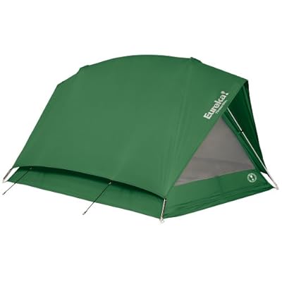
Eureka! Timberline 4 - Tent (sleeps 4)
253
posted on
08/27/2012 12:13:15 AM PDT
by
Errant
To: Lowell1775; dragnet2; Brad's Gramma
Lowell1775 wrote: "If CA does suddenly become a seabed.......w/o all those democrat votes anymore, Obamer is toast. Romney sure to win. Hate to say it CA Freepers, but I am praying for the big one. Thanks for taking a mag 9 and 300 foot tidal wave for the cause of liberty. Get down to Cabellas and grab a bass boat on 6 mos same as cash...will be the best deal you ever made. You can tie it up in Ohio anytime."
Such a classless wish and prayer for someone posting on a conservative website based in . . .
wait for it
. . .
California!
You also may be unaware of the name of the State where President Ronald Reagan had been Governor: well what do you know ...
...California!
Lowell1775, perhaps you do not know just how many registered California voters are registered Republicans = 5,314,800 which is nearly half of Ohio's total population of men, women and children = 11,544,951
254
posted on
08/27/2012 12:26:46 AM PDT
by
bd476
To: bd476
Good stat! I didn’t know that!
255
posted on
08/27/2012 12:32:18 AM PDT
by
Brad’s Gramma
(PRAY for this country like your life depends on it......because it DOES!)
To: Errant
256
posted on
08/27/2012 12:34:02 AM PDT
by
Brad’s Gramma
(PRAY for this country like your life depends on it......because it DOES!)
To: Errant
Errant wrote: "it is just an odd occurrence according to Dr. Lucy Jones What was it the guy in the movie 2012 said, when the government tells you there is nothing to worry about? lol "
LOL! You're right of course. Thank you for the link. Now all I have to do is save up a year or two to get it. Is that a good brand?
257
posted on
08/27/2012 12:42:17 AM PDT
by
bd476
To: SumProVita
Reference bump - looks pretty active to this non-geologist!
258
posted on
08/27/2012 12:46:40 AM PDT
by
Tunehead54
(Nothing funny here ;-)
To: Brad's Gramma
Brad's Gramma wrote: "Good stat! I didn't know that!"
Thanks. It kind of puts it all in a different perspective.
259
posted on
08/27/2012 12:48:23 AM PDT
by
bd476
To: bd476
Some people will never get over the hate for CA, no matter what...as they tromp to the movies, buy the music, support the dweebs in Hollywood.
260
posted on
08/27/2012 12:57:27 AM PDT
by
Brad’s Gramma
(PRAY for this country like your life depends on it......because it DOES!)
Navigation: use the links below to view more comments.
first previous 1-20 ... 221-240, 241-260, 261-280 ... 361-368 next last
Disclaimer:
Opinions posted on Free Republic are those of the individual
posters and do not necessarily represent the opinion of Free Republic or its
management. All materials posted herein are protected by copyright law and the
exemption for fair use of copyrighted works.
FreeRepublic.com is powered by software copyright 2000-2008 John Robinson
