Posted on 08/25/2006 1:33:28 PM PDT by NautiNurse
Tropical Storm Ernesto has formed in the Caribbean Sea. Currently, wind shear is providing an adverse environment for development. The tropical system is moving over the open waters of the Eastern Caribbean.
In other NHC news, Max Mayfield has announced his retirement after 34 years working for the NHC. He intends to continue working through the 2006 hurricane season. "I'm tired," he said with a smile.
Public Advisories Updated every six hours until landfall threat, then at least every three hours.
Tropical Storm Discussion Updated every six hours
Buoy Data Caribbean Sea
Storm Surge graphic
Satellite Images
| Category | Wind Speed | Barometric Pressure | Storm Surge | Damage Potential |
|---|---|---|---|---|
| Tropical Depression |
< 39 mph < 34 kts |
Minimal | ||
| Tropical Storm |
39 - 73 mph 34 - 63 kts |
Minimal | ||
| Hurricane 1 (Weak) |
74 - 95 mph 64 - 82 kts |
28.94" or more 980.02 mb or more |
4.0' - 5.0' 1.2 m - 1.5 m |
Minimal damage to vegetation |
| Hurricane 2 (Moderate) |
96 - 110 mph 83 - 95 kts |
28.50" - 28.93" 965.12 mb - 979.68 mb |
6.0' - 8.0' 1.8 m - 2.4 m |
Moderate damage to houses |
| Hurricane 3 (Strong) |
111 - 130 mph 96 - 112 kts |
27.91" - 28.49" 945.14 mb - 964.78 mb |
9.0' - 12.0' 2.7 m - 3.7 m |
Extensive damage to small buildings |
| Hurricane 4 (Very strong) |
131 - 155 mph 113 - 135 kts |
27.17" - 27.90" 920.08 mb - 944.80 mb |
13.0' - 18.0' 3.9 m - 5.5 m |
Extreme structural damage |
| Hurricane 5 (Devastating) |
Greater than 155 mph Greater than 135 kts |
Less than 27.17" Less than 920.08 mb |
Greater than 18.0' Greater than 5.5m |
Catastrophic building failures possible |
Thanks for the ping! Once again, freepers have the best insight and information around!
Now... just stay away from the gulf coast... If this thing gets near Lafayette, I'll begin to think I'm a hurricane magnet...
Nagin is already ignoring the fact that he probably has a whole boatload of new school buses sitting unused in NOLA parking lots. They still have no current hurricane evacuation plan, this was reported a few months ago.
Blank-Oh is too busy worrying about her office..and where in HELL IS SHE? She hasn't been seen on tv since Katrina. Honestly...she's in hiding, in a rubber room, perhaps?
Here in FL, when we have a storm brewing, Jeb is ALL OVER THE TV/RADIO to reasssure and LEAD. We Floridians KNOW how to get out the way of a serious storm.
Looking at that storm track, it hope it blows Castro's ass right out of his hospital bed.....
mark
What would Labor Day weekend be without a tropical threat? Seems there almost always is one. Thanks for the ping Nauti.
Ugh. I guess Labor Day's going to be stressful!
You don't believe me! Look at the track. I am having a dejavous all over again.
My fraternal grandfather was named Ernesto.
Thanks for the ping. Do we need to get drool bibs for the MSM yet?
Sorry, I meant paternal grandfather.
Oh that B!tch has been on TV, hell she was on last Monday night during the Saints/Dallas Game saying how the Saints were an icon and a symbol for everything that the people of Louisiana are. ... Bad choice of words of course... Dallas promptly stomped them....
I just have to say that SWLA isn't NOLA. We got hit by Rita 3 weeks later and was just as devastated by that storm yet we are growing like gangbusters here now. This area has some outstanding and very competent leaders. The people are also self sufficient and know to get the hell out the way of a Cat 5 storm. Of course, competence doesn't get air play nationally.
Dog,
I don't like that graphic. I live in Lake Charles...
Incredibly, yes. One year ago today, on a Hurricane Katrina thread:
Hurricane Katrina Discussion Number 9
Statement as of 5:00 PM EDT on August 25, 2005
Katrina is now a hurricane based on NOAA recon...There is still a short window of opportunity for Katrina to strengthen to around 70 kt before landfall occurs. After landfall ...Steady weakening is expected until the hurricane emerges off the southwest Florida coast in about 30 hours. Once Katrina moves over the warm Gulf of Mexico where the vertical shear is expected to be low...restrengthening into a hurricane seems likely. It should be emphasized that Katrina is not forecast to weaken prior to landfall ...Which could be implied by the official intensity forecast. In contrast...Katrina is expected to strengthen to 90 kt before landfall occurs in the Florida Panhandle. This is consistent with the SHIPS intensity model and the trend in the GFDL model... although the latter model makes Katrina a 118-kt category 4 storm.
816 PM EDT THU AUG 25 2005
...Hurricane Force Winds Continue Across Miami-Dade And Broward Counties...
...Hurricane Katrina made landfall just south of Ft. Lauderdale, FL
around 7pm this evening with sustained winds to 80mph and gusts
between 90-95mph.

Katrina was giving Miami/Dade a surprisingly hard hit this time last year.
Some radars--
6:11pm - Aug 25, 05
http://www.easternuswx.com/bb/index.php?showtopic=46943&st=280
7:15pm - Aug 25, 05
http://www.easternuswx.com/bb/index.php?s=&showtopic=46943&view=findpost&p=552264
That's just a historical map, so don't let it worry you too much. On the other hand, Ernesto might well whack Lake Charles. It's all a crapshoot a week out.
It can start to be narrowed at about 5 days, and at three days you'd better take it pretty seriously. At 1 day, it's a virtual certainty, but by then you're screwed.
Remember the stadium effect? What a giant...Hoping Ernesto stays weak.
Stay safe. 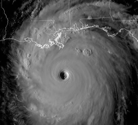
"there are FReepers who ... have java limitations "
You got that right. Running out of coffee is a serious limitation anytime;)
Thanks for the ping.
Do you think it's going toward the Cayman's?
Disclaimer: Opinions posted on Free Republic are those of the individual posters and do not necessarily represent the opinion of Free Republic or its management. All materials posted herein are protected by copyright law and the exemption for fair use of copyrighted works.