Skip to comments.
Wildland Fire News, 6/24
NIFC, NICC, WFAS, CBS ^
| 6/24/06
| Various
Posted on 06/24/2006 8:26:45 AM PDT by Knitting A Conundrum


Haines Index Map - Higher Haines means fire growth tends to be stronger:

Weekends mean I don't get the morning report in a postable format until quite late.
Here are some useful links:
Morning Report from NICC
National Interagency Air Space - shows where air flight is restricted over wildfires and for a variety of other reasons
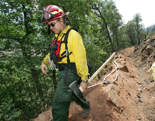
Firefighters Continue Fighting Ariz. Blaze
Fire commander reassures Arizonians about the safety of their homes as wildfire battle continues
SEDONA, Ariz., Jun. 24, 2006
By AMANDA LEE MYERS Associated Press Writer
 (AP) (AP)
|
|
(AP) The head of the team fighting a roughly 4,000-acre northern Arizona wildfire reassured evacuees Friday about the safety of their homes in a scenic canyon but said the battle continued.
Firefighters have created a good firebreak using a highway and deliberately set fires to clear away vegetation in part of Oak Creek Canyon, where roughly 430 homes and 30 businesses have been evacuated since Sunday, said incident commander Paul Broyles.
Officials said the fire was 20 percent contained Friday.
"It's still not a done deal," Broyles told about 100 people at a community meeting. "I'm not going to guarantee we've completely turned the corner just yet."
Broyles said residents may be allowed to return to their homes in two to four days. They're being kept out partly because embers could still start fires in the canyon. No homes have burned.
"I feel a lot better now about the safety of our house," evacuee Sarah Peterson said at the meeting.
The fire began Sunday as a transient's campfire and quickly spread to steep, rugged terrain above the canyon, a lush area dotted with homes and resorts. Sedona is about 90 miles north of Phoenix.
Elsewhere in the West, a 13,100-acre wildfire in southern Colorado was 35 percent contained.
Residents of about 70 homes in one rural subdivision were allowed back to their homes about 7 a.m., but at least 230 other homes were awaiting word from sheriff's deputies on when it would be safe for them to return.
A 1,530-acre wildfire in western Colorado started by a car wreck Tuesday was 25 percent contained. The fire was burning in the Manti-La Sal National Forest, about 225 miles southwest of Denver near the Utah border.
To the south in New Mexico, firefighters faced a half-dozen large fires that have charred more than 90,000 acres in the past week. The largest burned nearly 43,000 acres in the Gila National Forest 15 miles northeast of Glenwood. It was only 5 percent contained Friday.
The intensity of the blaze Thursday afternoon and thunderstorms that brought erratic winds forced the Forest Service to pull out crews in the Willow Creek area for their safety, fire information officer Brian Morris said Friday.
In southern California, a nearly 15,000-acre wildfire in Los Padres National Forest was 78 percent contained late Friday. The flames were burning on rugged terrain five miles south of New Cuyama and 45 miles east of Santa Maria. The fire began Monday afternoon when a piece of metal blew into electrical wires, authorities said.
CBSNews
TOPICS: News/Current Events; US: Alaska; US: Arizona; US: California; US: Colorado; US: New Mexico; US: Texas; US: Utah; US: Wyoming
KEYWORDS: brinsfire; matovegafire; wildfire; wildlandfire
Navigation: use the links below to view more comments.
first 1-20, 21-35 next last
Weekend reportage gets weird, but as I find'em I will report them.
Let me know if you want on the wildfire pinglist
To: Brad's Gramma; drungus; george76; familyop; moondoggie; Arizona Carolyn; nw_arizona_granny; ...
2
posted on
06/24/2006 8:27:22 AM PDT
by
Knitting A Conundrum
(Act Justly, Love Mercy, and Walk Humbly With God Micah 6:8)
To: Knitting A Conundrum
Saguache wildfire spurs evacuations
By Hector Gutierrez, Rocky Mountain News
June 24, 2006
As firefighters were getting a handle on the Mato Vega Fire on Friday, a fast-moving blaze in nearby Saguache County forced people from their homes.
The Saguache County fire was in the area of Cool Broth Canyon near La Garita, where sheriff's deputies were ordering mandatory evacuations.
The number of burned acres could not be immediately determined.
Meanwhile, residents of the Wagon Creek Ranch subdivision received good news Friday morning when Costilla County sheriff's deputies lifted a mandatory evacuation order.
The Mato Vega Fire had grown to about 13,000 acres and was about 35 percent contained Friday, Pramuk said.
On the Western Slope, firefighters were extinguishing the 640-acre Jolly Mesa Fire about three miles west of New Castle. Marilyn Krause, incident management team spokesman, said the blaze, which may have been caused by people, was about 25 percent contained.
No evacuations have been ordered, but authorities were concerned about structures scattered in the path of the fire.
http://www.rockymountainnews.com/drmn/local/article/0,1299,DRMN_15_4798814,00.html
3
posted on
06/24/2006 8:28:19 AM PDT
by
Knitting A Conundrum
(Act Justly, Love Mercy, and Walk Humbly With God Micah 6:8)
To: Knitting A Conundrum
U.S. 160 reopens, some evacuations lifted at La Veta wildfire
By Coleen Slevin
Saturday, June 24, 2006 - The Associated Press
FORT GARLAND - Some residents were back home Friday and traffic was flowing on a 30-mile stretch of U.S. 160 for the first time since Monday as crews gained ground on a 13,100-acre wildfire in southern Colorado.
The fire, burning in drought-stressed grasslands and forests about 150 miles south of Denver, was 35 percent contained.
Residents of about 70 homes in one rural subdivision were allowed back to their homes about 7 a.m., but at least 230 other homes were awaiting word from sheriff's deputies on when it would be safe for them to return.
"We had a good day on the line yesterday," fire information officer Louis Haynes said.
U.S. 160 is the main east-west route across southern Colorado, and the reopening was a relief to Luisa Sena, who owns Lu's Mainstreet Cafe in nearby Blanca.
Sena depends on business from summer travelers to keep her nine employees on the payroll year-round, but the highway's closure meant few tourists or truckers passed through.
"It's tough in the winter. It doesn't need to be like this in the summer," she said.
The road was shut down Monday and remained closed as the fire crept near a group of 37 homes near the highway. Fire managers had planned to keep the road closed until they completed a burnout of vegetation to keep the fire from spreading to the homes or across the highway, but officials also faced constant phone calls from people wondering when the road would reopen.
They decided to reopen the road late Thursday and shepherd vehicles through using pilot cars during the day so firefighters could continue their work.
Near New Castle, about 130 miles west of Denver, a wildfire of unknown origin scorched about 540 acres and threatened five homes and several power lines and oil and natural gas wells, said Larry Helmerick of the Rocky Mountain Area Coordination Center.
The fire, which was estimated at 50 percent contained the day before, spread in the afternoon and was only 25 percent contained by late Thursday. At least 100 firefighters were at the scene and more were on the way.
"They haven't gotten any of the moisture that we've gotten here, along the Front Range," Helmerick said. "They've been dry and it will continue to get worse."
In western Colorado, a 1,530-acre wildfire started by a car wreck Tuesday was 25 percent contained. The fire was burning in juniper, oak and ponderosa pine in the Manti-La Sal National Forest, about 225 miles southwest of Denver near the Utah border. The acreage was revised downward from 1,660 because of better mapping, fire information spokeswoman Barbara Bassler said.
Calm winds and cooler temperatures helped firefighters and the blaze was expected to be contained by Sunday evening.
In Teller County about 60 miles south of Denver, a 44-acre fire in ponderosa pines and grass was about 95 percent contained Thursday. Residents from three evacuated homes were allowed back Wednesday. Fire information officer Naomi Marcus said crews were focusing Friday on mopping up smoldering hot spots, but the danger to structures had been eliminated.
About 76,030 acres have burned in Colorado so far this year, according to the Rocky Mountain Area Coordination Center.
http://www.journal-advocate.com/Stories/0,1413,120~7826~3337190,00.html#
4
posted on
06/24/2006 8:29:18 AM PDT
by
Knitting A Conundrum
(Act Justly, Love Mercy, and Walk Humbly With God Micah 6:8)
To: Knitting A Conundrum
I thin my property. The difference between me and my neighbors is distinguishable on GoogleEarth from 20,000 feet up. If a fire comes here, I'll pour a cup of coffee and watch.
See tagline.
5
posted on
06/24/2006 8:52:33 AM PDT
by
Carry_Okie
(Oh Lord, my garden is so big, and my chainsaw is so small!)
To: Carry_Okie
It absolutely makes a difference. During the Rodeo Chedeski fire, there was a section the local Indians had thinned, and the other mismangaged stuff...when it hit the thinned, managed land, the fire laid down, and did what it was supposed to do, clean out the wildland without destroying everything down.
A lot of this is designed to burn, keeps the underbrush and bark beetles and such in proper balance...but we've made it burn in ways it ought not burn, too hot and not often enough in some places.
Some places are designed to burn catastrophically (lodgepole stands, for instance). Building there is like building in a flood plain.
There is a dance going on in the environment, like the waltz between the evergreens and the aspen that need lands managed properly. Denying this because of ideology is dumb.
And living in these lands means to take care of your property in ways that make sense.
6
posted on
06/24/2006 9:24:37 AM PDT
by
Knitting A Conundrum
(Act Justly, Love Mercy, and Walk Humbly With God Micah 6:8)
To: Knitting A Conundrum
It absolutely makes a difference. During the Rodeo Chedeski fire, there was a section the local Indians had thinned, and the other mismangaged stuff...when it hit the thinned, managed land, the fire laid down, and did what it was supposed to do, clean out the wildland without destroying everything down. I took pictures. They are here.
Some places are designed to burn catastrophically (lodgepole stands, for instance). Building there is like building in a flood plain.
Just like anywhere else, it can be done, but one must take careful provisions and maintain the land properly.
There is a dance going on in the environment, like the waltz between the evergreens and the aspen that need lands managed properly. Denying this because of ideology is dumb.
Wrote the book on that one.
7
posted on
06/24/2006 9:41:33 AM PDT
by
Carry_Okie
(Oh Lord, my garden is so big, and my chainsaw is so small!)
To: Carry_Okie
8
posted on
06/24/2006 9:59:14 AM PDT
by
Knitting A Conundrum
(Act Justly, Love Mercy, and Walk Humbly With God Micah 6:8)
To: Knitting A Conundrum; Carry_Okie
It absolutely makes a difference. I'm glad to hear that. My folks are in ponderosa country, and they have taken 500 trees off their land in the past couple of years. Then the Forest Service made a huge timber sale next to them. It looks like hell right now, but in a few years you won't be able to tell. The USFS no longer allows clear-cutting and many of the healthiest trees were left in place. I have no doubt their risk from a forest fire has gone down dramatically.
-ccm
9
posted on
06/24/2006 10:30:07 AM PDT
by
ccmay
(Too much Law; not enough Order)
To: Knitting A Conundrum
Look at the correlation between the fire map and the danger map. Pretty much dead on.
All in all, it looks pretty much like the standard early summer pattern. California will get hit north to south starting in late July, and getting to the Los Angeles area in September.
Same old, same old. It's going to continue until they get that new non-fuel fuel invented.
To: ArmstedFragg
Yep. The sagebrushy lands in southern Idaho on the south side of the Snake have started to burn, too. Pretty soon we'll be hearing about fires in the grasslands of eastern Oregon and Washingon.
They've had a fire in the eastern Montana plains, too.
South, Alaska and Southwest, northern states, then southern California. The rhythm of fire season
11
posted on
06/24/2006 10:51:02 AM PDT
by
Knitting A Conundrum
(Act Justly, Love Mercy, and Walk Humbly With God Micah 6:8)
To: Knitting A Conundrum
SEDONA, Ariz. Some residents near Sedona, Arizona, are being allowed to return home as fire crews reinforce lines around a 42-hundred-acre wildfire.
Residents of about 430 homes lining a narrow canyon area have been forced to stay elsewhere for nearly a week. The Cononino (koh-koh-NEE'-noh) County Sheriff's Office says the evacuation order was lifted today for 75 homes and four resorts near the south of Slide Rock State Park. Highway closures will mean a long ride home.
No homes have burned. Officials say the fire is 20 percent contained. Full containment could come Wednesday if favorable weather conditions prevail.
http://www.kvia.com/global/story.asp?s=5073972
12
posted on
06/24/2006 11:01:08 AM PDT
by
Knitting A Conundrum
(Act Justly, Love Mercy, and Walk Humbly With God Micah 6:8)
To: Knitting A Conundrum
Nevada is having some action. From the Western Great Basin GACC site:
Fires of concern:
1. Fay/Luther (HTF) - Southwest of Gardnerville near Job’s Canyon. Two air tankers, lead plane, T1 helicopter, and five T1 crews ordered. Black Mtn reassigned from Porter. Size currently unknown.
2. Olinghouse (NWS) – East of Reno near the I-80/Tracy Clark exit. T2 helicopter and T3 team ordered (Marfil). Estimated @ 5,000 acres.
13
posted on
06/24/2006 1:03:58 PM PDT
by
Knitting A Conundrum
(Act Justly, Love Mercy, and Walk Humbly With God Micah 6:8)
To: Knitting A Conundrum
Fire crews get line around fifth of fire
Foothill Road between Centerville and Fredricksburg roads has been closed to all but local traffic as firefighters battle a 30-acre wildfire about halfway up Jobs Peak.
Faye-Luther Trailhead is closed to the public and is being used for helicopters, according to Sierra Front Fire Information Officer Mark Struble.
The fire is located below Jobs Peak in Faye-Luther Canyon about a mile and a half upslope from homes.
Struble reports fire crews have a line around about a fifth of the fire, but did not estimate when they would have the fire contained or under control. Four hand crews are on the scene with six more on the way. Air support is coming from two single-engine air tankers and a single heavy P-3 air tanker are working to control the northeast flank of the fire.
Steep, rough terrain and rolling burning material are preventing containment efforts.
The fire started on Friday and spread through the night due to low humidity and high temperatures.
http://www.recordcourier.com/article/20060624/NEWS/60624002
14
posted on
06/24/2006 1:07:30 PM PDT
by
Knitting A Conundrum
(Act Justly, Love Mercy, and Walk Humbly With God Micah 6:8)
To: Knitting A Conundrum
15
posted on
06/24/2006 1:36:51 PM PDT
by
nw_arizona_granny
(Lord ,when we are wrong,make us willing to change. And when we are right, make us easy to live with.)
To: nw_arizona_granny
16
posted on
06/24/2006 1:56:17 PM PDT
by
Knitting A Conundrum
(Act Justly, Love Mercy, and Walk Humbly With God Micah 6:8)
To: Knitting A Conundrum
Don't know how big this will get, but a new firestart in the Gila NF:
Gila NF, new start, Grouse Fire: 5-10 acres, smokejumpers and crew assigned.
It has to be 100 acres before it's considered a large fire, but the Gila is bone dry and has several large fires now.
17
posted on
06/24/2006 2:32:23 PM PDT
by
Knitting A Conundrum
(Act Justly, Love Mercy, and Walk Humbly With God Micah 6:8)
To: Knitting A Conundrum
Fire weather watch in Wyoming for the Absaroka Mountains
Fire Weather Watch in effect until 10 PM MDT this evening...
The National Weather Service in Riverton has issued a Fire
Weather Watch... which is in effect until 10 PM MDT this evening.
Scattered thunderstorms are expected to develop this afternoon
over the Absaroka Mountains of northwest Wyoming. The combination
of the potential for dry lightning and critically dry fuels has prompted
the issuance of a fire watch for this area for this afternoon and evening.
A Fire Weather Watch means that critical fire weather conditions
are forecast to occur. Listen for later forecasts and possible
red flag warnings.
18
posted on
06/24/2006 2:36:59 PM PDT
by
Knitting A Conundrum
(Act Justly, Love Mercy, and Walk Humbly With God Micah 6:8)
To: Brad's Gramma; drungus; george76; familyop; moondoggie; Arizona Carolyn; nw_arizona_granny; ...
wow...I just did a news search on Topix for fire news, and there was this very thread!
In case you haven't checked the thread recently, I've posted a little news. There are fires breaking out in Nevada and a new start in the Gila NF.
19
posted on
06/24/2006 2:40:44 PM PDT
by
Knitting A Conundrum
(Act Justly, Love Mercy, and Walk Humbly With God Micah 6:8)
To: Knitting A Conundrum
Thank you for keeping us updated.
Navigation: use the links below to view more comments.
first 1-20, 21-35 next last
Disclaimer:
Opinions posted on Free Republic are those of the individual
posters and do not necessarily represent the opinion of Free Republic or its
management. All materials posted herein are protected by copyright law and the
exemption for fair use of copyrighted works.
FreeRepublic.com is powered by software copyright 2000-2008 John Robinson