To: All
2 days ago the NHC track said Emily would pass just south of Jamacia, they were right on.

To: No Blue States
NHC had this track last Tuesday night, with Emily still a TS, east of the Windward Islands:
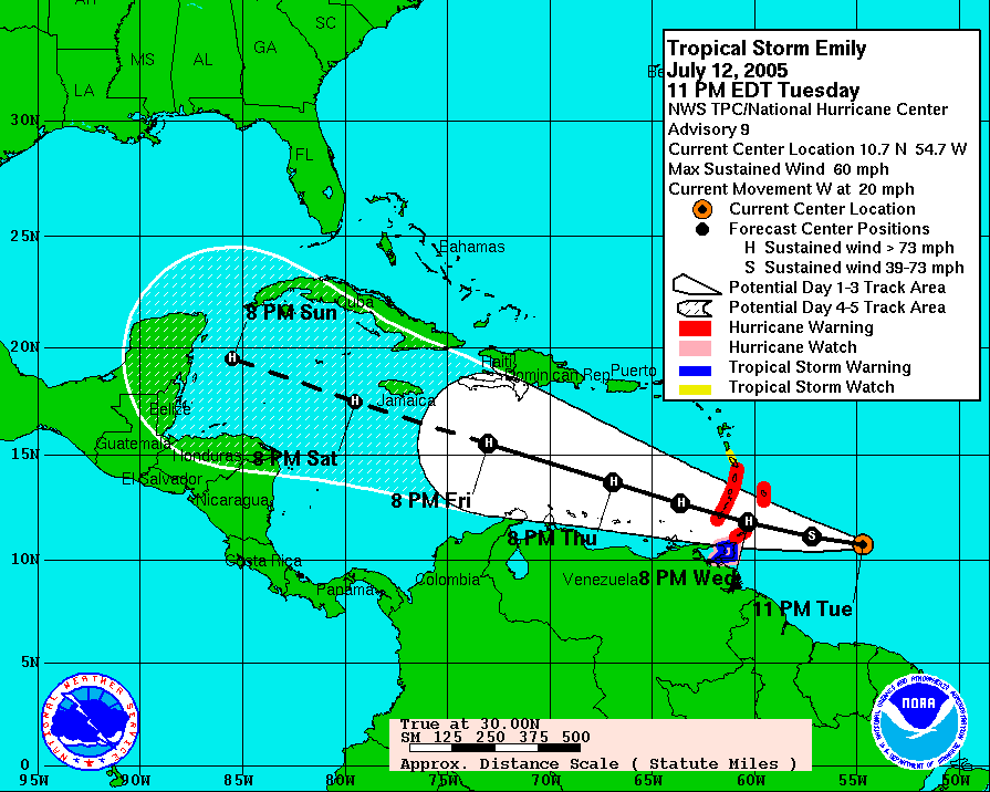
That's impressive...
719 posted on
07/16/2005 9:36:28 AM PDT by
NautiNurse
("I'd rather see someone go to work for a Republican campaign than sit on their butt."--Howard Dean)
To: No Blue States
Yes, last couple of years they are been pretty damn good a long range forecasting. New super computer?
732 posted on
07/16/2005 10:35:56 AM PDT by
jpsb
(I already know I am a terrible speller)
To: No Blue States
track was a smidge too far south according to the sat overlay, but close. She has been tracking slightly to the north of the official track.
748 posted on
07/16/2005 11:24:43 AM PDT by
rwfromkansas
(http://www.xanga.com/home.aspx?user=rwfromkansas)
FreeRepublic.com is powered by software copyright 2000-2008 John Robinson