
I knew it!!!!
Well, I thought this might be the case.
"...the older navigation charts provided to the Navy were never updated to show the obstruction, they
acknowledge, in part because the agency that creates them has never had the resources to use the satellite
data systematically."
If this is true and not just a political twist then this is lunacy....some big finger pointing about to start.
Ping!
Bad chart ping
hindsight is ALWAYS 20-20 NYT-dumbasses!
If you KNOW the exact location of a feature, it is a simple task to look over photos/scans for that one exact spot.
But former submarine captains said Navy investigators were likely to examine whether it had been prudent to travel at such a high speed, 30 knots, given the age and spottiness of the information."
Unfortunately, the Navy tradition is to be very harsh with a Captain who ship is endangered or damaged his ship, almost regardless of the circumstances.
Remember the skipper of the Indiana was steaming through the Pacific when torpedoed by a Japanese sub. There was a question about whether the ship was properly zig-zagging while under the command of a junior officer. Although most of his men stepped forward to testify for the Captain, he was court-martialed.
And the Captain of the intelligence ship Pueblo was sent into waters near N. Korea without any armed escort--but he took the blame when his ship was captured.
Actually, the Maps didn't show he gaps correctly.
BTTT
Hmm. I don't know. Subs have ben zipping around there for over 60 years. Could be more to the story.
Who of us knows what happend.
Some of my favorite sub sights
NAVSOURCE SUBMARINE PHOTO ARCHIVES
http://www.navsource.org/archives/subidx.htm
SSN-711 San Francisco
http://www.navsource.org/archives/08/08711.htm
Submarine Fleet-Diesel and Nuclear Submarine Homepages
http://www.rontini.com/fleet.html
THE USS HALIBUT SSGN/SSN 587 AND THE NEW SSGN's GANGWAY PAGE
http://users.erols.com/marelk/
USS Halibut Veteran's Association Web Page
http://users.erols.com/marelk/USS%20Halibut%20Vets.htm
Ping!
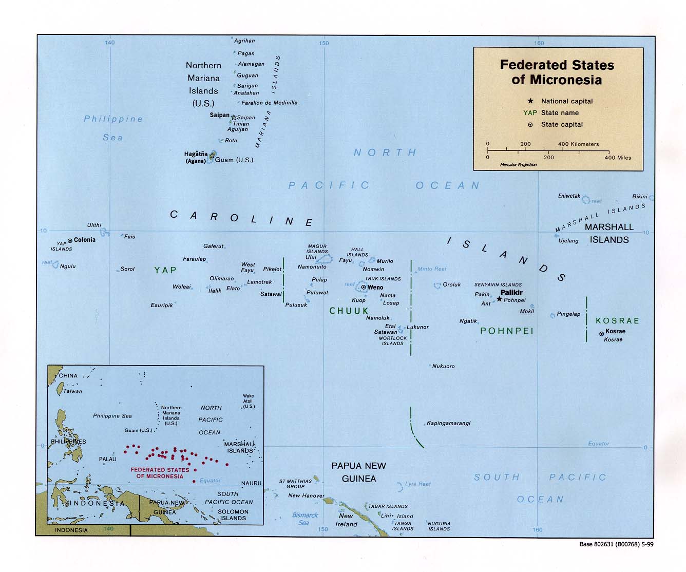
Note that the following islands in the Caroline Island chain can be seen on both maps and define the area around the crash site: Lamotrek, Pikelot, Satawal, West Fayu. To effectitvely view these maps, push F-11 on your keyboard.
That is all...
--Boot Hill
Even though not his fault, I believe that the skipper will become the scapegoat. Normal operandi for the Navy.
Going active, single ping.
It's Bush's fault!
bump
Nothing like breaking an expensive submarine to shake some resources loose.
Now I know why the Skipper, Gilligan, and friends were never found.
On a more serious note, it is amazing to me how much of the earth's suface remains undocumented, let alone what is below the surface. (At least the evolutionary biologists and geologists have it all figured out. /s)
Submarine PING