To: Jet Jaguar
| 8 |
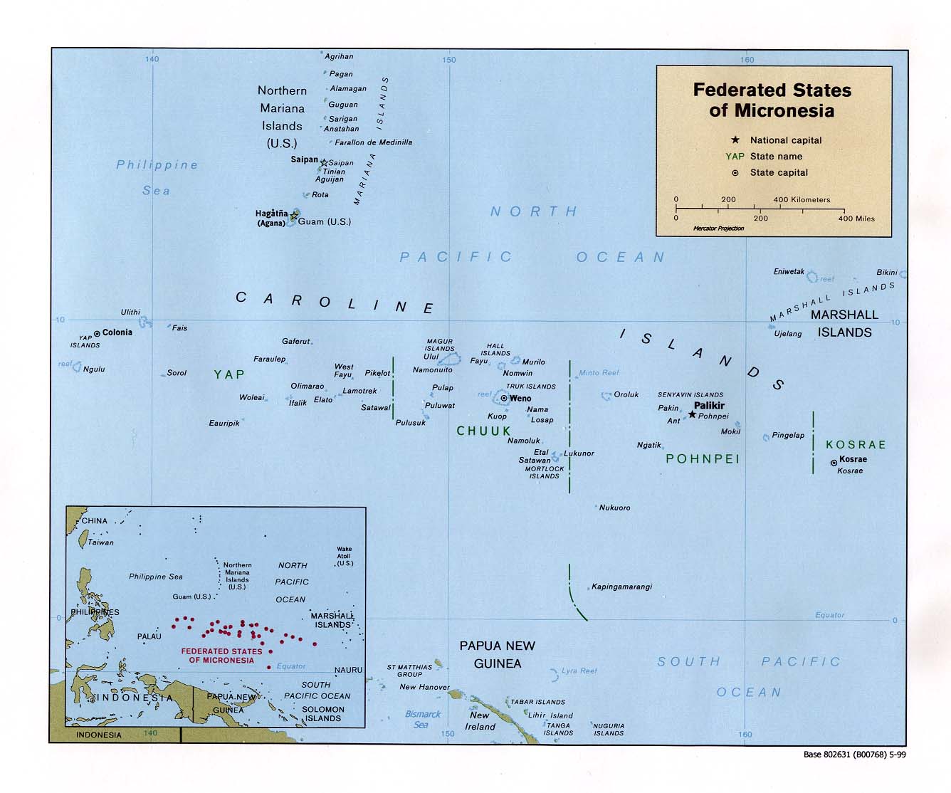
“A nuclear submarine ran aground about 350 miles south of Guam...” |
According to the location provided in the article, 350 miles south of Guam would place the incident within the Federated States of Micronesia in the Caroline Island chain that consists of many dozens of very small atolls and shoals. Based on the bearing provided, the most likely location is in an area bounded by the islands of Faraulep, Woleai and Ifalik. By using the scroll bars to center the map below, you should be able to easily locate Guam and the Caroline Islands mentioned.
Note that in Navy tradition, it doesn't matter who is at fault for this grounding, the captain's career is over, period, end of argument.
--Boot Hill
142 posted on
01/08/2005 6:04:48 AM PST by
Boot Hill
(Candy-gram for Osama bin Mongo, candy-gram for Osama bin Mongo!!!)
To: Boot Hill
Unless its changed, the naval charts on file from that region are horrible.
They were made in the early 1900's, IIRC.
To: Boot Hill
"Note that in Navy tradition, it doesn't matter who is at fault for this grounding, the captain's career is over, period, end of argument."
Except in those cases where that statement wasn't true, as folks have listed above.
To: Boot Hill
Overlay that map with known areas of volcanic activity and you may find some more information on why they ran aground.
The Caroline islands are a volcanic hotbed of activity, both underwater and in the island chains.
FreeRepublic.com is powered by software copyright 2000-2008 John Robinson