Skip to comments.
POWERFUL STORM HITS SOUTHERN BRAZIL COAST (First Hurricane recorded there)
Drudge Report ^
| March 27, 2004
| AP Wire
Posted on 03/27/2004 6:47:45 PM PST by varina davis
Powerful Storm Hits Southern Brazil Coast
Mar 27, 8:28 PM (ET)
By BERND RADOWITZ
RIO DE JANEIRO, Brazil (AP) - A large storm spiraled toward southern Brazil on Saturday as a debate raged between Brazilian and U.S. meteorologists over whether it was a hurricane.
The U.S. National Hurricane Center in Florida estimated the storm was a full-fledged, Category I hurricane with winds of between 75 and 80 mph, making it the first hurricane ever spotted in the South Atlantic. AccuWeather, Inc., a private forecasting company, said it also considered the storm a hurricane.
Brazilian scientists disagreed, saying the storm had top winds of 50 to 56 mph, far below the 75 mph threshold of a hurricane. The state of Santa Catarina put its civil defense on alert Saturday night, warning of high waves.
The U.S. forecasters said the worst part of the storm would hit Brazil early Sunday somewhere between the cities of Florianopolis and Porto Allegre, a span of about 130 miles. The Brazilians said the storm could peter out before then.
"Winds and rains will not be significant, so we don't need to alarm the population," said meteorologist Dr. Gustavo Escobar of the Brazilian Center for Weather Prediction and Climatic Studies.
U.S. scientists said they were baffled by the Brazilian position.
"We think the Brazilians are, quite frankly, out to lunch on this one," said Michael Sager, an AccuWeather meteorologist. "I think they're trying to play it down and not cause a panic. I don't know what they're doing, but they're obviously wrong."
All sides said they were basing their estimates on satellite data, since the United States has no hurricane hunter airplanes in the area and Brazil doesn't own any.
Satellite images showed a spiral-shaped mass of clouds with an open area in the center. Escobar called it an "extra-tropical cyclone."
Sager said the storm had a clear, well-defined eye and that it had lasted for more than 36 hours. Storms that are not hurricane-strength sometimes form strong eyes, but not for that long, he said.
Kelen Andrade, another meteorologist with the Brazilian center, said the storm was swirling only in a clockwise motion and was not showing motion in the opposite direction at higher altitudes, another mark of a hurricane. Sager disagreed.
"If you know what you're looking at, you can see that counterrotating quite readily," he said.
He predicted the storm would make landfall at hurricane strength just before dawn near the town of Torres.
Earlier Saturday, the outer edges of the storm brushed the coast of Brazil's southern Santa Catarina state with winds estimated at about 25-30 mph and moderate rains, Escobar said. The area is about 430 miles south of Rio de Janeiro.
Winds in nearby Florianopolis, a city of 700,000, were only about 12 mph, rainfall was mild, and no damage was reported, said meteorologist Kelen Andrade.
Jack Beven, a hurricane specialist at the National Hurricane Center in Miami, said the eye of the storm was near 29 degrees south latitude and 48 degrees west longitude by Saturday evening. That would place it about 50 miles east of the city of Laguna.
"To us, it has all the satellite appearance and intensity of a hurricane," Beven said. "I don't know what data (the Brazilians) are looking at. They may have data services locally that don't go out on the national data service."
He said no agency is sending out regular hurricane advisories on the storm.
"Down there, this is such a rare and unique event. The whole situation is strange," Beven said. "We're trying to help out, but because of the uniqueness of this event, it may be out of their expertise to some degree."
TOPICS: Foreign Affairs; News/Current Events
KEYWORDS: brazil; catarina; climatechange; coast; hurricane; powerful; storm
Navigation: use the links below to view more comments.
first 1-20, 21-26 next last
Brazil meteorologists are not taking this seriously -- prayers need for folks there.
To: varina davis
Water Vapor Imagery, I point clearly defined outflow bands from the slight high pressure center that sits over a hurricane causing the counterrotation effect. This basically keeps the hurricane well ventilated.

Note the clearly defined eye and how it persists in the images. You'll also notice more outflow on the south side as the counterrotation remaines persistant.

Visable satellite photo

No, I'm not a meteorologist by trade, but I've studied it almost as long as I could lift a book and read it. Two subjects that have kept my fascination are meteorology and astronomy.
2
posted on
03/27/2004 6:50:32 PM PST
by
Crazieman
To: Crazieman
Great images!
As I understand it, Cyclones are in the Pacific, Hurricanes in the Atlantic. This sure looks like a hurricane to me.
3
posted on
03/27/2004 6:55:20 PM PST
by
Jeff Head
To: Crazieman; varina davis
Wow. Neat-o.
Looks like a hurricane to me.
BTW - this AP article was already posted. Title was different so it probably didn't show up in Search. : )
4
posted on
03/27/2004 6:57:23 PM PST
by
nuconvert
("America will never be intimidated by thugs and assassins." ( President Bush 3-20-04))
To: Crazieman
It's George Bush's fault............
5
posted on
03/27/2004 6:57:52 PM PST
by
kcamtx
To: Quix
the first hurricane ever spotted in the South AtlanticFYI...
6
posted on
03/27/2004 6:58:03 PM PST
by
Polycarp IV
(PRO-LIFE orthodox Catholic--without exception, without compromise, without apology. Any questions?)
To: Chairman_December_19th_Society
If you are feeling better tomorrow, you might want to take a look at this!
To: Crazieman
Thanks for the input. Great pix. You might want to consider logging on the www.storm2k.net, a terrific site for 'cane watchers.
To: varina davis
Actually I pay more attention to supercell thunderstorms and tornadoes, living in Kansas. :)
9
posted on
03/27/2004 7:00:01 PM PST
by
Crazieman
To: Jeff Head
As I understand it, Cyclones are in the Pacific, Hurricanes in the Atlantic. This sure looks like a hurricane to me.
The term "Hurricane" is used for tropical systems with sustained winds above 75 mph in the Atlantic, AND the Eastern Pacific.
The term "Typhoon" is used for similar storms in the Western Pacific Only.
In the Indian Ocean and South Pacific, they're known as "Tropical Cyclones".
In the South Atlantic, given there's never been one before, no terminology is used.
10
posted on
03/27/2004 7:16:50 PM PST
by
John H K
To: varina davis
Hopefully it won't veer northward and hit São Paulo, which has 18.5 million people in the metropolitan area. Even Pôrto Alegre, with 3.6 million people would be a pretty big deal.
11
posted on
03/27/2004 7:17:23 PM PST
by
AntiGuv
(When the countdown hits zero, something's gonna happen..)
To: kcamtx
You are absolutely correct. I'm sure Halliburton will also benefit from this somehow.... ;)
Stephanie
12
posted on
03/27/2004 7:19:49 PM PST
by
marinamuffy
(Bush-Cheney '04!!! www.georgewbush.com)
To: Crazieman
The rotation is the opposite of the hurricanes we get here in the Northeast. probably because it is south of the equator.
Which makes me wonder what would happen to a hurricane if it tried to cross the equator. -Tom
13
posted on
03/27/2004 7:25:51 PM PST
by
Capt. Tom
(Don't confuse the Bushies with the dumb republicans. - Capt. Tom)
To: Crazieman
Two subjects that have kept my fascination are meteorology and astronomy.
Same here! I've loved looking at the sky, regardless of the time of day or night. There's always something to look at!
14
posted on
03/27/2004 7:28:32 PM PST
by
Pyro7480
(Minister for the Conversion of Hardened Sinners,Tomas de Torquemada Gentlemen's Club)
To: Capt. Tom
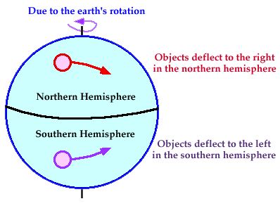
Which makes me wonder what would happen to a hurricane if it tried to cross the equator.It's physically impossible. The Coriolis force would tear it apart. That's also the same effect which causes the clockwise spin in the Southern Hemisphere vs the counterclockwise spin in the Northern Hemisphere.
15
posted on
03/27/2004 7:28:48 PM PST
by
AntiGuv
(When the countdown hits zero, something's gonna happen..)
To: AntiGuv
16
posted on
03/27/2004 7:35:41 PM PST
by
ServesURight
(FReecerely Yours,)
To: marinamuffy
. I'm sure Halliburton will also benefit from this somehow.... ;)Obviously a result of global-warming. Bush lied, high tide.
17
posted on
03/27/2004 7:42:23 PM PST
by
BfloGuy
(The past is like a different country, they do things different there.)
To: BfloGuy
I wonder how they're going to fingerprint this thing when it tries to enter their country.
To: Crazieman
Living on the Gulf coast of Texas all my life; this sure looks like a hurricane to me. Those folks are definitely in LA LA land. The poor folks that are going to get hit, will not know what's up. Cat 1 isn't too bad, but my experience with hurricanes as they approach the coast, water is usually warmer and the strength of the storm goes up. Hits a lot harder than expected. Geeezzzz!!! Those folks in the path aren't expecting anything.
19
posted on
03/27/2004 7:57:48 PM PST
by
shield
(The Greatest Scientific Discoveries of the Century Reveal God!!!! by Dr. H. Ross, Astrophysicist)
To: varina davis
Brazilian scientists disagreed, saying the storm had top winds of 50 to 56 mph, far below the 75 mph threshold of a hurricane. They are correct, I would be sceptical too: what does a 3rd world country like USA know about science and technology. Brazil, on the other hand...
It's a part of "we are not going to be subdued by the USA" mentality -- as if someone was really trying to suppress them. Much like the tit-for-tat fingerprinting.
20
posted on
03/27/2004 8:26:03 PM PST
by
TopQuark
Navigation: use the links below to view more comments.
first 1-20, 21-26 next last
Disclaimer:
Opinions posted on Free Republic are those of the individual
posters and do not necessarily represent the opinion of Free Republic or its
management. All materials posted herein are protected by copyright law and the
exemption for fair use of copyrighted works.
FreeRepublic.com is powered by software copyright 2000-2008 John Robinson