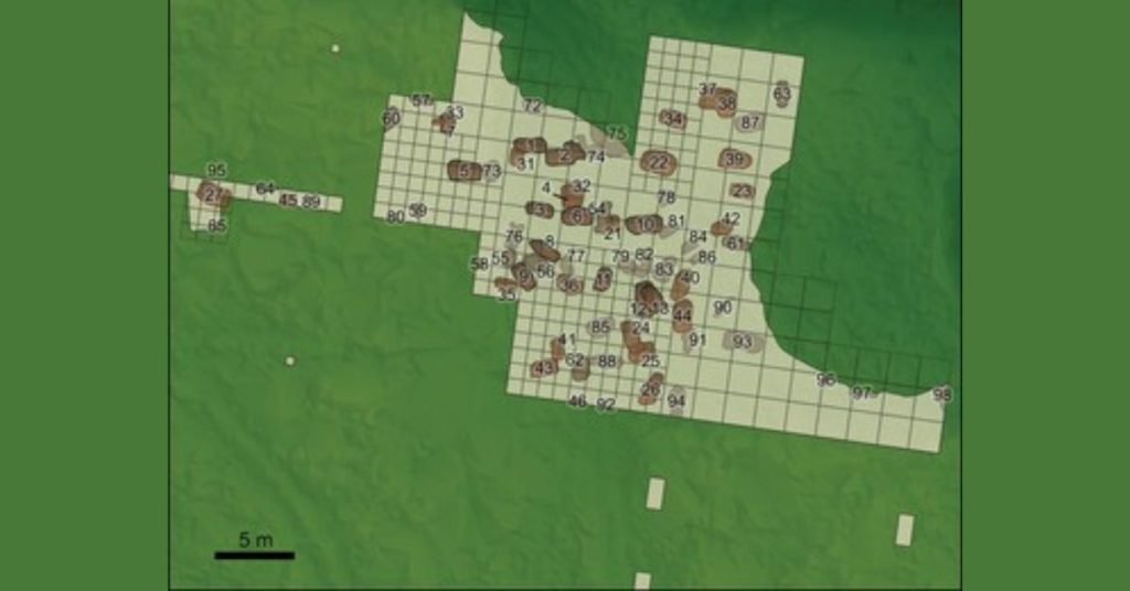
The pits discovered in previous excavation.Image: Antiquity
The pits discovered in previous excavation.Image: Antiquity
Global warming worked for them I guess.

Figure 1. A) elevation map of northern Europe. Tainiaro is marked as a star near the Arctic Circle; B) the topography of the environs of Tainiaro (and Tainilanrotko) along the Simojoki River, with the sea level set at 76m above current level, representing the ancient shoreline of c. 5000 BC (elevation model 2m resolution by the National Land Survey of Finland, NLSF) (figure by Aki Hakonen).
Note the https://en.wikipedia.org/wiki/Tectonic_uplift since that time.