Posted on 07/05/2023 5:21:42 PM PDT by AirForceVet1988
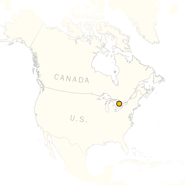
Locals used to say that Crawford Lake was bottomless. Its waters ran deeper than people could reach. Anything that dropped into the basin, it seemed, would fall till the end of time.
Yet when scientists finally looked into the lake’s murky depths, they found not a void, but a mirror. Each line is a sediment layer.
2020
2010
2000
1990
1980
1970
1960
1950
Locals used to say that Crawford Lake was bottomless. Its waters ran deeper than people could reach. Anything that dropped into the basin, it seemed, would fall till the end of time.
Yet when scientists finally looked into the lake’s murky depths, they found not a void, but a mirror.
For centuries beyond memory, Crawford Lake has quietly absorbed signs of change from the surface world.
Whatever fell into the water would drift down to the lake floor. Specks of soot, Crop pollen, Logging debris.
There, it was permanently preserved in layers of mud.
Digging into these sediments, scientists have uncovered a record of more than a thousand years of history. It shows — perhaps more than any other place on Earth — that humans have transformed the planet’s chemistry and climate at a pace never seen before.
These changes are so fundamental, many scientists believe they mark a new chapter in geologic time: The Anthropocene.
(Excerpt) Read more at washingtonpost.com ...
Not sure what earthy-crunchy means, but I haven’t got any problem with Gaia. The Earth is a wonderful place that I’d like to see more of before it’s gone.
Seemed interesting, but the artsy gimmicks and the Gaia worship kept me from getting very far into the article.

Gaia worship ?

Looks like any number of Kettle Lakes left over from the last glacial episode some 15,000 years ago. All of which have been getting filled in with sediment over that time period.
We used to play at one as a kid. It was peat bog all around the edge and you could never get to the actual water as we would get too scared we would fall through the floating peat. We’d take a stick and when it poked all the way through the peat and into the water below we knew we were getting close.
Went back to it a few summers ago after being away for 30 years and you could walk a lot farther out on top of the lake. I suppose in another 100 years the peat will completely cover the water.
So, how deep is it actually?
Tried to read the article but the source freezes up my antique cell phone.
I think quite a few FReepers have had boating accidents there in which firearms were lost.
I don't know your age but not to worry. You will see as much of earth as your travels take you before you are gone.
A kettle lake, kettle pond, kettle hole or pothole is a depression or hole in an outwash plain formed by retreating glaciers or draining floodwaters. The kettles are formed as a result of blocks of dead ice left behind by retreating glaciers, which become surrounded by sediment deposited by meltwater streams as there is increased friction. The ice becomes buried in the sediment and when the ice melts, a depression is left called a kettle hole, creating a dimpled appearance on the outwash plain.
Lakes often fill these kettles; these are called kettle hole lakes. Another source is the sudden drainage of an ice-dammed lake. When the block melts, the hole it leaves behind is a kettle. As the ice melts, ramparts can form around the edge of the kettle hole. The lakes that fill these holes are seldom more than 10 m (33 ft) deep and eventually fill with sediment. In acid conditions, a kettle bog may form but in alkaline conditions, it will be kettle peatland. Kettle lakes are found in all glacial areas.
I read some of the article (the formatting was difficult). I guess what makes this “bottomless” lake (78’ deep!) special somehow is that the bottom sediments are “fed” a constant stream of air from the porous limestone below it. (Not sure how that works.) They said it was beneficial to keep the sediment layers from decaying. But then I would think that the air would bring modern-day contaminants into the sediments?
The article was just a fluff piece with no science behind it. I imagine that they take samples and have all sorts of data regarding pesticides, heavy metals, etc. Of course an ash layer 30 feet deep and 6000 years ago (or whatever) would indicate a large volcanic eruption which resulted in more “climate change” than we’ll ever do.
Or - even 200 years ago. 1815, “The Year without Summer” due to the eruption of Mount Tambora in Indonesia.
It was difficult to read on a PC due to the format. This “bottomless” lake was 78’ deep IIRC.
It took 5 people to write this story? Why ??
Go hug a tree and get back to us.
This is a deep topic.
Disclaimer: Opinions posted on Free Republic are those of the individual posters and do not necessarily represent the opinion of Free Republic or its management. All materials posted herein are protected by copyright law and the exemption for fair use of copyrighted works.