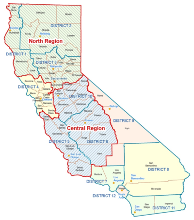
So here’s how it would break down. Northern California would get districts 1, 2, 3, 4, 10 and the northern bit of 5 (basically Santa Cruz county). Coastal California gets the rest of 5 plus 7. And South California gets 6, 8, 9, 11, and 12.
While it’s tempting to look at the number of miles of highways in each new state that the transportation agency would have to manage, that’s a fool’s errand. Eastern California (at least down to King’s County) is home to some of the heaviest snowfall in the U.S. Currently the base at a Lake Tahoe ski area is 400 inches. The northwest part of the state is subject to heavy rain. In fact, Del Norte county gets an average of 132 inches of rain per year. Contrast that with Imperial’s annual average of 3 inches. Southeastern California is home to the Joshua Tree National Park, Death Valley, and a lot of desert. Add to all that the varying degrees of earthquake risk in various areas, and it’s easy to see that highway miles alone would not be a good predictor of likely costs.
