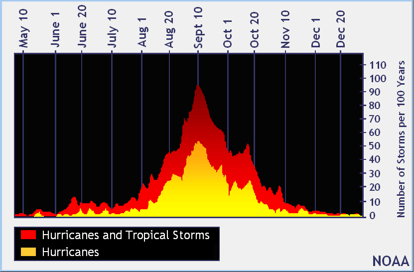
Hurricane season starts June 1st and ends November 30th (total of 180+ days) with the peak occurring on on September 10th. We are 2/3rds done with the season.
Posted on 09/30/2016 8:09:10 PM PDT by rdl6989
An Air Force reconnaissance plane recently measured a peak SFMR wind of 143 kt and then 138 kt during this mission's eye penetrations. Furthermore, the satellite presentation has improved considerably with a distinct eye surrounded by a ring of very deep convection. The raw objective T-numbers from UW-CIMSS have been above 7.0 since 2100 UTC. On this basis, the initial intensity has been increased to 140 kt, making Matthew a Category 5 on the Saffir-Simpson Hurricane Wind Scale. This is the first Category 5 hurricane in the Atlantic basin since Hurricane Felix in 2007.
(Excerpt) Read more at nhc.noaa.gov ...
LOL! Well put! ;-)
That was my takeaway as well: Cat 5 if the winds are actually that high, but the radar/satellite image does not show a well-developed center eye.
Sunday (tomorrow) or one week from tomorrow?
It should be south of Cuba on Sunday Oct 2. Waves higher, but those forced north by the storm will be somewhat blocked by Hatii and Cuba’s coastlines. Then, after it crosses those two, there is nothing between the storm center and the east coast, so waves will increase through Thursday or Friday as it goes north.
Sunday the 8th? Could be over, could be well out to sea towards the north Atlantic, could still be off of the US coast.
Matthew to Arrive 4,000 days after Last Major Hurricane
http://www.drroyspencer.com/2016/09/matthew-to-arrive-4000-days-after-last-major-hurricane/
29SEP2016
Updated 1OCT2016
Major Hurricane Matthew was briefly a Category 5 hurricane overnight, the first Cat 5 in the Atlantic in nine years. It now has 155 mph sustained winds, making it a strong Category 4 storm on the Saffir-Simpson scale.
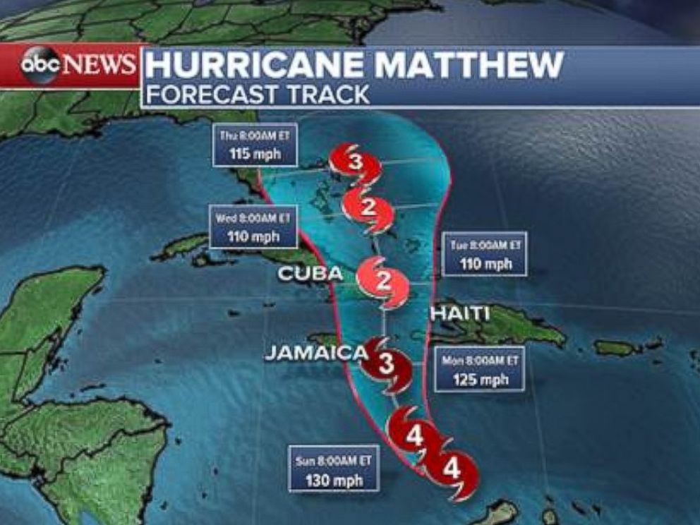
Matthew is over the south-central Caribbean, traveling slowly westward, but a turn to the north is expected on Sunday. Matthew is expected to cross eastern Cuba Tuesday morning and possibly make U.S. landfall somewhere on the East Coast around next Friday or Saturday.
Thursday will mark exactly 4,000 days after Major Hurricane Wilma’s landfall.
Hurricane Wilma, the last major hurricane (Cat 3 or stronger) to hit the U.S., struck Florida on October 24, 2005. Will Matthew arrive as the first major hurricane to strike the U.S. in almost 11 years? Only time will tell. (Sandy was Cat 1 at landfall, and technically not a hurricane at that time. Hurricane Ike, 2008, was a Cat 2.)
Here is the latest GFS model forecast for Matthew on midnight Sunday, Oct. 9 (graphics courtesy of Weatherbell.com): (see pic at link)
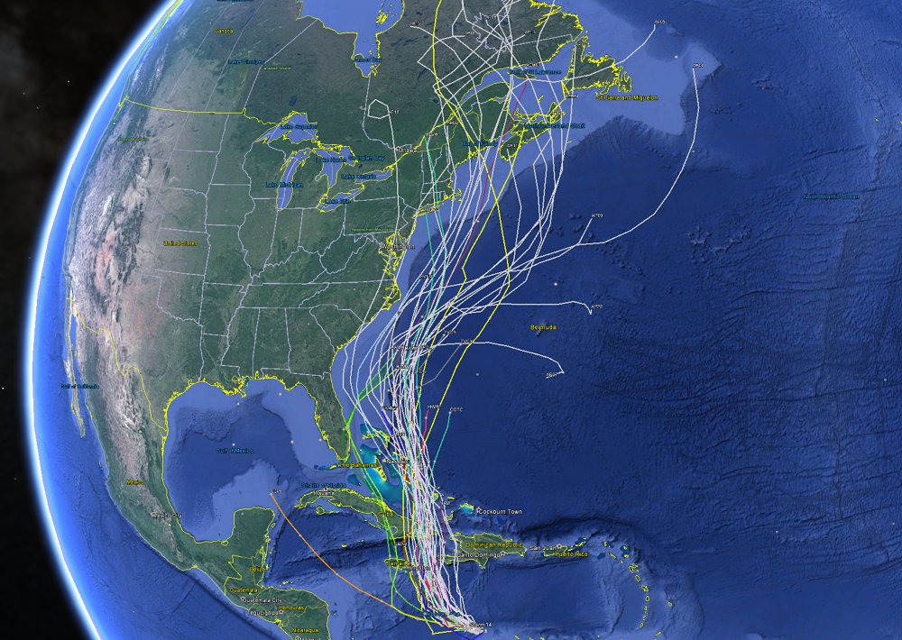
That particular forecast, which remains very uncertain this far in advance, has Matthew making landfall at Cape Hatteras, Cape Cod, and then going inland in Maine. Here is the spread of model forecasts from NOAA’s GEFS ensemble forecast system: (see pic at link)
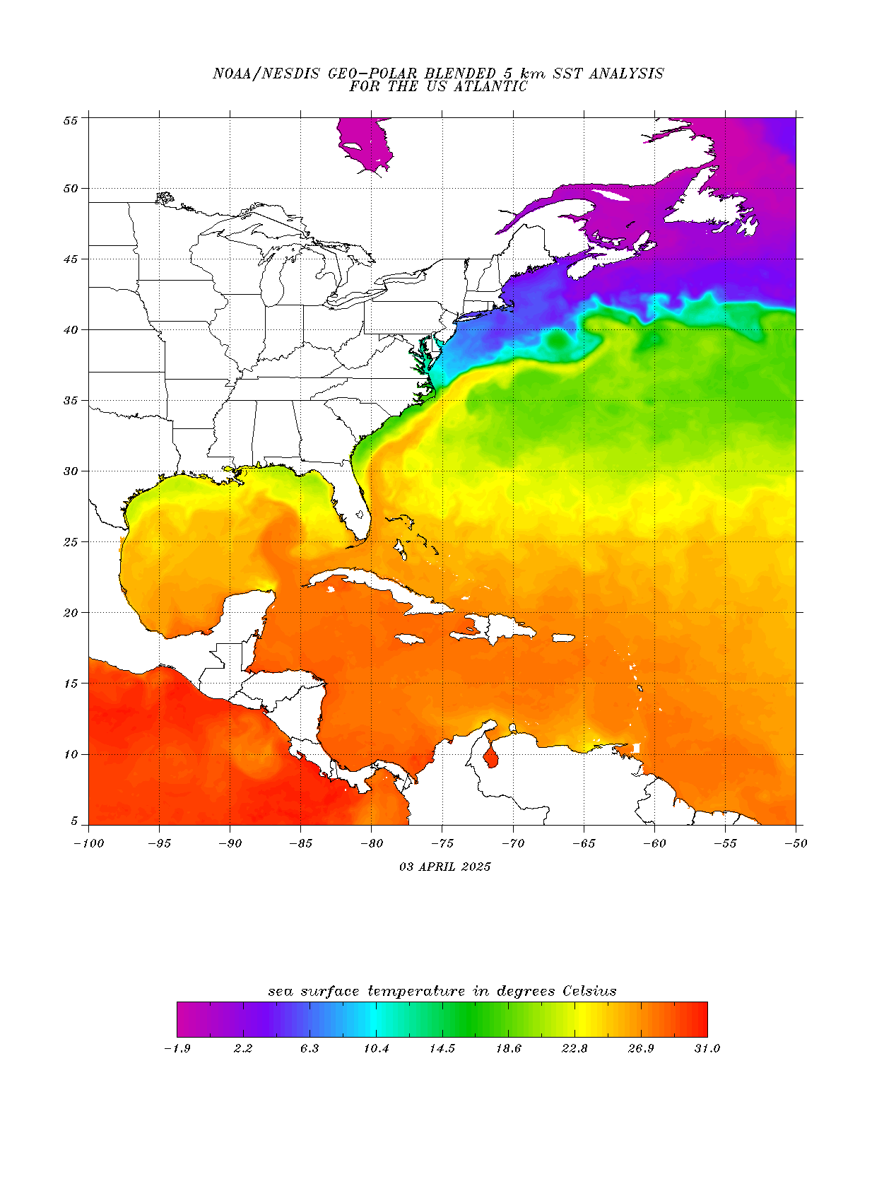
There’s still a lot of heat in the waters of the Caribbean.

“It would be hilarious if Walmart sent it’s own employees in to burn down all the Walmarts in the path of this “hurricane”. LOL.”
Wal-Mart Lives Matter!

This may be the big one. Usually, when they forecast the end of humanity, it BS, but this one looks nasty.


bump
Jumpin Jack Flash, that’s a bad looking himicane.
5.56mm
Ok.
I certainly intend to closely monitor Mathew as I will be leaving Boston by ship on Oct 7th Friday 4PM, and heading to Bermuda for a 1PM Sunday arrival in Bermuda.
Monday I will have to really take a look at where "Mathew" is located and where it is expected to go. - Tom
THEN, we'll see how badly Matthew will treat the US. :-(
Thank you for posting the many plots of the likely path.
I found out Saturday evening that my step daughter left the DR Sunday. Her son stayed there with his wife for a honeymoon. ......Appears they will be safe.
Yay!
Disclaimer: Opinions posted on Free Republic are those of the individual posters and do not necessarily represent the opinion of Free Republic or its management. All materials posted herein are protected by copyright law and the exemption for fair use of copyrighted works.