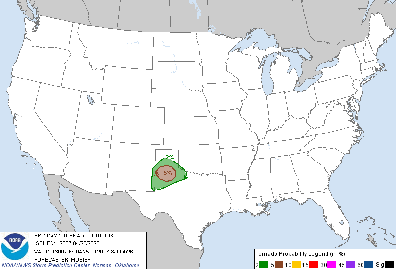

Posted on 10/26/2010 4:42:14 AM PDT by TSgt
MESOSCALE DISCUSSION 1999 NWS STORM PREDICTION CENTER NORMAN OK 0600 AM CDT TUE OCT 26 2010
AREAS AFFECTED...SRN WI/SRN LOWER MI/ERN IL/INDIANA/WRN OH/SERN MO/ERN AR/WRN AND CENTRAL KY/NRN MS/WRN AND MIDDLE TN/NWRN AL
CONCERNING...TORNADO WATCH 719...720...721...
VALID 261100Z - 261300Z
THE SEVERE WEATHER THREAT FOR TORNADO WATCH 719...720...721...CONTINUES.
ARCING BAND OF STRONG/SEVERE STORMS CONTINUES MOVING RAPIDLY EWD/ENEWD ACROSS THE MID AND UPPER MS VALLEY REGION AND VICINITY...ALONG THE SURFACE COLD FRONT ASSOCIATED WITH A VERY STRONG UPPER SYSTEM CENTERED OVER MN/IA/MO ATTM. A MOIST PRE-FRONTAL BOUNDARY LAYER IS SUPPORTING MODEST INSTABILITY -- FUELING THE ONGOING STORMS...WHILE VERY STRONG FLOW FIELD THROUGH THE ENTIRE TROPOSPHERE IS AIDING IN STORM ORGANIZATION/INTENSITY. CONVECTION HAS REMAINED LARGELY CONFINED TO THE FRONTAL BAND -- AND THUS MAIN SEVERE THREAT REMAINS DAMAGING WINDS. HOWEVER...WITH SHEAR SUPPORTIVE OF UPDRAFT ROTATION...THREAT FOR ISOLATED TORNADOES WILL PERSIST EARLY THIS MORNING -- AND MAY INCREASE THROUGH MIDDAY AS POTENTIAL FOR MORE WIDESPREAD PRE-FRONTAL CELLULAR CONVECTION INCREASES.
WITH THE MOST EWD PORTION OF THE ARCING BAND OF STORMS -- NOW MOVING INTO THE LOWER OH VALLEY REGION -- SHIFTING EWD AT 40 KT...STORMS WILL NEAR THE ERN FRINGE OF TORNADO WATCHES 720 AND 721 AROUND 13Z. THIS WILL REQUIRE NEW WATCH ISSUANCE WITHIN THE NEXT 1-2 HOURS.
..GOSS.. 10/26/2010
ATTN...WFO...CLE...JKL...ILN...DTX...LMK...IWX...GRR...OHX... IND...BMX...HUN...PAH...GRB...LOT...ILX...MKX...MEG...LSX...DVN... ARX...LZK...
LAT...LON 42649050 43589116 43978821 43758474 43028432 41748331 40128282 38608324 36688476 34228723 34119261 35179151 37678949 39778900 41608982 42649050


Watch for flying houses, especially if your last name is Pelosi!
This is the kind of storm that sank the Edmund Fitzgerald.
Are they expecting a massive drop in temperature too?
Our weather radar is down (Lincoln, Illinois) so it is a little hard to see what is going on. http://www.wandtv.com/Global/link.asp?L=246691 has a live doppler radar, but it doesn’t seem to have the time lapse capability. The system seems to be moving on to the east over Champaign now.
Gas grills and trees flying last night down here in the Ozarks. Still windy now, but not near as bad as at 2AM!!
Gonna watch this one come in over lake Michigan.
http://www.earthcam.com/usa/michigan/grandhaven/lakemichigan/
The legend lives on from the Chippewa on down
Of the big lake they call Gitche Gumee
The wind in the wires just now making a tattle-tale sound here in Southwest Michigan.
Well, poop! Its heading right straight for us. Got to go turn on the TV. Good luck everybody in the path of this storm.
Bad weather bump!


We got one in the ABQ metro area after this bad boy blew through last night, so I'd say yes.
Hey, that’s pretty cool!

Bad weather bump!
Amazing how they block out Canada in the graphic.
Disclaimer: Opinions posted on Free Republic are those of the individual posters and do not necessarily represent the opinion of Free Republic or its management. All materials posted herein are protected by copyright law and the exemption for fair use of copyrighted works.