http://www.atsr.rl.ac.uk/images/sample/atsr-1/index.shtml
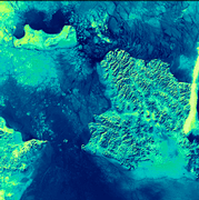
Verging on the Arctic Circle, the sea in this image is packed with ice floes. In the cracks and gaps between the ice, the much less-reflective water surface appears almost black. The brightest area is the finger of cloud on the western side of the image. Also brighter than the icy sea, are the three land areas in the picture. From the western side of the image, the eastern extremity of the Russian Federation reaches out towards the tip of Alaska. The International Date Line bisects the inter-continental gap and then veers south-west keeping St. Lawrence Island with Alaska a day behind the Russian Federation. ATSR data have proved very useful in the detection of sea ice and the location of icebergs.
(This is a 1.6 micron day-time image acquired on 5th February 1992; the area covered is 512 x 512 square km.)
See #83
...The authors attribute the change in Arctic conditions to the evolution of the Fram Strait into a wider, deeper passageway that allowed an inflow of saline North Atlantic water into the Arctic Ocean... something similar happened to fill the Black Sea. Look at the shoreline of the Bospherus...

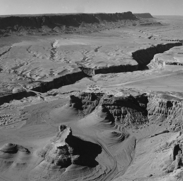
Was this a shallow inland sea before the fissure opened?
http://daac.gsfc.nasa.gov/oceancolor/images/black_sea.jpg
Recently, geologists Walter Pitman and William Ryan suggested that the Black Sea had been a freshwater lake at one time, and it became an anoxic marine basin fairly recently. Around 5600 B.C., as sea levels rose due to glacial melting, a flood of seawater broke through the Bosporus and inundated the Black Sea basin. The influx of Mediterranean seawater raised the level of the lake about 150 meters, and created the density difference that prevented mixing. Once the Black Sea was filled, the development of anoxia would have happened relatively quickly. One indication of the event is the age of freshwater mussels that died as oxygen concentrations fell. The anoxic bottom waters also hold the promise of preserving ancient wooden vessels, and even buildings in coastal communities that existed before the flood.
(NOTE, November 2003:
As scientific examination of this hypothesis has progressed since it was first proposed by Ryan and Pitman, the dramatic rapid infilling scenario can no longer be supported. See the Black Sea section of the “Associated URLs” below for a recent report on the status of understanding the paleohistory of the Black Sea and surrounding regions. There may have been a much more powerful flood earlier in time, approximately 15-16,000 years ago, resulting from the overflow of the Caspian Sea into the ancient Black Sea basin. The Ryan and Pitman event, while still appearing to have occurred, did not involve as much water or as large a rise in the level of the Black Sea as first proposed.)
Dr. Robert Ballard, famed as the discoverer of the wreck of the Titanic , searched the Black Sea in 1999 and found indications of the ancient shoreline of the freshwater lake. In 2000, Ballard found evidence of ancient settlements on the underwater shore of this ancient lake, well-preserved due to the anoxic conditions, which preserve organic matter well. (Ryan and Pitman proposed that the sudden filling of the Black Sea was the basis for the Noah’s Flood story in the Bible, but we won’t get into that debate here.)