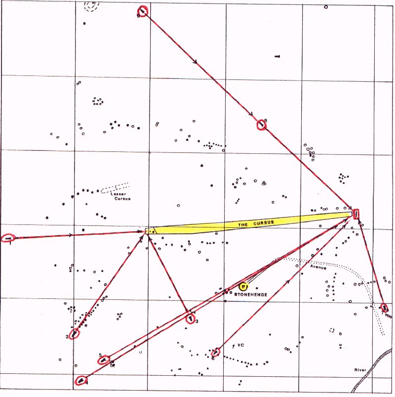
The map indicates the known Neolithic long barrows (circled in red) which are within sight of the Cursus and also shows the Bronze Age round barrows. All 10 of the 10 long barrows within sight of the Stonehenge Cursus are aligned on either the western end or the eastern end of the cursus which proves that these long barrows post-date the building of the cursus. Therefore, it was the building of the cursus which prompted the subsequent positioning of these long barrows. The Cursus was built about 5300 years ago. An explanation for the design and location of the Stonehenge Cursus which accords with known archaeological and scientific data and anthropological research is given in the book Stonehenge: The Secret of the Solstice whose details are on the books page.
http://www.stonehenge-avebury.net/stnhngeinfo.html