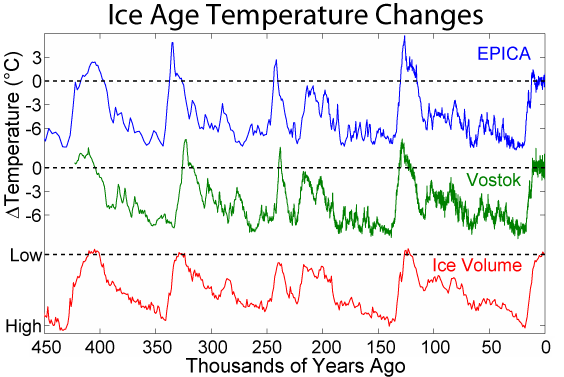
"all the maps I saw showing Asia 40,000 ya show them connected" Yes, this theory is the most popular and feasible for 18k ago at the glacial maximum, which is what your map shows. But the peopling happened much before that. And from 40k back to 124k it was much warmer and warmer going back to the previous interglacial maximum. So much of what your map shows had not been exposed yet because the levels had not dropped that much yet. It did so after they were already there. So if they did use a land bridge it would have had to have been during the previous glacial maximum around 140k ago when it would have been possible.
Man, I tried to reduce that image size but it increased it instead. It reduced it and made it smaller as it should in the preview but increased it even more than the original when posted.
I did width=”70%” but it looks like it ended up +30% over the original width. Did I do it wrong? Or is there a swap of values happening?