Did any of them change their minds? No. They weren't coming back. Well Lincoln clearly thought they would, but we know in hindsight that the promise of permanent legal slavery in the US wasn't what they wanted. Apparently what they wanted was to not be part of the US.
Yes, you impose your own notions on the history. And again with the stupid Bush v. Gore map. I could post a dozen maps from US electoral history that show different configurations of states with parties, but don't want to waste time on that.
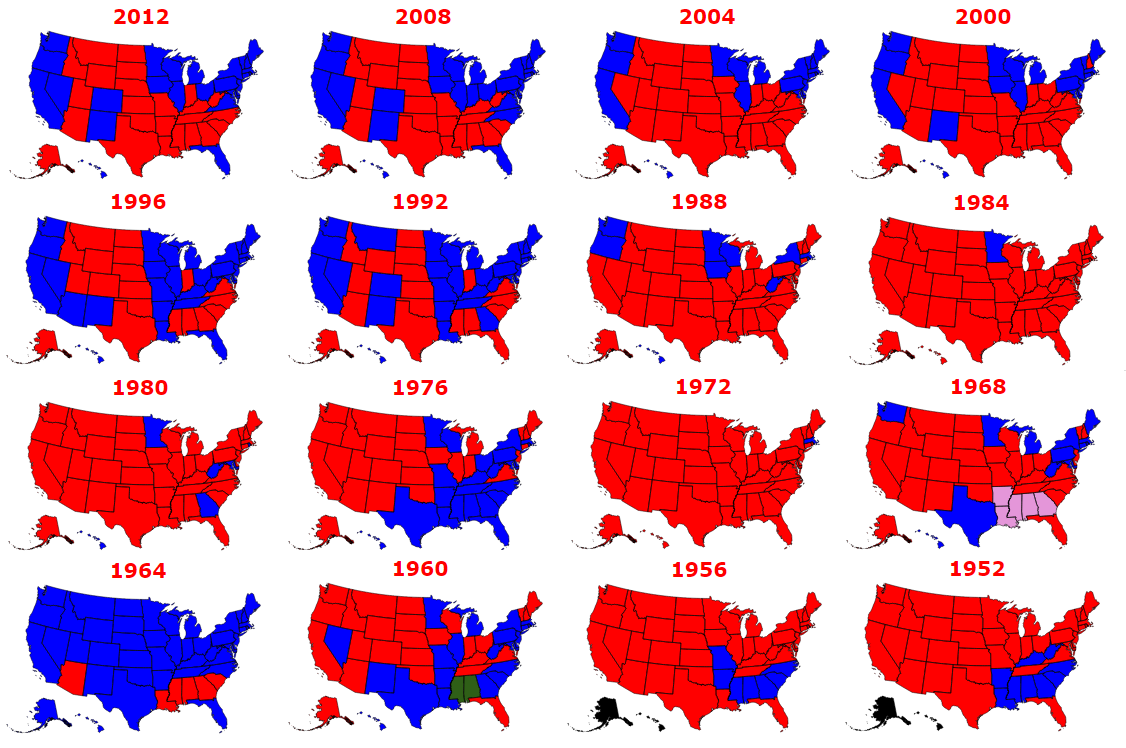
I have looked at a lot of election maps over the years. I can't think of any where there was a great deal of separation between New York and the Great Lakes states.
They are commercially connected together. They share financial interests.
So when you aren't saying that NYC wanted war with the South, you are saying NYC would do what it took to be the South's bidding.
You are trying to split hairs to make it look like I am saying something contradictory.
New York wanted what was in the best financial interest of New York. Avoiding war and keeping the status quo where *THEY* continued to handle the 200 million per year in Southern trade with Europe was optimal.
Yes, New York of 1860 would vote to ratify a slavery forever bill if it maintained the status quo.
New York would also urge war if *THAT* is what it took to prevent losses to their industry.
New York would go down either of two different paths to pursue what it perceived as being in its own financial interests, and it would pressure the great lakes states that depended on it to go along with it.
And they would have done.
Well Lincoln clearly thought they would, but we know in hindsight that the promise of permanent legal slavery in the US wasn't what they wanted. Apparently what they wanted was to not be part of the US.A big reason why they didn't want to be a part of the US was because they didn't trust the Republicans to respect slavery. As I've said over and over -- and as historians have said -- they feared that Lincoln could use his appointment power to build up an anti-slavery Republican Party in the South.
I can't think of any where there was a great deal of separation between New York and the Great Lakes states.
Even in the maps you show, the elections of 1960, 1968, 1976, and 1988 do show some of the Great Lakes States voting differently from the Midatlantic Tristate area. The same was true in 2016. Maps from the FDR era (say, 1928-1948) reveal a variety of different patterns. New York's FDR was a hero to the South and not that popular in the Midwest. Going back further into the late 19th century, the South voted as a solid bloc, and the North voted almost as a bloc. People remembered which side they fought on in the Civil War. But when Democrats did win, it's because of the swing states: New Jersey, Indiana, sometimes Connecticut, and New York above all. New York City's real electoral alliance was with the South. That started with Jefferson and Burr in 1800 and ended with Carter and McGovern in the 1970s.
There is some overlap in the voting between the Northeast and the Midwest. They were early industrializers and now they are old industrial/urban states. They had similar ancestry. They both fought for the union. But there were also serious rifts between the two. It's folly to think that Illinois or Wisconsin or Michigan were only singing New York City's tune in 1860. Such states were mostly agricultural then and no more beholden to New York City than the Southern states. In fact, a good deal less. Twenty or thirty years before, Michigan and Wisconsin had been the West. Cities there were small, and the largely agricultural population was quite independent minded.
But if you just want one big idea to explain everything, details don't matter.